York flood prevention update due to be discussed next week

Another update on the work being undertaken to prevent flooding in the York area is being considered on 3rd December.

The report has been produced by the Environment Agency.

Details are also provided on the alleviation plans for the Clementhorpe part of the City.

Regular updates have been provided since the flooding in late December 2015 which followed an intense period of rainfall across November and December due to the impacts of Storms Desmond and Eva.

Record river levels were observed in many river catchments across the north of England. More  than 4000 homes and 2000 businesses flooded across Yorkshire with 453 properties and 174 businesses flooded in York.

Funding has been allocated to the Environment Agency (EA) following the floods to renew existing and provide new flood defences across the city, £17m has been allocated to the Foss Barrier improvements and £45m to the wider flood defences across the city

Click to read full Clementhore update reprt

Click to read full report

Good work evident in Westfield as schools return

Road resurfaced, white lines refreshed and a “gateway” painted on the highway near the entrance to Westfield School. School crossing patrol also working efficiently. Good work by the school and ward Councillors

Hardcore has been put down under the access gate to the Westfield Place sports field. Previously the area had been subject to flooding. More good work by the Council

Reported full paper and can banks at Acomb car park at 3:15pm today. Also some fly tipping. Message back from the Council at 3:30pm saying “issue solved” Gasp!

Surface water flooding – York Council and Environment Agency plans updated

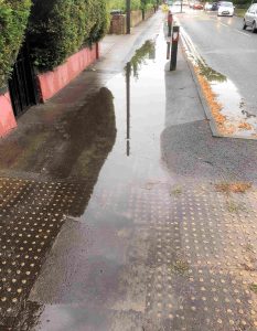
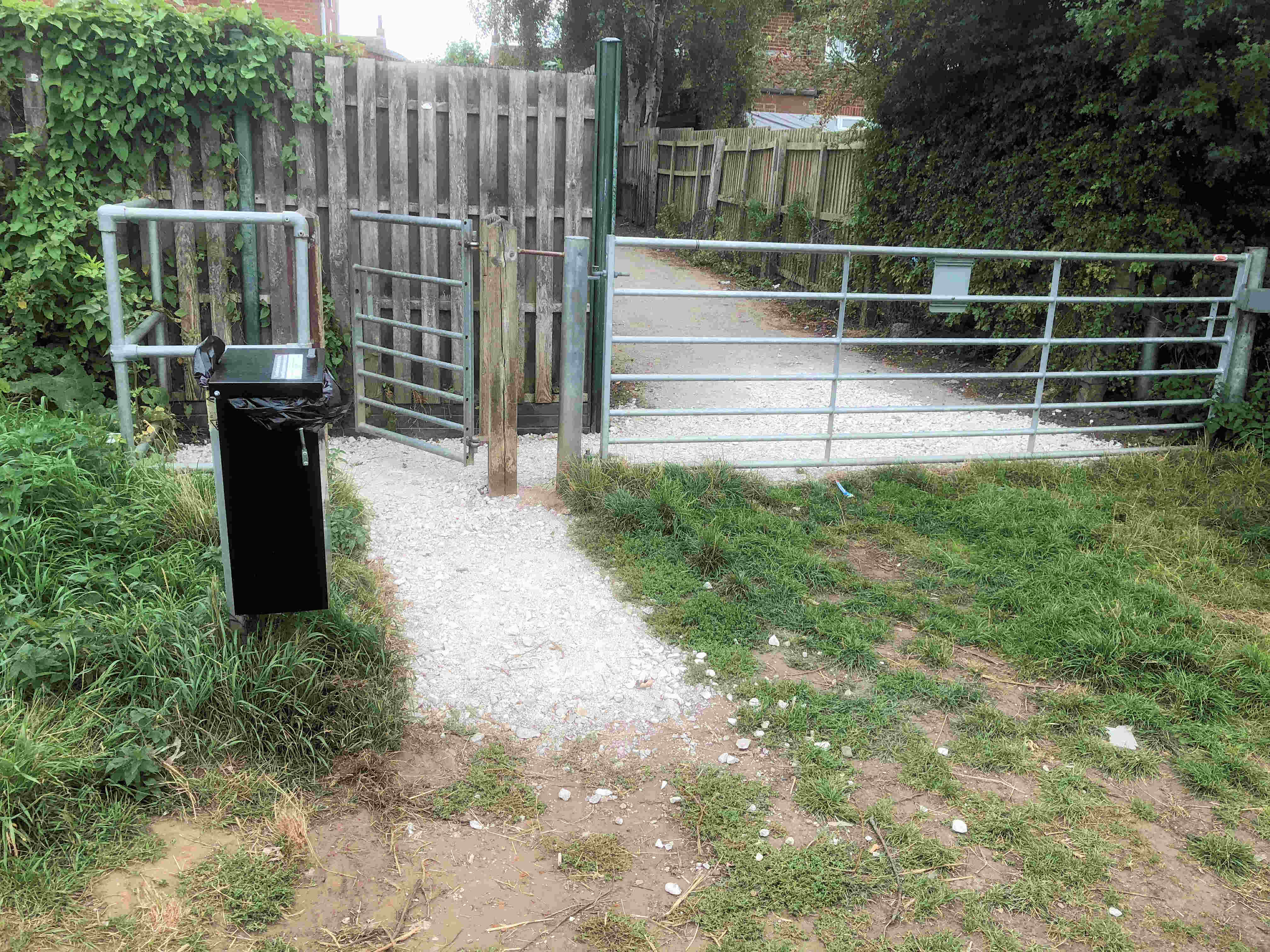
Gale Lane blocked footway gully

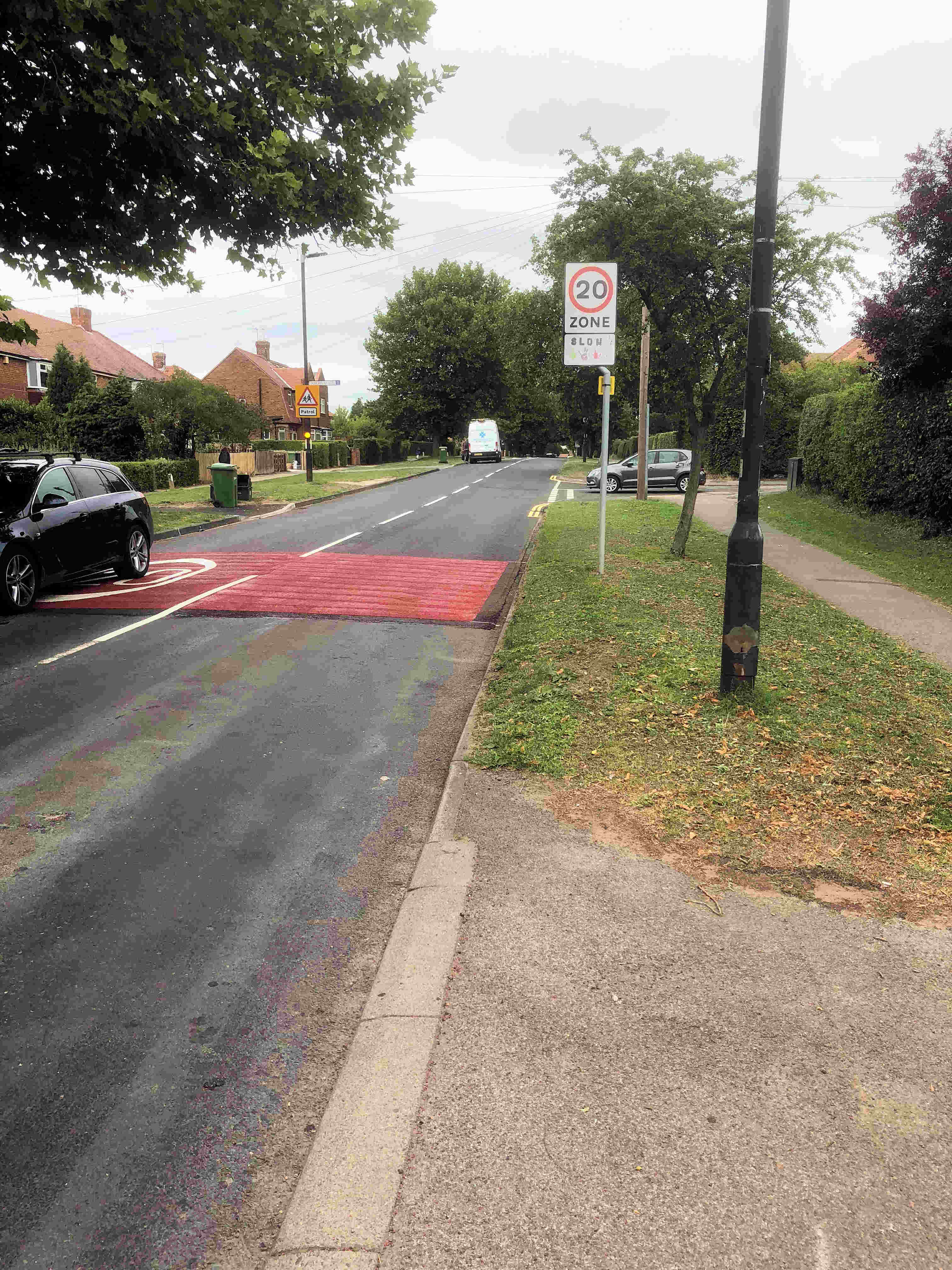
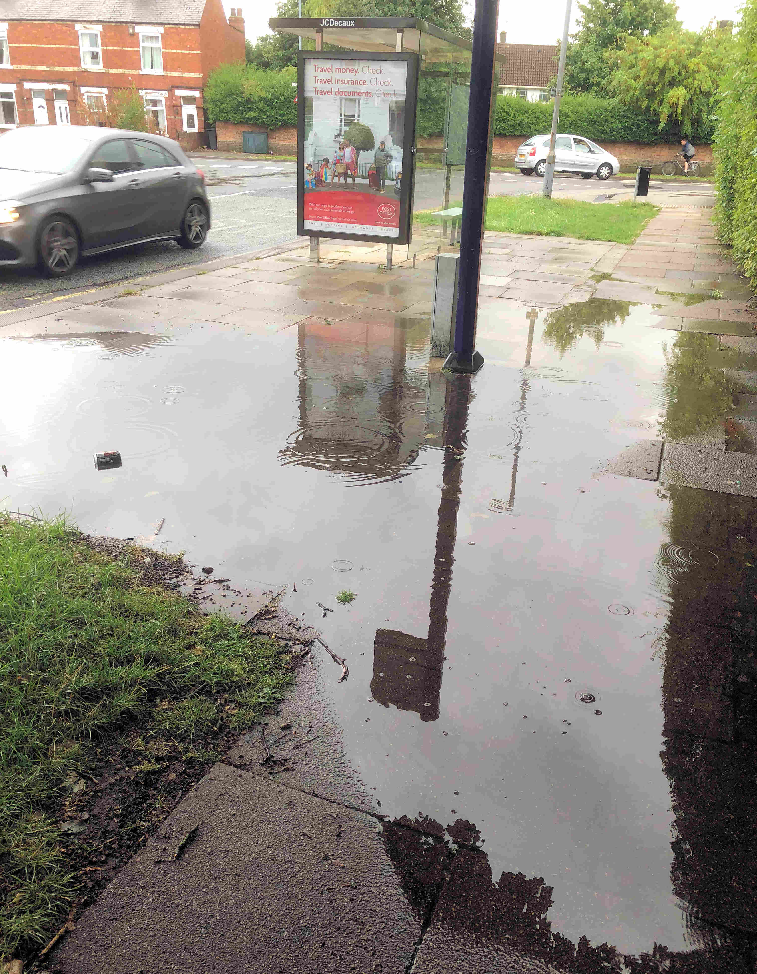
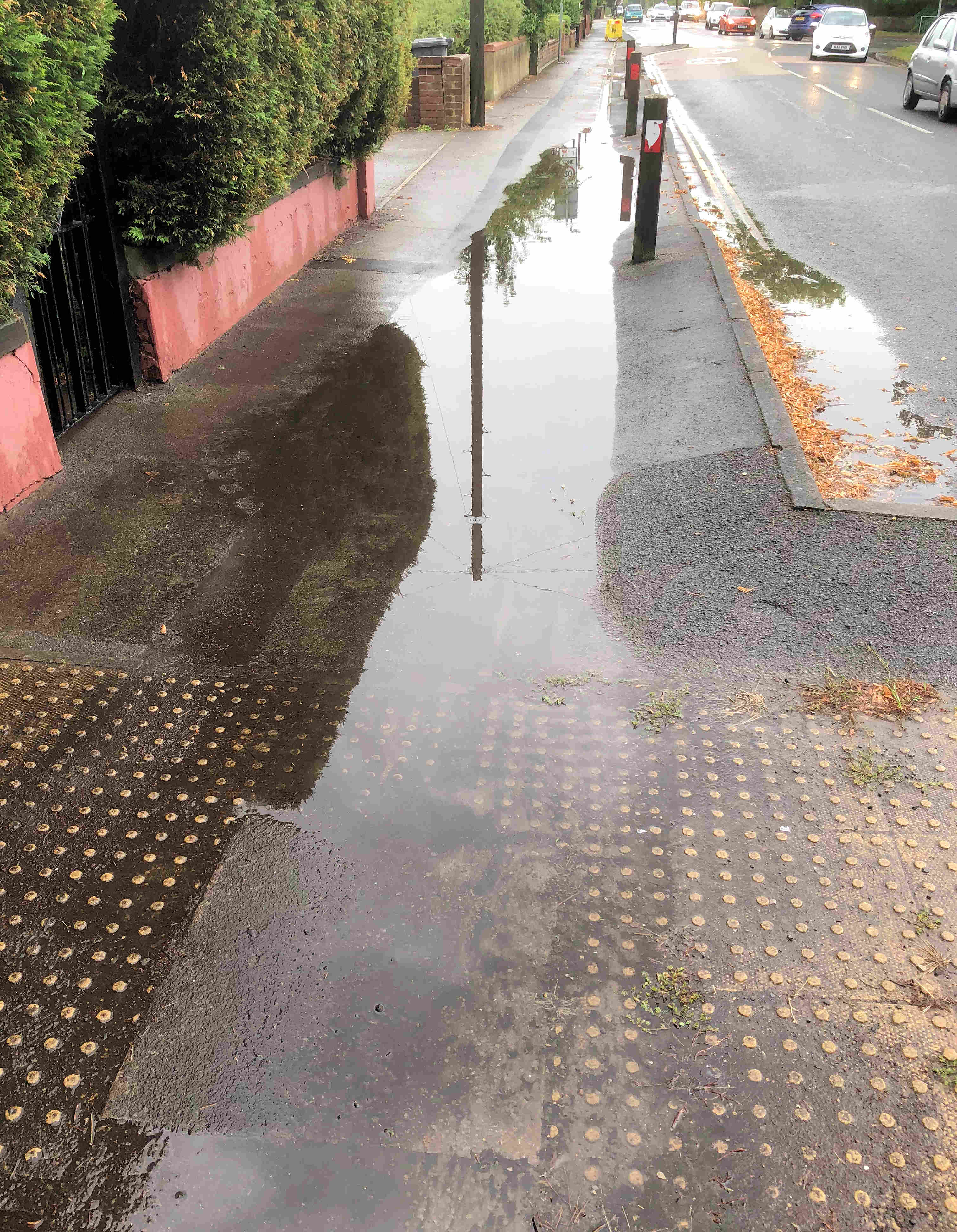
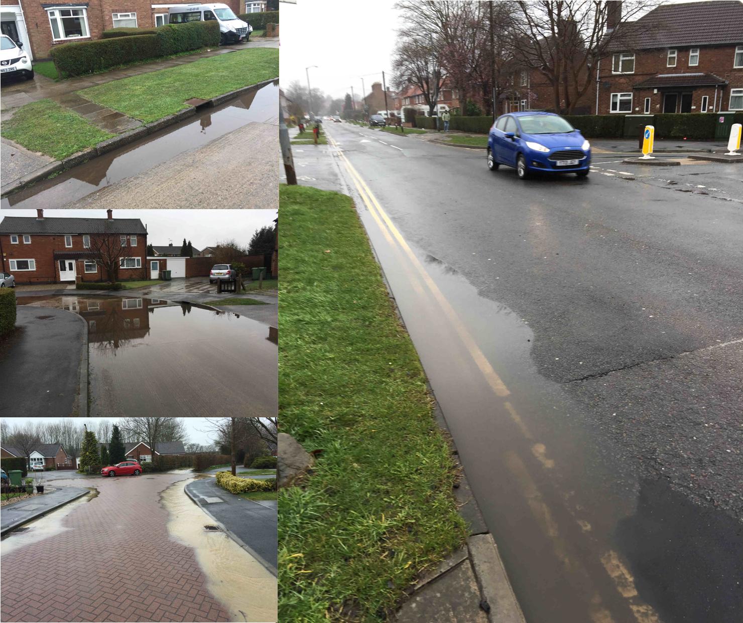
The recent surface water flooding which we saw a few weeks ago is being addressed by the Council. In a report to be considered next week, they say that their Flood Risk Management Team is currently investigating the consequences of the 13th August 2018 storm which affected the city. More than 40mm of rain fell on the city in just over 15 minutes, Rainfall rates more than 120mm/hour were recorded.

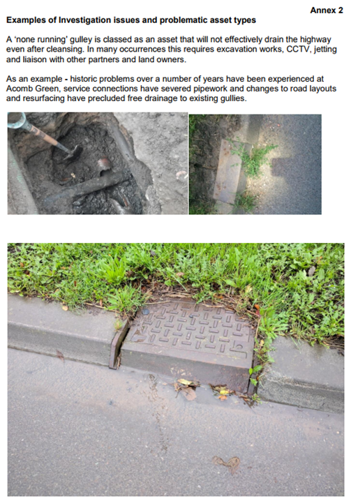
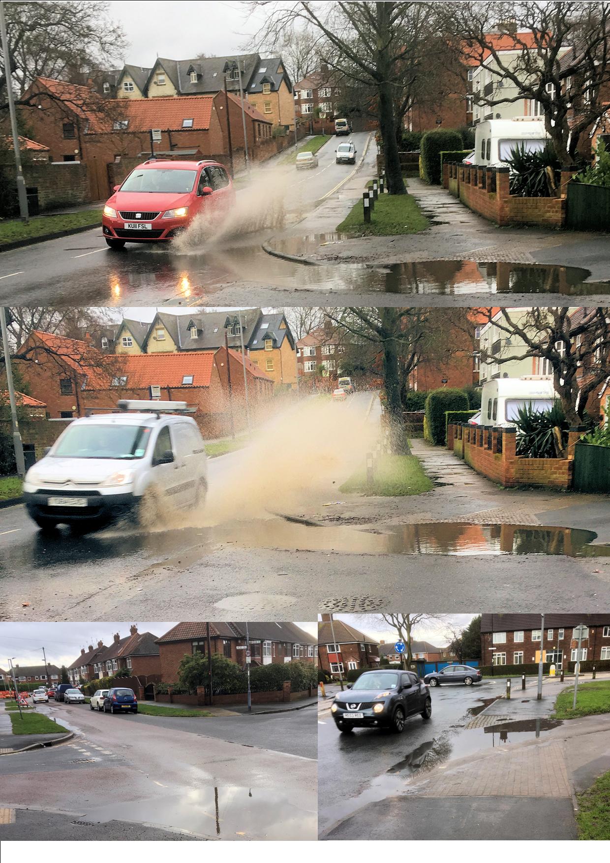
The problems seemed to be exacerbated by blocked gullies. This was a problem on some roads where footpath gullies were obstructed.

A policy adopted by the then Labour controlled Council 5 years ago meant that gullies were cleaned only upon report. Due to this reactive cleanse policy in recent years, approximately 53% of drains have been found to be blocked upon attendance.

The Council says the revised gulley cleansing policy aims to proactively cleanse all gullies on the gritting network annually and all other assets are reactively cleansed following reports of issues. “There are more than 43,000 gullies in the CYC area and approximately half of these are on the gritting network”.

The Council has allocated funding, in the period up to 2020, which will allow the whole network to be surveyed, the development of an improved asset register and an effective proactive cleanse of each asset to be carried out. Over the whole programme, which started in 2015, the added investment will have ensured that in the region of 23,000 gullies were left in a free running state that were previously not draining effectively.

Additional gullies cleansed, and data recorded

2015/16 8,000
2016/17 15,074
2017/18 12,810
2018/19 2,468 (to date)

However, more than 900 ‘non-runner’ assets have been identified where the gulley cleansing process could not ensure free drainage and significant engineering works (digging out) are required to improve them. None of the current defects were found to be in a location where property flooding could occur as a direct consequence of severe rainfall.

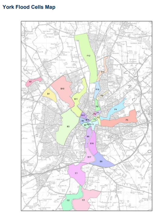
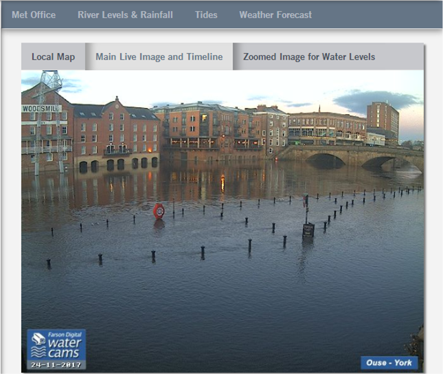
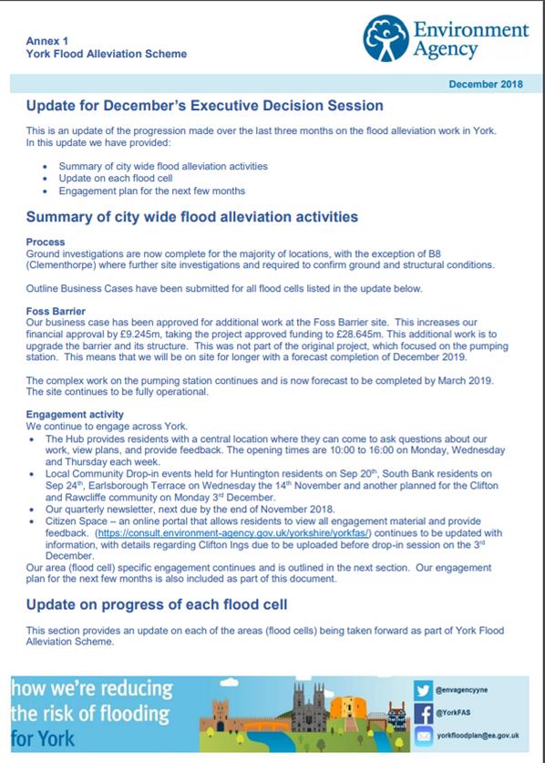
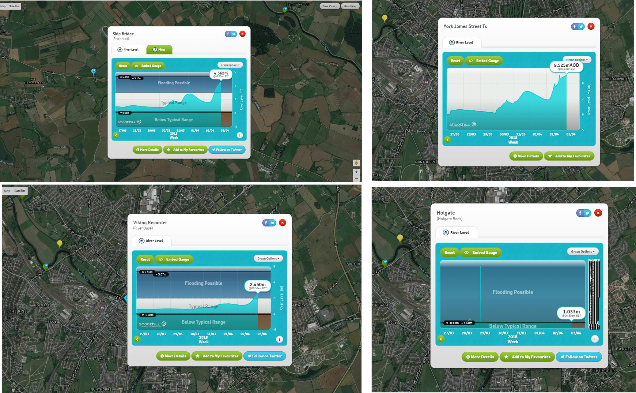
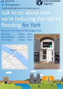
Separately the meeting will consider an update report from the Environment Agency on tacking river flooding issues across the City. The Agency is doing well in keeping residents briefed on the work that they are doing. They have now started a web site which builds on their communications plan tick here This complements the information  “hub” that they established on Wellington Row.

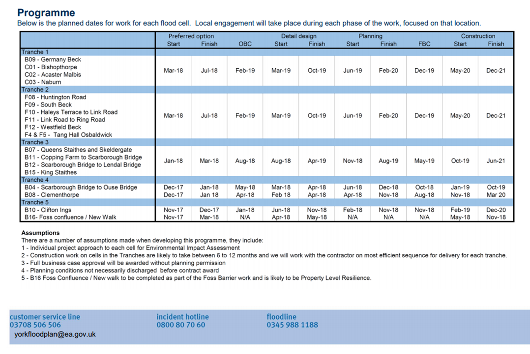
Generally, the update says that work to improve flood defences is proceeding in line with the agreed timetable

Residents urged to report local blocked gullies and drains

The deluge that engulfed the City yesterday evening produced surface water flooding problems in many areas.

The Council says it is working hard to remedy problems. It asks residents to report issues to FRM@york.gov.uk or call the customer centre on 01904 551550.

These are couple that we reported yesterday.

Tudor Road

Gale Lane


Flooding in York: What to look out for

The heavy rain in the City has subsided today but several rivers are still showing increasing levels. We recommend that residents check the river gauges regularly and in particular those located upstream of the City. There is still a lot of water to flow through.

Click here for the river gauge real time map

Click here for the latest flood alerts and flooding maps

Drivers faced another hazard yesterday as a large pothole developed on the A59 road works on the south bound side of Skip Bridge. The carriageway is single file, over the bridge, there at the moment. Some delays may be expected,.

Several Councillors including – Andrew Waller – toured their wards yesterday to identify areas where gullies might be blocked. Some surface water flooding was identified by Andrew in Osprey Close (run off from agricultural land), Westfield Place, Cornlands Road, St Stephens Rd., St Stephens Square and Gale Lane,  Any blocked gullies have been reported for attention.

Good work by York Council as Hob Moor access restored

Anyone for a shower?

There are still too many blocked drainage gullies in parts of York. This mornings rain demonstrated the scale of the problem with flooding at the bottom of Hamilton Drive East a particular hazard. There were similar if less spectacular problems on Nigel Grove and Foxwood Lane. All have been reported for attention

53% of road drains found to be blocked in York Council survey

£5 million cost to upgrade whole system

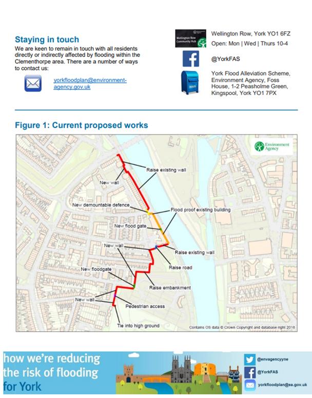
Considerable concern was expressed in 2015 when it was discovered that large areas of highway were flooding during wet weather. Many residents complained that the reduced  gulley cleaning service – introduced by the last Labour led Council – was inadequate. The City has over 42,000 gulleys.

In 2016 and 2017 there were major surface water problems in several parts of York.

The led the new Councillor – Andrew Waller – responsible for surface water drainage systems to institute a review of standards.

The initial findings of the comprehensive survey into the effectiveness of drainage systems will now be presented to a meeting next week

The report says,

“To date more than 35,000 of the 43,690 known gullies have been logged, investigated and cleansed as part of the capital funded investigation process, a flood risk assessment process has been previously carried out to ensure key assets have been prioritised.

53% of all assets were found to be blocked but significant work has ensured the majority of the system investigated to date is operating effectively, however more than 900 assets will require wider engineering works to ensure they can operate effectively”.

With many gullies now cleared, the report goes on to say,

“Subsequent heavy rainfall events have given rise to reduced numbers of complaints and reports of localised flood incidences, this is a clear indication of the success of this process, however, significant rainfall such as experienced on the 23rd August this year can still overwhelm a well maintained and operable drainage system as their design capacity would be compromised”.

The findings of an investigation into surface water ponding on Acomb Green is included in the papers (see below)

York flood plan update – Works start in March

It looks like work could start in March on works aimed at reducing flood risk near Westfield (Hob Moor) beck.

The Environment Agency has today published an update report on its planned works.

The report is the latest response to flooding in late December 2015 followed an intense period of rainfall across November and December due to the impacts of Storms Desmond  and Eva. Record river levels were observed in many river catchments across the north of England. More than 4000 homes and 2000 businesses flooded across Yorkshire with 453 properties and 174 businesses flooded in York.

Funding has been allocated to the Environment Agency (EA) following the floods to renew existing and provide new flood defences across the city, £17m has been allocated to the Foss Barrier improvements and £45m to the wider flood defences across the city.

The report will be discussed by the Council at a meeting taking place on 4th December