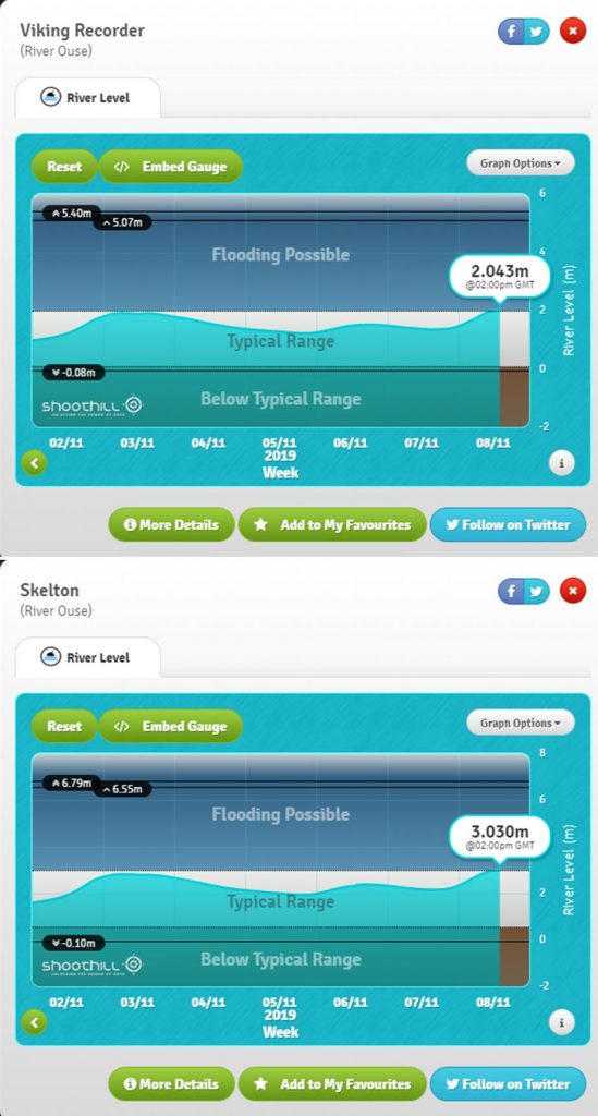
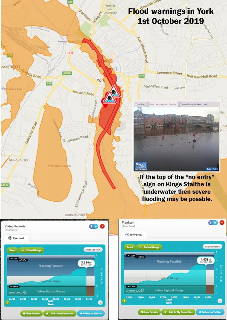
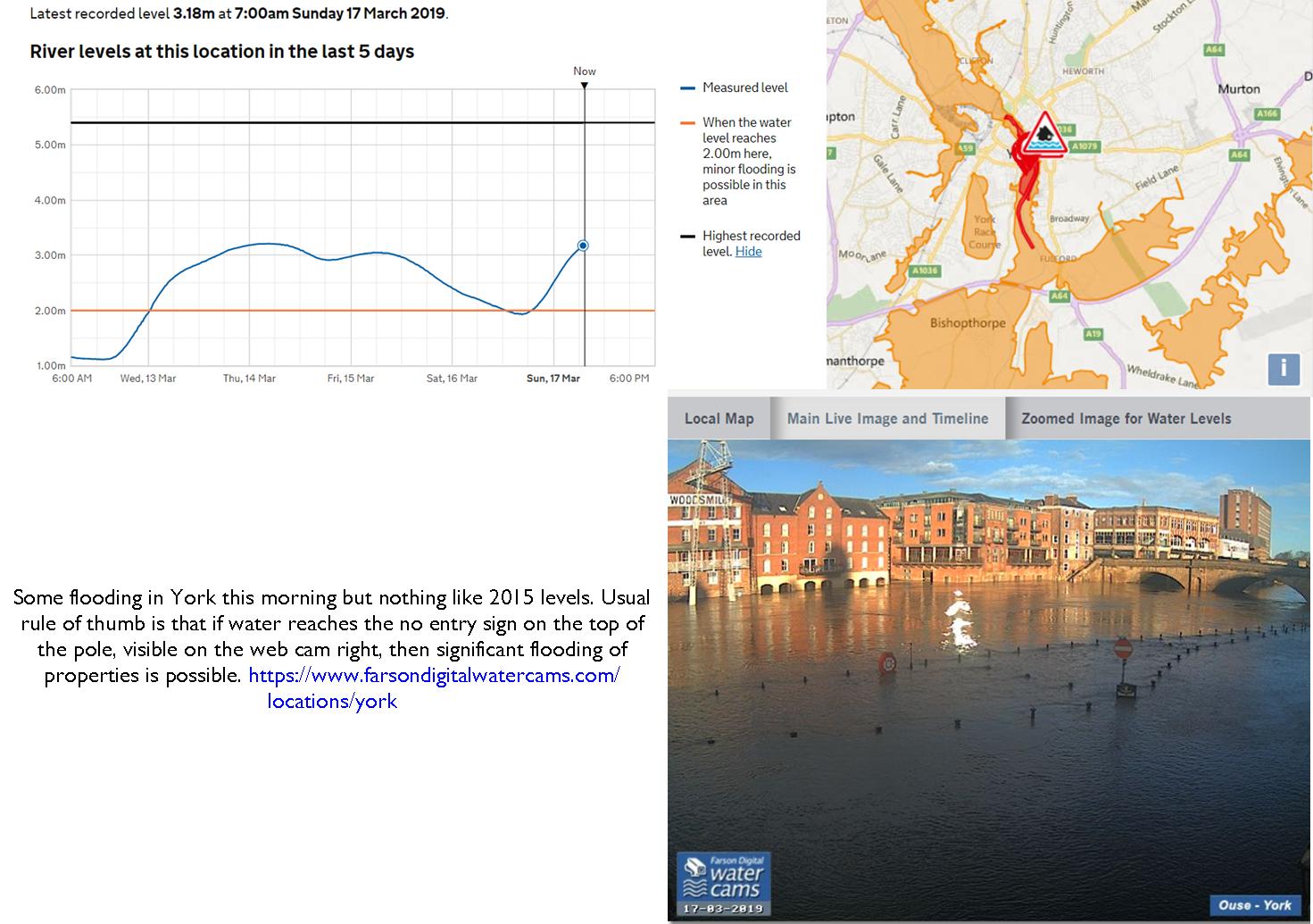
Flood alerts issued for River Ouse. Not expected to reach a warning level.
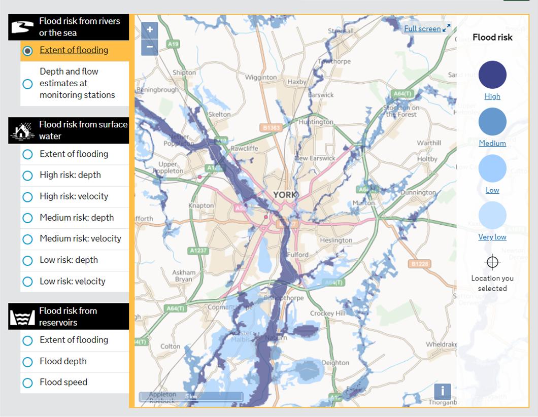
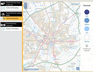
Just a reminder that a map indicating long term flooding vulnerability in the City can be found by clicking here.
It covers both surface water (drain capacity) issues and also the potential for rivers and streams to overflow.
There are currently no flood alertsin York although their are warnings in place in other parts of Yorkshire. These are likely to impact on travel arrangements,.
Real time water level gauges can be viewed by clicking here
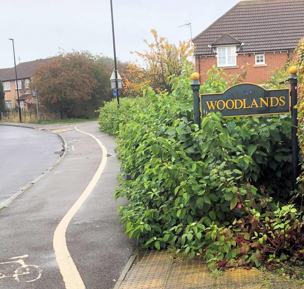
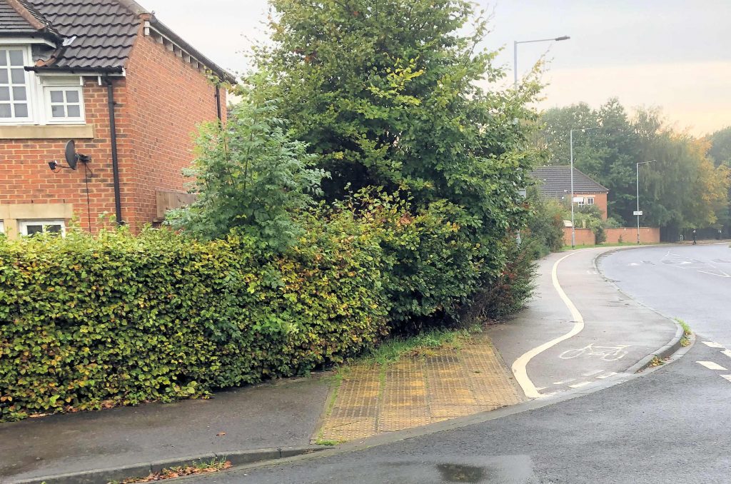
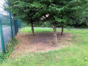
We were pleased to here that the JoRo housing team have agreed to trim back hedges from Bellhouse Way near their Woodlands estate. The path there is obstructed as it is further round near The Gallops, although the problem there involves a more hazardous thorn hedge.
Some of the hedges to the rear of Foxwood Lane are also obstructing footpaths.
The Council will be dealing with these issues
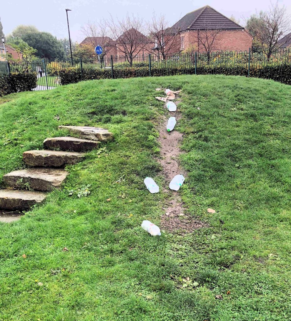
JRHT will trim back hedges near their Woodlands estateGathering of milk bottles where the slide used to be on the Teal Drive playground. We’ve requested a tidy upThorn hedges like this one near The Gallops junction are a safety risk as darker nights approachHouseholders are being asked to cut hedges back form public footpathsWith heavy rainfall expected, it is important to report blocked drainage gullies. This is a particular issue at the moment because of increased leaf fall and inadequate weed clearance during the summer months. Blockages can result in localised flooding
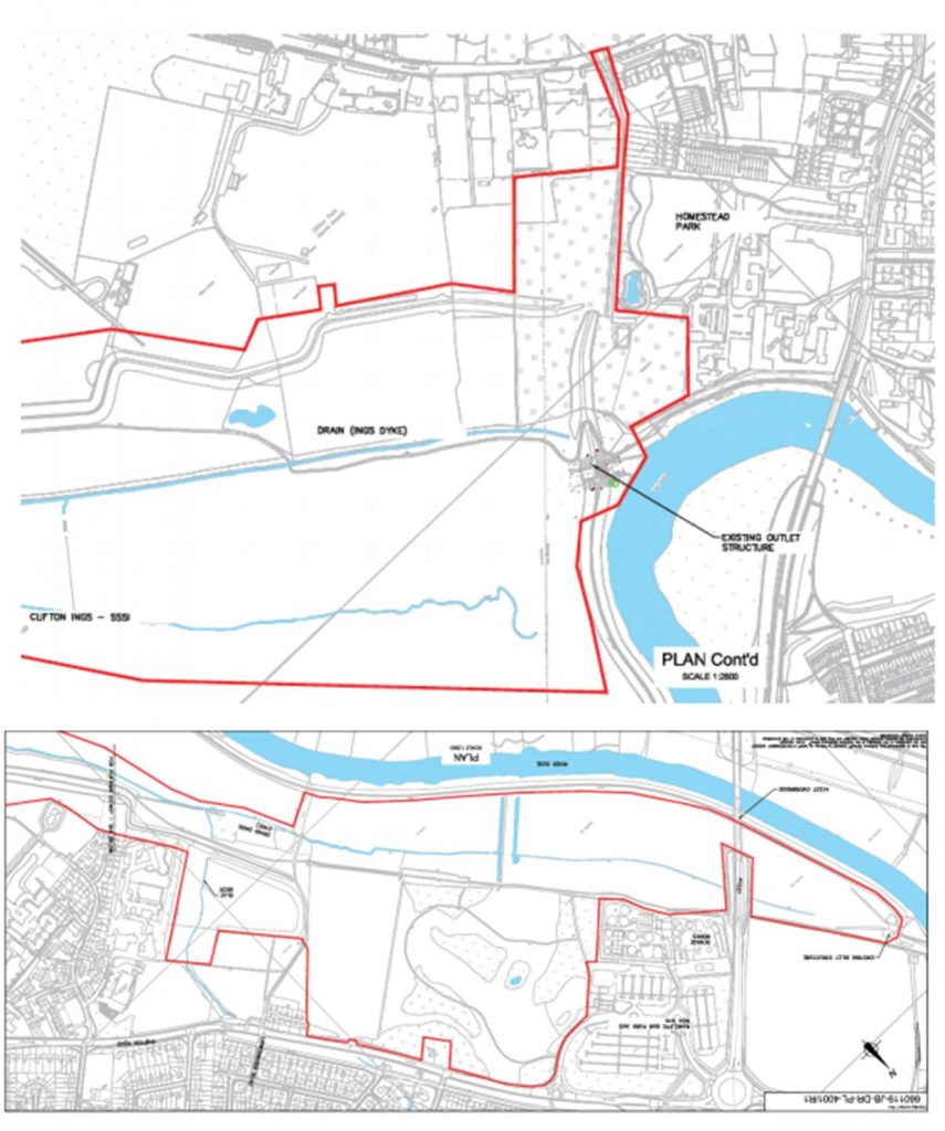
The Friends of Rawcliffe Meadows(FRM) are objecting to a plan to raise and extend flood barriers on the river Ouse near Rawcliffe.
Rawcliffe Meadows
They say “FRM believe the Environmental Statement is fundamentally flawed and must be comprehensively revised to give an honest and comprehensive account of the likely destruction of and damage to SSSI grassland”.
They go on to say, “There will be adverse impacts on the Cornfield Nature Reserve which are of regional or at least district-wide significance”.
The report says, “The application is for works to repair and extend the Clifton Ings barrier bank. This is one of the projects within the agencies flood alleviation scheme (FAS) to reduce flood risk throughout the city. £45 million has been allocated to the EA which will upgrade defences in 19 areas (referred to as flood cells).
The objective of the FAS is to protect against the 1 in 100 year flood (1% AEP) plus climate change and where this cannot be achieved then deliver the maximum level of protection in each cell within the context of existing flood risk and considering other environmental, social and cultural aspects.
The purpose of the barrier bank is to reduce flooding from
rivers (fluvial flooding) to the Clifton / Rawcliffe area.
However, during the floods in 2000, water from the river
outflanked the flood defences, spilled onto Shipton Road and flooded over 100
homes. The flood basin at Blue Beck also exceeded its capacity in 2000. In
these instances, the Environment Agency had to provide temporary pumps to
reduce flooding upstream on Blue Beck.
The barrier bank was constructed in 1980. It is of earth
fill construction and is up to 4.5m high. The embankments on both sides of the
River Ouse currently have issues with stability created by high pressure in the
banks when the reservoir empties. This has meant that the drawdown rate for the
reservoir has had to be reduced from 1,360mm/day to 300mm/day in order to
reduce the risk of failure. This reduction in the drawdown rate significantly
impacts on the operation and effectiveness of the reservoir as a flood defence,
particularly for any consecutive flood events.
Clifton Ings provides a flood storage reservoir on the eastern side of the River Ouse close to Rawcliffe Park and Ride and the sports clubs Clifton Alliance and York. When not flooded, the northern section of Clifton Ings is used for grazing and the southern section is used as open land by the public. A Sustrans cycle route runs through this area.
During high flow events it has a flood capacity of 2,300,000 m3. It is owned and maintained by the Environment Agency.
The Planning Committee is meeting on Thursday at 4:30pm. The
meeting will also consider a separate proposal to create a temporary access
route into the site.
A Council meeting today will consider an update report on the work being undertaken to avoid flooding problems in the City.
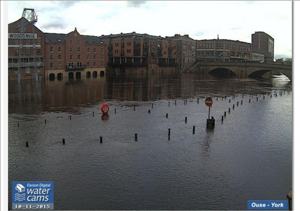
Flooding
in late December 2015 followed an intense period of rainfall across November
and December due to the impacts of Storms Desmond and Eva.
Record
river levels were observed in many river catchments across the north of
England. More than 4000 homes and 2000 businesses flooded across Yorkshire with
453 properties and 174 businesses flooded in York.
Funding
has been allocated to the Environment Agency (EA) following the floods to renew
existing and provide new flood defences across the city, £17m has been
allocated to the Foss Barrier improvements and £45m to the wider flood defences
across the city.
Funding has been awarded to City of York Council by the Environment Agency to lead and develop a property flood resilience pathfinder project to enable better uptake of resilience measures across Yorkshire. Details of the pathfinder project can be viewed by clicking here
A copy of the full report can be read by clicking here
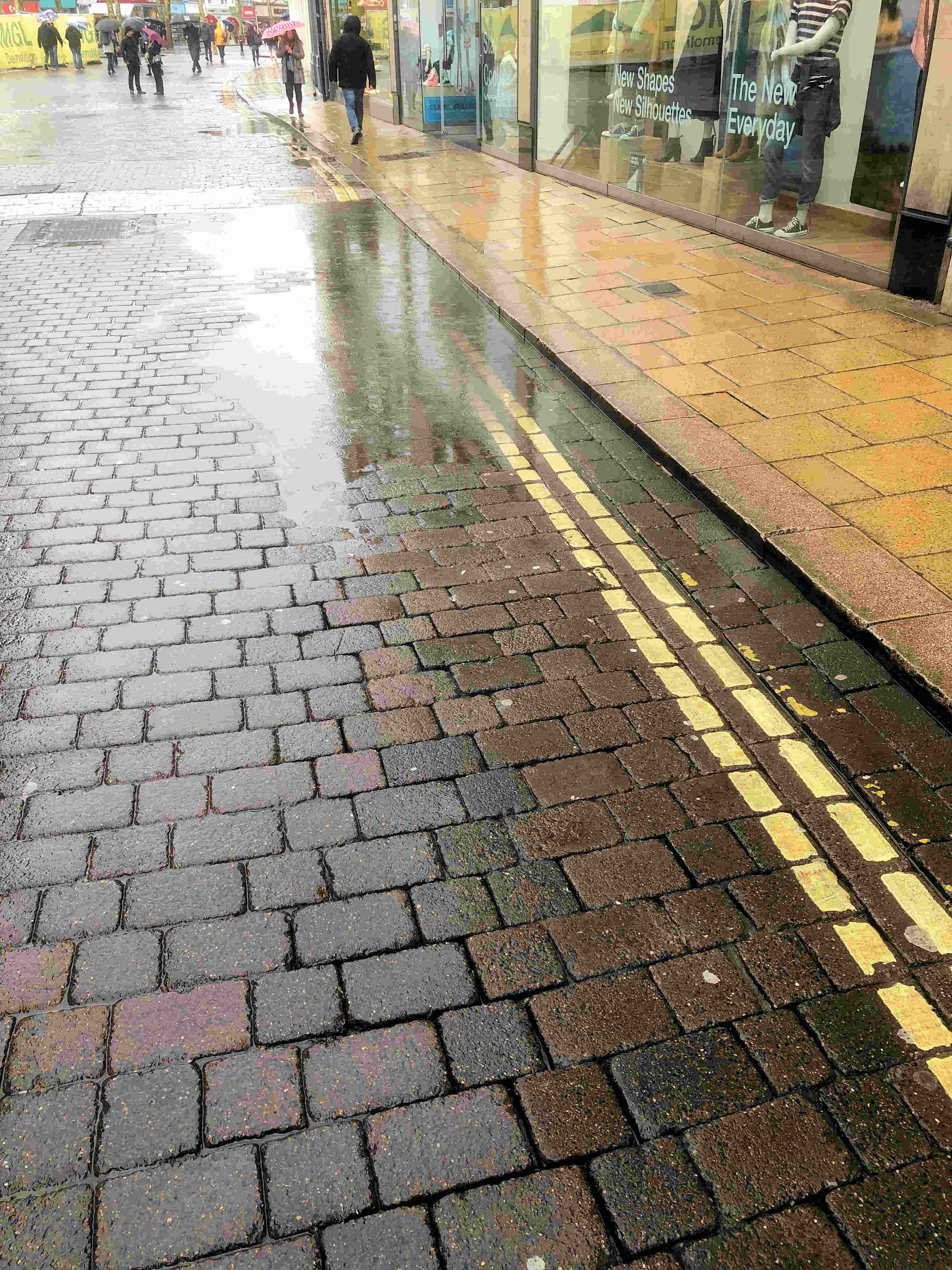
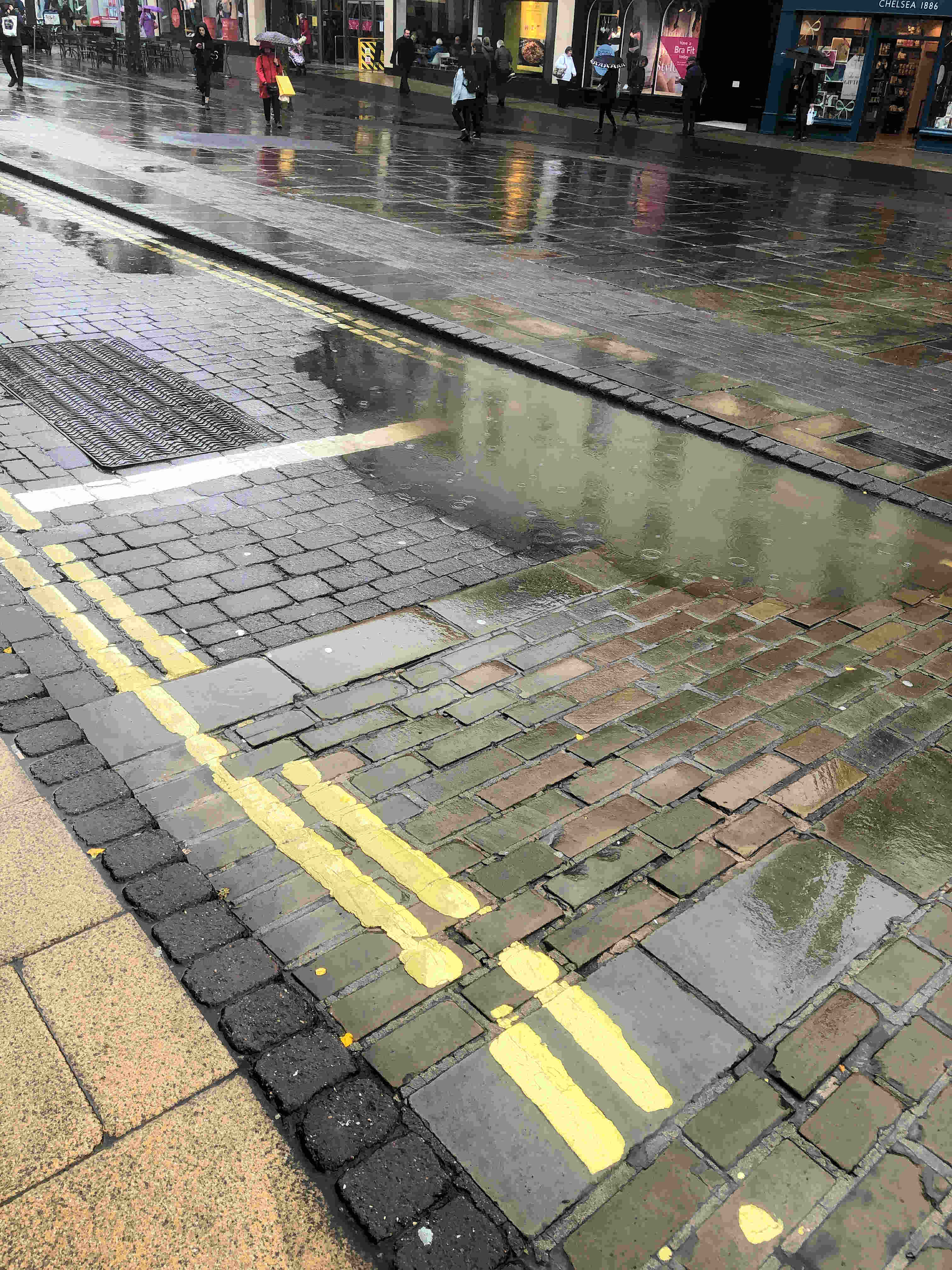
Although surface water flooding is usually associated with winter conditions, issues can arise at this time of year.
We are likely to experience intense rainfall over the next few days.
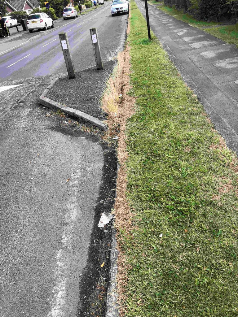
This means that any blocked drainage channels and gullies will be tested. Residents would be wise to check any public gutters near their properties and report any blockages.
The gully near the Foxwood shops has been blocked for several months. It has got gradually worse as weeds have gone untreated and detritus has accumulated. We have asked for prompt attention.
More than 40mm of rain fell on large areas of the City in just over 15 minutes on the 13th August 2018, the intense nature of the storm led to significant areas of the cities road network being impacted by standing water and drainage systems were unable to cope.
Several properties were internally flooded and outbuildings and gardens of a greater number of properties were similarly affected.
Surface water flooding occurs when rainfall exceeds the capacity of open or piped systems or cannot soak into the ground. It typically occurs because of high intensity rainfall and can be aggravated by pipe or ditch blockage.
Click to view surface water vulnerability map of York
The York Council report is well written and makes several suggestions for improvements It refers to ongoing problems in Haxby but more generally highlights the gully reconstruction and cleaning programme that has been taking place over recent months.
The August event, when 120mm/hr of rainfall were recorded, is exceptional. Any event like this will cause some surface water accumulation but the City is now better prepared to deal with heavy rainfall in future.
One of the recommendations in the report is that network of digital rain meters is installed across the city.
We understand that the Foxwood Residents Association have formally objected to the Councils plans to “replace” the children’s all-weather games area on Kingsway. The objection stems from the Councils proposal to build “fitness equipment” on Chesneys Field during the summer. The Association points out that no consultation has taken place over this proposal which could intensify the use of what is Public Open Space. When a similar idea was mooted 2 years ago, the preferred site for a fitness track was judged to be the Thanet Road Sports Area. The Association have suggested that the Council seek a partnership with the Acorn Rugby Club which could see a new 3G games area provided. Sport England have also objected to the Council’s plans
The Yorspace proposals for the Lowfields site have been criticised by the localDrainage Board. They are asking for further details of how surface water runoff will be handled. They point out the fact that – for the whole site – water run off is likely to be more severe than occurs from the existing greenfield use. There are already some problems with flooding in the gardens of some properties in the Green Lane and Tudor Road area.
Separately the Lowfields Residents Group has objected to plans which would see the number of off street parking spaces reduced near 108 Tudor Road. They are also concerned about the traffic implications of building a new access road onto the Lowfields site
NB. The contract for “enabling works” at Lowfields was awarded to NMCN. It is valued at £260,000. The end date for the contract is 19th April 2019.