
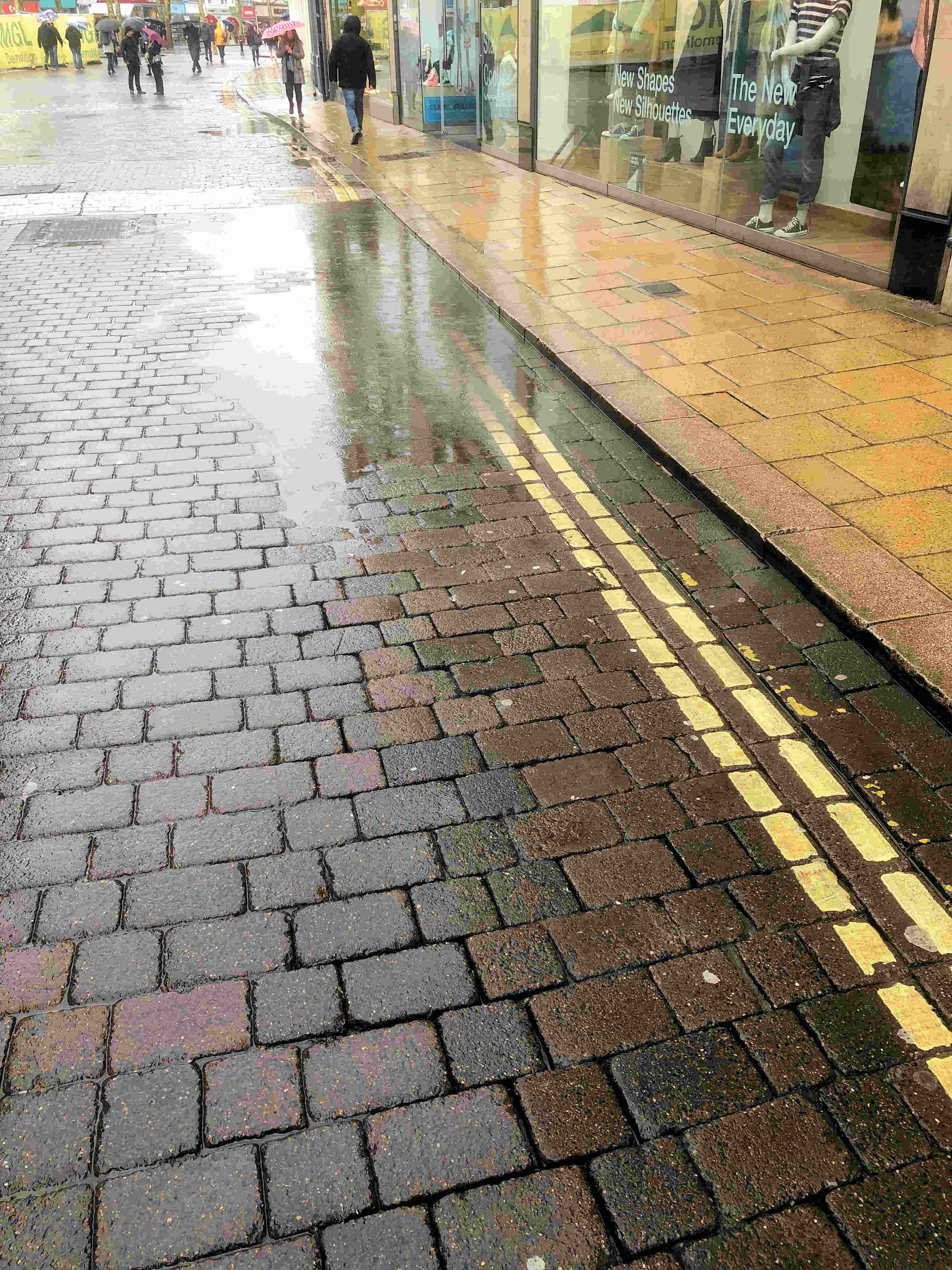
Surface water #flooding is possible across parts of Yorkshire due to rain falling on saturated ground.
— Environment Agency – Yorkshire & North East (@EnvAgencyYNE) February 6, 2021
Stay safe and don’t walk or drive through flood water.
For guidance on #SurfaceWaterFlooding in your area, contact your local authority.#FloodAware pic.twitter.com/ObX36kA0GB
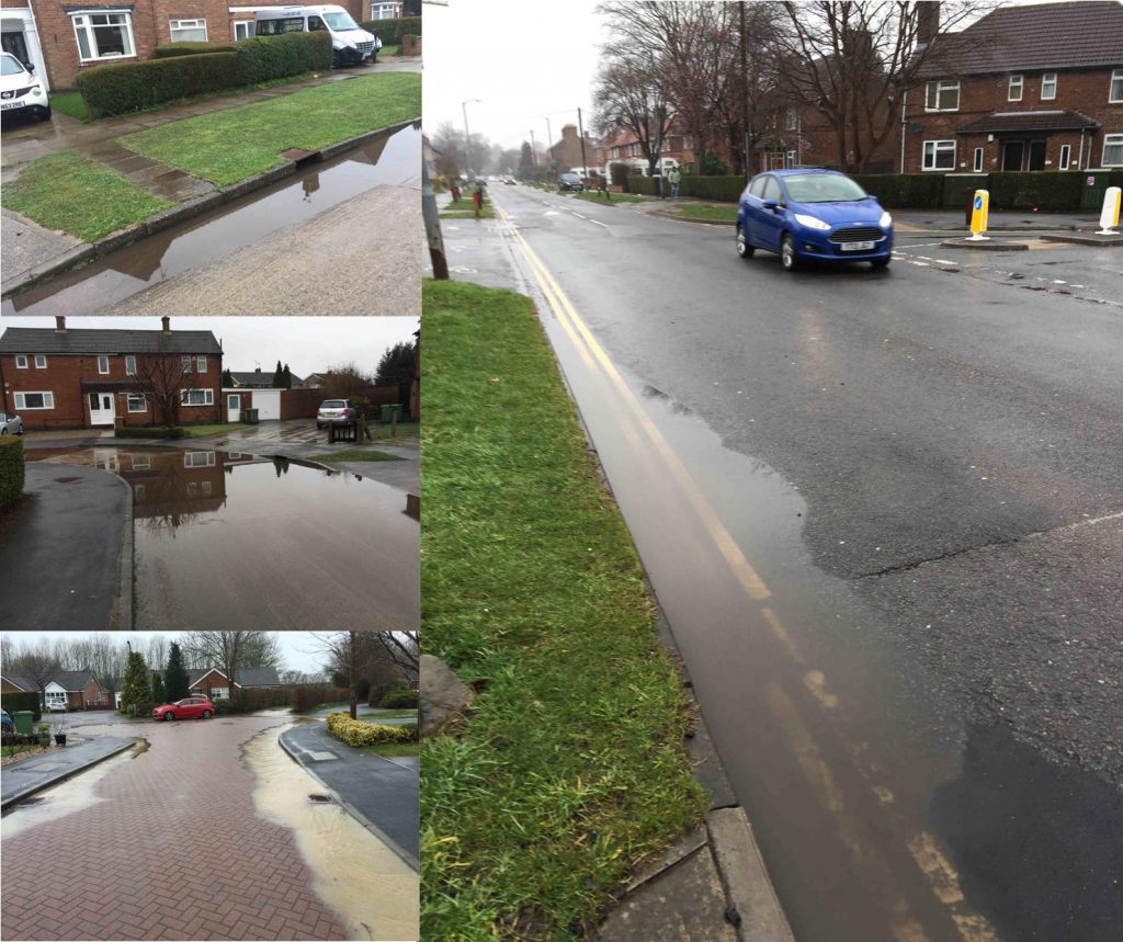
Report those puddles!
Residents are being urged to report any accumulation of surface water to the York Council.
Today’s heavy rain has meant that several roads and footpaths are impeded by large puddles.
In some cases these may be the result of blocked gulleys
In other cases the cause may be a poorly aligned carriageway.
Either way, the Council needs to add any vulnerable locations to its future maintenance programmes.
Reports can be made on line via the “Report it” system. Click to accesshttps://www.york.gov.uk/reportproblems
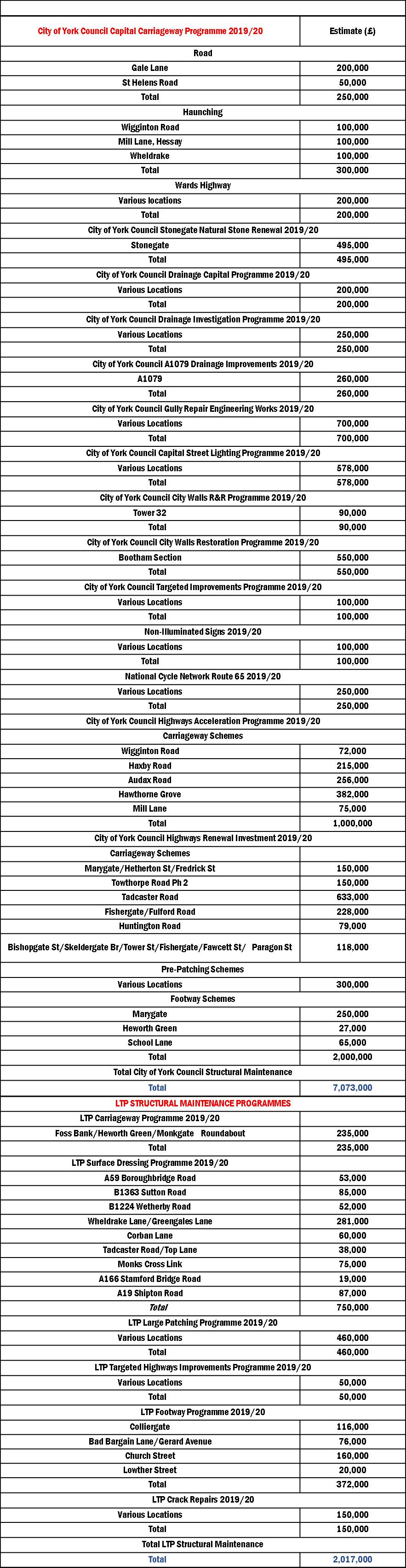
Road and footpath resurfacing in York
The York Councils maintenance programme for the forthcoming year has been published. Expenditure of over £9 million has been identified although a lot of this will go on addressing surface water drainage problems. The schedule includes £700,000 for gulley repairs
The programme also includes investment of over £600,000 to maintain the City Walls, with the focus being on the Bootham section.
One of the most expensive single schemes will see Stonegate repaved at a cost of £500,000.
On the west of the City the carriageways on both Gale Lane and Tadcaster Road will be resurfaced. Cycle routes will get a £250,000 maintenance boost.
However, the funds allocated for footpath repairs is disappointingly low. The identified major footpath resurfacing schemes are all on the east of the City.
It must leave residents living in streets like Walton Place wondering just how bad a footpath must be before being repaired.
Predictably last night the York Council woke up to the major backlog in highway repairs that has developed in the city during the last decade. Cynics may say that Labour and the LibDems vying to be the voice of the road user has something to do with the imminent Council elections which take place in early May.
However, successive residents’ surveys have confirmed that poor highway maintenance is now the biggest concern that residents have.
It will take a major and sustained boost in funding if the roads and paths in the City are to be returned to a safe condition.
Surface water flooding in York: Final report published
The final report in the flooding which took place in the City on 13th August 2018 has been published.
click to read
More than 40mm of rain fell on large areas of the City in just over 15 minutes on the 13th August 2018, the intense nature of the storm led to significant areas of the cities road network being impacted by standing water and drainage systems were unable to cope.
Several properties were internally flooded and outbuildings and gardens of a greater number of properties were similarly affected.
Surface water flooding occurs when rainfall exceeds the capacity of open or piped systems or cannot soak into the ground. It typically occurs because of high intensity rainfall and can be aggravated by pipe or ditch blockage.
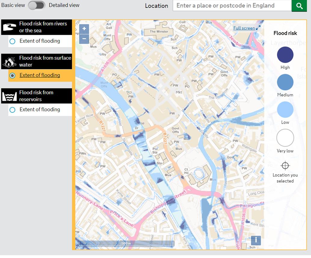
A map showing areas potentially vulnerable to surface water funding can be found here https://flood-warning-information.service.gov.uk/long-term-flood-risk/map
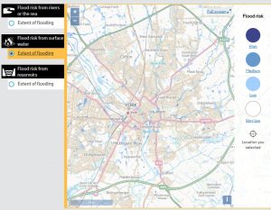
Click to view surface water vulnerability map of York
The York Council report is well written and makes several suggestions for improvements It refers to ongoing problems in Haxby but more generally highlights the gully reconstruction and cleaning programme that has been taking place over recent months.
The August event, when 120mm/hr of rainfall were recorded, is exceptional. Any event like this will cause some surface water accumulation but the City is now better prepared to deal with heavy rainfall in future.
One of the recommendations in the report is that network of digital rain meters is installed across the city.
Surface water flooding – York Council and Environment Agency plans updated
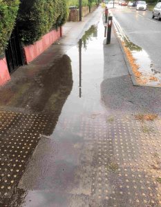
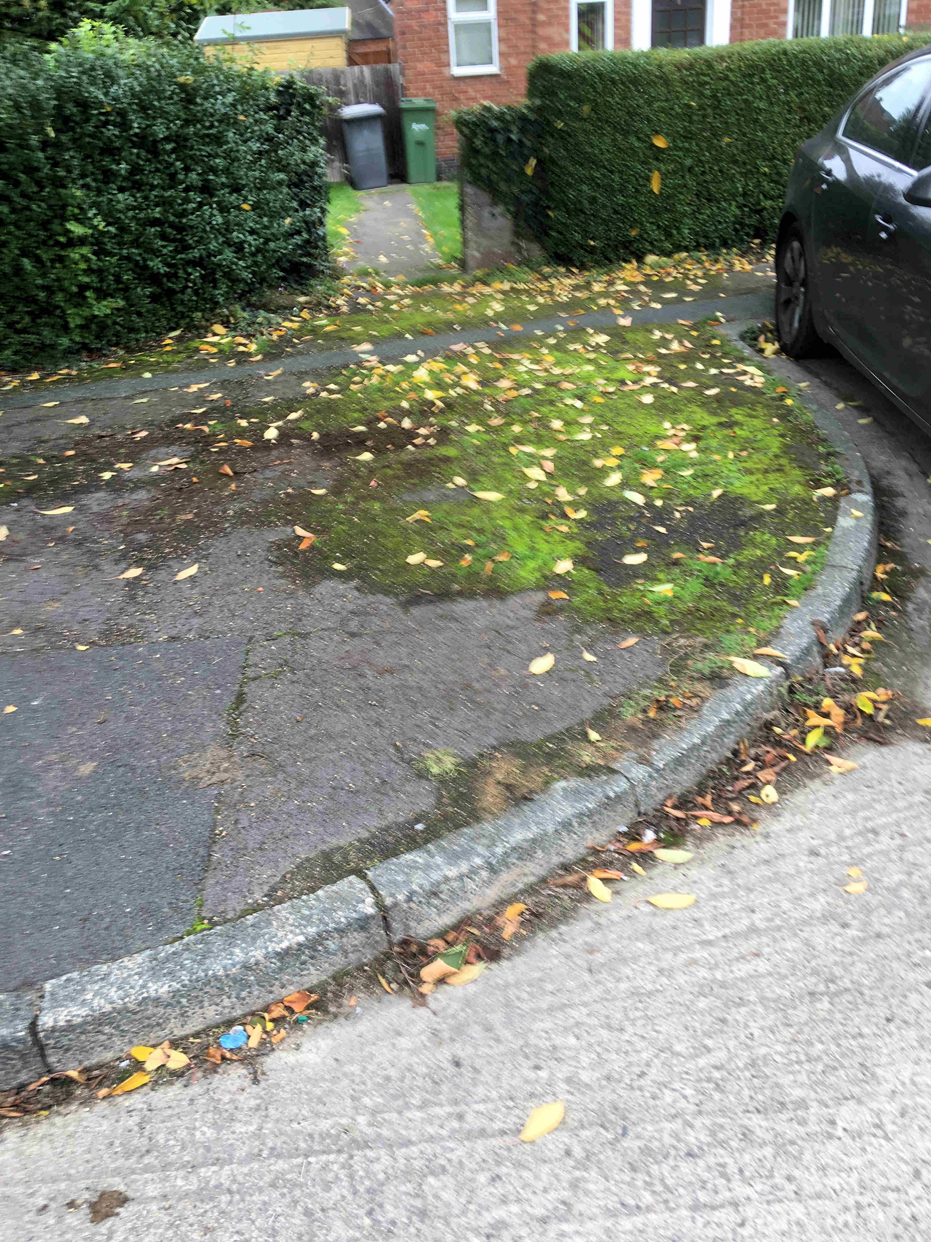
Gale Lane blocked footway gully
The recent surface water flooding which we saw a few weeks ago is being addressed by the Council. In a report to be considered next week, they say that their Flood Risk Management Team is currently investigating the consequences of the 13th August 2018 storm which affected the city. More than 40mm of rain fell on the city in just over 15 minutes, Rainfall rates more than 120mm/hour were recorded.
The problems seemed to be exacerbated by blocked gullies. This was a problem on some roads where footpath gullies were obstructed.
A policy adopted by the then Labour controlled Council 5 years ago meant that gullies were cleaned only upon report. Due to this reactive cleanse policy in recent years, approximately 53% of drains have been found to be blocked upon attendance.
The Council says the revised gulley cleansing policy aims to proactively cleanse all gullies on the gritting network annually and all other assets are reactively cleansed following reports of issues. “There are more than 43,000 gullies in the CYC area and approximately half of these are on the gritting network”.
The Council has allocated funding, in the period up to 2020, which will allow the whole network to be surveyed, the development of an improved asset register and an effective proactive cleanse of each asset to be carried out. Over the whole programme, which started in 2015, the added investment will have ensured that in the region of 23,000 gullies were left in a free running state that were previously not draining effectively.
Additional gullies cleansed, and data recorded
| 2015/16 | 8,000 |
| 2016/17 | 15,074 |
| 2017/18 | 12,810 |
| 2018/19 | 2,468 (to date) |
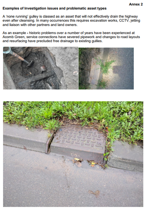
However, more than 900 ‘non-runner’ assets have been identified where the gulley cleansing process could not ensure free drainage and significant engineering works (digging out) are required to improve them. None of the current defects were found to be in a location where property flooding could occur as a direct consequence of severe rainfall.
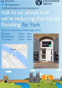 Separately the meeting will consider an update report from the Environment Agency on tacking river flooding issues across the City. The Agency is doing well in keeping residents briefed on the work that they are doing. They have now started a web site which builds on their communications plan tick here This complements the information “hub” that they established on Wellington Row.
Generally, the update says that work to improve flood defences is proceeding in line with the agreed timetable
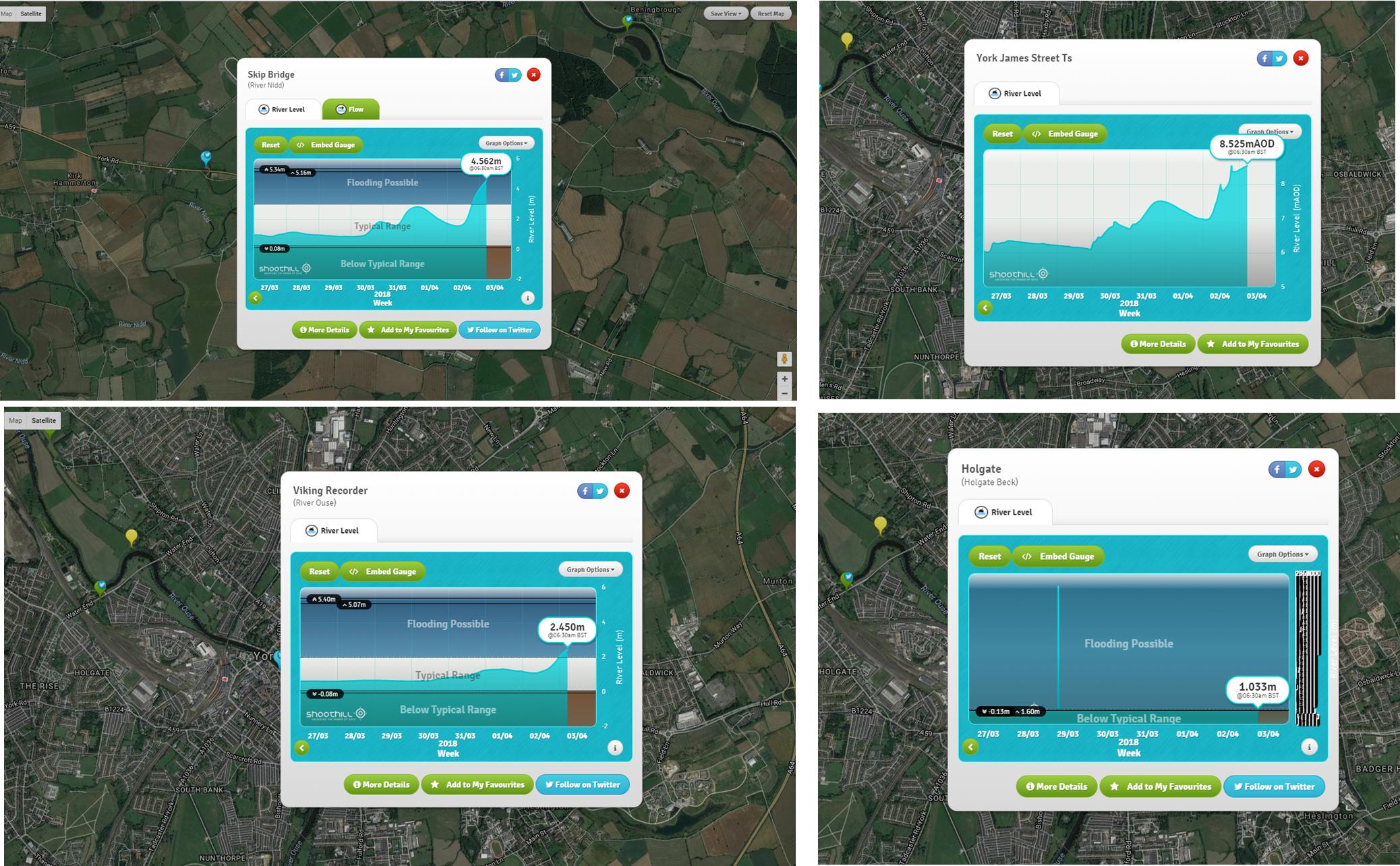
Flooding in York: What to look out for
The heavy rain in the City has subsided today but several rivers are still showing increasing levels. We recommend that residents check the river gauges regularly and in particular those located upstream of the City. There is still a lot of water to flow through.
Click here for the river gauge real time map
Click here for the latest flood alerts and flooding maps
Drivers faced another hazard yesterday as a large pothole developed on the A59 road works on the south bound side of Skip Bridge. The carriageway is single file, over the bridge, there at the moment. Some delays may be expected,.

Several Councillors including – Andrew Waller – toured their wards yesterday to identify areas where gullies might be blocked. Some surface water flooding was identified by Andrew in Osprey Close (run off from agricultural land), Westfield Place, Cornlands Road, St Stephens Rd., St Stephens Square and Gale Lane, Any blocked gullies have been reported for attention.
53% of road drains found to be blocked in York Council survey
£5 million cost to upgrade whole system
 Considerable concern was expressed in 2015 when it was discovered that large areas of highway were flooding during wet weather. Many residents complained that the reduced gulley cleaning service – introduced by the last Labour led Council – was inadequate. The City has over 42,000 gulleys.
In 2016 and 2017 there were major surface water problems in several parts of York.
The led the new Councillor – Andrew Waller – responsible for surface water drainage systems to institute a review of standards.
The initial findings of the comprehensive survey into the effectiveness of drainage systems will now be presented to a meeting next week
The report says,
“To date more than 35,000 of the 43,690 known gullies have been logged, investigated and cleansed as part of the capital funded investigation process, a flood risk assessment process has been previously carried out to ensure key assets have been prioritised.
53% of all assets were found to be blocked but significant work has ensured the majority of the system investigated to date is operating effectively, however more than 900 assets will require wider engineering works to ensure they can operate effectively”.
With many gullies now cleared, the report goes on to say,
“Subsequent heavy rainfall events have given rise to reduced numbers of complaints and reports of localised flood incidences, this is a clear indication of the success of this process, however, significant rainfall such as experienced on the 23rd August this year can still overwhelm a well maintained and operable drainage system as their design capacity would be compromised”.
The findings of an investigation into surface water ponding on Acomb Green is included in the papers (see below)
Flooding in York – where to find information
The government produces maps which show which streets in the City are subject to surface water flooding risks.
Of course, as we saw this morning, other areas can be vulnerable if the capacity of drains is exceeded (and/or they are blocked).
You can access the information here: https://flood-warning-information.service.gov.uk/long-term-flood-risk
Real time flooding maps can be found via this link https://flood-warning-information.service.gov.uk/map
Real time river level gauges can be found here http://www.gaugemap.co.uk/#!Map
The York Council’s surface water management plan can be downloaded from this link http://www.york.gov.uk/download/downloads/id/11055/surface_water_management_plan.pdf