York braced for flood season

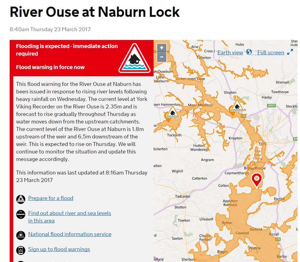
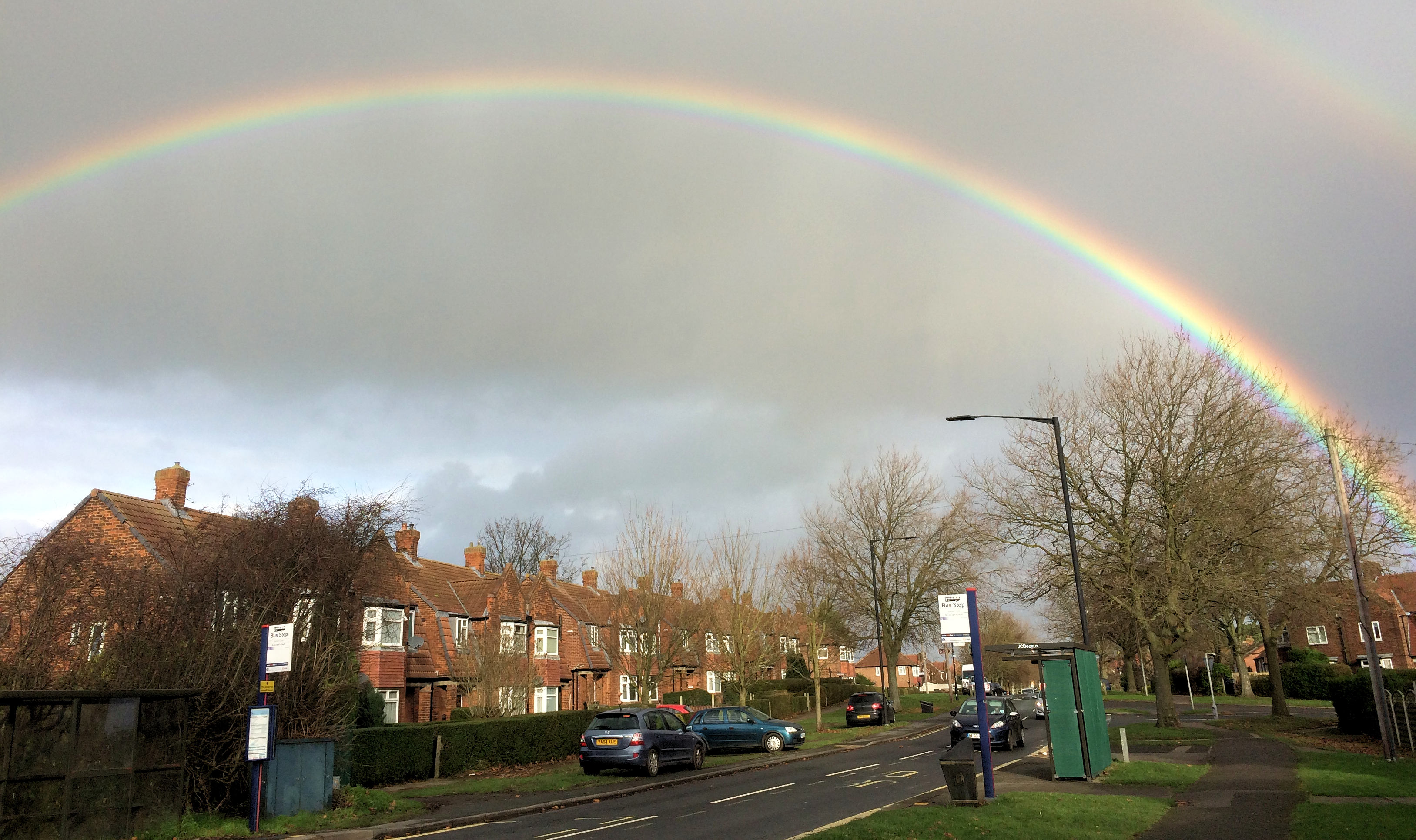
It’s that time of year again and thoughts of some York residents will focus back onto flood risks.

The first flooding of the season has occurred in Craven overnight. That water will be heading in York’s direction.

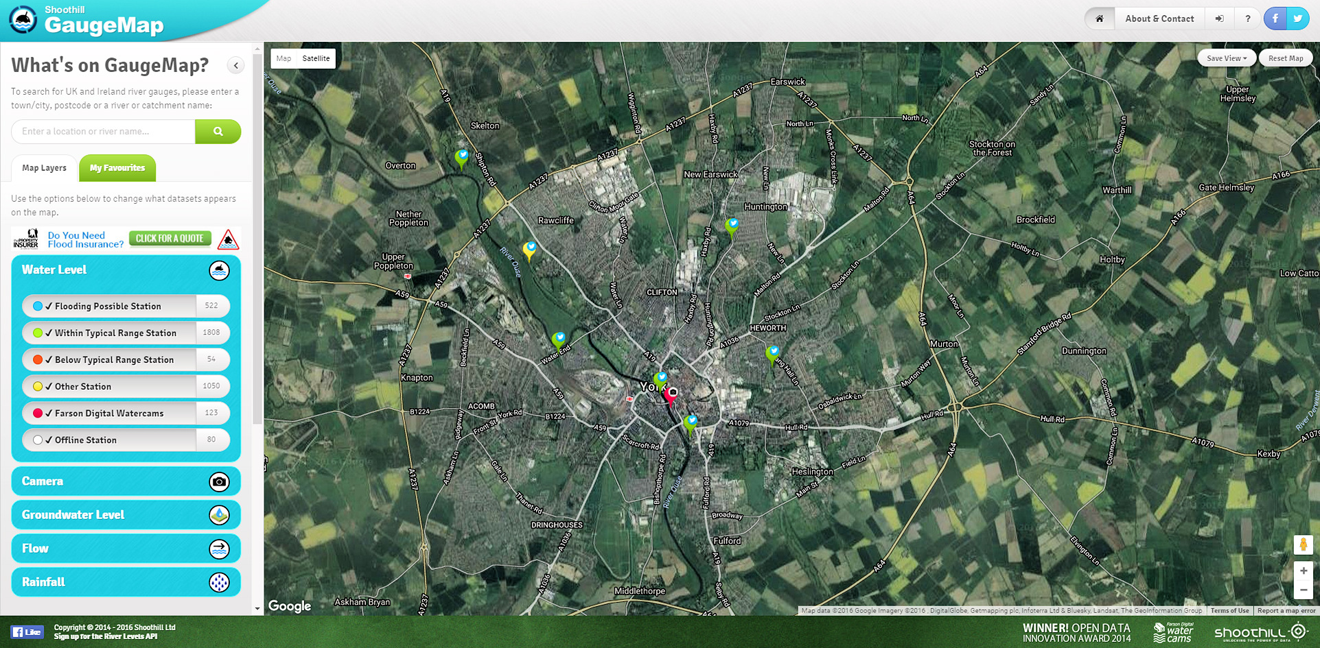
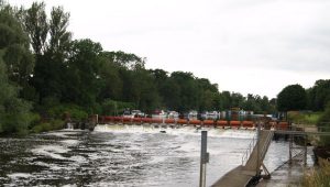
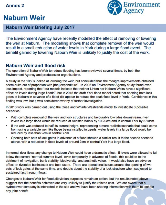
In tte main the rivers to keep an eye on are the Swale, the Ure, the Nidd and the Foss. All contribute to Ouse river levels in and near York

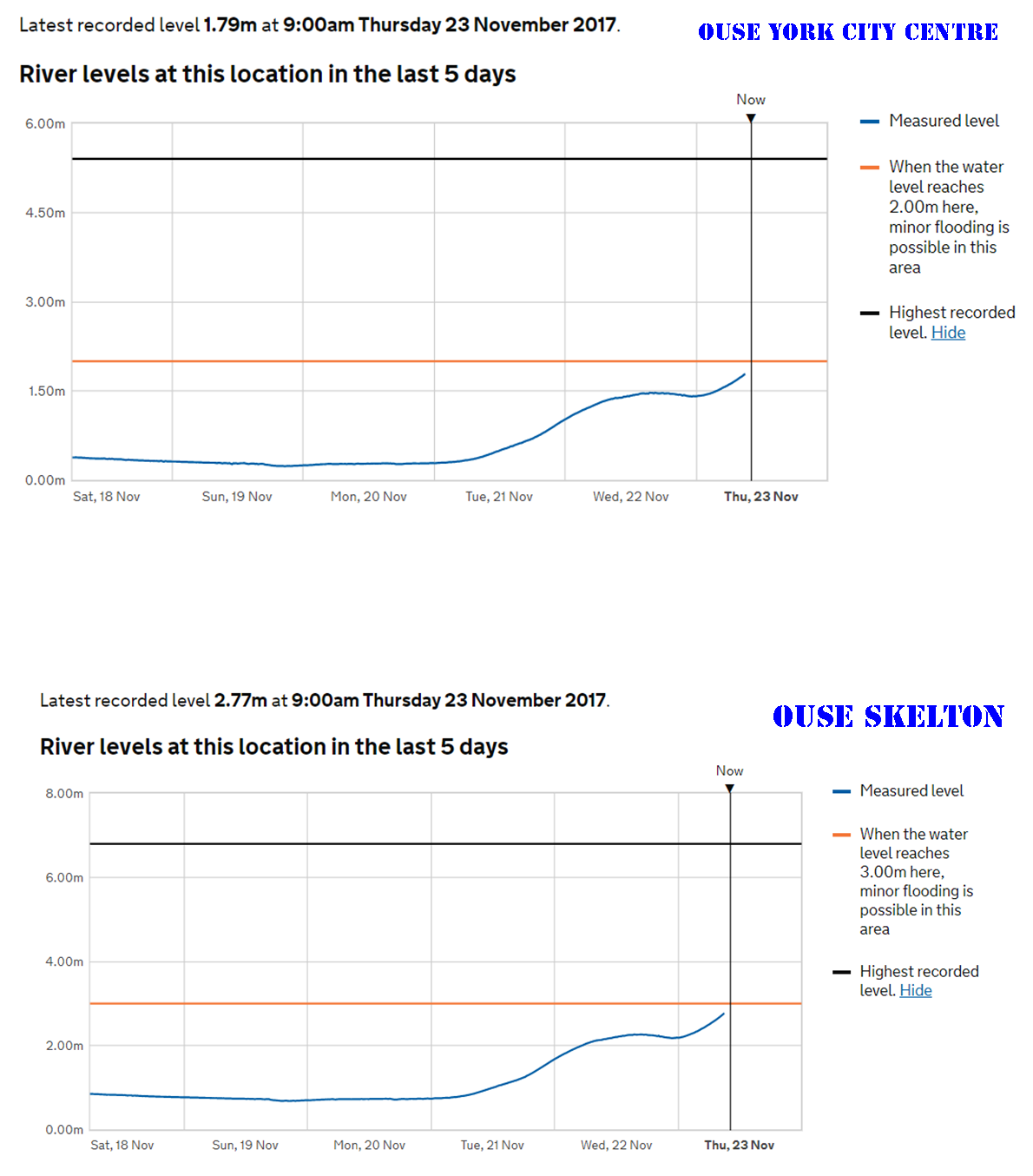
You can check real time river levels at this site Click 

River gauges in and around York as of now (am 23rd November) are still below flooding levels but there are concerns about the Swale and Ure. The Swale at Myton is now in flood range  as is the Ure at Boroughbridge.

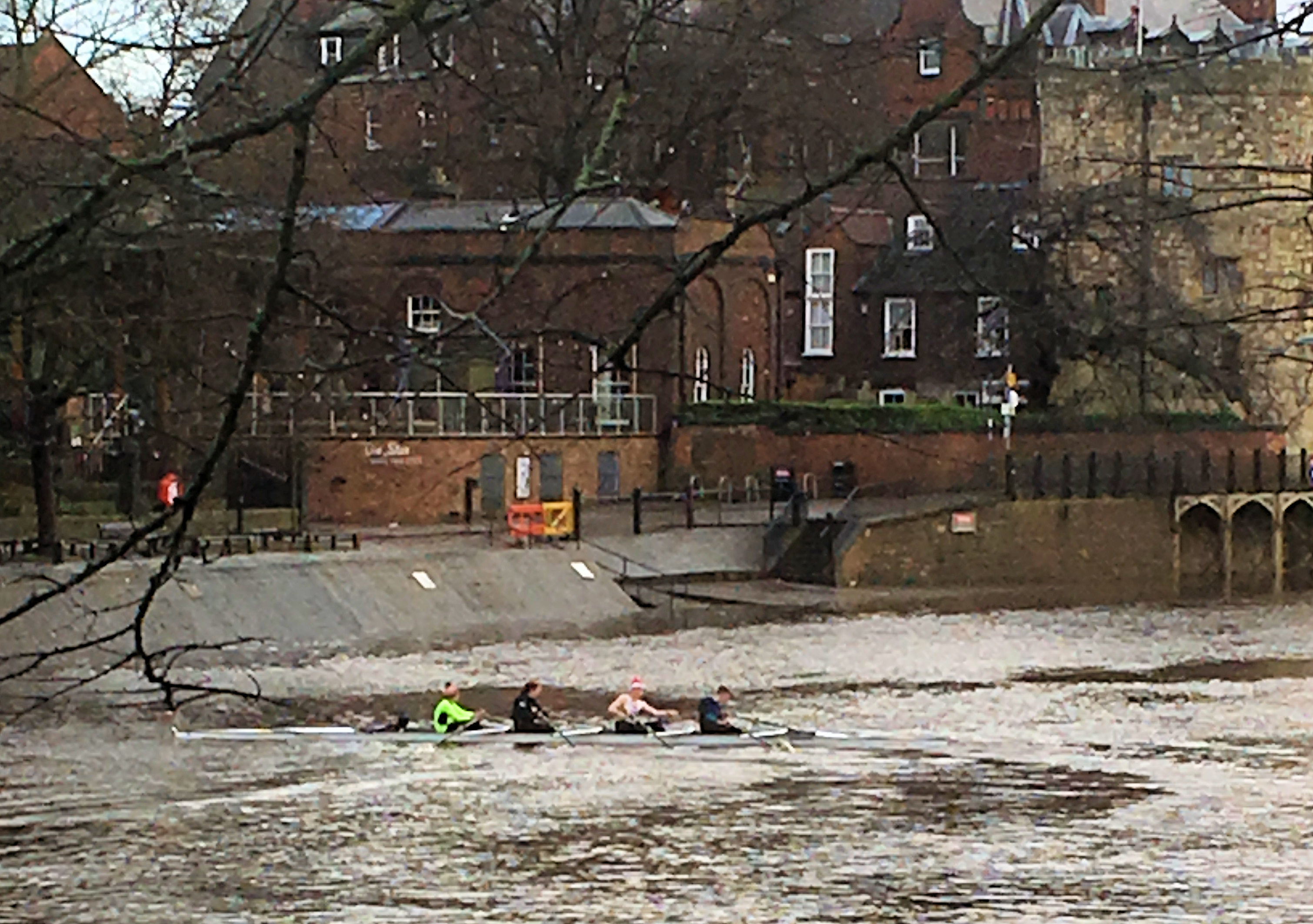
It would be unusual for major flooding to occur in the City as a result of recent rainfall. Usually flooding happens when a combination of factors (sodden ground, snow melt, sustained rain) come together.

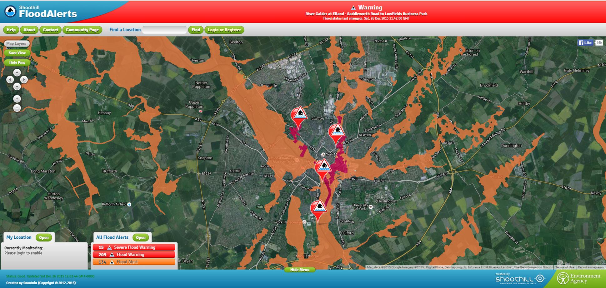
Better safe than sorry though so we recommend the Flood Warning Alert service Click

York flooding – more details emerge of £45 million action plan

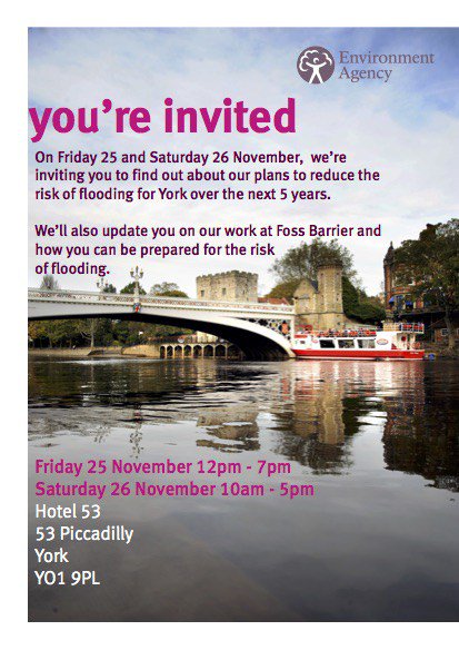
A meeting on 4th September will, receive an update report on plans to tackle flooding problems in York.

In late December 2015 followed an intense period of rainfall across November and December due to the impacts of Storms Desmond and Eva, record river levels were observed in many river catchments across the north of England.

More than 4000 homes and 2000 businesses flooded across Yorkshire with 453 properties and 174 businesses flooded in York.

Funding was  allocated to the Environment Agency (EA) following the floods to renew existing and provide new flood defences across the City.

£17m has been allocated to the Foss Barrier improvements and £45m to the wider flood defences across the city

The Environment Agency has produced an update of its 91 point action list, as well as a briefing leaflet (see below).

The decision meeting is open to the public and takes place at West Offices on Monday 4th September starting at 5:30pm

York Council to receive update report on 5 year flood plan

Naburn Weir

A meeting taking place on 3rd July will receive an update report on the progress made in reducing flooding risks in York.

The meeting will also receive reports on addressing flooding problems in Fulford and on plans to make significant changes to Osbaldwick beck in the Hull Road park area.

The flooding in late December 2015 followed an intense period of rainfall across November and December due to the impacts of Storms Desmond and Eva.

Record river levels were observed in many river catchments across the north of England. More than 4000 homes and 2000 businesses flooded across Yorkshire with 453 properties and 174 businesses flooded in York.

Funding was allocated to the Environment Agency (EA) following the floods to renew existing and provide new flood defences across the city.

£17m has been allocated to the Foss Barrier improvements and £45m to the wider flood defences across the city.

The Environment Agency has provided a summary report for the meeting and also an analysis of options for changes to Naburn Weir

Naburn Weir

Cycle hub set to become Environment Agency floods showroom

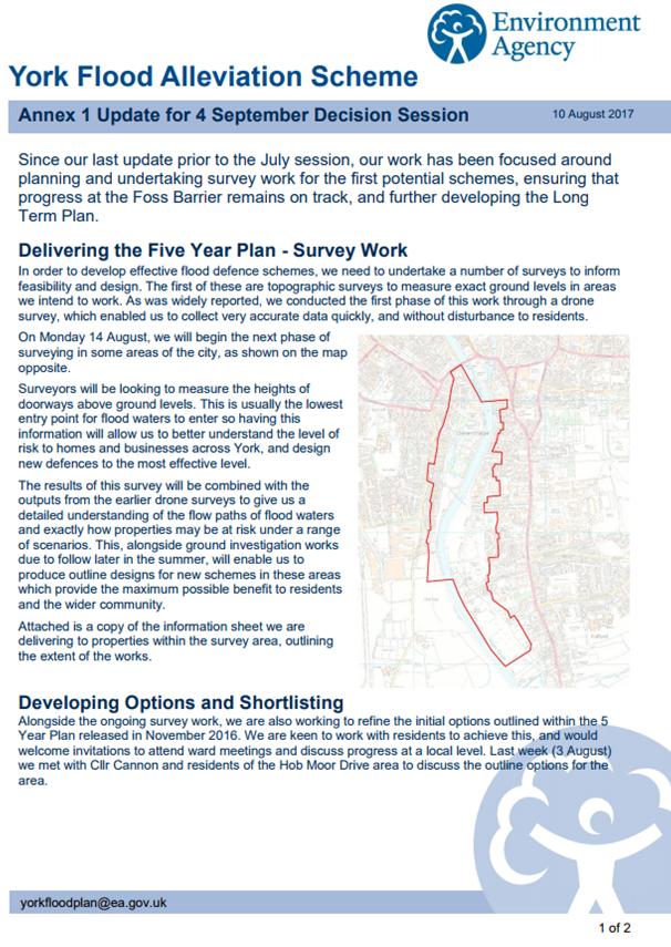
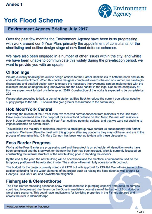
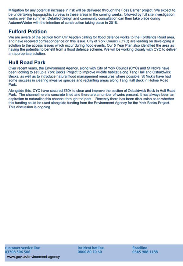
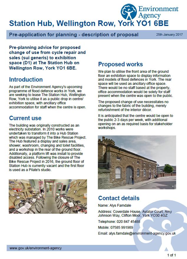
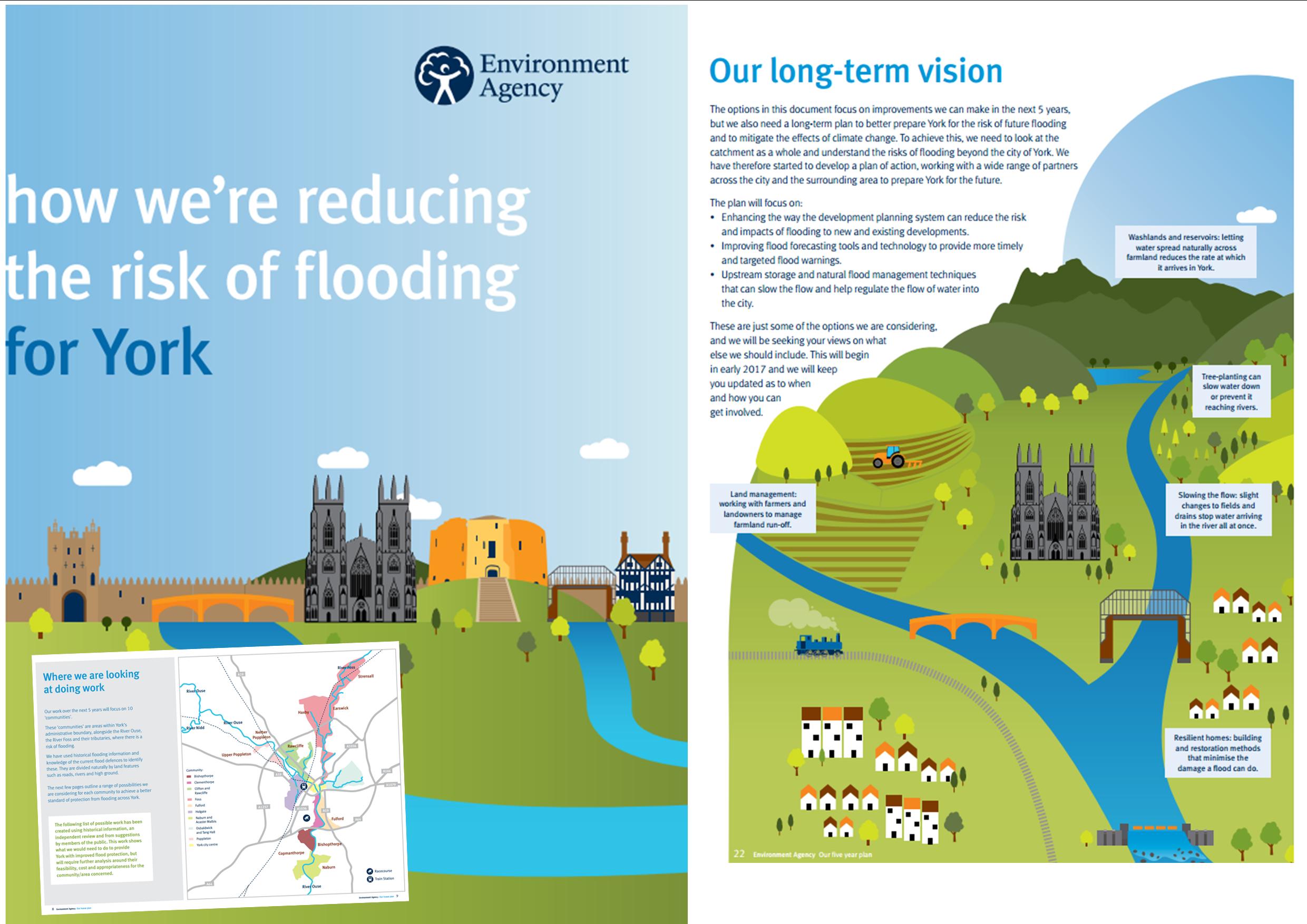
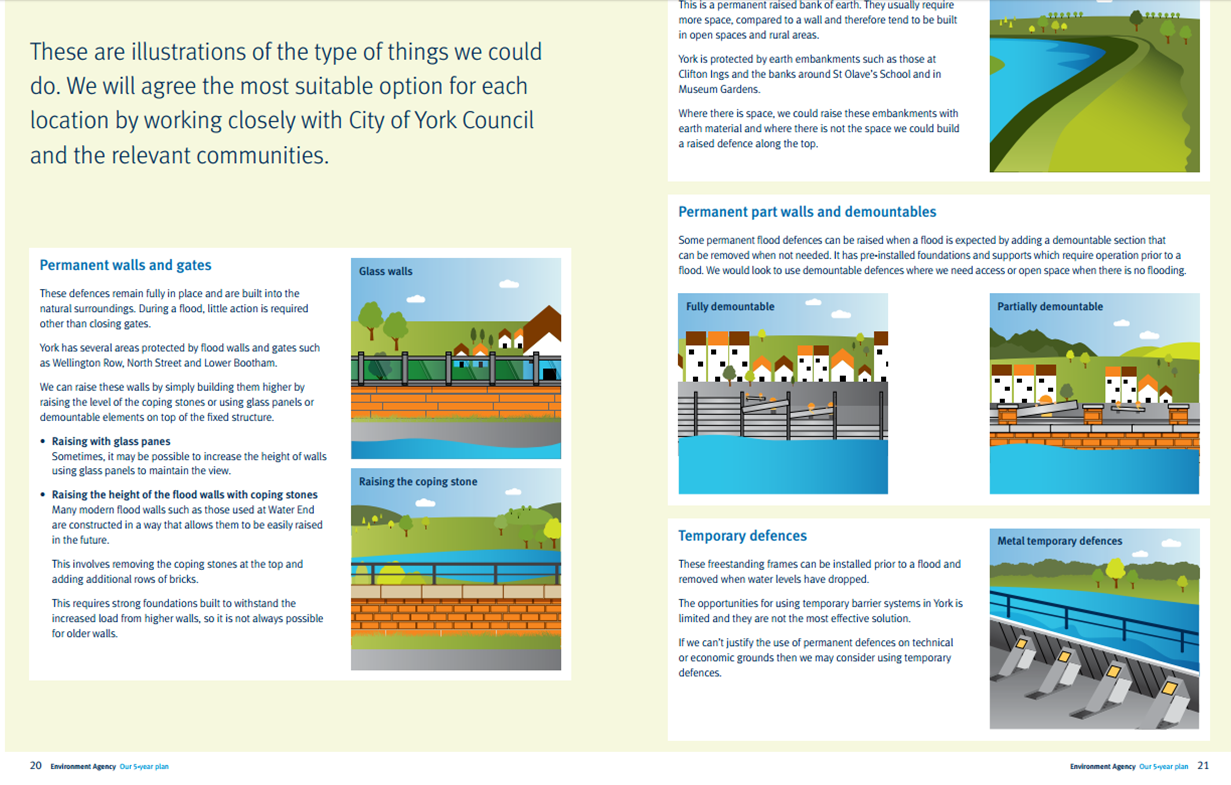
The Environment Agency say they want to establish a permanent exhibition of flood defence works at the former cycle repair workshop in Wellington Row.

They say that the show room would be open “2 or 3” days a week

They have submitted a “change of use” planning application

The showroom would be located only metres away from a key flood defence gate that is closed when the Ouse threatens to overtop its banks

What a difference a year makes

huntington-road-26th-dec-2015

Flood warnings 26th Dec 2015

It’s exactly a year since it became clear that something was going very wrong with the flood defences on the River Foss

. Few, including the media and the Council, initially reacted to the warnings issued by the Environment Agency but by 6:00pm properties were being inundated.

The Foss barrier pumps had failed.

A year later and residents are still waiting for the independent report into the flood to be published

However, this year the weather is much better No flood warnings have been issued by the Environment Agency 

& Christmas Day this year was one of the warmest on record as these photos illustrate


York - Selby cycle tarck 25th Dec 2016

York – Selby cycle track 25th Dec 2016

Rainbow over Acomb 25th Dec 2016

Rainbow over Acomb 25th Dec 2016


Quiet in York centre this Christmas Eve …. so far

It’s been a quiet start to Christmas Eve. Morning storms appear to have passed by now, leaving a  lot of surface water on roads and footpaths where drains are blocked. There are particular problems on Mount Vale, under the Leeman Road railway bridges and on Carr Lane.

Only a few people have ventured into the City centre and there are car parking spaces available in most car parks. They may however fill up quickly this afternoon as public transport begins to wind down.

The St Nicholas fair is now closed although the Shambles Market is doing some brisk business.

There is a lot of tree detritus and fallen leaves on the paths so care is required.

shambles-market-1100-hrs-24th-dec-2016

Shambles (Newgate) market is open

The St Nicholas Fair has ended

The St Nicholas Fair has ended

Slippery leaves pose a threat for unwary pedestrians and cyclists

Slippery leaves pose a threat for unwary pedestrians and cyclists

Innovative forms of transport may be needed later today

Innovative forms of transport may be needed later today


No immediate flooding fears in York despite heavy rain

York river level guages remain within normal limits despite recent heavy rain.

You can check river levels at the following web site http://www.gaugemap.co.uk/#!Map

Click to access river level guages

Click to access river level guages

Meanwhile the Environment Agency have confirmed details of the flood prevention project exhibitions that they plan for the City.

The exhibitions will take place on Friday and Saturday

floods-exhibition-25th-nov