Flood defences to remain in place as more rain forecast

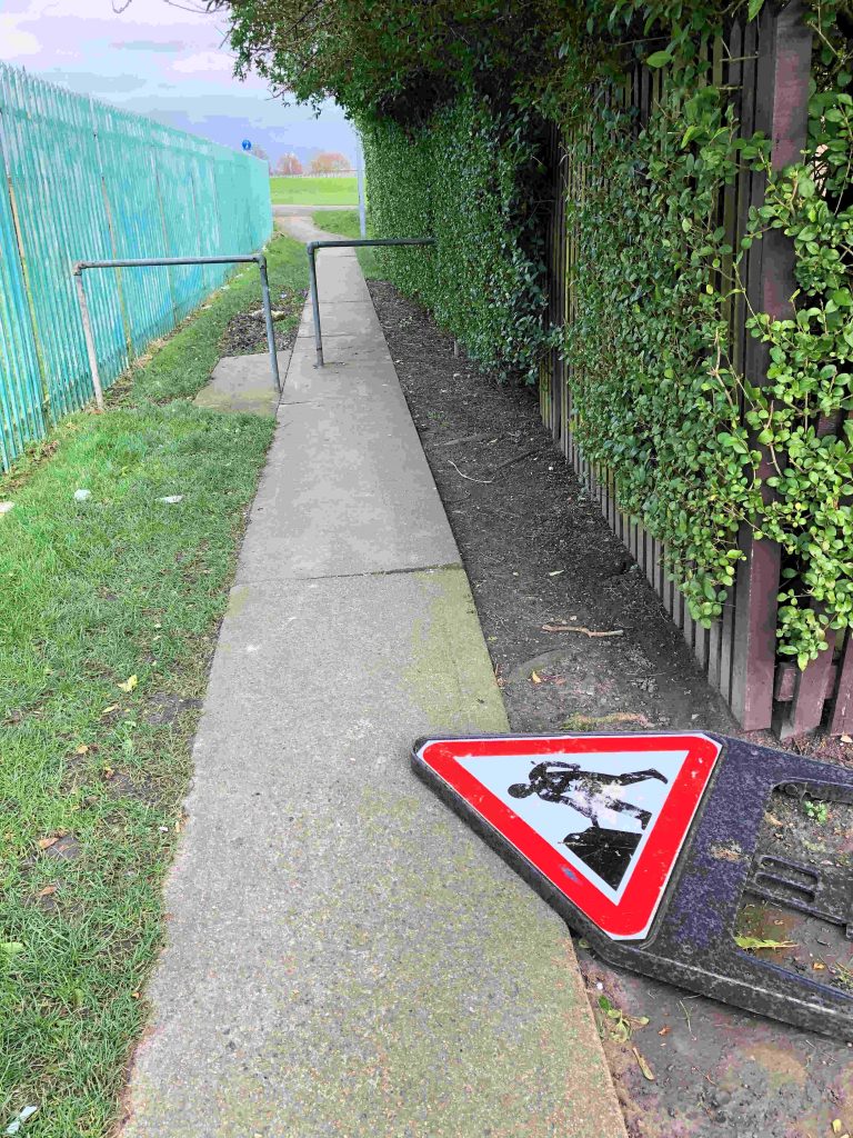
Clean up operation start across the city

City of York Council’s clean-up operation will start from today, but flood defences are staying firmly in place to continue protecting the city as heavy rain is expected this weekend.

The council continues to work closely with the York and North Yorkshire Local Resilience Forum, which includes police and fire services as well as North Yorkshire County Council, Met Office and Environment Agency.

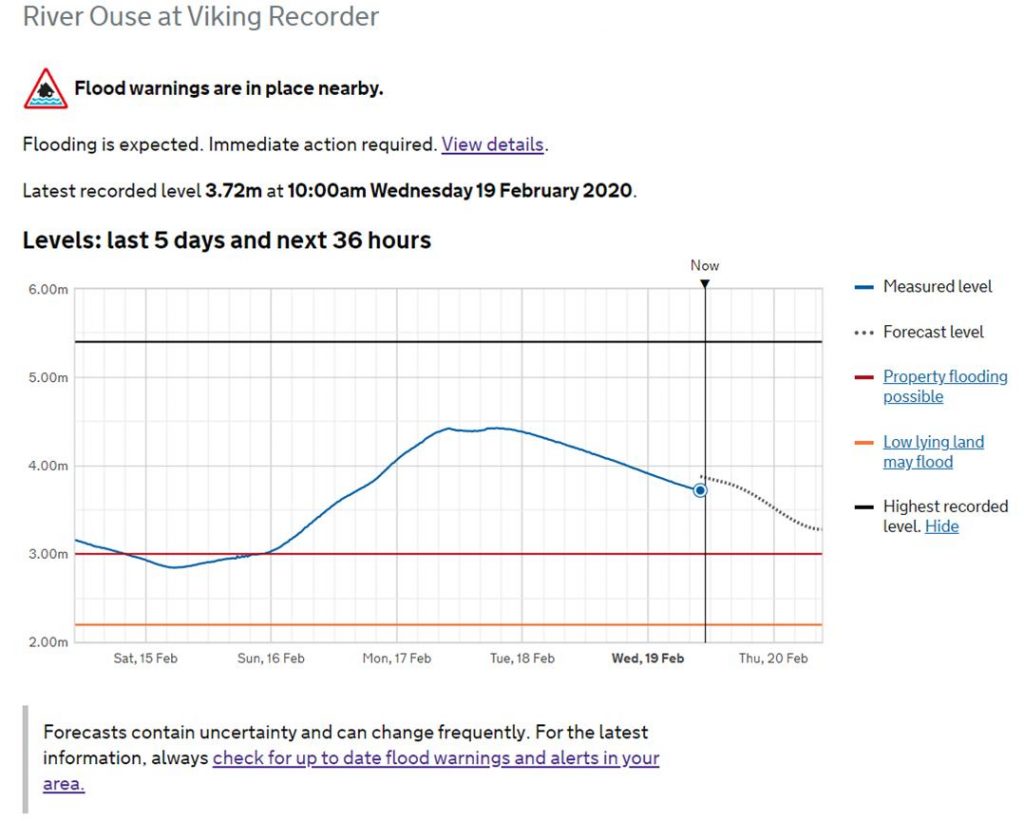
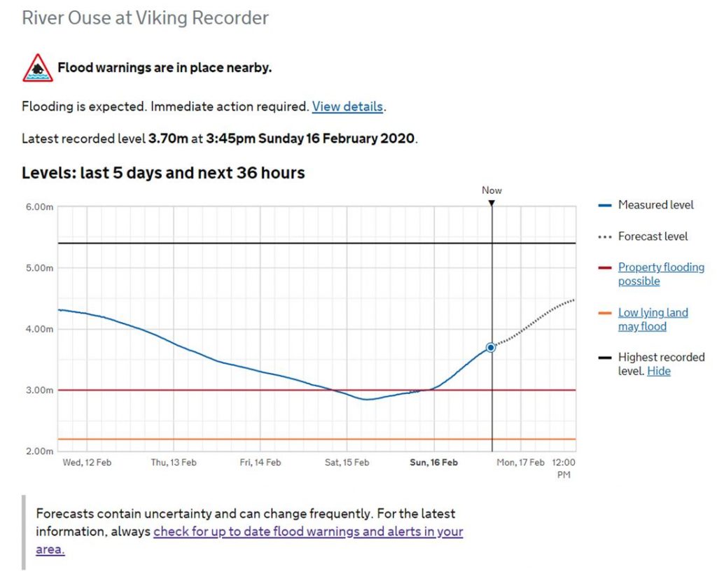
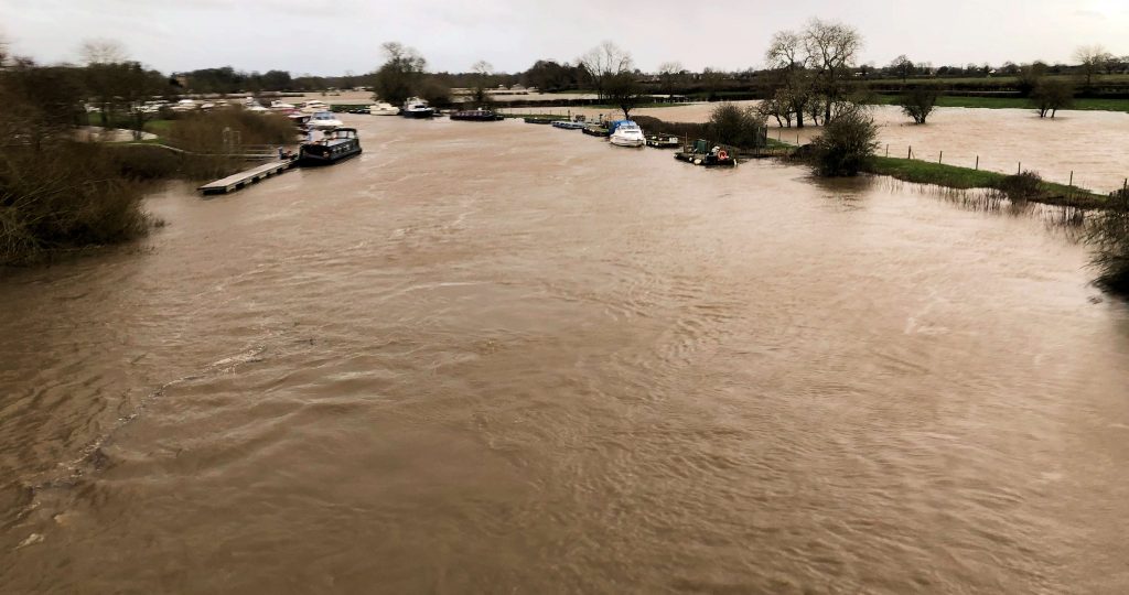
The latest advice from the Environment Agency is that the River Ouse is currently falling (slowly) so York is very much open for business.

With the expectation some warnings may be taken off, these may come back into force throughout the weekend with heavy rain expected. View the latest river level predictions and warnings here

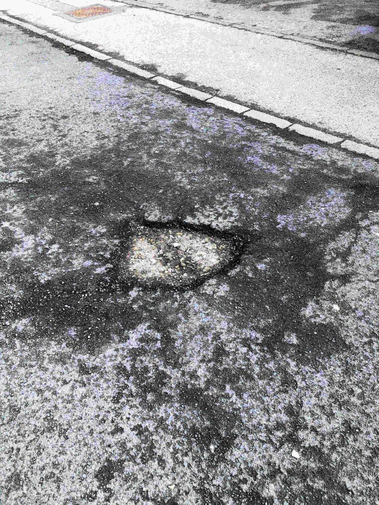
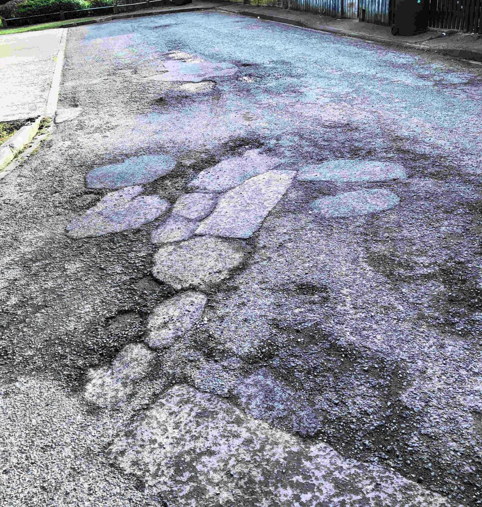
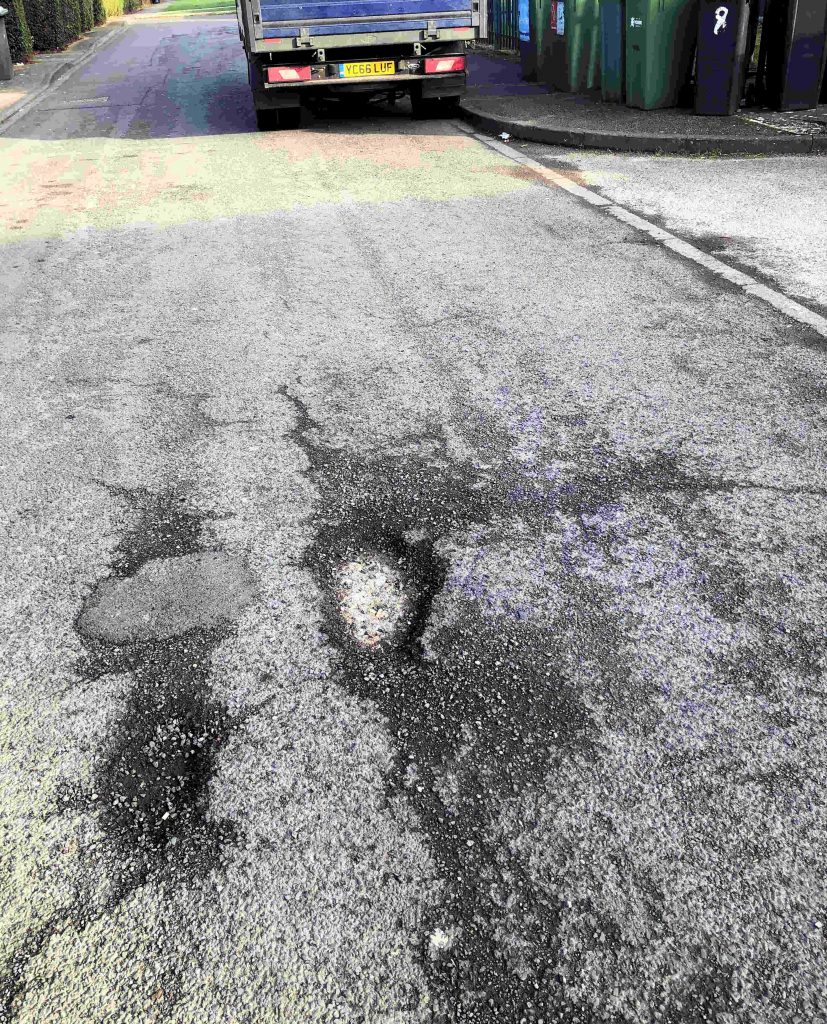
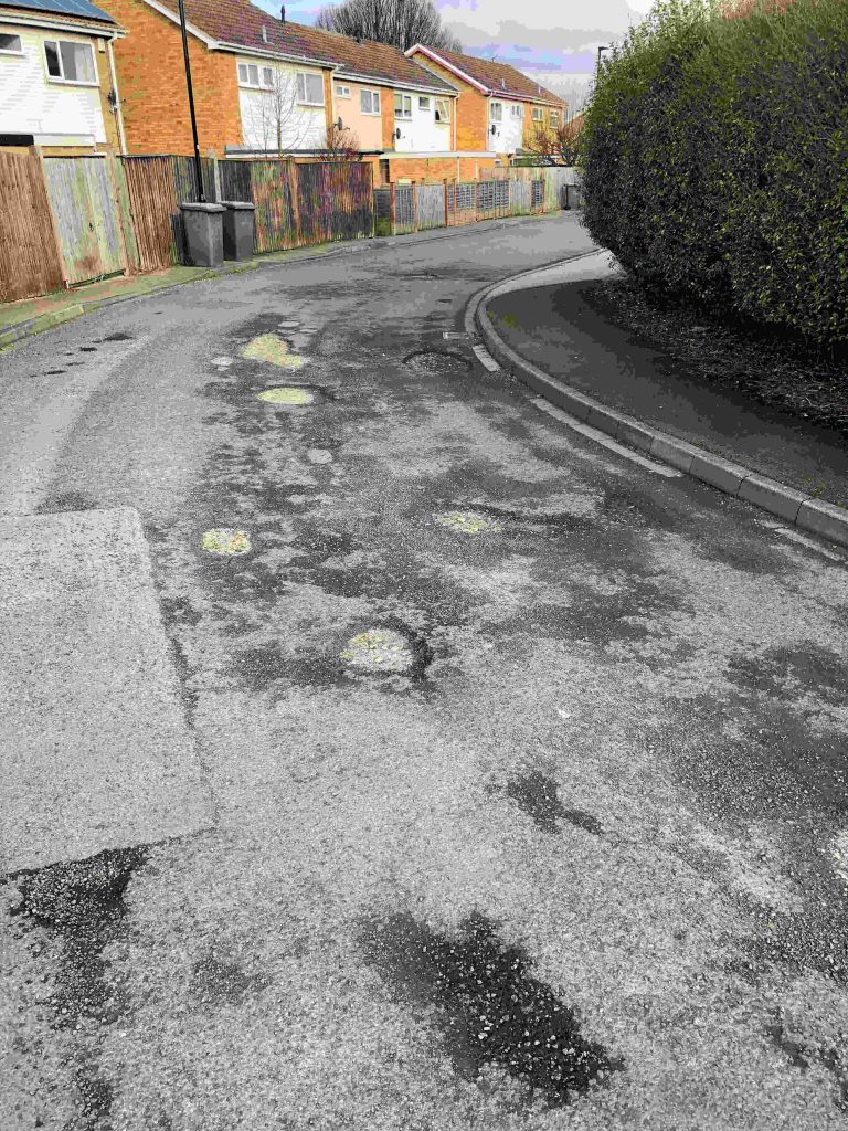
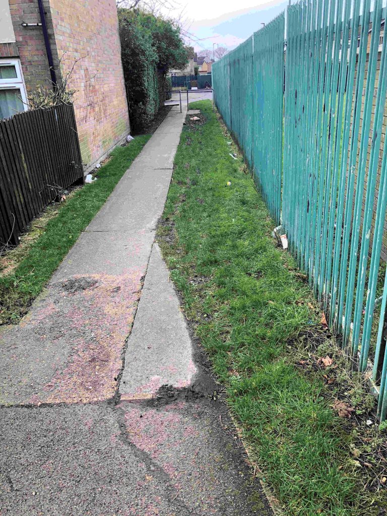
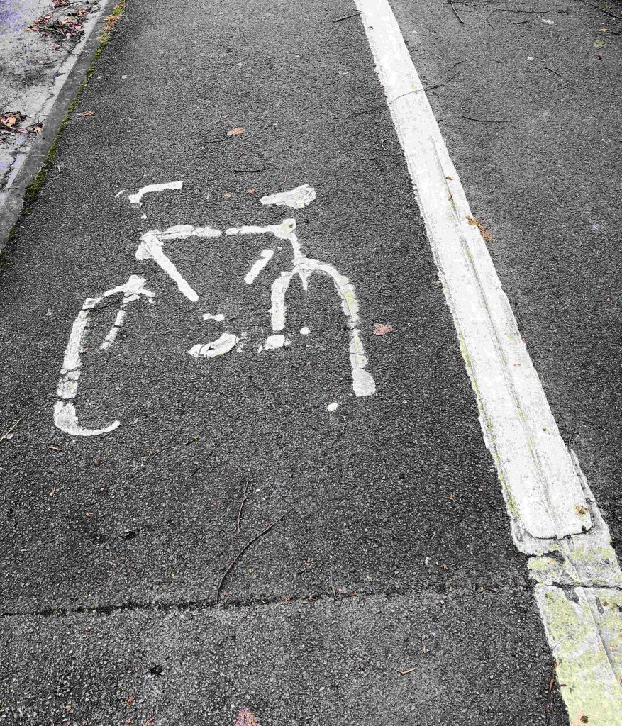
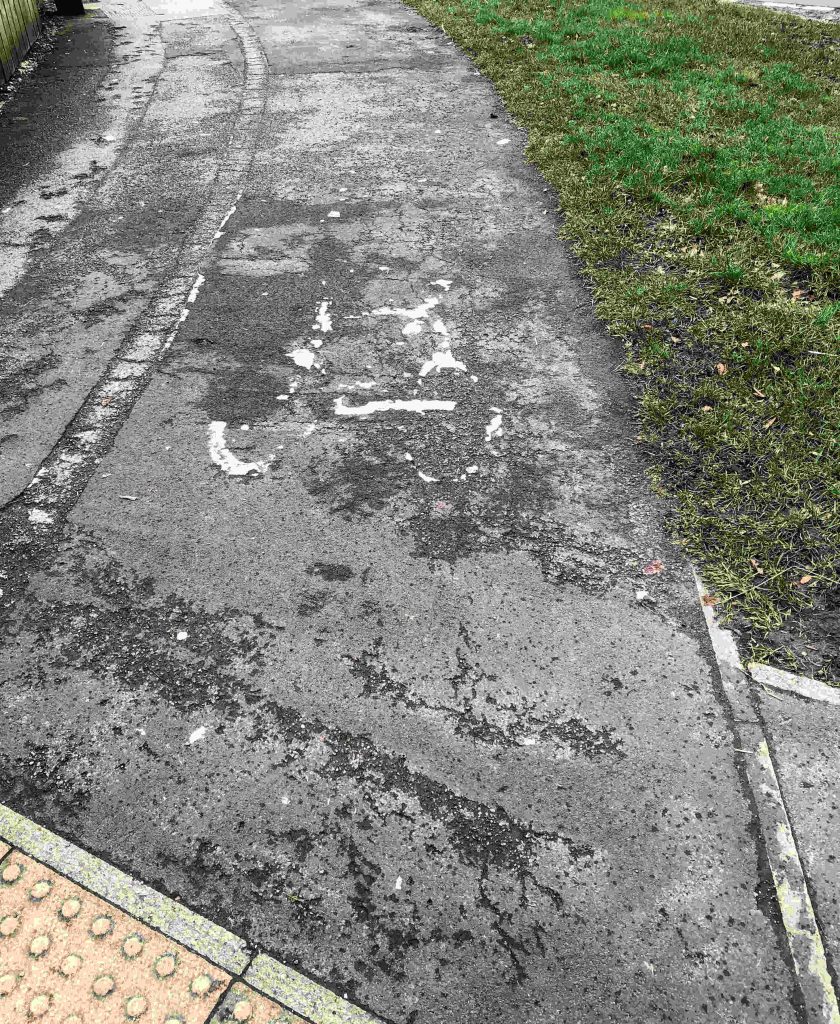
Councillor Keith Aspden, Leader of City of York Council said: “As our clean-up operation starts, you’ll see our front line teams sweeping and cleaning paths and cycle routes across the city from today. We’ll also be carrying out additional inspections of our roads to repair potholes.

“York remains vibrant and exciting as usual, offering lots of activities and events for residents and visitors over this half-term.

“We will be visiting hundreds of residents in flood-risk areas again over the rest of the week tomorrow and Thursday, to assess their needs and give the latest advice and information.

“Thank you again to all residents for your patience and support as the city deals with storms on consecutive weekends. My thanks also go to our staff and partners for their fantastic work, which has gone above and beyond required duties.”

“Please keep an eye out for the latest information and alerts from the Environment Agency for updates on river levels in the city.”

The Environment Agency river forecasters will continue to monitor the situation 24/7 and provide further updates.

As of Wednesday 19 February, the council has:

  • Having cleared over 300 gullies, swept roads and cleared drains, we also have tankers on standby for any surface water flooding incidents that occur.
  • Teams will now start to carry out the clean-up operation of sweeping and cleaning paths and cycle routes across the city (and river routes when water levels fall).
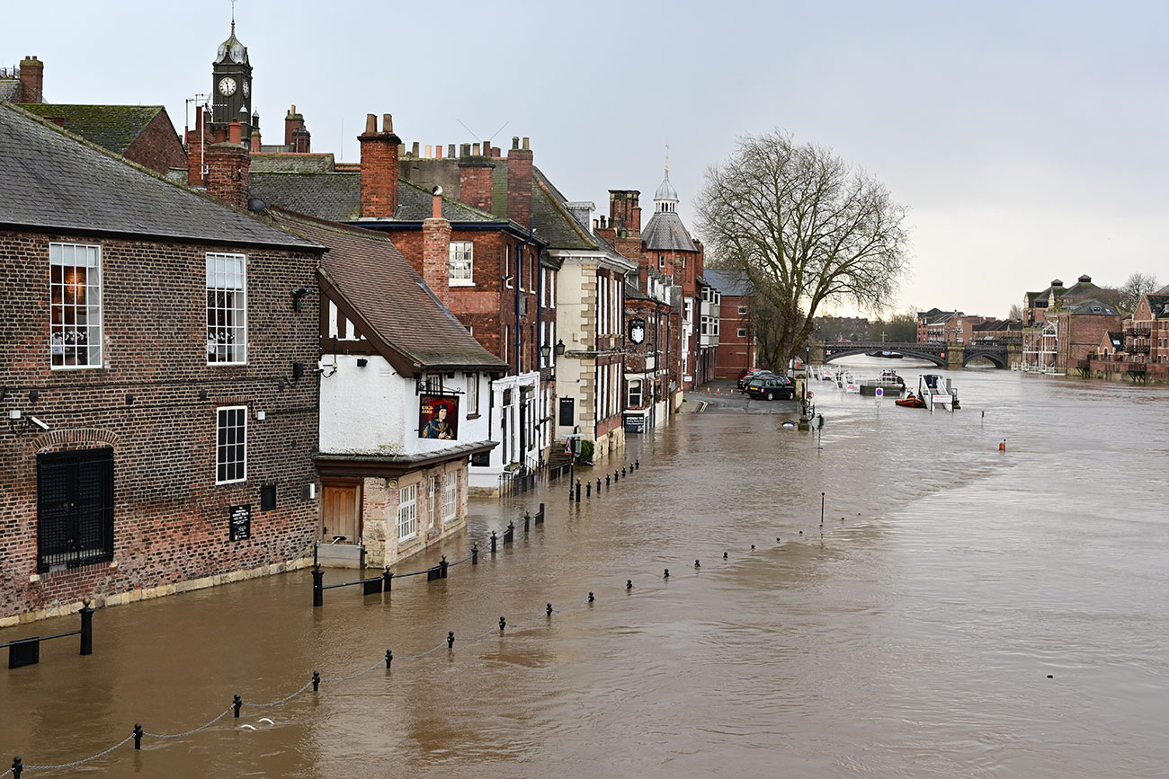
  • Hand delivered letters to properties considered to be at risk from flooding, offering up to date information and advice. This will include homes around Tower Gardens, Fishergate, Fulford and Naburn along the north bank of the River Ouse, and homes in Clementhorpe, Bishopthorpe and Acaster Malbis on the south bank.
  • Reopened Millennium Bridge
  • Reopened Esplanade car park
  • Carrying out additional inspections of the highway and preparing to repair pothole, caused by flood water.
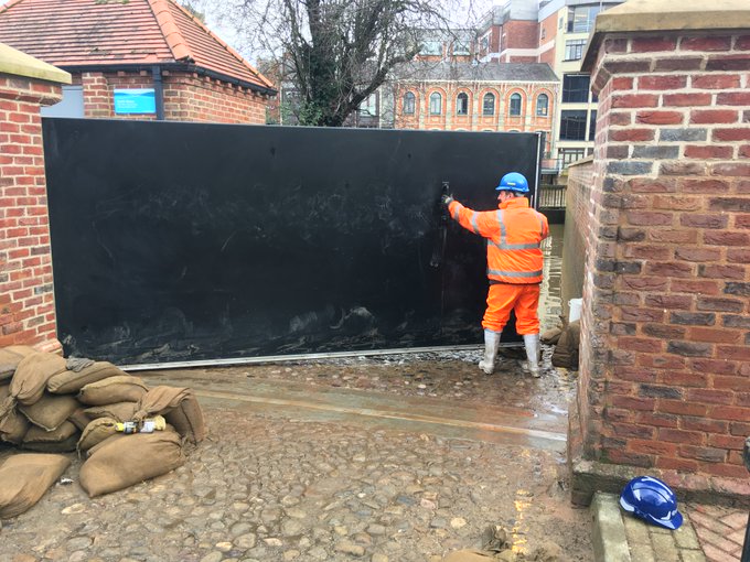
  • Staff defences 24/7 with reinforcements including 11 pumps and extra sandbags available for Peckitt Street, Tower Gardens, Clementhorpe and the A19 at Germany Beck
  • Regularly updated the www.york.gov.uk/flood page to share the latest updates and advice.
  • Speaking to communities at risk and reiterating our commitment to protect them and offer advice.

(more…)

Post storm public service issues

River levels are rapidly returning to normal levels now with streets like Skeldergate reopening to traffic.

It will be several hours before the riverside paths are open and cleared of debris

Attention will now turn to how to restore other public services to an acceptable standard

River levels begin to drop in York – backlog of refuse collection work

The level of the river Ouse is now falling. It is expected to remain above normal levels for several days although riverside paths should reopen in a day or two.
Not surprisingly the Council has been unable to collect refuse from areas affected by flooding. Areas affected include Naburn, Acaster Malbis and Skeldergate.

York flooding UPDATE at 4:00pm 16th February 2020

Local gullies and drainage ditches seem to be coping well with surface water in York.

Acomb Wood

River levels are high but are not expected to peak now until late on Monday.

Meanwhile the York Council Leader Keith Aspden has issued a statement .

With the news that river levels are increasing, I wanted to email to provide an update on the impact of Storm Dennis in York, and to reassure residents that a wide-range of actions are being taken, both by the Council and key partners, to ensure the impact to the city and our communities is kept to a minimum.

The Environment Agency (EA) has confirmed levels on the River Ouse in York are forecast to be close to the levels in 2015. Current forecasts from the EA are showing that river levels could reach between 4.8 and 5 metres on the morning of Tuesday 18 February. However, conditions remain unsettled, with further rain forecast over the next 48 hours, and this could result in changes to the levels and peak timings. The Environment Agency river forecasters will continue to monitor the situation 24/7 and provide further updates.

The Council has spent Friday and Saturday strengthening the city’s flood defences and today we will be helping residents in the most ‘at risk’ locations with the provision of sandbags to protect their homes and businesses. Local Liberal Democrat Councillors have also been out working with local communities to ensure precautions are taken and vulnerable residents are provided support. We will continue to make preparations to keep our fantastic city open.

With the uncertainty over weather conditions, we ask that people continue to keep an eye out for the latest information and alerts from the Environment Agency, which provides river levels for the next 36 hours in York, and to look out for friends and neighbours who may need support. Above all, please stay well away from the rivers and flood water. I have copied below some useful information and links. For the latest information and advice visit: www.york.gov.uk/flood.

The Liberal Democrats in York have long campaigned to secure better flood defences for York and since the Boxing Day floods of 2015, a number of flooding schemes have been given the green light. However, far more needs to be done and further action is needed to build in the latest in flood prevention technology across the entire city. I will continue to make the case to the new Government and request that immediate action is taken to aid affected communities across our city.

Finally, I would like to thank all community volunteers, staff, and key services who are working tirelessly to keep York safe and open for all everyone.


Deep water
River Ouse near Naburn

Defences to remain in place this weekend ahead of Storm Dennis

City of York Council will be keeping all temporary measures in place and will be monitoring all flood defences ahead of Storm Dennis, which is expected this weekend.

The following flood defences will remain in place in line with the council’s flood plan throughout this week as teams assess the potential impacts of Storm Dennis over the weekend.

These include:

  • Flood signage has been deployed
  • New A19 defences were successful and kept this main route into York open
  • B1222 was closed due to flood water
  • Bus routes diversions are in place for Skeldergate, Acaster Malbis and Naburn
  • Clementhorpe, Tower Gardens, Peckitt Street and Tower Place temporary defences put in place
  • St George’s field and Esplanade car-park were closed with all others remaining open
  • Rowntree Park was closed.
Image

It is unlikely that the riverside paths will be fully accessible but they will be cleansed after river levels return to 2.5m.

Following on from Storm Ciara, the River Ouse peaked at 4.35m (0.85m lower than the 2015 peak) at 6am on 11 February. No properties have flooded internally and defences installed since 2015 have been operating effectively.

Stay up-to-date with the latest storm information related to York at www.york.gov.uk/FloodUpdate11022020

Cllr Paula Widdowson, Executive Member for Climate at City of York Council, said:

“I’d like to thank all our staff and key services, such as the Environment Agency and emergency services, who have worked round the clock to ensure York remains open and safe for all our residents and visitors.

“We’ll be keeping a close watch on rainfall and wind strength over the coming days and into the weekend, with Storm Dennis forecast to arrive on Saturday 15 February, with heavy rain and strong winds.  The council will work with partners to take action should river levels rise again.

“River levels are likely to rise over the weekend and into early next week. So, all temporary measures will be kept in place and monitored during this period.

“We have an exciting weekend of events taking place here in York, including the much loved JORVIK Viking Festival, which has announced new venues to avoid potential damage from the storm. We look forward to welcoming lots of residents and visitors to our beautiful city this weekend!”

Council to invest in anti flooding measures

The York Council is set to spend more on reducing the impact of flooding in the City.

The plans, revealed just hours before the latest flooding problems hit the City, include the provision of a dedicated pump which will help to keep the A19 near Fulford clear of water.

A council report also promises more work to deal with surface water drainage issues

” £200,000 for improved drainage. To continue funding the restoration of the Council’s drainage infrastructure supporting the findings of the Surface Water Management Plan. This funding reflects the amount of work that can realistically be done using the available resources within the Council where there is extensive local knowledge

£3.5 million will be spent on Gully Repair Engineering Works – A rolling programme of capital funded drainage survey and investigation works has led to significant improvements of the cities highway gullies and has provided detailed information to identify the condition of the assets and their long term maintenance needs.

It is calculated that more than £8m of investment will be needed over 12 years to address all defective assets on a priority/needs based approach.

£200,000 will also be invested in improving real time signage and on rainfall monitoring equipment (see below).

York flood prevention update

The Council will receive an update report on the progress with flood prevention works at a meeting taking place on 13th January 2020.

Flooding in late December 2015 followed an intense period of rainfall across November and December due to the impacts of Storms Desmond and Eva. Record river levels were observed in many river catchments across the north of England. More than 4000 homes and 2000 businesses flooded across Yorkshire with 453 properties and 174 businesses flooded in York

Funding was allocated to the Environment Agency (EA) following the floods to renew existing and provide new flood defences across the city, £28m has been allocated to the Foss Barrier improvements and £45m to the wider flood defences across the city.

The Yorkshire Future Flood Resilience Pathfinder project led by City of York Council has recruited three Flood Resilience Project Officers who are in the early stages of the development of a range of demonstration and awareness materials that will be used to build flood resilience across Yorkshire.

Flood defence plans criticised by amenity body

The Friends of Rawcliffe Meadows (FRM) are objecting to a plan to raise and extend flood barriers on the river Ouse near Rawcliffe.

Rawcliffe Meadows

They say “FRM believe the Environmental Statement is fundamentally flawed and must be comprehensively revised to give an honest and comprehensive account of the likely destruction of and damage to SSSI grassland”.

They go on to say, “There will be adverse impacts on the Cornfield Nature Reserve which are of regional or at least district-wide significance”.

The comments are revealed in a report to next weeks planning committee which is being recommended to approve the Environment Agency proposals .

The report says, “The application is for works to repair and extend the Clifton Ings barrier bank. This is one of the projects within the agencies flood alleviation scheme (FAS) to reduce flood risk throughout the city. £45 million has been allocated to the EA which will upgrade defences in 19 areas (referred to as flood cells).

The objective of the FAS is to protect against the 1 in 100 year flood (1% AEP) plus climate change and where this cannot be achieved then deliver the maximum level of protection in each cell within the context of existing flood risk and considering other environmental, social and cultural aspects.

The purpose of the barrier bank is to reduce flooding from rivers (fluvial flooding) to the Clifton / Rawcliffe area.

However, during the floods in 2000, water from the river outflanked the flood defences, spilled onto Shipton Road and flooded over 100 homes. The flood basin at Blue Beck also exceeded its capacity in 2000. In these instances, the Environment Agency had to provide temporary pumps to reduce flooding upstream on Blue Beck.

The barrier bank was constructed in 1980. It is of earth fill construction and is up to 4.5m high. The embankments on both sides of the River Ouse currently have issues with stability created by high pressure in the banks when the reservoir empties. This has meant that the drawdown rate for the reservoir has had to be reduced from 1,360mm/day to 300mm/day in order to reduce the risk of failure. This reduction in the drawdown rate significantly impacts on the operation and effectiveness of the reservoir as a flood defence, particularly for any consecutive flood events.

Clifton Ings provides a flood storage reservoir on the eastern side of the River Ouse close to Rawcliffe Park and Ride and the sports clubs Clifton Alliance and York. When not flooded, the northern section of Clifton Ings is used for grazing and the southern section is used as open land by the public. A Sustrans cycle route runs through this area.

During high flow events it has a flood capacity of 2,300,000 m3. It is owned and maintained by the Environment Agency.

The Planning Committee is meeting on Thursday at 4:30pm. The meeting will also consider a separate proposal to create a temporary access route into the site.

Site Plans

Check those drains!

Although surface water flooding is usually associated with winter conditions, issues can arise at this time of year.

We are likely to experience intense rainfall over the next few days.

This means that any blocked drainage channels and gullies will be tested. Residents would be wise to check any public gutters near their properties and report any blockages.

The gully near the Foxwood shops has been blocked for several months. It has got gradually worse as weeds have gone untreated and detritus has accumulated. We have asked for prompt attention.

Surface water flooding in York: Final report published

The final report in the flooding which took place in the City on 13th August 2018 has been published.

click to read

More than 40mm of rain fell on large areas of the City in just over 15 minutes on the 13th August 2018, the intense nature of the storm led to significant areas of the cities road network being impacted by standing water and drainage systems were unable to cope.

Several properties were internally flooded and outbuildings and gardens of a greater number of properties were similarly affected.

Surface water flooding occurs when rainfall exceeds the capacity of open or piped systems or cannot soak into the ground. It typically occurs because of high intensity rainfall and can be aggravated by pipe or ditch blockage.

A map showing areas potentially vulnerable to surface water funding can be found here https://flood-warning-information.service.gov.uk/long-term-flood-risk/map

Click to view surface water vulnerability map of York

The York Council report is well written and makes several suggestions for improvements It refers to ongoing problems in Haxby but more generally highlights the gully reconstruction and cleaning programme that has been taking place over recent months.

The August event, when 120mm/hr of rainfall were recorded, is exceptional. Any event like this will cause some surface water accumulation but the City is now better prepared to deal with heavy rainfall in future.

One of the recommendations in the report is that network of digital rain meters is installed across the city.