The Friends of Rawcliffe Meadows (FRM) are objecting to a plan to raise and extend flood barriers on the river Ouse near Rawcliffe.

They say “FRM believe the Environmental Statement is fundamentally flawed and must be comprehensively revised to give an honest and comprehensive account of the likely destruction of and damage to SSSI grassland”.
They go on to say, “There will be adverse impacts on the Cornfield Nature Reserve which are of regional or at least district-wide significance”.
The comments are revealed in a report to next weeks planning committee which is being recommended to approve the Environment Agency proposals .
The report says, “The application is for works to repair and extend the Clifton Ings barrier bank. This is one of the projects within the agencies flood alleviation scheme (FAS) to reduce flood risk throughout the city. £45 million has been allocated to the EA which will upgrade defences in 19 areas (referred to as flood cells).
The objective of the FAS is to protect against the 1 in 100 year flood (1% AEP) plus climate change and where this cannot be achieved then deliver the maximum level of protection in each cell within the context of existing flood risk and considering other environmental, social and cultural aspects.
The purpose of the barrier bank is to reduce flooding from rivers (fluvial flooding) to the Clifton / Rawcliffe area.
However, during the floods in 2000, water from the river outflanked the flood defences, spilled onto Shipton Road and flooded over 100 homes. The flood basin at Blue Beck also exceeded its capacity in 2000. In these instances, the Environment Agency had to provide temporary pumps to reduce flooding upstream on Blue Beck.
The barrier bank was constructed in 1980. It is of earth fill construction and is up to 4.5m high. The embankments on both sides of the River Ouse currently have issues with stability created by high pressure in the banks when the reservoir empties. This has meant that the drawdown rate for the reservoir has had to be reduced from 1,360mm/day to 300mm/day in order to reduce the risk of failure. This reduction in the drawdown rate significantly impacts on the operation and effectiveness of the reservoir as a flood defence, particularly for any consecutive flood events.
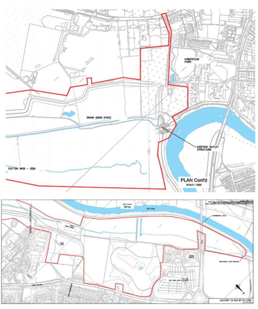
Clifton Ings provides a flood storage reservoir on the eastern side of the River Ouse close to Rawcliffe Park and Ride and the sports clubs Clifton Alliance and York. When not flooded, the northern section of Clifton Ings is used for grazing and the southern section is used as open land by the public. A Sustrans cycle route runs through this area.
During high flow events it has a flood capacity of 2,300,000 m3. It is owned and maintained by the Environment Agency.
The Planning Committee is meeting on Thursday at 4:30pm. The meeting will also consider a separate proposal to create a temporary access route into the site.