Cycle path still blocked/Future of MUGA

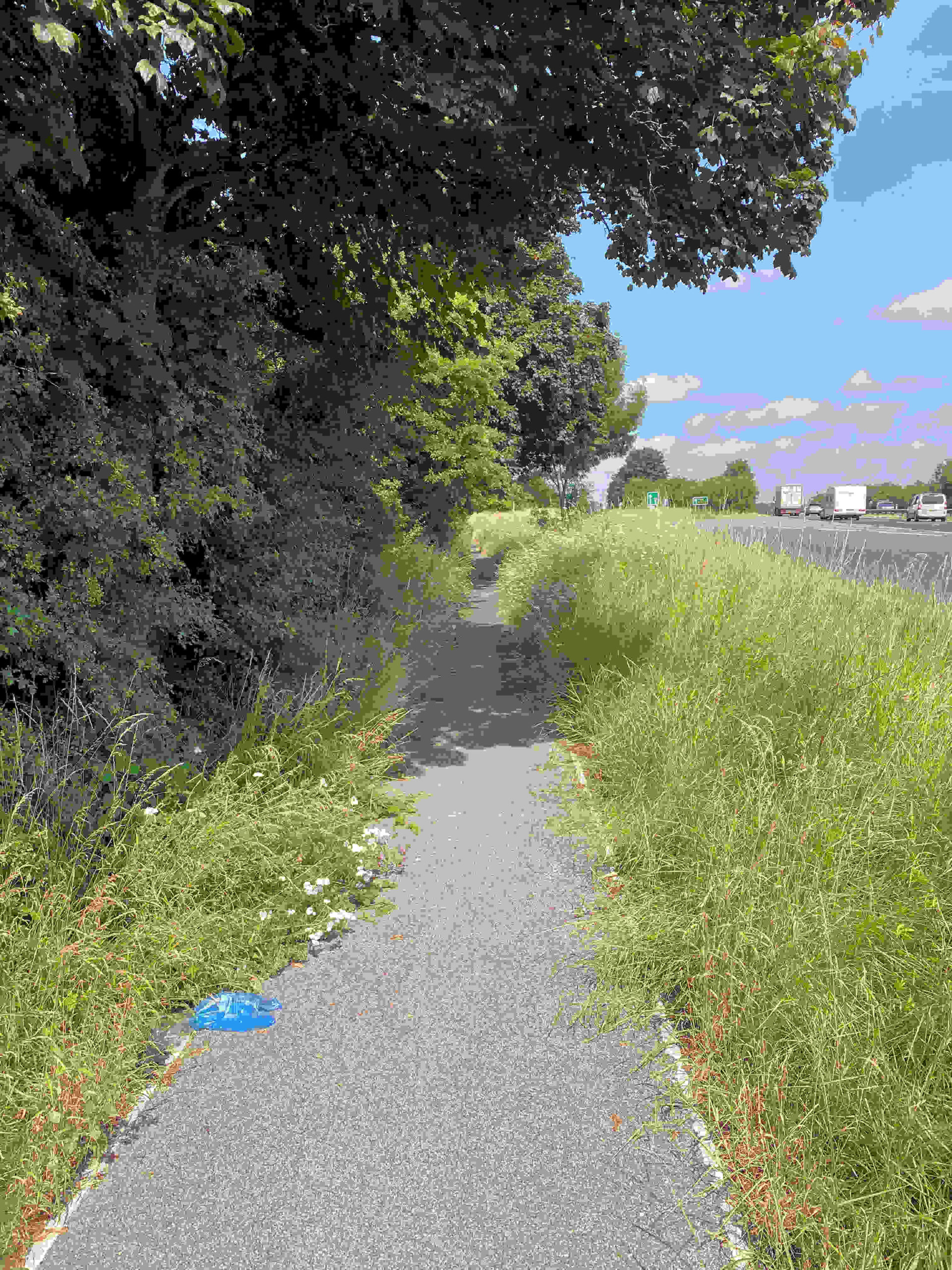
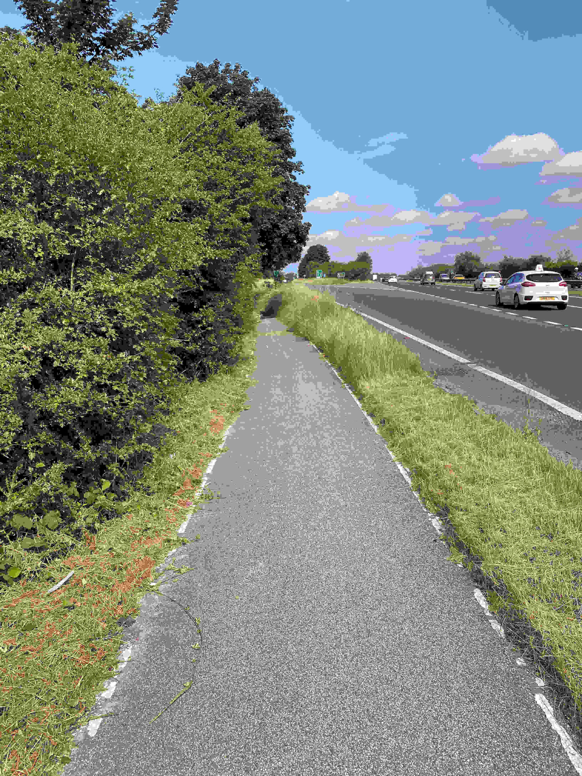
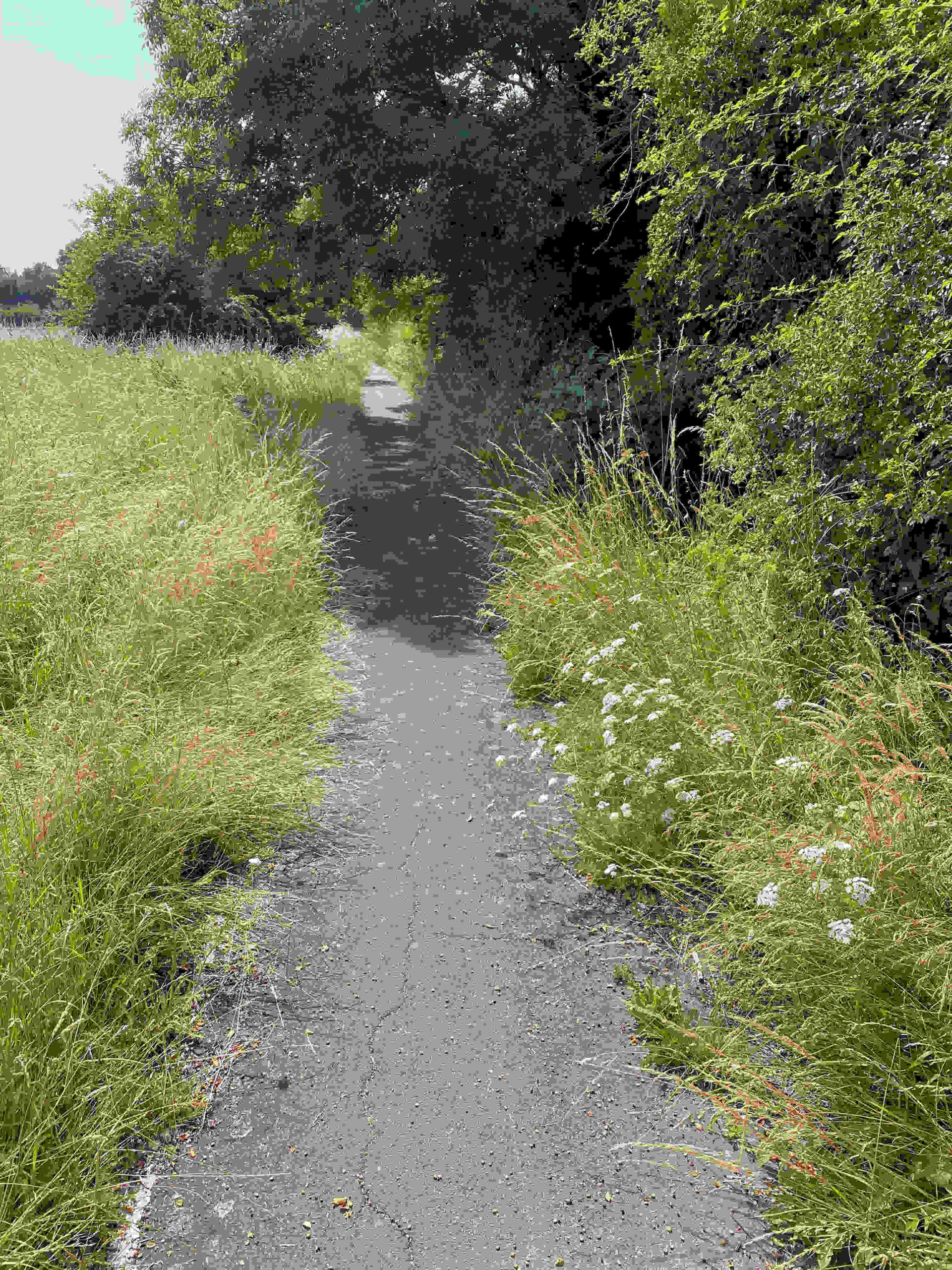
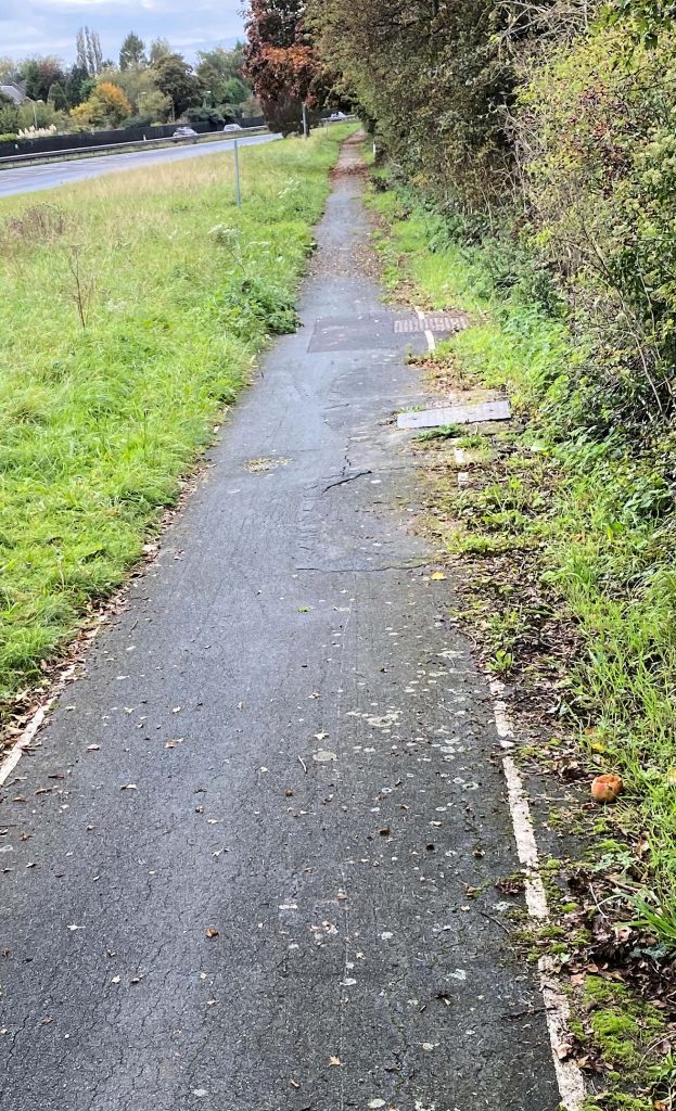
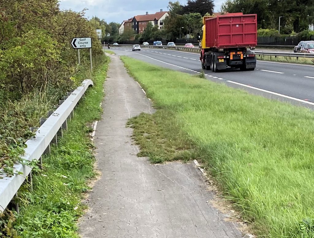
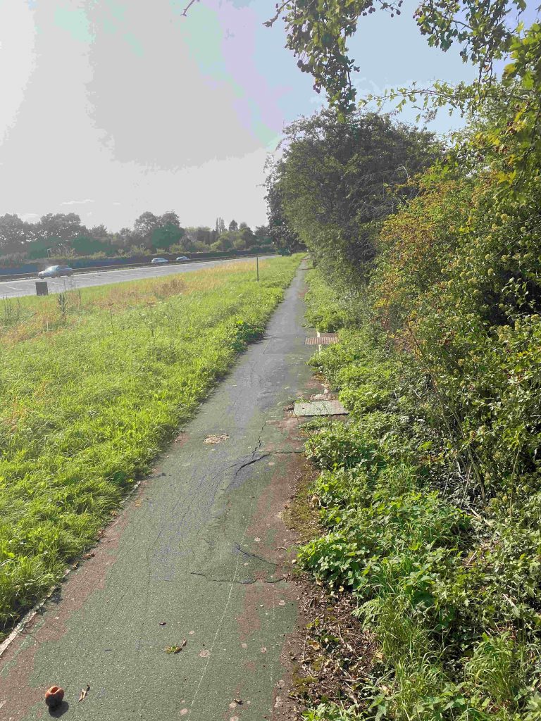
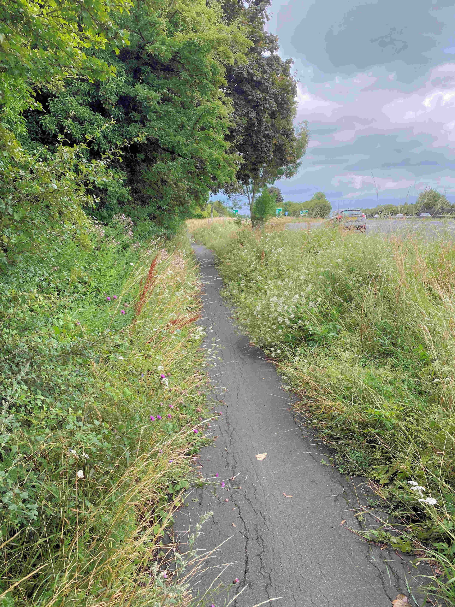
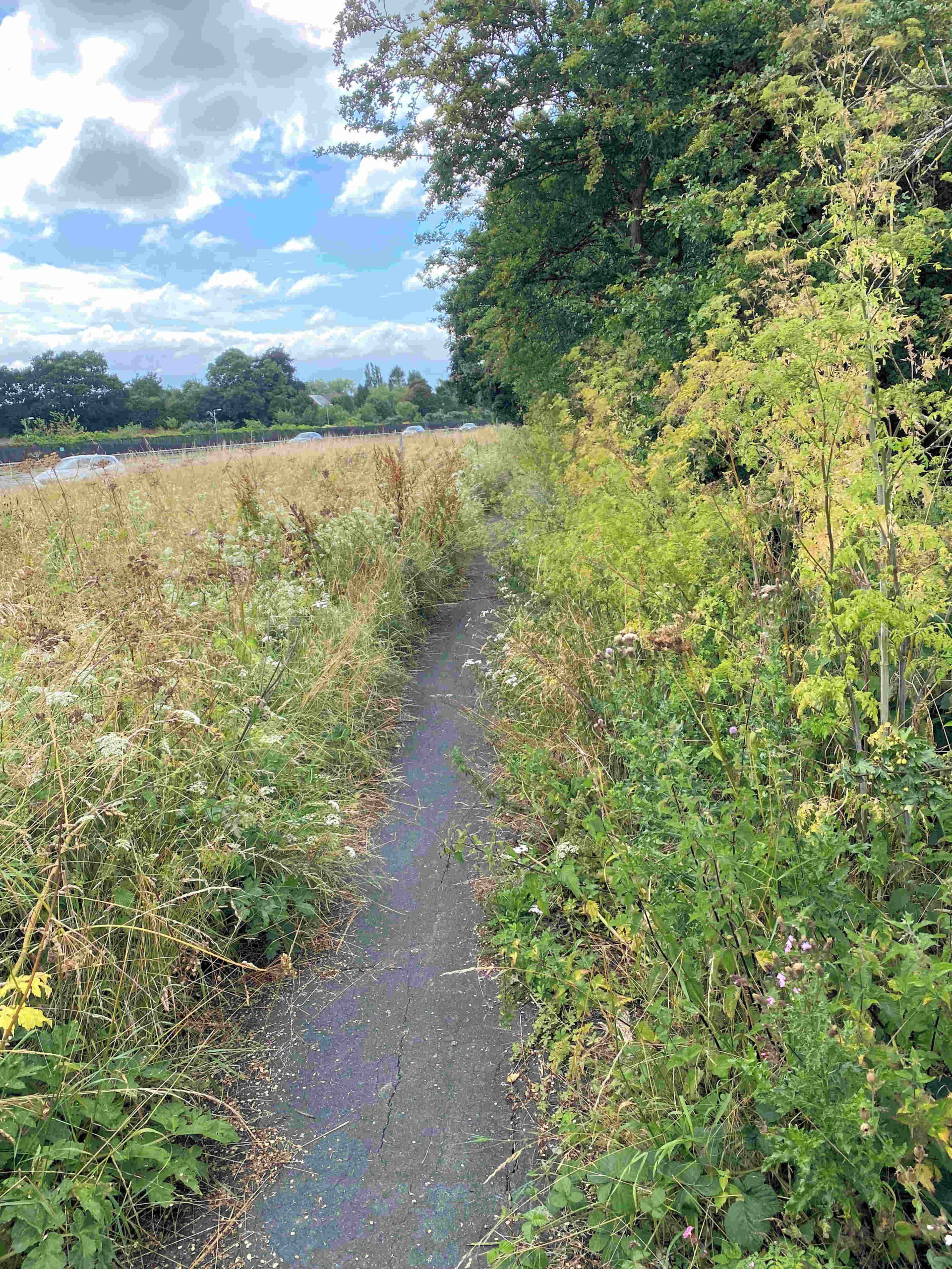
Despite promises by Highways Yorkshire, the cycle path on the A64 slip road next to Pike Hills golf course remains obstructed, The overgrowth problem was reported in June. Shortly afterwards Highways Yorkshire (who are responsible for the path up to the junction with the A1036) tweeted to say that the whole path would be routinely freed of obstructions during July.

That has proved not to be the case.

Now the issue is set to be escalated to the local MP but this really shouldn’t be necessary. A team could clear the hazardous overgrowth (thorn branches) in just a couple of hours.

We hope that the issue is not left to volunteers to tackle. If the government is serious about encouraging sustainable transport – the the very least they should do is maintain existing paths in a useable condition.

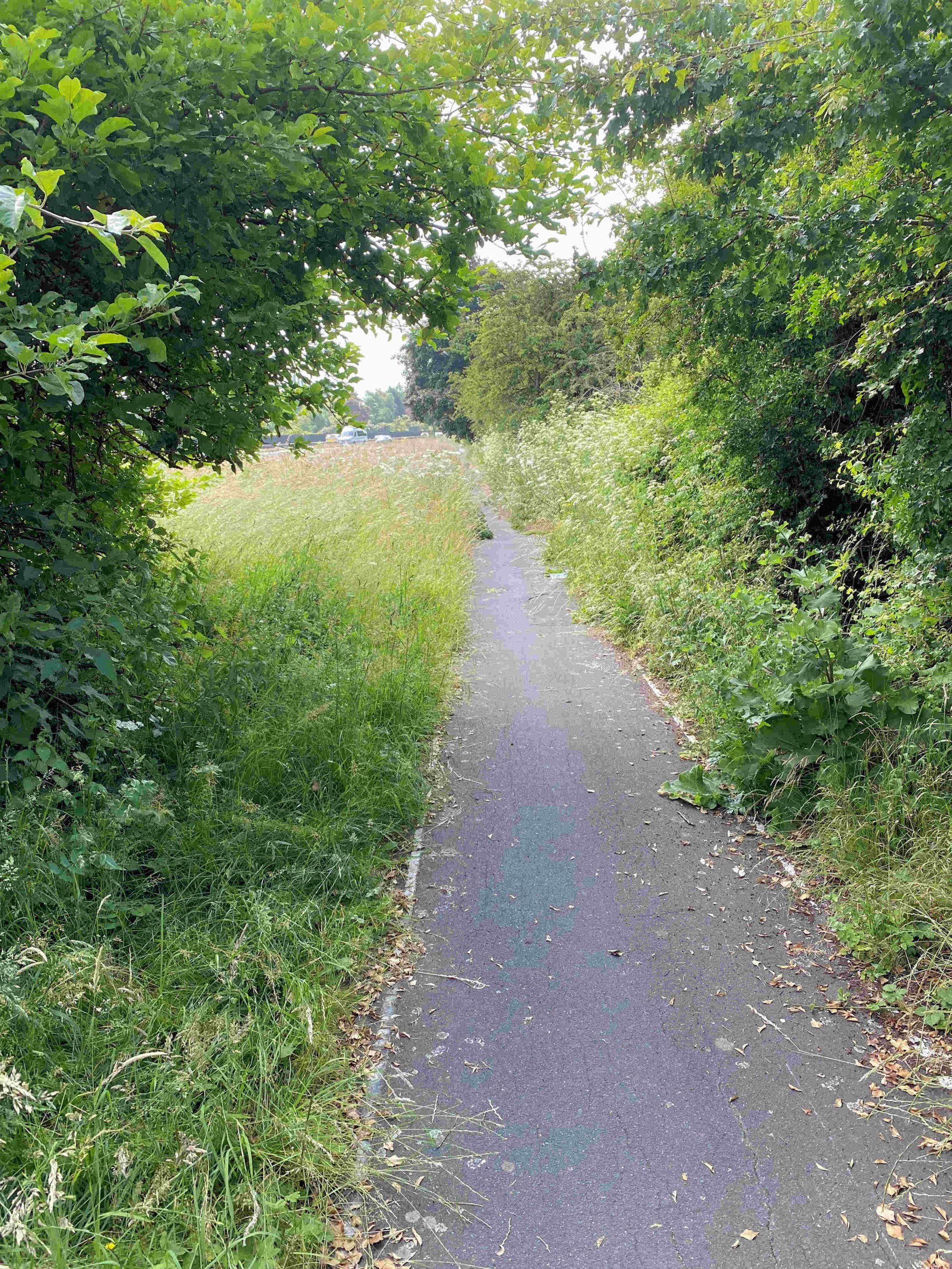
UPDATE: Highways Yorkshire have tweeted to say that the path “is due to be cleared in the very near future”

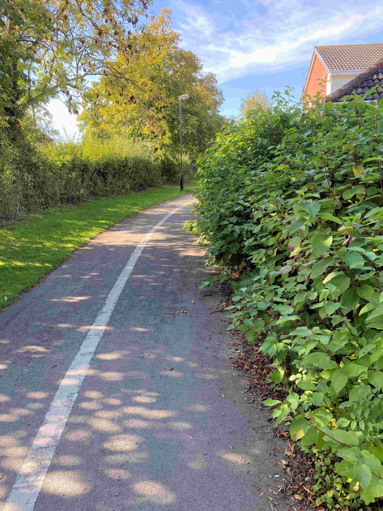
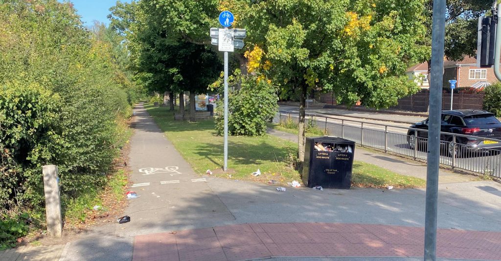
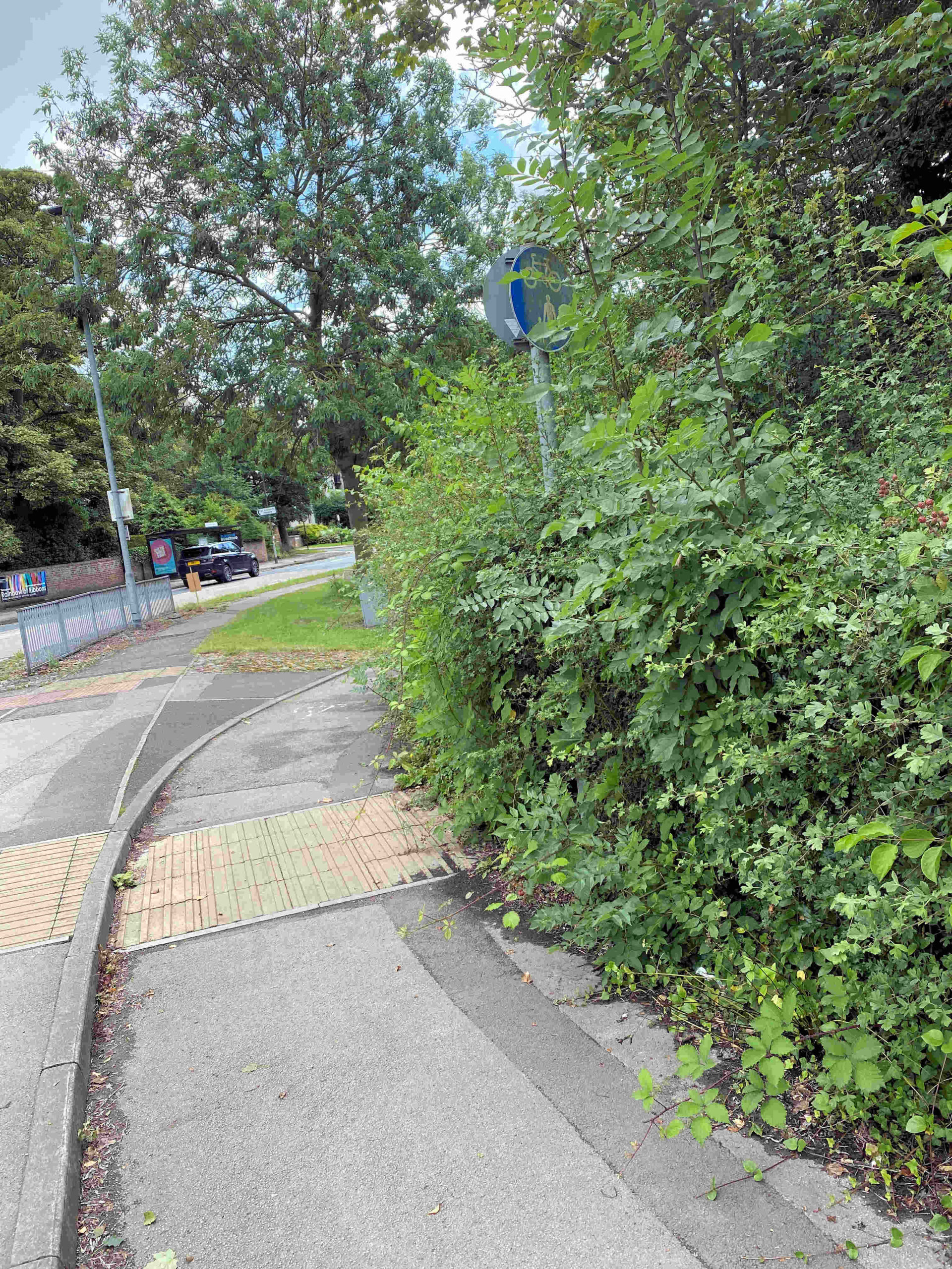
We’ve also reported overgrowth near the cemetery and at the Tesco roundabout (York Council responsibility)

MUGA Mugged

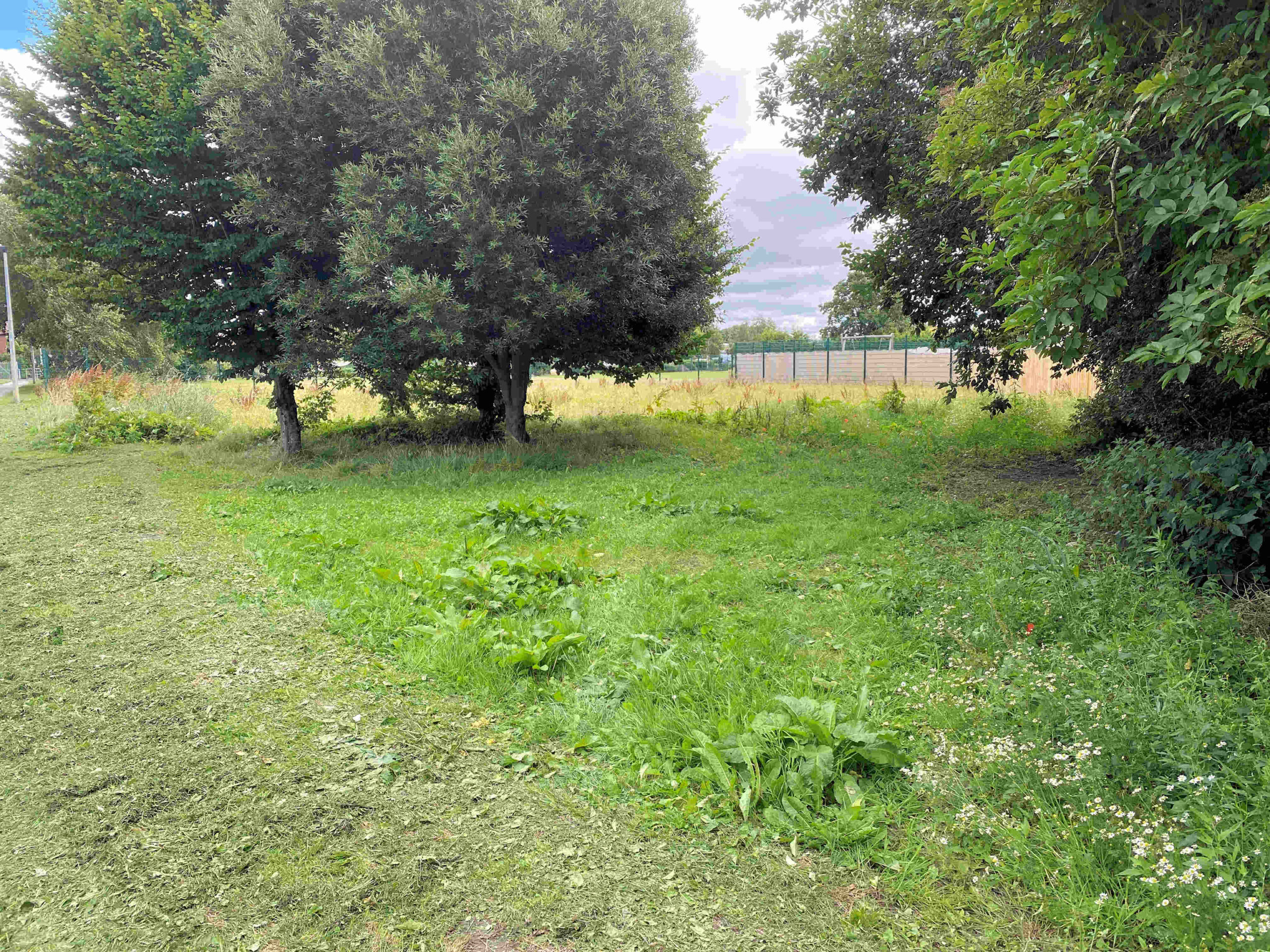
Separately we have queried with Councillors representing the Westfield ward what the future of the former Multi User Games Area (MUGA) site off Kingsway West is. It was used as a building compound for a couple of years but was subsequently abandoned.

The expectation was the the area would be leveled and grassed over. At present it is a weed infested eyesore.

The Council mowers studiously avoid cutting the area. They stick religiously to a route outside the line of the MUGA fence (which was removed last year).

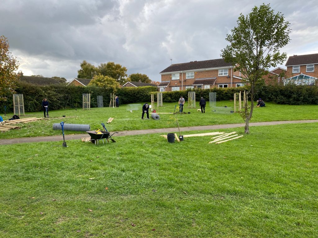
If the area isn’t to be maintained as grassland then there is scope for more tree and wildflower planting. Neglect shouldn’t be an option.

Sadly there is still no news of the promised replacement games area. An all-weather surface, to replace what was lost, was due to be provided at the Thanet Road Sports Area, but progress has been glacial.

Former MUGA site off Kingsway West

Hob Moor disabled access gates in working order

Claims were made in the media earlier in the week that access gates at the entrance to Hob Moor were faulty. The gates are intended to allow movement, by people with disabilities, to the path around the moor and have been in use for nearly 20 years. They can be operated using a “RADAR” key. The keys are widely available,  

One Hob Moor access point for disabled users is obstructed by nettles and thistles.

The gates allow entry for 3 and 4 wheel specialist machines and wheelchairs although the configuration may be awkward for some types of cycle.

There is an adjacent pedestrian “kissing gate” as well as a separate lane for conventional cycles.

There are 6 gates positioned at key points around the perimeter of the moor. They were installed many years ago as part of a configuration which was aimed  at preventing access by off road motorcycles. The motorcycles had become a  major source of irritation to nearby residents. The motorcyclists had also caused disruption to wildlife (particularly ground nesting birds) and flora on the moor.

The design also aimed to secure the moor for cattle grazing.

Generally the arrangements achieved their objective, with much of Hob Moor now a peaceful haven for wildlife.

The gate mechanisms were all working correctly yesterday.

One gate near Hob Moor Drive was obstructed by weeds and nettles and this has been referred to a local Councillor for attention.

There is some pressure for improvements. The equipment needs to be repainted. There is a suggestion that there should be a trial removal of one of the “plinths” at a cycle access point. This would allow cyclists to move more freely through the dedicated lane without the risk of getting a bent pedal.

More ambitious is a proposal to replace the RADAR keys with an electronic version which could also involve powered gates. Such options were not available 20 years ago when the gates were designed. The proposal would be  expensive to implement

There will be some who think that the top priority should be to ensure that maintenance standards on existing routes are improved. This would include an improved inspection regime, the systematic removal of overgrowth and repairs to signs/lineage.

 The same could also be said of the obstructed cycle and footpaths which can be found in other parts of the City.

More confusion over cycle path improvements

Part of the planning approva,l for the provision of sports pitches on land off Tadcaster Road/Sim Balk Lane, was that improvements had to be made to the cycle track link to the Park and Ride site. Users of the pitches would use parking spaces at the P & R site and then walk to the changing rooms. Details of the improvement works had to be agreed by the Council and published before building work started. This didn’t happen but, before the pitches can be used, improvements must be implemented.

A new application was published on the Councils “Planning on Line” web site a few weeks ago. It purported to give details of the way in which condition 14 of the original application would be fulfilled. However, no details of the proposals (understood to include some resurfacing work and better lighting) were included.

The application has some additional significance as a certificate of completion for the new pitches can’t be issued until the work is completed. Completion of the pitches is a planning condition attached to the Council’s housing development at Lowfield.

The condition said that homes there couldn’t be occupied until the replacement pitches were brought into use.

Not withstanding this, the Council announced in the media yesterday that the home s at Lowfields were being occupied. No attempt seems to have been made by the Councils housing arm (Shape Homes) to discharge the condition or have the planning permission amended.

The muddle is now subject to a formal complaint to the Councils planning enforcement team.

Meanwhile more bad news for cyclists. The cycle path which runs adjacent to the A64 slip road near the Pike Hills golf course remains blocked. Some mowing has taken place next to the dual carriageway but the slip road area has been ,missed.

We’re not sure whether this was just an oversight or whether a “demarcation dispute” is taking place between Highways Yorkshire and the York Council?

Either way, cyclists currently need PPE to negotiate the nettles, brambles and thistles which impede the path.

Some progress on cycle path blockages

Following on from our story yesterday, there has been some progress with getting cycle paths cleared of overgrowth

Workers were out on the SUSTRANS York – Riccall path today. They had cleared vegetation blockages from about 50% of the track by mid afternoon. They hadn’t reached the path near Riccall whichsuffers the worst obstructions

Meanwhile Highways England have tweeted (left) to say that the section of cycle path next to the A64 will be cleared later this month

The York Council responded today to say that the section of cycle track on Tadcaster Road next to the golf course had been cleared. Sadly, on checking today, we found that it hadn’t been touched.

It is remans obstructed by nettles and thistles

Tadcaster Road cycle path is still obstructed.

After the snow may come the floods

Forecasters are saying that it will get warmer next week.

With the thaw will come rain and concerns about flooding.

The worse floods in York have usually occurred when the ground has been saturated, where there has also been rapid snow melt upstream and when this has coincided with heavy rain.

We hope this doesn’t happen next week.

Meanwhile we have had some rare winter views to enjoy in and around the City over the last few days.

Good news for squirrels

19 trees were planted in Dickson Park this week by a team of volunteers from the Foxwood Residents Association and AVIVA. The trees were supplied by DEFRA. The project was so popular with neighbours and passers by that several offers of sponsorship were received.

We are now led to understand that the York Council’s new “forest” will be planted on land boarded by Wetherby Road, Knapton, the cycle path and Harewood Whin. The precise boundaries have not yet been revealed.

New “forest” in west York

There are some mixed feelings about the plan which, unless government funding can be obtained, could cost local taxpayers over £1 million.

The site is currently in agricultural use and self sufficiency in food production could become more important over the next few years. No economic or environment analysis of options has been published

The land is currently planted ready for a spring harvest

While there is a precedent for the Council managing local farms (they did so in the last century in an attempt to sustain a supply of land for new tenant farmers) the scale of the forest venture is new.

It has the advantage of potentially helping to reduce pollution levels.

One advantage of the location (if the speculation in the media is correct) is that it is close to the popular Rufforth – Knapton cycle track.

NB. The Council, while saying it has obtained 10 acres of land for tree planting “on the inner ring road”, has still not confirmed where this is located.

UPDATE. According to Cllr Nigel Ayre posting on twitter this is a map of the site. If correct, then part of it straddles Wetherby Road

Resurface Tadcaster Road cycle track plea

It seems that the Council will go ahead with its controversial plan to dig up Tadcaster Road again. No report has been produced indicating the scale of he planned works although the replacement of gas mains is included in the project.

Tadcaster Road cycle path is uneven and overgrown in places.

One area that could do with attention is the off road cycle track between Moor Lane and the A1237.

Parts of the, increasingly well used, path are in poor condition and could do with widening and resurfacing. This would be in line with government policies which seek to encourage the use of sustainable transport modes. So getting their agreement to use a small proportion of the £5 million available budget shouldn’t be a problem.

Narrow path makes social distancing more difficult near Golf Club

Marygate car park and the cycle path changes

Yesterday we revealed that the Council had started consultation on changes to the pedestrian/cycle route from the railway station to Bootham.

We pointed out that the impact on the Marygate car park had not been explained in the Councils documents.

We are now led to understand that a drawing, which details what will happen at the car park, was for some reason omitted from the consultation papers. It has now been added (click)

This new layout apparently requires virtually all the spaces in the car park to be re-marked.

Officials claim that, overall, 6 spaces will be lost.

The Railway Walk path would be widened to 3.4 metres.

The 40 spaces currently coned off would be restored for parking use.

There may be access, turning radius and other implications for users which are not clear from the large scale map provided, so we will hope that residents will be given sight of the stage 1 and 2 safety audit reports.

It is still unclear why the Council launched this consultation without telling anyone how to participate.

Tadcaster Road clean up required

Disappointing to see litter bins filled to overflowing on the Tadcaster Road entrance to the City. Also some graffiti. We’ve reported both.

Its also disappointing to see that the cycle path near the golf course still hasn’t received any maintenance.

Given that the Council has been rushing around trying to introduce new cycling facilities it seems strange that those which already exist are so badly neglected. Not the way to get people out of their cars and onto their bikes.

Huge amounts of money are on offer to Councils to get issues like this sorted.

cycle path being gradually overgrown. Surface now breaking up.