More evidence of neglect of our cycle routes. Two of the direction signs on the cycle link between Thanet Road and Sherringham Drive have been removed.
Time to use some of the Councils large cycling budget to get the signs replaced and to get the white lines repainted?
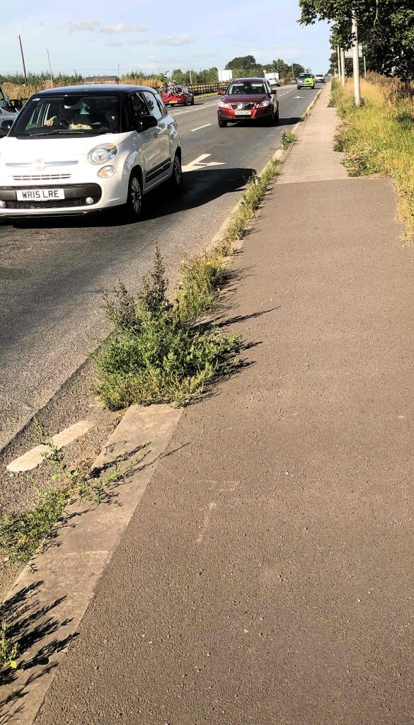
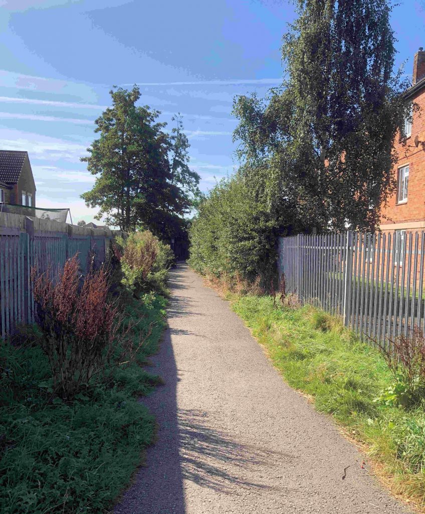
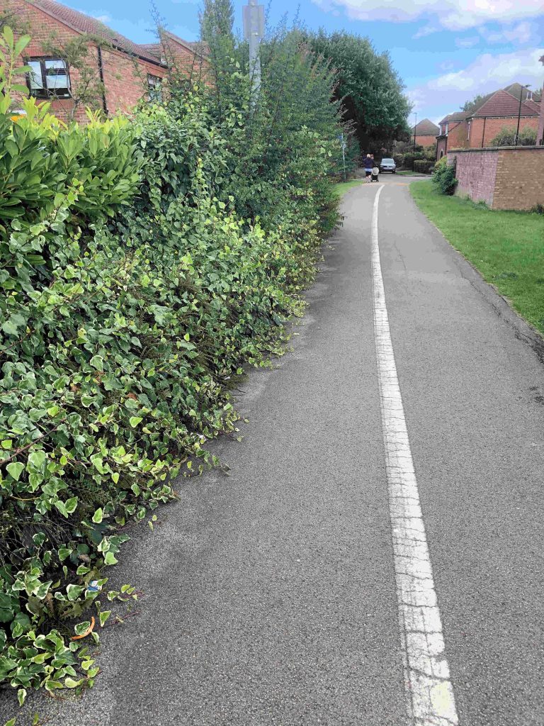
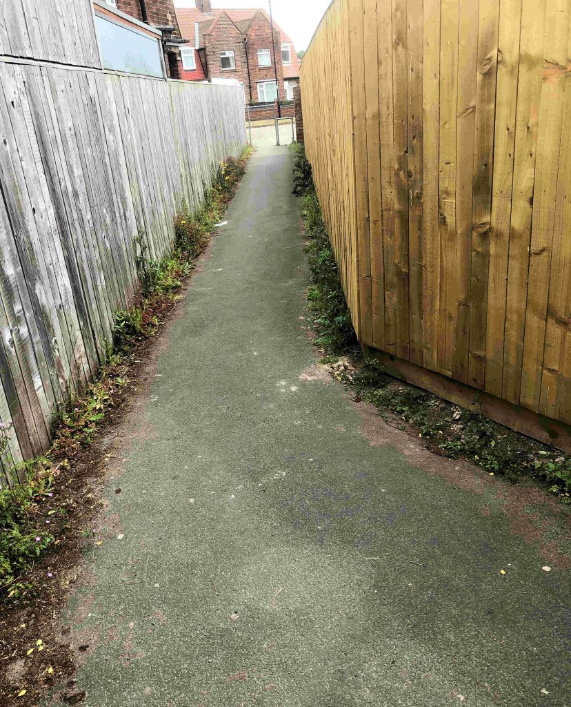
Missing sign at the Thanet Road junction. Delineating while lines have almost disappeared. Similar problem at the Wains Road linkAnyone getting as far as Sherringham Drive will find the path still covered in weeds with overgrown hedges making progress difficult.
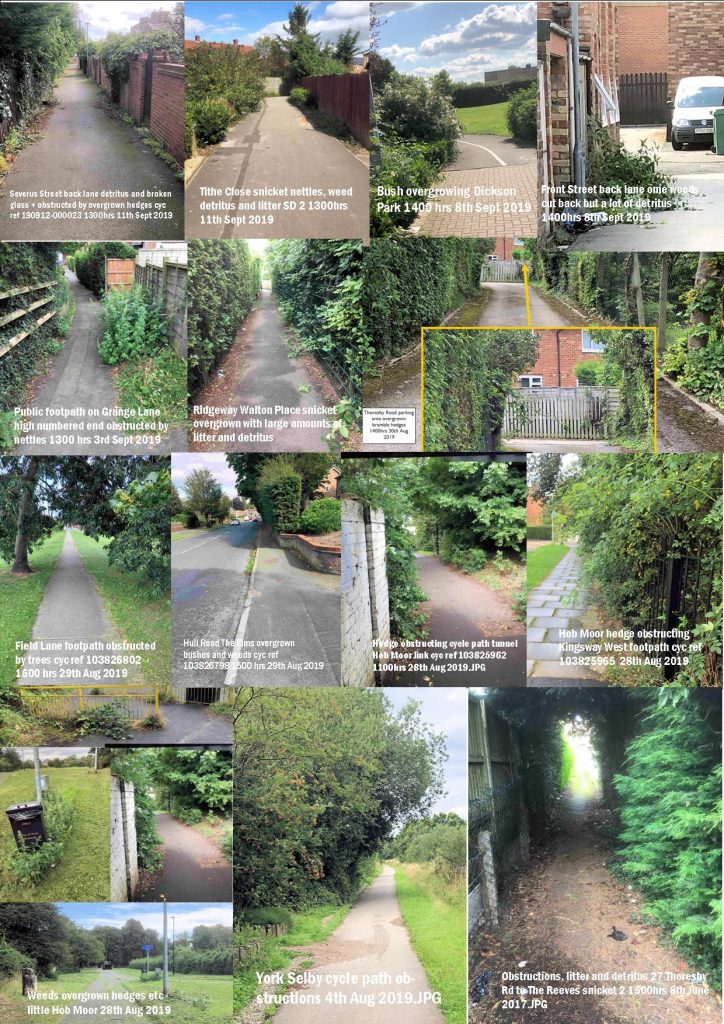
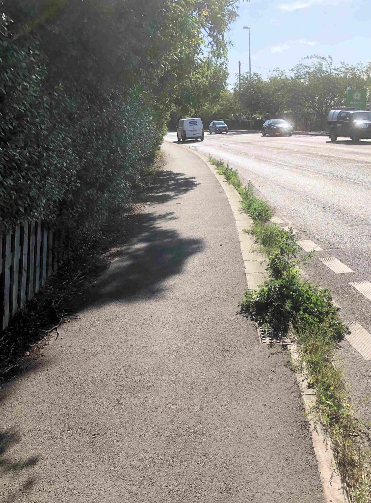
Following an exchange of views on social media we have received several more complaints about obstructions on foot and cycle paths.
In the main this is caused by overgrown hedges but in some cases low hanging tree branches are to blame while the, still out of control, infestation of hazardous weeds like nettles and brambles remains a problem.
Most of the overgrowing vegetation is the York Councils responsibility to cut back.
We urge residents to Report any issues. (Just don’t expect to get any feedback from the Council!)
If no action is taken then escalate the issue to your local Councillor.
We think getting problems like these sorted out should be a top priority for the Council as such obstacles represent an increased hazard as nightfall creeps ever earlier.
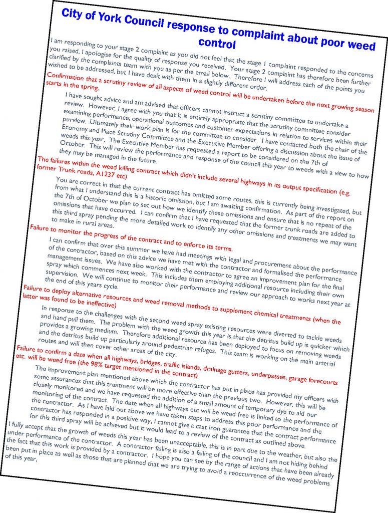
The Council has now replied to our complaint about inadequate weed control on public areas this summer.
They candidly accept now that the spraying has not been satisfactory.
They are now commencing a re-spray. The spray will include a colouring agent which will show which areas have received attention.
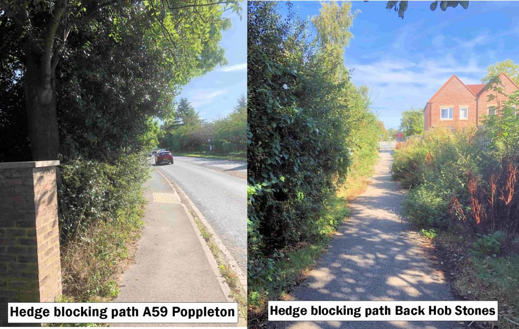
Weeds on the A59 have not been treated
This will be supplemented by Council staff who will work on areas not included on the contract. The areas near Poppleton on the A59 are a high priority.
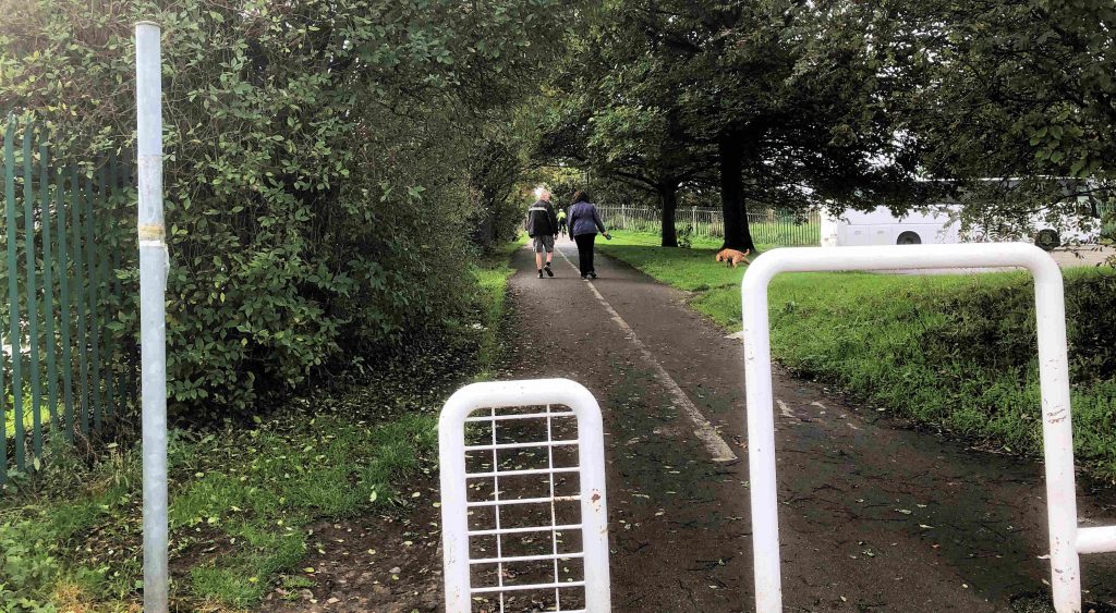
Another problem has developed with obstructions to public cycle and footpaths.
Again the path on the A59 is one that is blocked
Path near Poppleton is still blocked
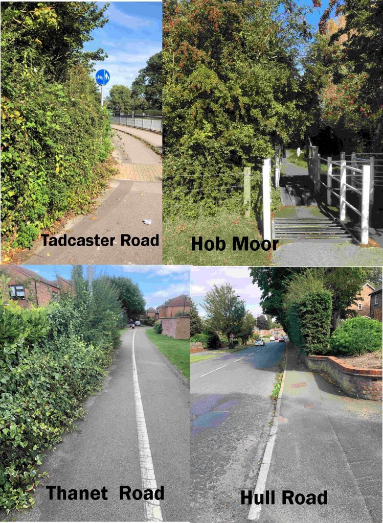
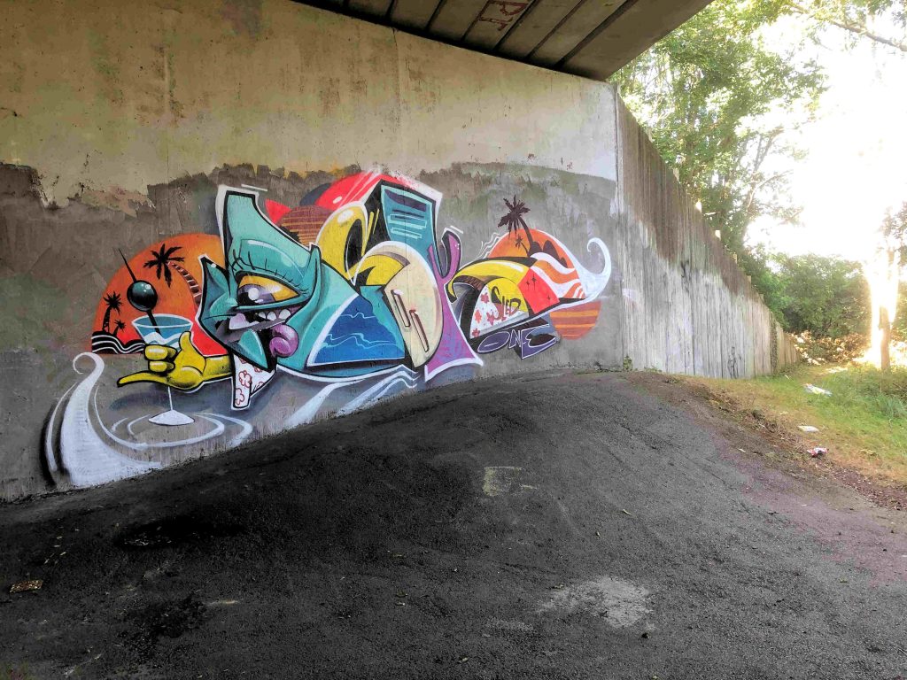
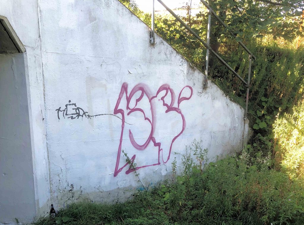
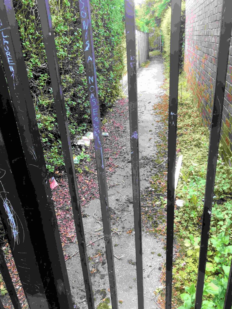
Brambles over growing the cycle path on Tadcaster Road may become a safety issue with darker nights coming.Bushes are impeding access to the Hob Moor cycle trackHedges blocking the cycle path at the rear of Hob Stones still haven’t been cut backSomeone has spent some time on this graffiti near the southern by pass But less time on this!
New off road vehicles are set to be used to grit 11miles (18km) of York’s cycle network this winter.
If successful, the pilot could be extended across the city to help keep cyclists safer in winter conditions.
A report detailing the pilot will be taken to a public meeting on Thursday 19 September, for approval to start during the winter season between November and March.
The pilot includes using two different vehicles to grit 11miles (18km) of cycle network, using small all-terrain vehicles including a quad bike and a gator type machine.
The trial is welcome but rather distracts attention from other more pressing issues facing cyclists.
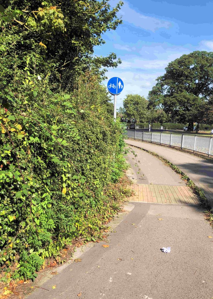
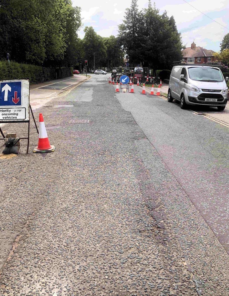
Many cycle paths in the City are obstructed
Many cycle paths are currently obstructed by overhanging hedge and tree branches. Unchecked weed growth has also reduced path widths as has the failure of the Council to systematically “edge” verges.
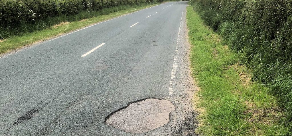
Perhaps the most pressing issue though is potholes. These affect some cycle lanes and many inner sections of carriageways – the surfaces most used by cyclists.
It is now 10 years since the last major programme of cycle margin maintenance works took place in the City.
The Council says that, “Popular cycle routes have been chosen for the de-icing trial, including the new Scarborough Bridge and other off road bridges too.
The introduction of the new smaller vehicles will ensure the networks are effectively gritted. Off road cycle networks are often difficult to grit or salt because cycles don’t have the same weight or action as a vehicle tyre. Effective gritting works by vehicles driving over the grit with their tyres which beds the grit into the snow and ice.
Whilst cars or heavy vehicles generally follow the same tyre path. Cycle tyres are much thinner and therefore these typical treatments are less effective.
For the pilot, the council will hire the vehicles and if, following the pilot, the council decides to roll this scheme out across York, it will look to purchase new vehicles to the council’s fleet.
The cost of the pilot is estimated to be £42k. This will be met by the current winter maintenance budget which is £401k.
By its nature the winter maintenance budget is not predictable, in 2018/19 there was an underspend of £61k. Should this not occur in 2019/20 there is a winter maintenance contingency available of £258k, in addition to the annual budget, which could be utilised.
This pilot will not formally be part of the council’s Winter Service Plan, but will run alongside this a pilot. After the winter the pilot will be assessed and considered for formally incorporating into the Winter Service Plan”.
Preparing for the winter season:
The council has stockpiled 3,000 tonnes of grit, which is stored in its grit barn at Hazel Court depot.
On average, crews spread around 4,500 tonnes of grit per season, over 75 road treatments (gritter runs).
Each season, crews treat eight routes across the highway, covering 365km of York’s road network, including 22km of priority footpaths and, when recourses allow, 58km of cycle network.
The decision session takes place on Thursday 19 September at West Offices from 2pm and is open to members of the public or is available to watch later online from: www.york.gov.uk/webcasts
It looks like the York Council will reintroduce cycling
access on High Petergate. The street which links through Bootham Bar was pedestrianised
many years ago.
This did make cyclists traveling north to south dismount or take a more circuitous route.
Shared pedestrian/cycle space can work and is popular in
some continental City’s such as Bruges.
However, in York, there are some cyclists who travel too
fast in shared spaces like that around the Minster and the narrow streets
around Bootham Bar are often packed with tourists who may be unaware of local
conventions.
So we hope that any trial will include advice for cyclists
to give way to pedestrians.
A decision on the plan is expected to be taken at a meeting being held on 24th October.
NB. Any cycle routes will permit cycling in High Petergate in a southerly direction (i.e. from Bootham Bar to Duncombe Place ) only at all times. The street would remain one way. There are no plans to allow cycling in other footstreets.
The York Business Improvement District(BID) team is reminding residents that additional cycle parking facilities were provided earlier in the year. Funded by the BID, the security hoops can be found at the following locations
# Blake Street
# High Petergate
# Spark: York Piccadilly
# Lord Mayors Walk
#Esplanade
#Deangate
#St Maurice’s Road
#George Street
#Castlegate Area
The overall capacity of city centre cycle parking was increased by 10%. Along with this the BID brought seven new signposts showing a map of the cities cycle routes and all the available cycle parking.
Each of the cycle racks features information and maps
detailing cycle routes and parking around the city centre.
York BID’s Street Rangers
also play a role in ensuring that as much bike parking is available as possible, by
monitoring bikes that have been abandoned throughout all
of the city’s cycle parking facilities.
“There is a high demand for dedicated cycle
racks, so we regularly look out for bikes that have been left for long periods of
time, and work with City of York Council to remove those that go unclaimed,”
Tags are attached to any bicycle that appears
to have been abandoned, and if it not moved after a month, it is taken away for
storage for a further month, before any unclaimed bikes are recycled and sold.
A cycling map can be downloaded from this link (click)
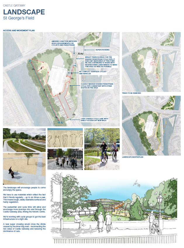
York residents are being invited to see the final plans for the St Georges Field and Castle Mills developments.
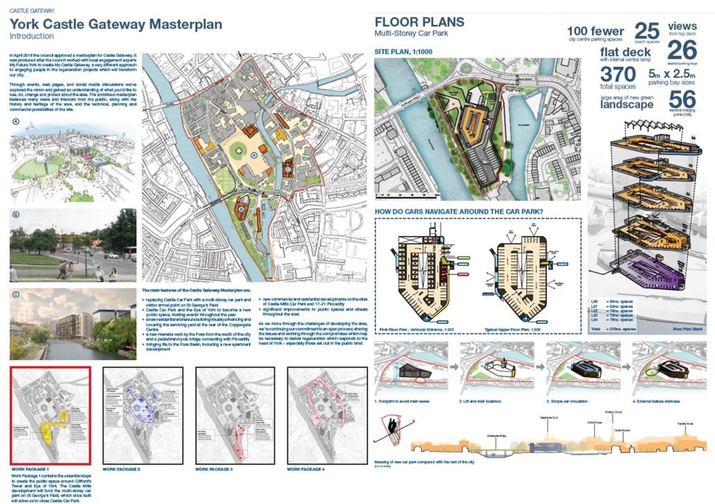
City of York Council is sharing plans for a multi-storey car park at St George’s Field, a new bridge over the Foss and a residential development at Castle Mills area ahead of submitting planning applications over the next two months.
The proposed developments are “the vital first stages to deliver the centrepiece of the vision for Castle Gateway – a new public space around Clifford’s Tower and the Eye of York”.
The four-storey car park at St George’s Field is “needed to replace the parking places which would be lost on the current Castle Car Park, and would be funded through the new residential apartment developments on the site of the now demolished Castle Mills Car Park. By moving the car park, the plan would remove a number of journeys from inside the inner ring road”.
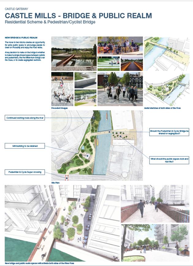
As part of the plans a new public bridge spanning the River Foss would connect Piccadilly and the rear of the Castle Museum, opening up a planned cycle and pedestrian route along the river into town.
The plans involve the loss of 100 car parking spaces to which can be added to those already lost when the Castle Mill car park was closed a couple of years ago. The multi storey car park is further away from the main shopping streets. Its lower floor is likely to be unusable when river levels are high.
How the retail community will view this reality remains to be seen.
There is a new shared cycle/pedestrian crossing at the junction with the inner ring road. The proposal fails to separate these users from general traffic, a failing also evident in the solution proposed for cycle priority in the Leeman Road/Marble Arch area.
There will be a shared cycle/pedestrian bridge across the Foss near the rear of the Castle Museum.
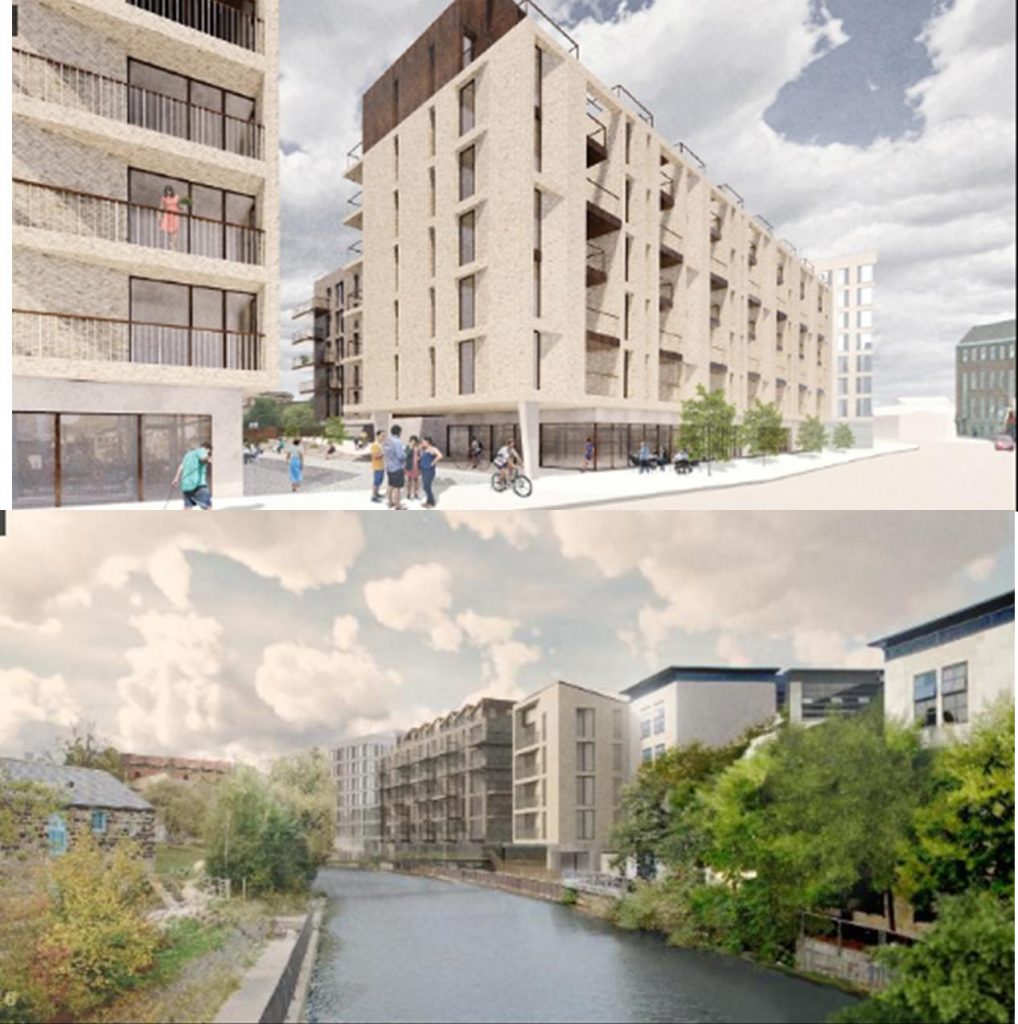
More controversially the artists impressions for new residential buildings on Piccadilly show an unrelentingly brutal architectural approach. It will not be to everyone’s taste.
The Council claims that the plans have been refined since they were shared at public events, online and through social media in March.
The two drop-in events feature an exhibition of the proposals and the opportunity to talk to the team about the plans. There is also the chance to take guided walks of the area to explore the developments on location:
Saturday 1 June Drop-in 11am-2pm / Guided walks at 11:30am and 1pm Spark : York, Piccadilly
Wednesday 5 June Drop-in 3pm-7pm / Guided walks at 4pm and 6pm Friends Meeting House, Friargate
Residents are invited to a drop-in session or to join the conversation on twitter @MyCastlGateway , www.facebook.com/MyCastleGateway.
The Castle Gateway masterplan was created after City of York Council teamed up with a local group called My Future York to develop ‘My Castle Gateway’. The ongoing, open conversation has taken in walks, talks and conversations on social media to develop a brief and explore emerging ideas before this masterplan was finalised.
St Georges Field layoutCar Parking plansPiccadilly/Foss developmentBrutal architecture
We mentioned last week that we hoped the new York Council would tackle some long outstanding problems with cycle routes
The biggest problem remains the state of road surfaces.
Potholes, like this on Bland Lane, pose a hazard for cyclists, particularly at nightUneven carriageways are uncomfortable for cyclists. This is in Low Poppleton Lane
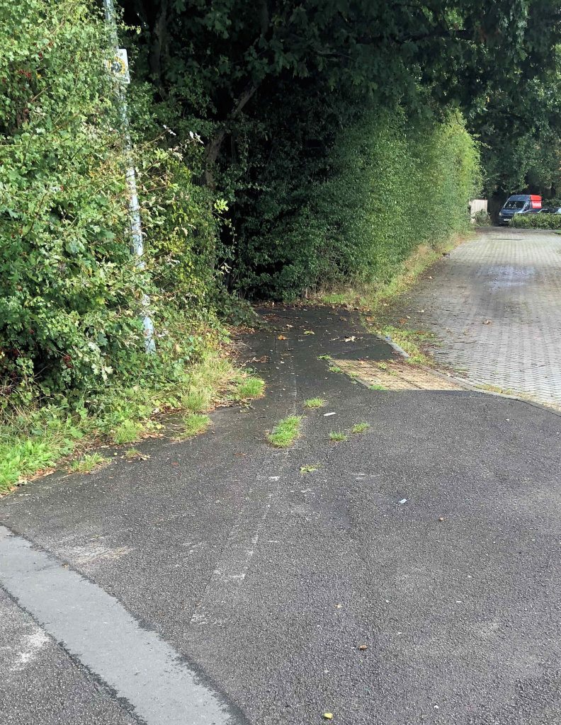
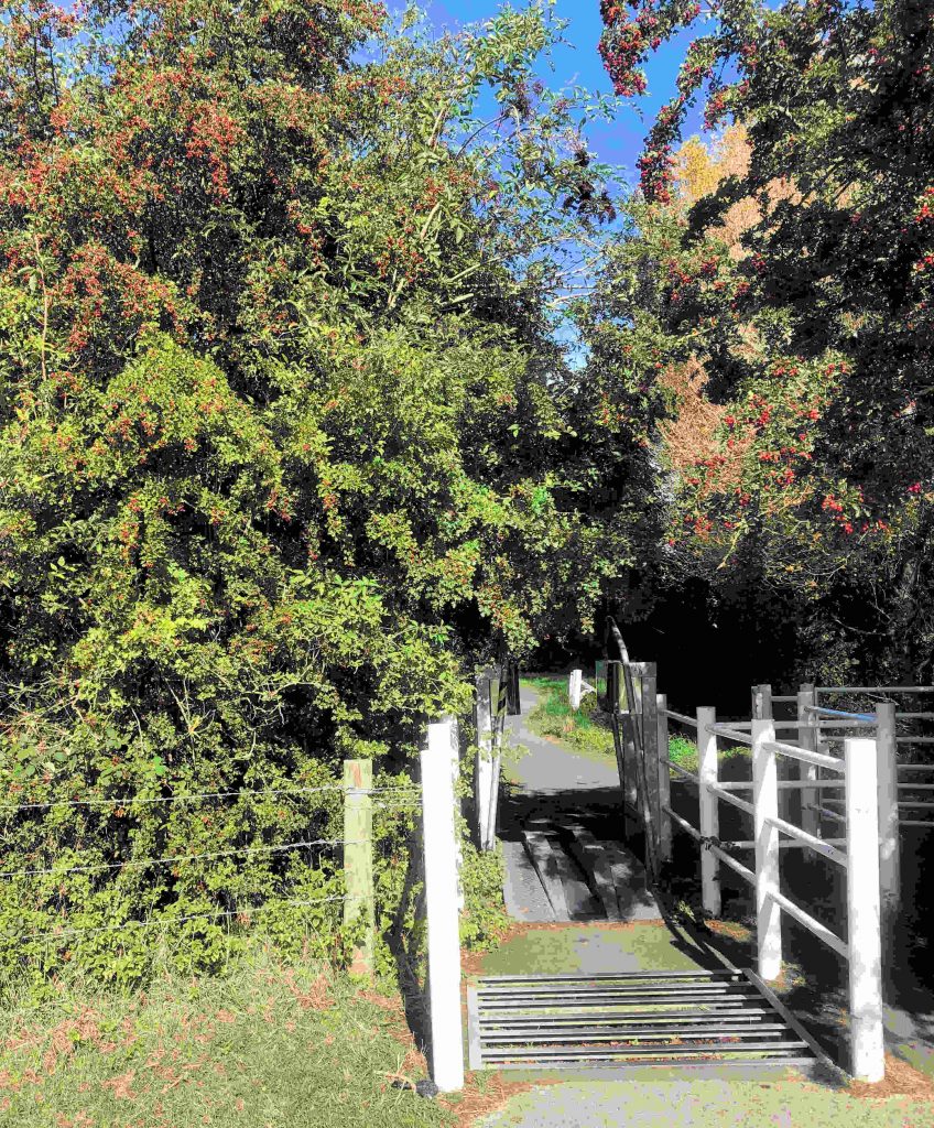
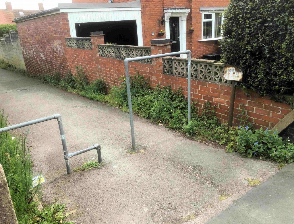
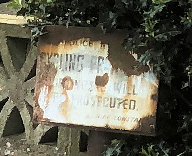
On the Beckfield Lane to Jute Road path a (very) old notice prohibits cycling. The Council has however fitted cycle friendly barriers.
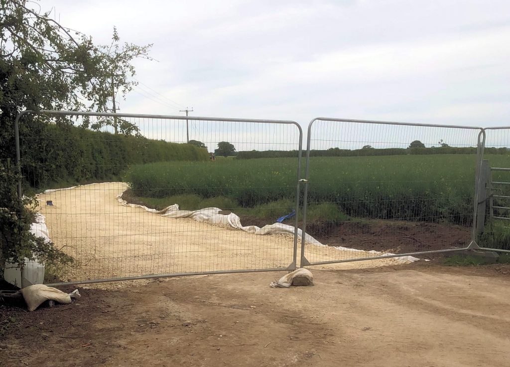
The same Jute Road snicket is obstructed by weeds.Detritus is a particular problem on the gated sectionThe cycle path link from North Moor Lane to Rufforth is taking a long time to complete
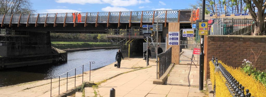
Over 4,000 pedestrians and cyclists have been using the upgraded Scarborough Bridge foot and cycle bridge everyday since it reopened after a £4.4m upgrade.
This is already an increase of 1,000 extra journeys on the average of 3,000 daily crossings on the old footbridge.
The new accessible bridge has been delivered in partnership by City of York Council, the York, North Yorkshire and East Riding Enterprise Partnership (YNYER)and West Yorkshire Combined Authority (WYCA) through its £60m City Connect programme, aimed at encouraging more people to cycle and walk.
Although the bridge is now open to the public, work will continue to complete sections of the ramps, install the permanent handrail and erect new lighting.
The new steps to the riverside are open for public use in an interim state, with the final Yorkstone finish and permanent handrail to be installed in the next two weeks.
The bridge and ramps remain open to the public at all times, although the public are reminded that direct access into the station remains – as it was before the upgrade – closed between 22.30 and 05.30.
The £4.4m project has been funded by a £1.9m grant through the Combined Authority’s CityConnect programme, a £1.5m Local Growth Fund secured by YNYER and £1m of City of York Council funds.
At 65-metres long the new bridge is three times as wide at 3.7metres, increasing access to more people and the new ramps and steps mean that it is accessible even at times that the river is in flood. The new bridge is constructed of weathering steel – the same as Gateshead’s famous statue, The Angel of the North.
In March, the West Yorkshire Combined Authority and City of York Council were awarded £300,000 from the Government’s Transforming Cities Fund. to make further improvements to cycle and walkways between Scarborough Bridge, York railway station and the city centre.
These improvements will include:
An enhanced crossing of Bootham linking into the cycle route through to the district hospital.
Improving the riverside cycle route on the Esplanade side of the river.
Replacing the steps from St Mary’s to Marygate Lane with a ramp.
There may be some new hope that cyclists will get a better deal from the new administration which is taking over at West Offices this week.
Both the LibDems and the Green Party promised better road surfaces in the City.
Potholes represent a particular hazard for cyclists.
There is talk of an emergency budget in June which would present an opportunity to rejig transport priorities.
We hope so.
In the slightly longer term, the Council needs to take a fresh look at its off road cycle network.
One notorious section in Acomb comes to a dead end in the middle of Front Street with no one apparently able to decide how to safely continue the route towards the Askham Lane and Foxwood areas.
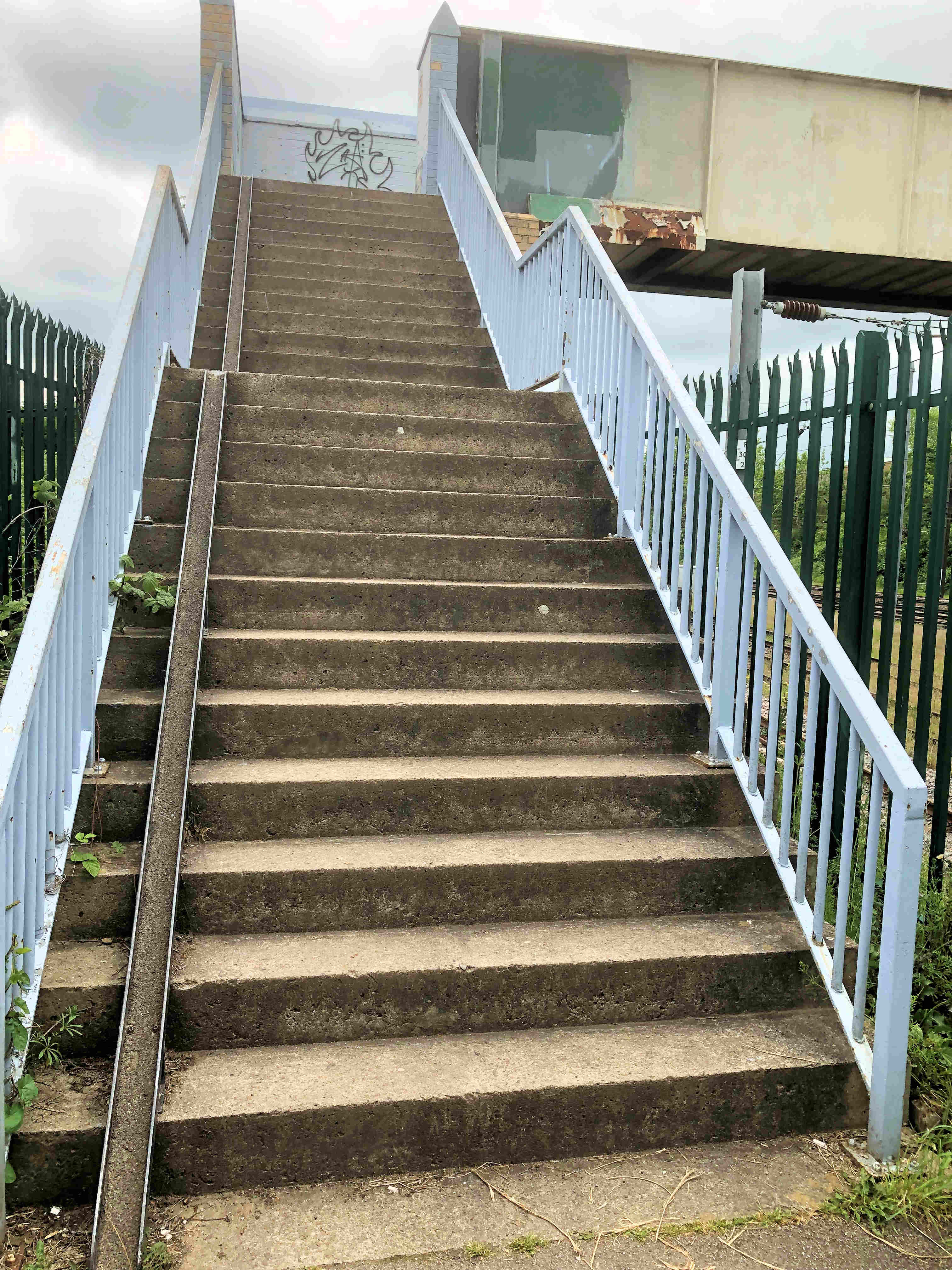
In other areas stop gap measures, introduced 20 years ago, are still in place. These include the makeshift metal channels which were installed on the approaches to several railway bridges. They are supposed to make it easier for cyclists to push their machines up steep access stairways.
Bridge over Holgate sidings. Cycle access from Barbara Grove is steep. There is scope to construct a much gentler gradient.
In reality, it is often easier to carry the bike or – more likely – just take a longer and possibly more hazardous route using the ordinary road network