The Foxwood Community Centre on Bellhouse Way (Cranfield Place junction) is opening between 12:00 noon and 2:00pm today (Sunday) to receive gifts of:
- Clean bedding
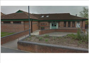
Foxwood Community Centre
- Warm clothing particularly coats
- Cleaning materials
- Clean towels
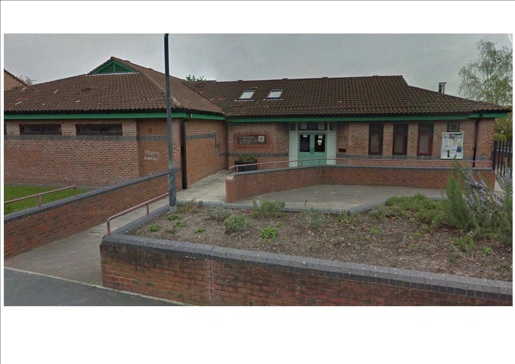
which will be offered to the victims of flooding here in York.
https://www.facebook.com/FoxwoodResidentsAssociation/
http://foxwoodcommunitycentre.org.uk/
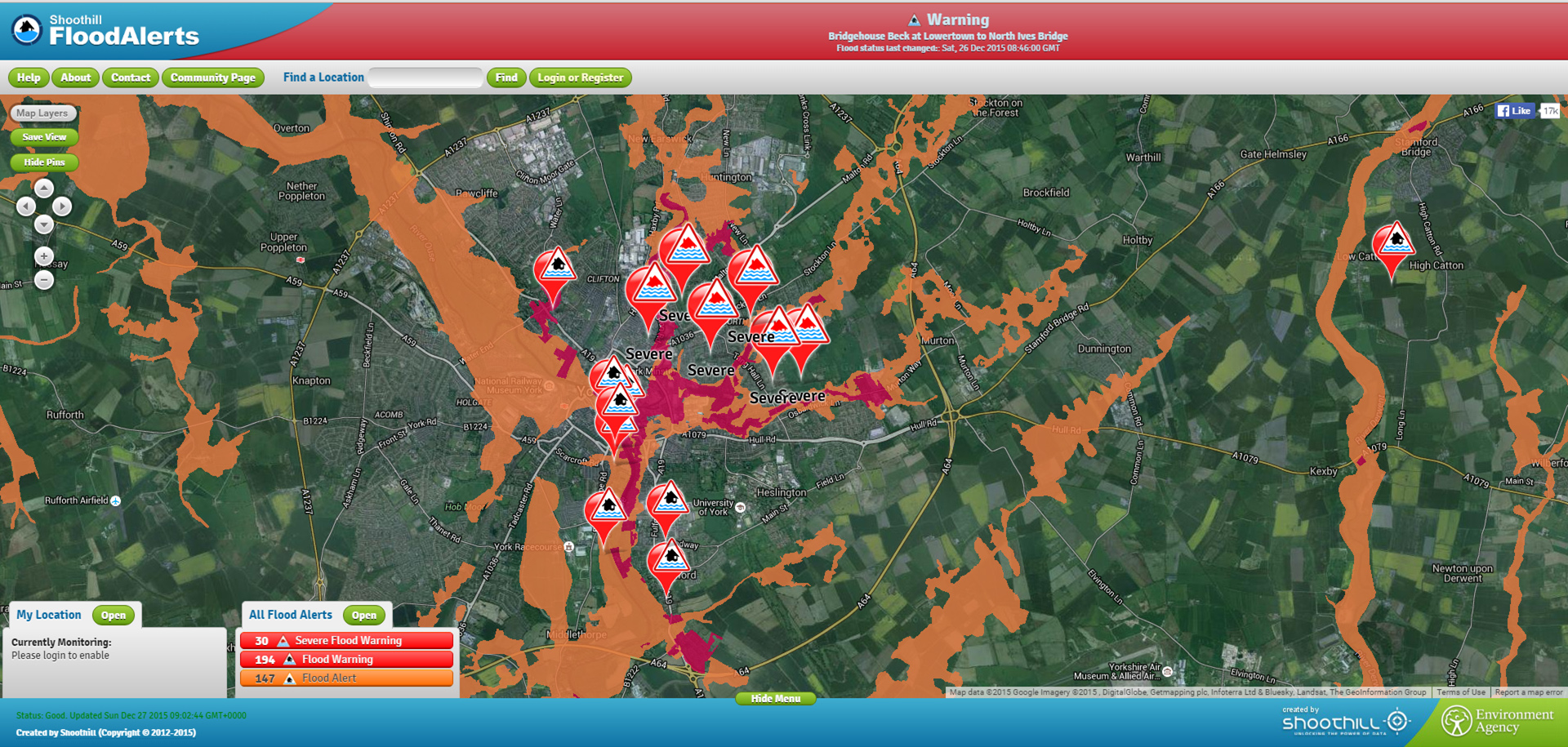
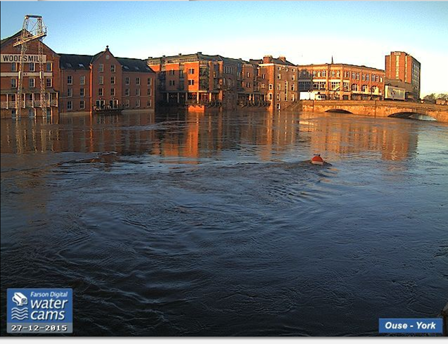
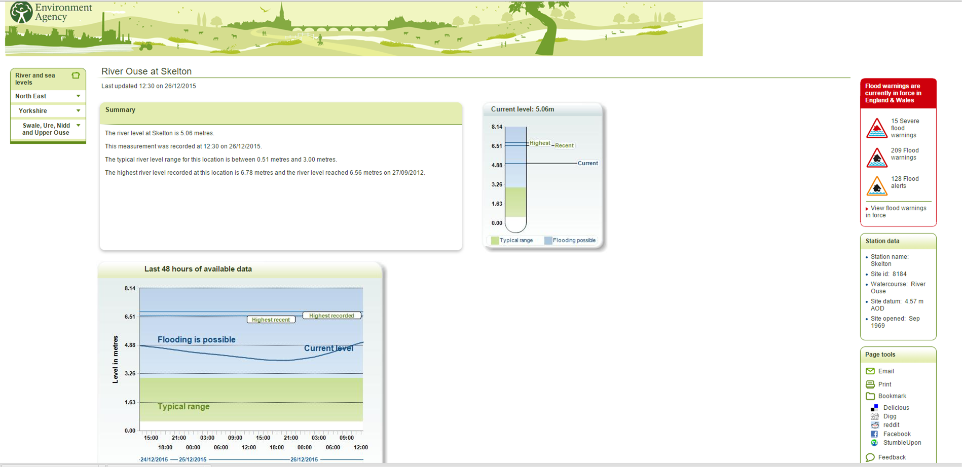
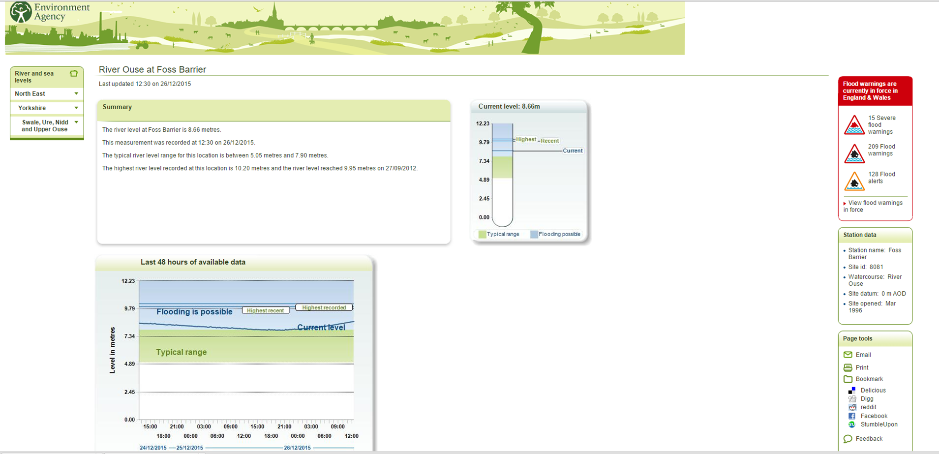
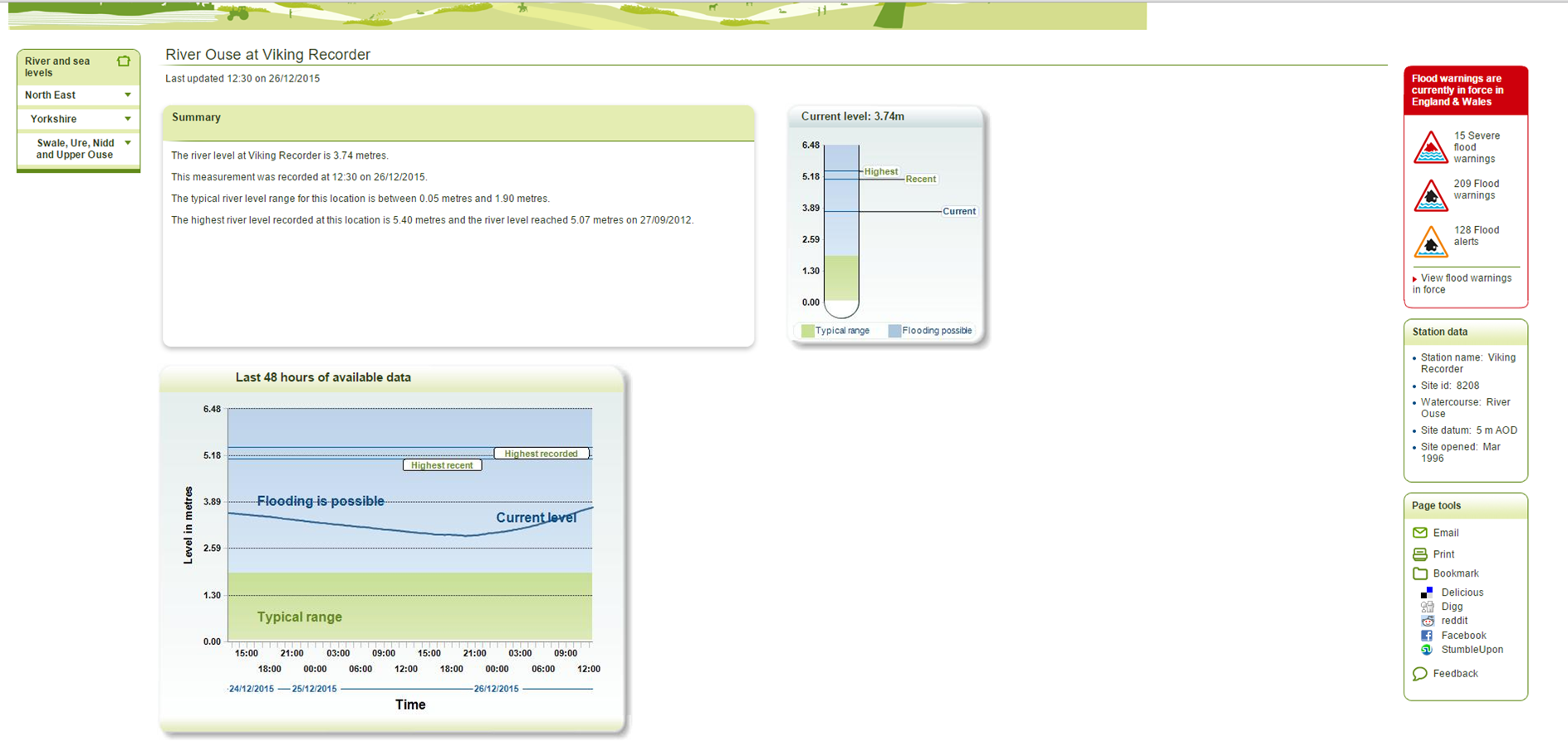
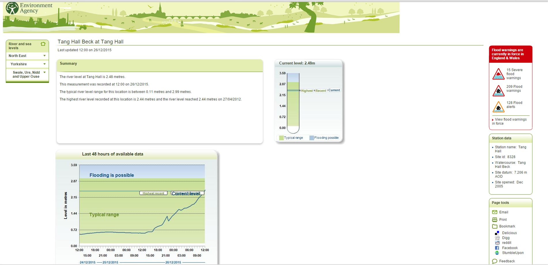
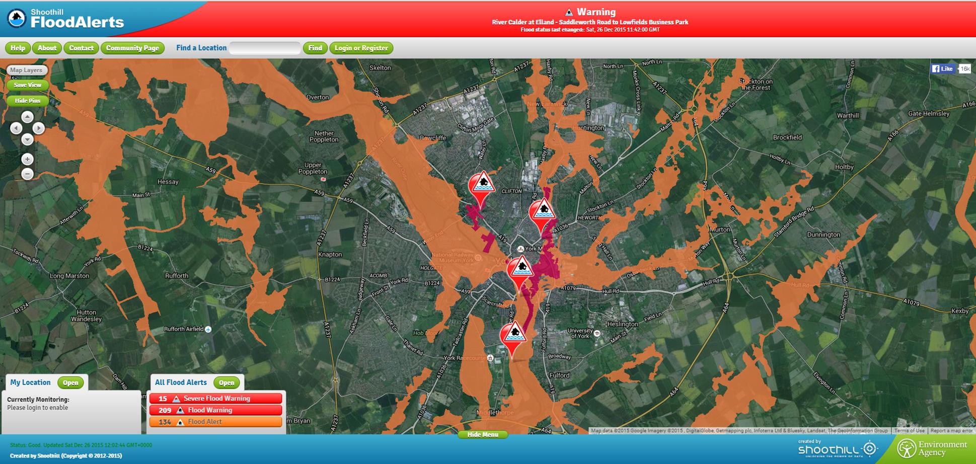
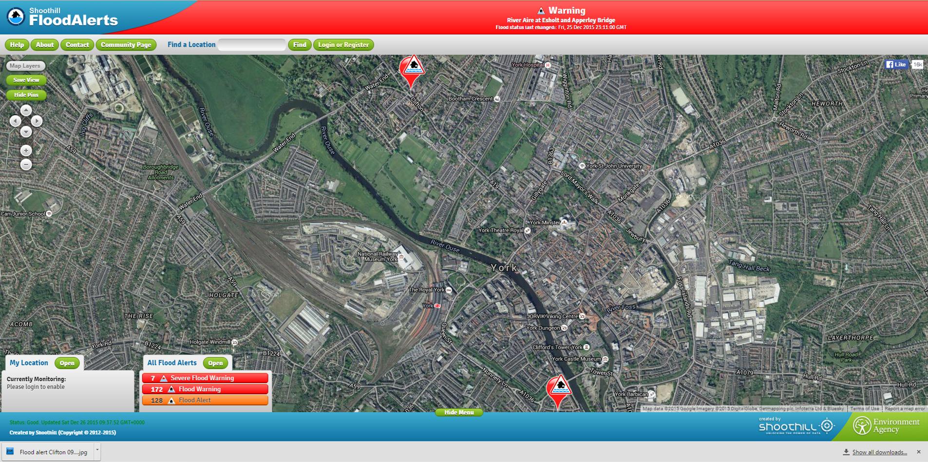
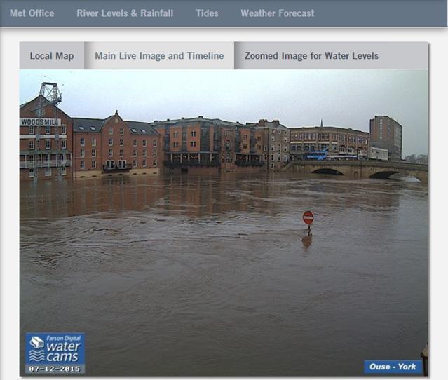
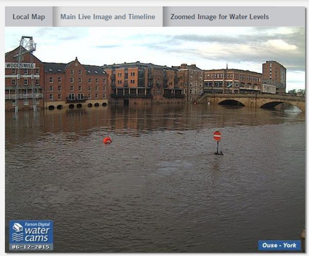
Generally the floods have had less impact on west York than on roads nearer the Foss and the Ouse.
Windsor House older peoples home suffered basement flooding yesterday and the was a re-occurrence of “backing up” problems in the sewers in Foxwood Lane south.
In the Woodthorpe area sandbags had to be deployed in the Coeside/Nevis way area.
The Community is therefore being asked to help wherever possible those who have been evacuated from their homes in central and east York