
Wet feet? Here’s who to blame!
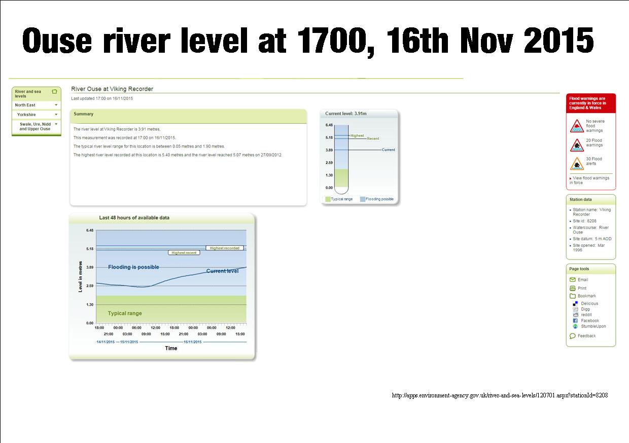
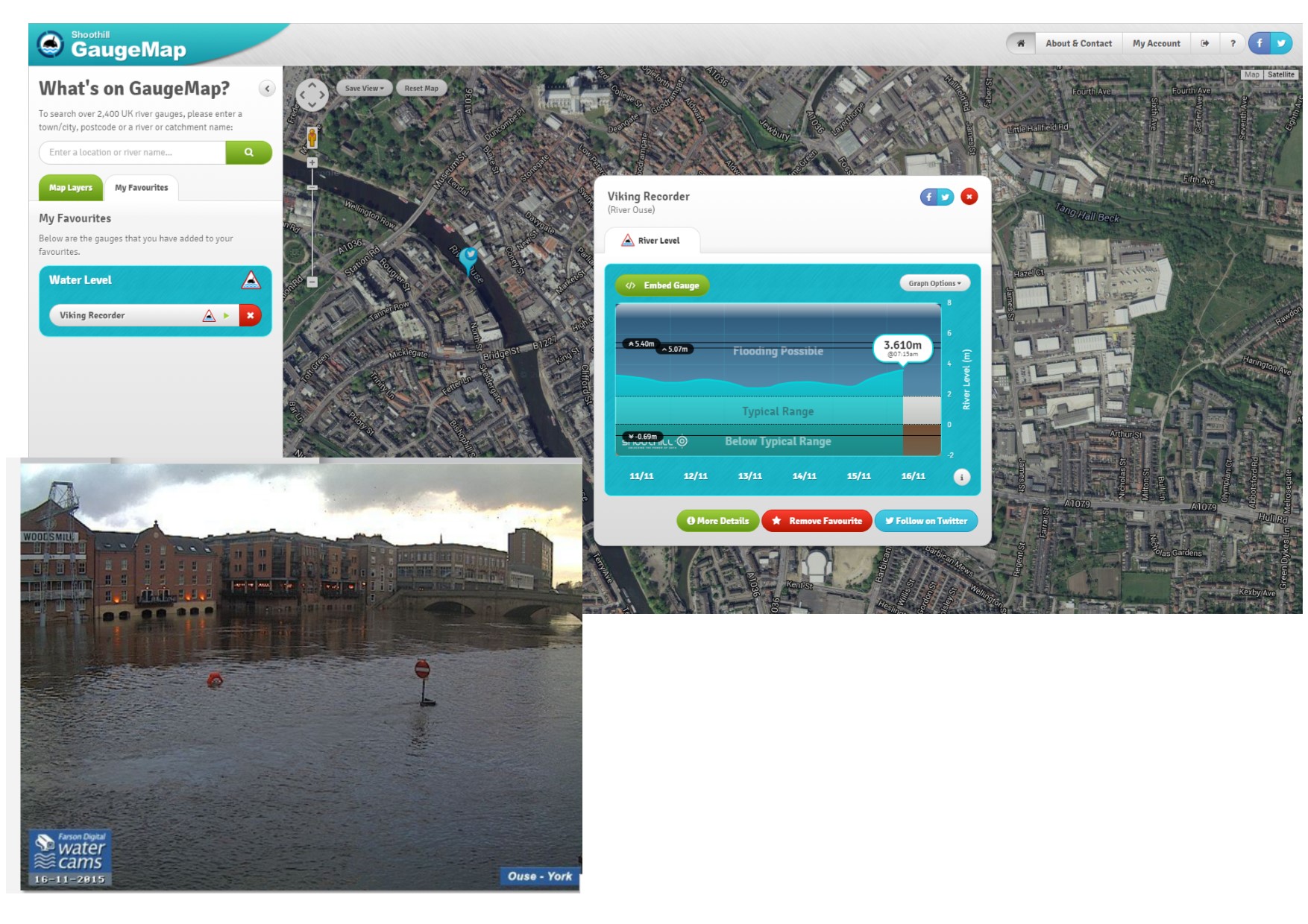
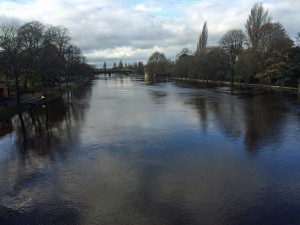
River levels in York are set to peak later tonight. They are not expected to reach 2012 levels, but some riverside properties are at risk.
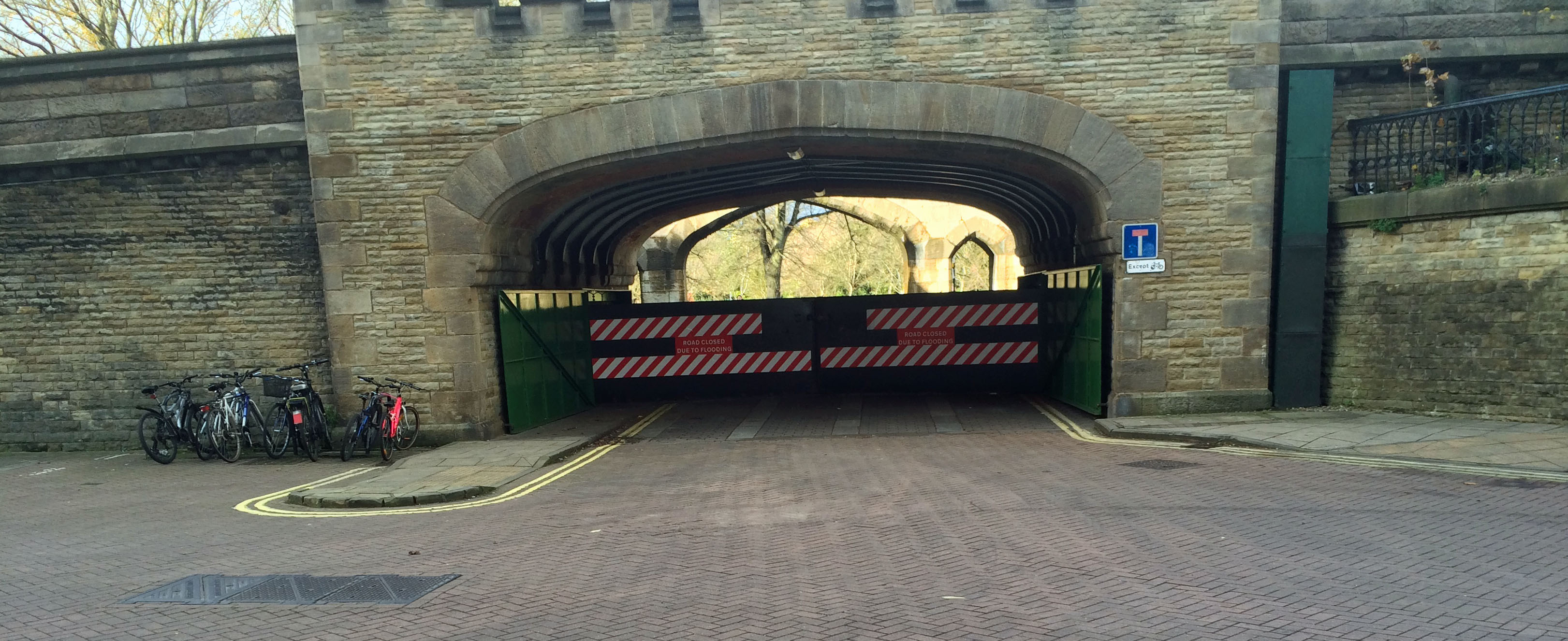
The St Georges Field car park remains closed.
Click to access Environment Agency web site
In a strange coincidence, the York Council has today added the minutes of a large number of drainage Board meetings to its public “on line” library.
- Ouse Derwent Internal Drainage Board: 21-01-14 Minutes
- Ouse Derwent Internal Drainage Board 04-02-14 Minutes
- Ouse Derwent Internal Drainage Board: 17-06-14 Minutes
- Ouse Derwent Internal Drainage Board 07-10-14 Minutes
- Ouse Derwent Internal Drainage Board: 21-10-14 Minutes
- Ouse Derwent Internal Drainage Board: 20-01-15 Minutes
- Ouse Derwent Internal Drainage Board 03-02-15 Minutes
- Ouse Derwent Internal Drainage Board: 16-06-15 Minutes
- Kyle & Upper Ouse Drainage Board: 09-02-15 Minutes
- Kyle & Upper Ouse Drainage Board: 01-06-15 Minutes
- Ainsty Drainage Board Minutes of 14 September 2015
- Ainsty Drainage Board: Minutes of 15 June 2015
- Ainsty Drainage Board Minutes of 9 March 2015
- Ainsty Drainage Board Minutes of 26 January 2015
- Ainsty Drainage Board Minutes of 15 September 2015
- Ainsty Drainage Board Minutes of 10 November 2015
- Ainsty Drainage Board Minutes of 16 June 2014
- Ainsty Drainage Board Minutes of 10 March 2014
- Foss Internal Drainage Board: Minutes of 7 September 2015
- Foss Internal Drainage Board Minutes of 8 June 2015
- Foss Internal Drainage Board Minutes of 2 March 2015
- Foss Internal Drainage Board Minutes of 5 January 2015
- Foss Internal Drainage Board : Minutes of 3 November 2014
- Foss Internal Drainage Board Minutes of 8 September 2014
- Foss Internal Drainage Board Minutes of 9 June 2014
- Foss Internal Drainage Board Minutes of 3 March 2014
Buses
- Quality Bus partnership 24-06-15 Minutes
- Quality Bus partnership 15-12-14 Minutes
- Quality Bus partnership 14-07-14 Minutes
- Quality Bus partnership 17-03-14 Minutes
Local Government Employers
- LGYH employers 20-11-14 Minutes
Safer York
Flooding warnings in place for York
Click for latest information
Flooding in York – New web site makes checking easy
A new web site provides an instant representation of flooding levels across the country. Click to access
Currently serious flooding is not expected in York but more water is on its way.
click to access
Action Taken
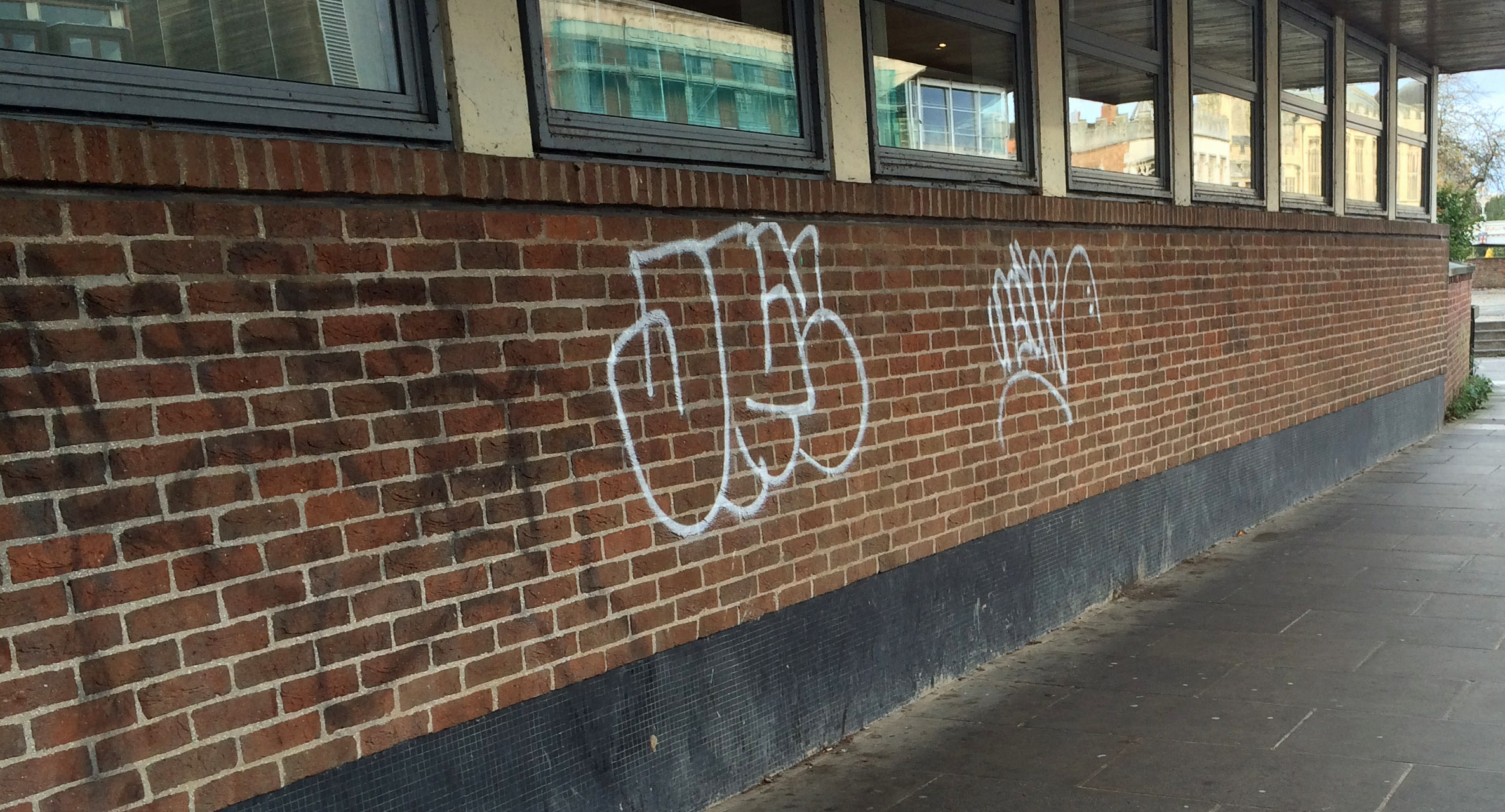
Good to report that the graffiti has been removed from the North Street flood gates
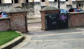
Graffiti now removed from second set of flood gates on North Street
All the flood gates have been closed as a precaution today

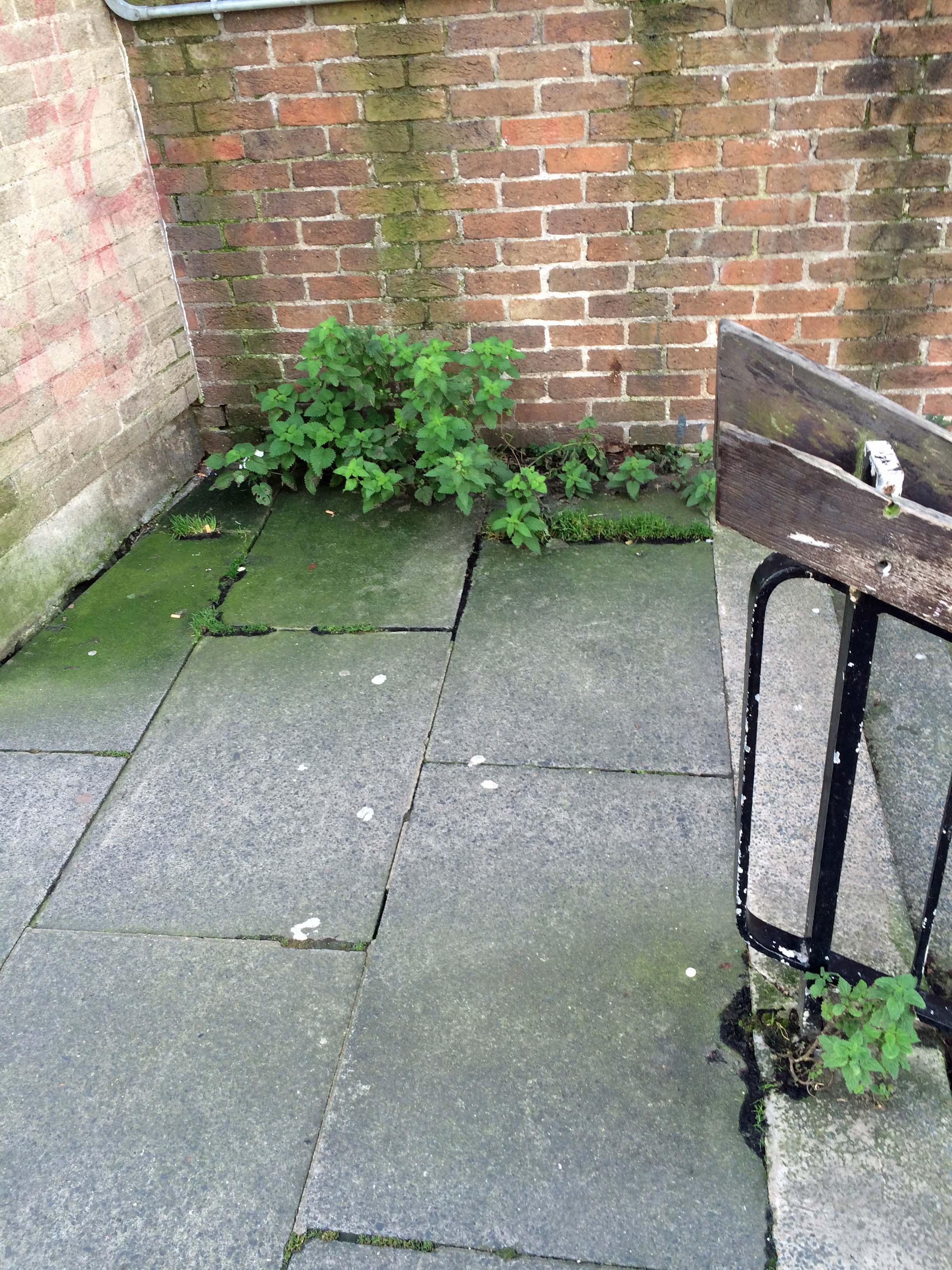
Unfortunately weed growth on Ouse Bridge is still there as is a similar problem on the Riverside Walk


Pose Bridge

Riverside Walk
Riverside walk
and some graffiti blights also blights the Riverside Walk
and a final bit of good news, the Council has agreed to repaint the cycle barriers on the Teal Drive to Carrfield snicket
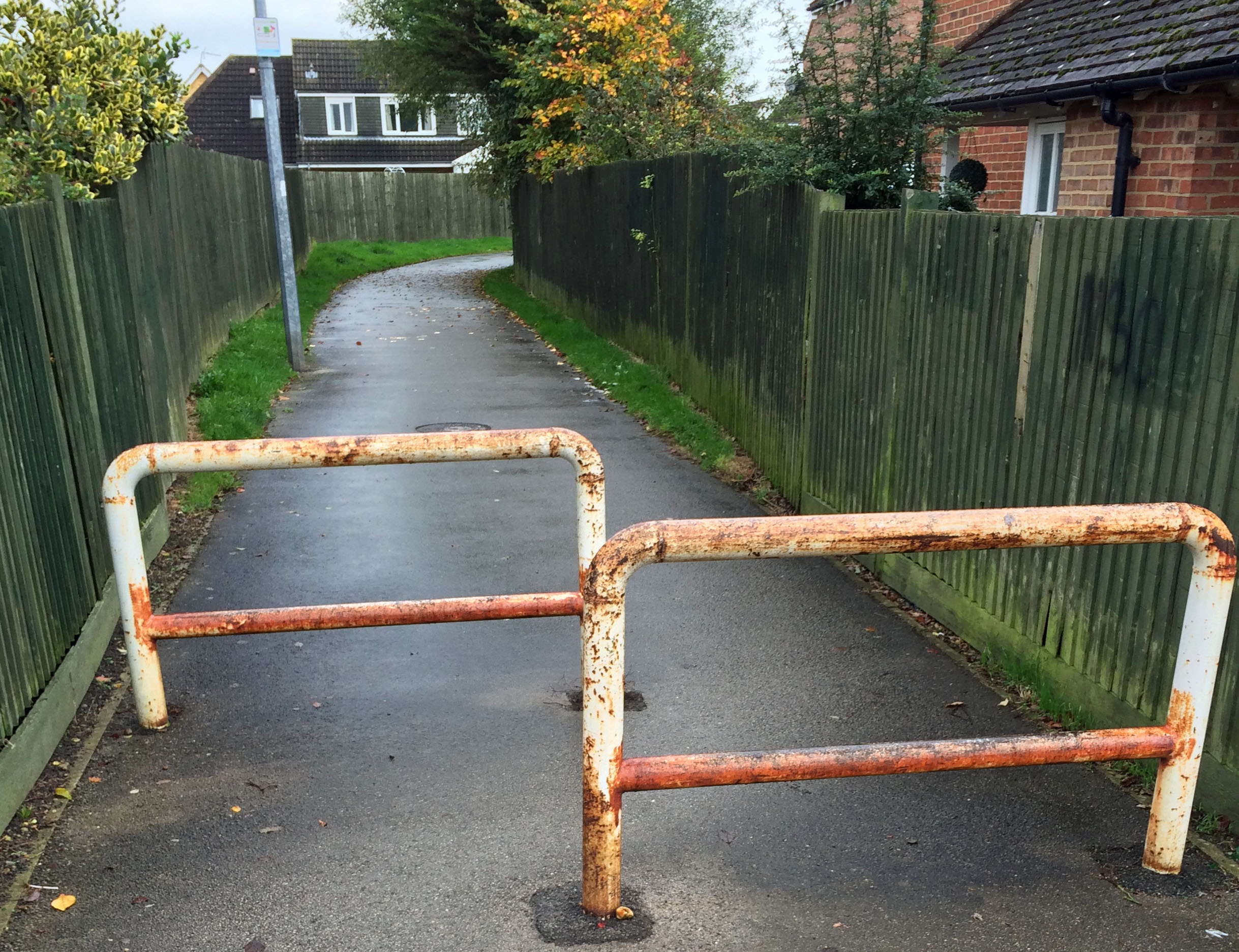
Cycle barriers Teal Drive Carrfield snicket
Flooding risks in York
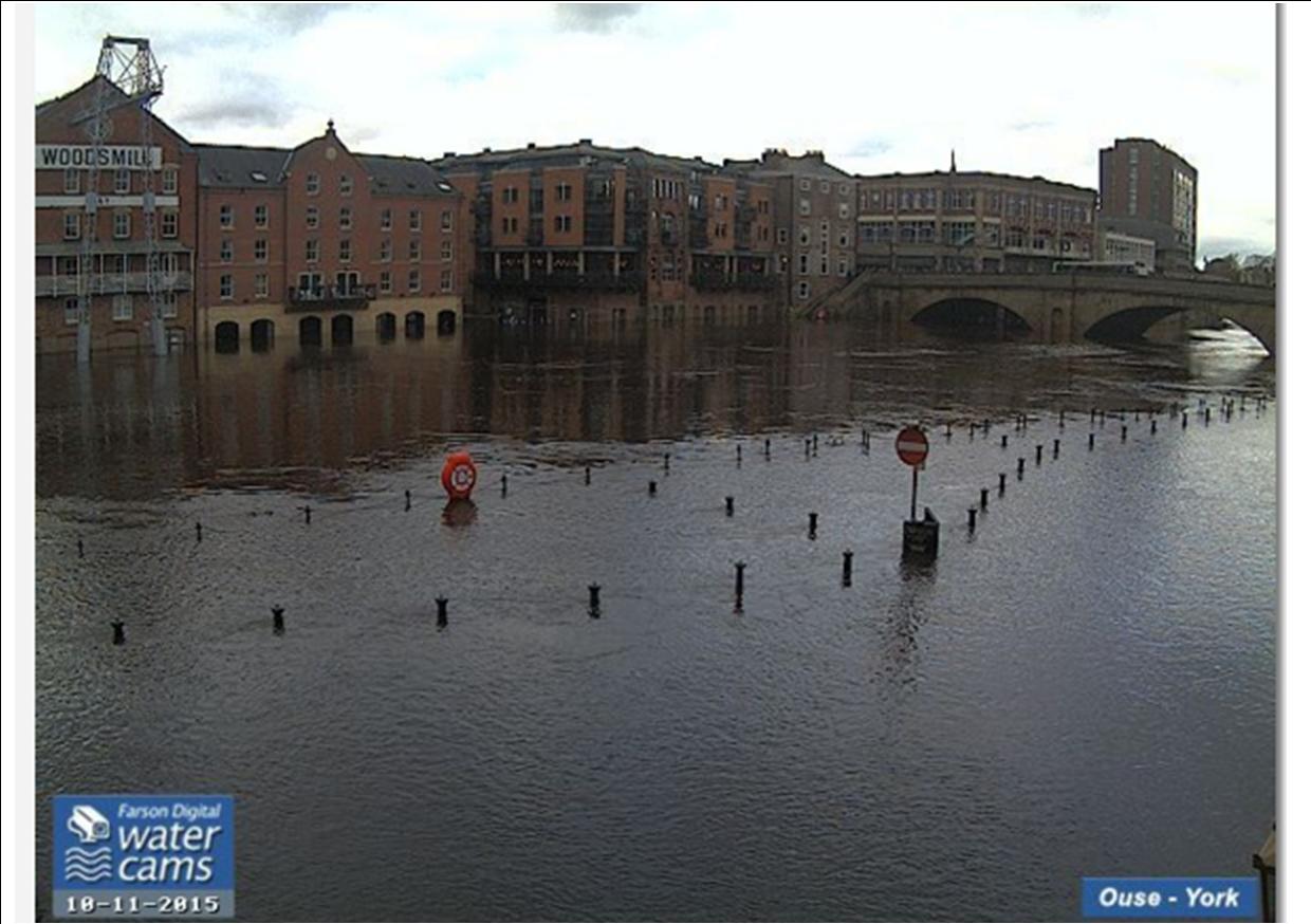
10th Nov 2015
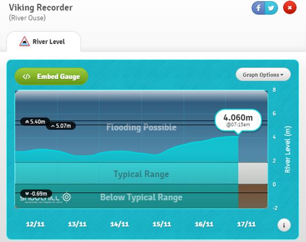
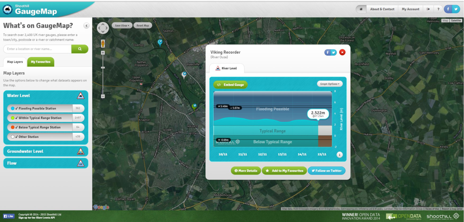
It’s that time of year again and a flood warning has been issued by the Environment Agency.
River levels are not expected to increase to those seen in 2012.
Detailed river levels can be found on the EA web site http://tinyurl.com/Ouse-catchment
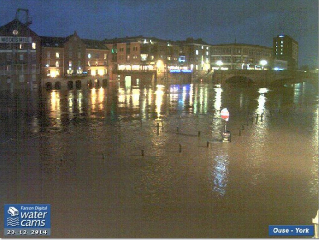
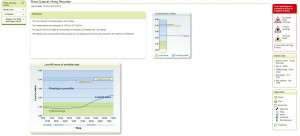
The best indicator remains the real time CCTV camera which records river levels on Kings Staith (above).
There is a significant risk if the top of the “no entry” sign disappears under water!
You can register to receive flooding alerts by clicking here (phone text or Email)
Flood warning for York
A flood warning has been issued by the Environment Agency. River levels are not expected to increase to those encountered in 2012.
Click for access (commercial web site with advert)
River Ouse web cam Click to access latest information
The best indicator remains the real time CCTV camera which records river levels on Kings Staith.
Click to access Environment Agency monitoring station data (central York)
There is a significant risk If the top of the no entry sign disappears under water!
Detailed river levels can be found on the EA web site http://tinyurl.com/Ouse-catchment
You can register here to receive flood warnings by phone, text or email.
Foxwood Lane anti flooding measures near completion
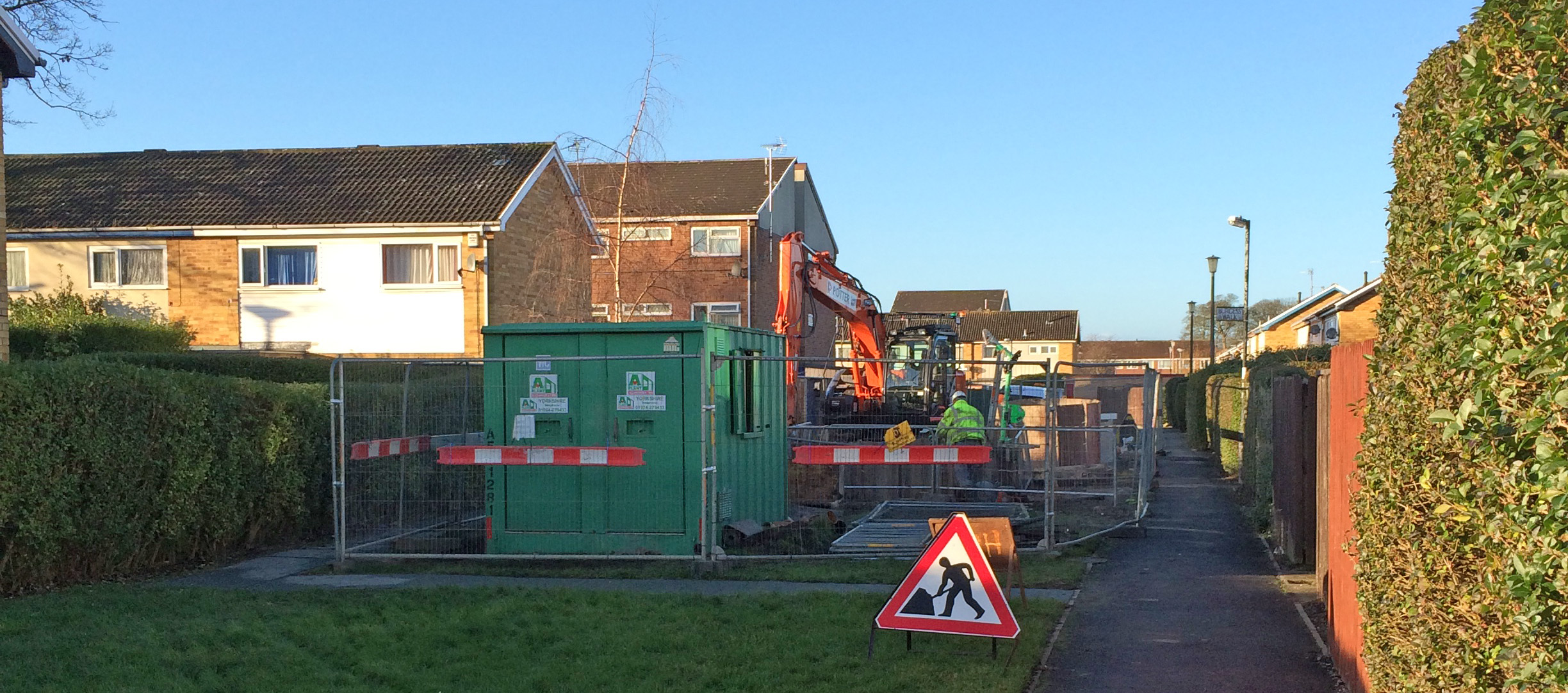
Works to address flooding issues on Foxwood Lane
Works are well underway to address flooding problems affecting some properties on Foxwood Lane.
One property has been empty for over a year as a result of water entering the building.
A few years ago the pumping station pumps failed and caused chaos on the street. Automatic alarms were later fitted at the pumping station to prevent a repetition of that problem.
The current works don’t increase the size of the main sewer pipe serving the area. Lack of drainage capacity effectively prevents any further building in the area
More flooding problems reported
New Westfield Councillor Andrew Waller is following up several reports of flooding in the area.
Most seem to be linked to blocked drainage gullies.
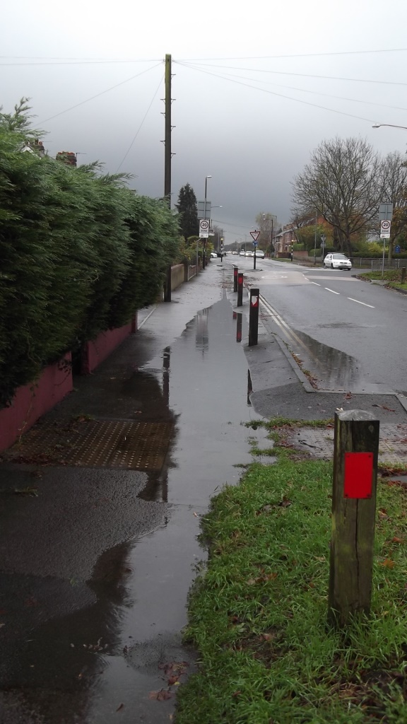
Gale Lane – footpath flooding
Footpath and carriageway flooded on Acomb Green
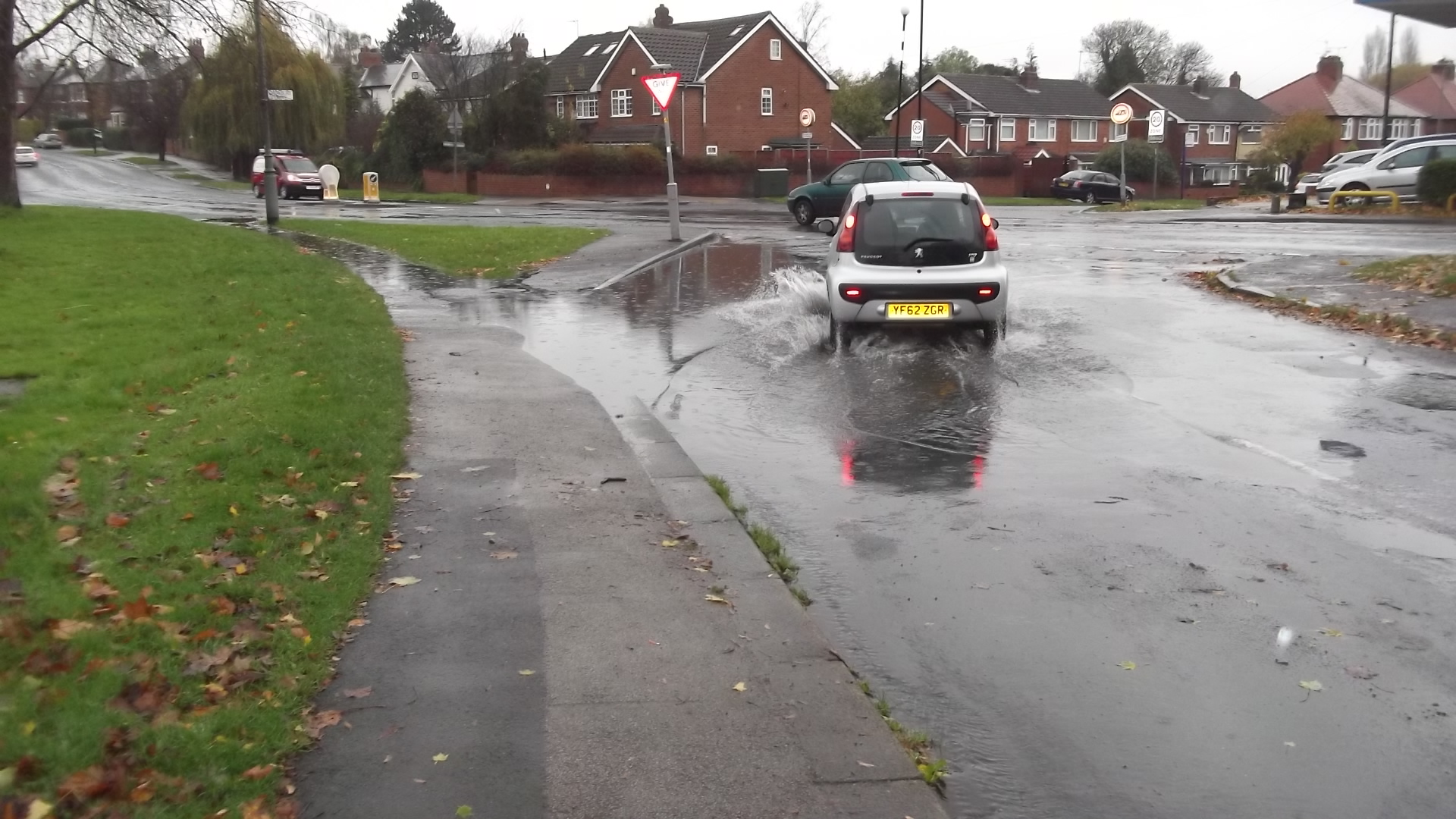
Ponding reveals blocked drains in Foxwood area

Bellhouse Way flooding
Bellwood Drive flooding
A combination of accumulated leaves and inadequate routine cleaning of drainage gullies has resulted in quite a lot of localised ponding today.
Flooding occurred on part of Bellhouse Way.
It also became clear that a blocked drain in the housing area off Bellwood Drive – which was reported over a month ago – had still not been cleared.
We have reported both issues.