Council failed to monitor key aspect of Groves traffic scheme

After several attempts, responses to Freedom of Information (FOI) requests have confirmed that the Council had not established key base line data measurements before implementing The Groves traffic ban in the summer.

Although never formalised, those favouring the changes argued that rerouting “through traffic” onto neighbouring roads would;

  1. improve air quality
  2. reduce traffic levels and thereby accident numbers
  3. make the area “quieter”
  4. encourage cycling/walking
  5. utilise time limited central government funding grants

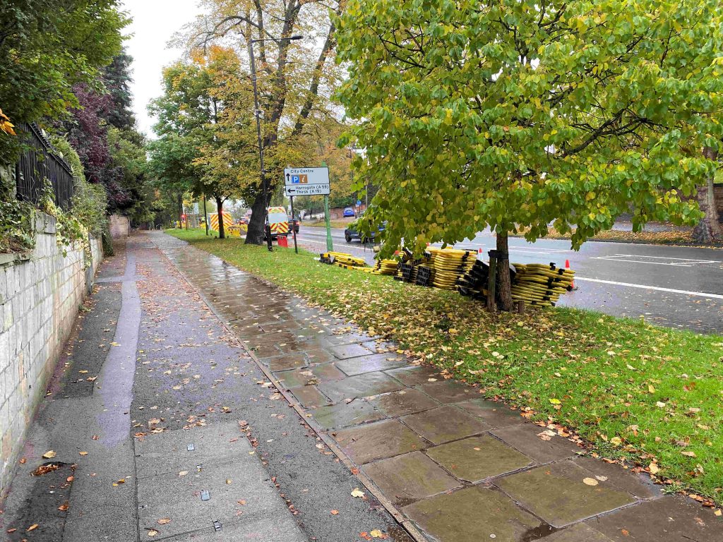
At the time of the decision to press ahead with the scheme (June 2020), the area had been virtually traffic free for 3 months because of the lockdown restrictions.

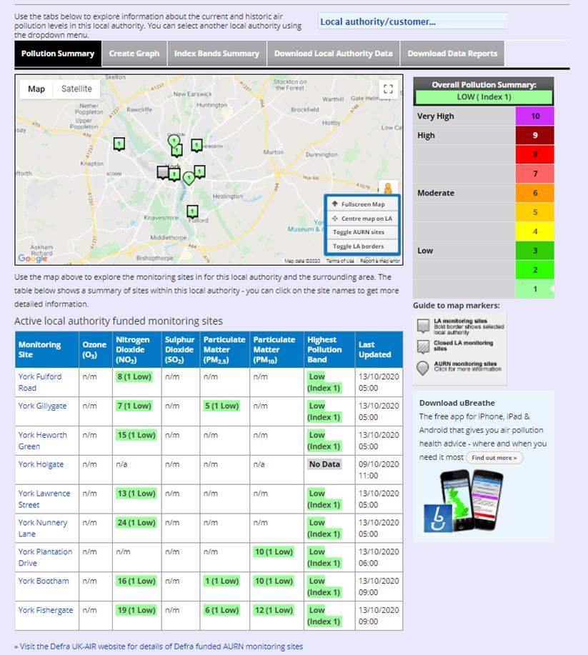
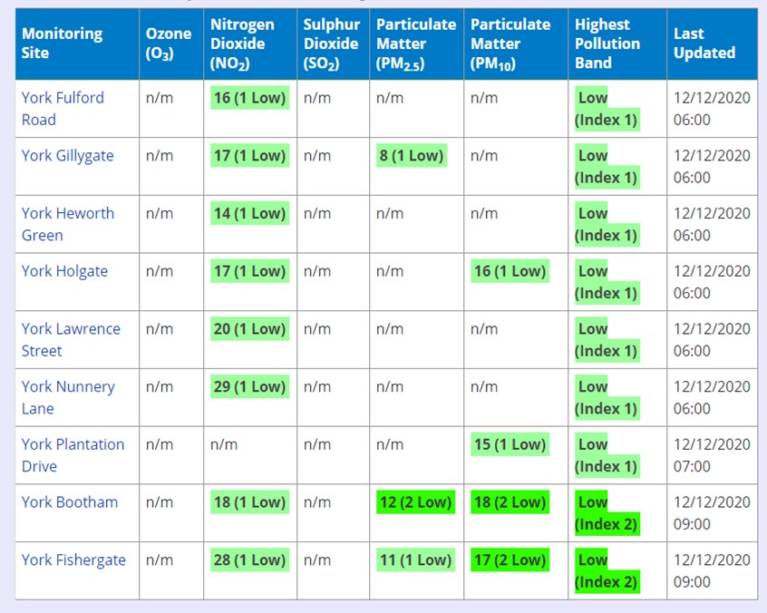
One of the consequences of lower economic activity has been greatly reduced pollution levels during 2020. The table below shows the current situation.

click to access latest figures

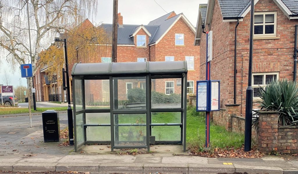
No noise measurements have been published, for streets within The Groves area, by the Council.

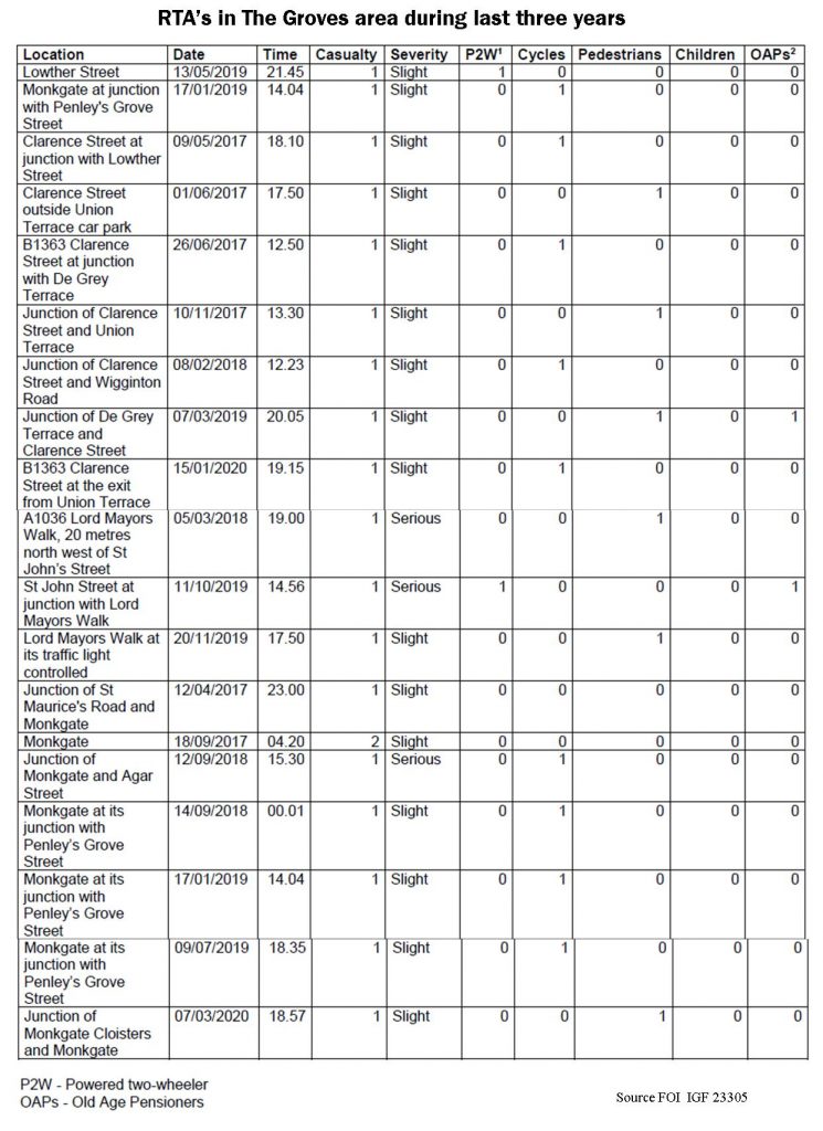
A response to an FOI request a few months ago revealed that accident levels have been very low within The Groves area during the last 3 years.

The Council has admitted that it doesn’t have any base line air quality measurements for the streets within The Groves area. Nor, apparently, is it monitoring current pollutions levels there (although, like the rest of the City, these are likely to be very low – see above).

The Council is also being very coy about what traffic volume information it holds. Traffic flow information for 2019 – when the plans were first discussed – should, in our view, have been published.

Similar benchmark information for June 2020 (post pandemic) should also have been published to inform decisions at that time.

Such figures as have been made public concentrate on the capacity of the nearby diversionary routes.

The Council is refusing to release information about movements within the Groves area raising, at least, a suspicion that it hadn’t completed counts. It now says that it will release information in June 2021.

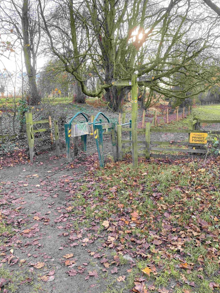
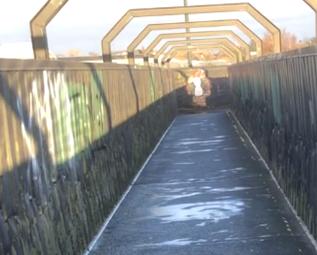
The most concerning aspect of this whole process has been the lack of any safety audits. The Council has promised that a stage 3 audit will be completed. But it doesn’t say when.

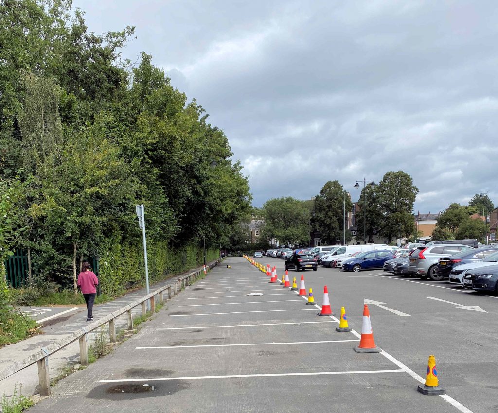
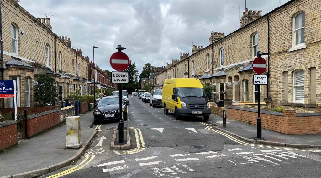
In the meantime the hazards – particularly for cyclists – remain and will grow as movements return to more normal patterns.

Unsegregated contraflow cycle routes represent a safety risk

We could use the FOI appeal processes to try to force the Council to publish the details it holds on internal modal travel patterns for the periods before the traffic ban was introduced.

It would have no practical effect unless backbench Councillors were prepared to challenge the system. This they don’t seem to be prepared to do.

We must just hope that some of the more perverse aspects of the scheme don’t lead to more avoidable accidents during the run up to next years review.

Highways schemes approved by Council

More minor highways improvement schemes have been approved under the York Councils delegated ward budgets.

They are located in the Dringhouses, Fulford and Osbaldwick wards. A list can be viewed by clicking here

The process and method of prioritisation of the use of the £1 million available budget is obscure. No comprehensive list of the improvements approved and implemented in each part of the City has been published on the Councils web site. Requests for improvements to footpaths and roads in the Westfield area have produced little response.

Even in Fulford, where funds are being allocated, some may wonder whether an investment in replacing opaque panels in local bus shelters might have deserved some consideration? Instead two prominent shelters look shabby or are overgrown by vegetation.

It is a similar picture on the west of the City.

The delegation of funding decisions to local communities is a step in the right direction but currently allocation processes look to be a combination of patrimony and chance.

York transport and planning policies stalling

 The decision of the York Councils planning committee to delay a decision, on a plan to replace the Castle Car park with a multi storey alternative at St Georges Field, throws into contrast the conflicting policies of the present Council.

The multi-story option emerged after nearly 2 years of public agonising. £2.2 million has already been spent on design work, consultants fees and consultation costs. The resulting plan didn’t suit everyone (including us) but it did present a way forward.

Multi storey car parks are usually ugly, there can be security issues, they concentrate vehicle movements onto limited sections of the road network and – in the case of the St Georges Field site –  park visitors to far away from their ultimate destinations whether that be shops, work or hospitality outlets.

The Council had submitted its planning application despite already acknowledging that changes to the Castle car might have to wait until the, Coronavirus prompted recession, has eased.

No great problem.

The Castle car park has been there for decades and it is the parking location of first choice for many shoppers and visitors. In July and August this summer it was rammed full.

Castle car park full to overflowing this summer

Now a Planning Committee has rejected the St Georges Field plan by 8 votes to 7. The key vote was cast by Cllr J Barker a hitherto low profile LibDem Councillor from Poppleton. The same meeting also deferred consideration of a new housing scheme on the former Castle Mills car park site.

That car park was lost to general use over a year ago and is still unavailable.

Like the odd decision last year, when Labour Councillors bounced the Council into pledging to stop through traffic from using Lendal Bridge, the impracticalities and contradictions in policy now threatened the economic recovery of the City.

The Council has said it will spend £40,000 consulting on the future of car parking in the City centre. If it appoints consultants to undertake the exercise then they will come under pressure from sectional interest groups including the “folksy fringe” who really don’t want any city centre car parking provision at all.

Personal transport remains the preferred mode for getting around for many people. Post COVID, cycling levels have fallen and public transport use has collapsed.

Meanwhile the number of City centre shops going into administration is creeping upwards.

The beginning of the new year – traditionally a poor time of year for traders – may see even more businesses facing ruin.

Some consistency from the York Council is required to avoid an economic collapse

Government announce funding for York transport schemes

City of York Council has been allocated £658,350 to support more active travel across York and the many residents who are choosing to walk and cycle more throughout the city’s COVID recovery.

No new bridge for cyclists crossing the river Ouse on the A1237 (not enough money) but the Council says it can widen the existing cycle path (!)

The Government’s Active Travel Fund is designed to support walking and cycling as a long-term method for commuting. To receive any allocation from the fund, the council must carry out wide reaching engagement on a variety of proposed schemes to inform designs for people-centred transport infrastructure and more active travel opportunities for residents.

There is likely to be some scepticism about the Council choice of schemes (see below). It’s plan for a cycle path from Wheldrake (pop 2000) to the City centre for example doesn’t appear to have been based on any sort of cost benefit analysis.

Other villages such as Dunnington (pop 3300) are closer, so cycling is likely to be a much more attractive option for commuters living in that area.

The Council has computer modelling facilities available which would allow it to prioritise, what are very scarce, resources on initiatives which will give the maximum “bang per buck”. We’ve had too many impulsive decisions in the recent past ..and too many vanity projects. Decisions need to be made with clear base line figures, milestones, quantifiable targets and proper outturn appraisals.

No plans have been announced to improve the lamentable state of the existing cycle network. Parts of the York Selby cycle path – which is not too far away from Wheldrake – is currently unusable because of surface damage

Cycle lanes are planned for Acomb Road in Holgate

According to the Council, “the consultation, which will launch later this year, will provide residents the opportunity to shape future plans and ensure that they are designed to meet the needs of local communities.  By using the consultation to develop high quality cycle routes, we can encourage more people to walk and cycle as part of their everyday travel in the city”.

This funding is the second phase of funding, following on from an initial £193,000 received in summer this year.

The Council claims that, “This second phase of funding will allow the city to build upon action taken so far this year through temporary changes to road layout and improving cycle safety, and enable the council to design and implement more permanent and wider reaching schemes to support residents with active travel opportunities across the city”.

The measures proposed to be consulted upon and delivered include:

  • Measures on Shipton Road (north of Clifton Green), linking with ongoing improvements to cycling infrastructure on Bootham;
  • Cycle lanes along Acomb Road;
  • Some city centre measures, for example a pedestrian/ cyclists crossing of Tower Street near St George’s Field;
  • Improvements to the cycle lane on the A1237 bridges over the Ouse and East Coast Main Line;
  • Cycle improvements between Wheldrake and Heslington.

Consultation will be carried out in the coming months and feedback collected from this will be reported at an Executive Member for Transport Decision Session in early 2021.

This work will be carried out in coordination with the implementation of the council’s Economic Recovery Strategy. The strategy focuses on prioritising active travel, working with bus and rail operators to ensure people can continue to use public transport with confidence and creating a more people-focussed city centre.

The council’s iTravel team will be supporting engagement across local communities and schools to better understand barriers to active travel and how this funding can improve this across the city.

Tadcaster Road

It looks like more may emerge over the Councils blunder in resurfacing Tadcaster Road in the summer and then deciding to dig it up again in the autumn.

In total over £5.5 million is being spent on the road with Northern Gas networks currently installing a new supply pipe along one side of the road.

When this work is completed the Council intends to lay new, surface water, drains.

Gas main works in The Mount area

The Councils scheme is being funded from a grant announced in June by the government. The announcement came a few days after the initial resurfacing scheme had been completed.

At the time there was some scepticism that York Council officials had not communicated with their DpT counterparts and explained that the work had been completed. We commented on the plans earlier in the year.

Now correspondence has been unearthed which suggests that the Northern Gas Network repairs were known to the Council in February (before the resurfacing contract was let).  An email says that the gas main would need replacing within 5 years.

It is one of several in west York that will need to be upgraded before 2026 as metal pipes are replaced with plastic. They are shown in purple on the plan.

Gas main replacement programme

An internal Council Email dated 2nd July confirmed that Tadcaster Road would be dug up again. It gave utilities a second chance to get their work done before the Council moved in again.

It was a response to this invitation which led to the current Northern Gas works, which are due to be completed in February.

We suspect that – like several other transport schemes – officials were keen to use the first lockdown period to get disruptive works out of the way while traffic levels were light.

 Although the right approach in principle, it led to corners being cut and, in this case, has resulted in a substantial waste of taxpayers’ money.

Tinkering with traffic schemes in York

The new lockdown arrangements will alter once again traffic flows in the City.

The changes will affect the monitoring of schemes like The Groves, where the Council have so far been unable to produce before and after figures for air pollution and congestion.

A review of the scheme was promised early in 2021.

Very low traffic levels on Penley’s Grove Street during first lockdown

The effected streets were – like many in other parts of the City – virtually deserted during the first lockdown. Alternative routes have also been quiet since the beginning of the year.

Now the Council has formally changed the The Groves restrictions twice in the space of 7 days.

As no figures have been shared with residents it is impossible to judge whether the changes are justified.

However, the absence of any action on safety aspects of the scheme – including the controversial contra flow cycle routes – tells its own story.

Reopening the restricted access, at least for emergency vehicles, would also have been worth addressing as pressures on the NHS grow. .

Elsewhere, West Offices leaked a plan to the media yesterday which said that foot-street hours were being changed to 10:30am – 5:00pm during the lockdown.

There was no consultation on the proposal and no decision appears in the Councils official “on line” log. Sources say that it is aimed at making access to “takeaways” easier.

Maybe so.

But it is unclear why the revision simply didn’t reinstate the traditional footstreet hours (10:30am – 4:00pm). At least the signage for that restriction is already available!

York Central

It seems that the Council will determine the detailed planning application for the York Central site during the lockdown.

The proposal is likely to go to a public inquiry but when and how that could be arranged under the pandemic restrictions remains to be seen.

The applicants have failed to satisfy perfectly reasonable objections to transport access proposals for the site.

The Marble Arch pedestrian access

The Leeman Road tunnel (next to Marble Arch) would still be made one way with cyclists apparently expected to brave a deluge of liquid manure during wet weather.

Wilton Rise existing footbridge

Problems with the poor access for cyclists in the Wilton Rise area have also not been addressed.

Local residents – quite legitimately – are objecting to losing pedestrian access down the current line of Leeman Road as the railway museum stubbornly pursues its “annexation” policies.

Other more extreme objections have been lodged – including the impractical “no vehicles” lobby – but it is the failure of the developers to satisfy the concerns of “moderate” residents, which may lead to lengthy delays is getting this important scheme actually built.

Marygate car park will be smaller

A report being presented to a decision meeting next week recommends that Marygate car park be reduced in size by six spaces.  

It is part of the fall-out from a proposal which would see the adjacent railway cycle path widened.

Marygate car park was often full during the summer. Railway cycle path on left

There have already been complaints from season pass holders that they have been unable to find space to park because of an impulsive, and totally unjustified, initiative which saw 70 spaces coned off a few months ago.

More welcome, are plans to provide a ramp access to St Mary’s. This will help both disabled buggy users and cyclists.

A design for new traffic lights at the St Mary’s junction with Bootham is also suggested.

More accessible link for cyclists is promised at the bottom of St Mary’s

Objections to the plans are dismissed out of hand by officials although the report does say that a safety audit on the proposals has been completed (the results of it are not detailed in the papers).

The scheme will cost around £360,000 including £60,000 for the path widening part of the project.

No safety audit completed on Groves traffic scheme

Contrary to claims made on social media a few months ago, a response to a Freedom of Information request has revealed that no road safety audits were completed on The Groves road layout changes before they were introduced in the summer.

Safety audits area mandatory for changes to highway layouts. Their purpose can be viewed by clicking this link

It is without precedent in York, for a scheme of this size to be implemented without the Stage 1, 2 and 3 audits being completed.

It is of no relevance that the scheme may have been labelled as “experimental” by Council officials.

It appears that a Stage 3 (post construction) audit will be undertaken when changes to the layout have been completed. It is unclear when this will happen and what changes may be planned*.

The revelation is the most serious of several concerns highlighted by the Councils refusal to respond fully to the request for information. In due course, this may be explored further with the Information Commissioner, but the safety aspect (including the controversial unsegregated contraflow cycle lanes) may require action from Grant Shapps the Transport Minister  who has been scathing about the quality of some “emergency” traffic changes introduced post COVID. The Groves scheme was funded from the governments “emergency transport budget”

Unsegregated contraflow cycle lanes on narrow road have been heavily criticised

The Groves scheme was designed in late 2019 and so preceded the start of the pandemic.

The response also raises the question of just what the scheme was intended to achieve?

Most commentators have pointed to improvements in air quality. However, air quality across the whole highway network in York has been good since the start of February and the Council has been unable to produce any figures suggesting that The Groves is any different in that respect.

Some said that there would be fewer collisions. Accident data – mostly pre lockdown –   reveals that there were no severe accidents in The Groves area and that there were no accidents at all involving children. The severe collisions that were recorded happened on the alternative route for traffic (Clarence Street, Lord Mayors Walk, Monkgate) with most at the road junctions which are still open to traffic. Thus, the scheme may actually have increased risks on the network as a whole.

The Council has refused to reveal the pre and post implementation traffic levels in the area. There is absolutely no reason why the 2019 base figures should not be in the public domain. The Council instead promise to include the figures as part of a public review of the scheme during the first quarter of 2021.

With traffic levels currently running at about 80% of pre COVID levels, we are not expecting to see a significant impact on congestion levels on alternative routes.

The removal of “through traffic” from The Groves will offer residents who live there a quieter lifestyle. Whether it is safer or less polluted may now be open to question.

The type of closure chosen and its impact on emergency services, deliveries and local businesses has been subject to criticism

There is no good reason for the York Council to be so secretive about the scheme and it is downright irresponsible to include elements which increase hazards for road users without undertaking, transparent, risk assessments.

Recent accidents in The Groves area. May not include most recent incidents.
  • The Council has now published the changes it is making. They are;

a. Change the position of the road closure on St. John’s Crescent, to relocate it at the junction with Garden Street. Removable bollards will be installed for part of the closure to provide a secondary emergency access route to streets off Garden Street/St John Street;

b. Remove 2.4m of on street parking on St John Street (both side) near the junction with Garden Street to facilitate turning movements at the junction;

c. Change the position of the road closure in place at the junction between Neville Terrace, Park Grove and Brownlow Street, to address issues with some drivers using the alleyways between Neville Terrace, Eldon Terrace and Amber Street to bypass the closures;

d. Remove the parking bay adjacent to 25 Neville Terrace to facilitate access and egress for larger vehicles, including emergency vehicles.

2. Approve a Temporary Traffic Regulation Order (TTRO) to waive Pay & Display charges for parking areas near the shops on Lowther Street and adjacent to the local shop on Townend Street (between Abbot Street and Del Pyke) for a duration of 6 months.

Changes published by York Council on 20th October 2020

“Act in haste, repent at leisure” time for York Council transport changes

Cycling numbers decline in York

It looks like more of the road restrictions introduced in the summer, as part of the Councils reaction to the COVID crisis, will be dropped.

The most criticised restriction – closure of Bishopthorpe Road –  was scrapped a couple of months ago, although officials are now threatening to revive the idea as part of “a review of the Local Transport Plan”.

A report to a meeting taking place next week provides an insight into how travel habits have changed in the City since COVID struck.

The most recent monitoring data, for September, shows that AM peak traffic volumes are around 80% of pre-lockdown, with the PM peak around 85% of pre-lockdown levels. Between the peaks, and at weekends, vehicle trips are down by around 5-10%. Bus use is 50-60% of pre-lockdown levels.

There is some bad news for the cycling lobby.

“Cycling levels appear to have fallen by around 30% in the peaks, whilst interpeak levels are not changed in comparison to the same period last year. It is likely that fewer people are commuting to and from work by bike or cycling to the railway station for onward travel by train, offset by higher levels of exercise/ leisure cycling”.

The report pointedly fails to comment on pollution and air quality levels in the City. These continue to be at record low levels (so probably don’t suit a doom and gloom narrative).

click to access

Several of the “emergency” schemes involved little more than putting out more traffic cones. Those in the Marygate and Monk Bar car park were largely unnecessary. The £10,000 a month taxi shuttle service for disabled people from the latter continues to run although it is little used. Most of the 40 parking spaces lost at Marygate are set to be restored as part of a new scheme to install a permanent cycle path link to Bootham.

Of the others, the report recommends

  • The temporary one way restriction on Coppergate is extended
  • The temporary cycle lane at Castle Mills Bridge on Tower Street is removed (only 3% of users are cyclists and there is an alternative, off road, route along the riverside)
  • The proposed scheme for improvements to York’s North – South cycle route is taken forward to implementation, with a proposed restriction on Navigation Road
  • The proposed scheme for improvements to cycle lanes on Bootham is taken forward to implementation, with a consultation commenced on the rest of the Shipton Road cycle lane scheme, including the element which would require changes to residents’ parking on parts of Bootham.
North – South cycle route

The Council has not heard whether its plea for funding a further tranche of works will be approved. These include the very expensive, but desirable, cycle bridge over the river and railway on the A1237 as well as some more eccentric ideas (a cycle path for Dunnington to the City centre).  

Despite the lack of obvious government enthusiasm for the Councils plans, the authority intends to spend £40,000 on further development of the ideas.

As we have said many times, one of the main criticisms of the Councils transport polices over the last 12 months has been its total insensitivity to the state of repair of the existing infrastructure.

Infrastructure is decaying

That is particularly true of cycle paths many of which are obstructed by potholes, weeds, and hedges. White lines have worn away, signage has faded and, in some cases, disappeared altogether.

It is that neglect that is limiting the expansion of walking and cycling numbers in the City.

Capital expenditure (funded by borrowing) is limited to providing or improving assets with an extended lifespan. Resurfacing existing paths could fall within that definition.

The suspicion is that the executive Councillors favour high profile vanity projects simply because they provide an opportunity for a good “Photo Op”.

The reduction in the numbers cycling is one symptom of poor prioritisation

Out of Step?

Deep Traffic - DQN Tuning for Traffic Navigation ? | by Greg Surma |  Towards Data Science

It is 2½ years since the York Council was awarded £2.85 million by the government to develop a “Smart Travel Evolution Programme” (STEP). It would monitor and enable “analysis of real-time journey information to improve travel in York”.

The Council said it would use “co-operative ‘urban traffic control’ (UTC), where vehicles and traffic signals work together to improve the network  reducing congestion and emissions”.

STEP will also generate a multi-layered, real-time model of traffic, public transport and air quality data, allowing York to prepare for connected and autonomous vehicles”.

We were told that the scheme would see the control systems capture data, process it and react to conditions in real-time.

Since then taxpayers have heard little although a £200k contract to Dynniq UK Ltd for a “Smarter Travel Evolution Programme – Green Light Optimised Speed Advisory System” was let a few months ago.

It is understood that this is aimed at improving the efficiency of the Councils own fleet.

Time for an update on this expensive project we think.

Just what benefits have we seen?