Council failed to monitor key aspect of Groves traffic scheme

After several attempts, responses to Freedom of Information (FOI) requests have confirmed that the Council had not established key base line data measurements before implementing The Groves traffic ban in the summer.
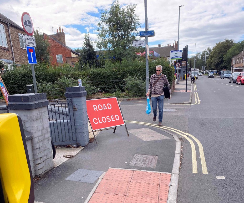
Although never formalised, those favouring the changes argued that rerouting “through traffic” onto neighbouring roads would;

  1. improve air quality
  2. reduce traffic levels and thereby accident numbers
  3. make the area “quieter”
  4. encourage cycling/walking
  5. utilise time limited central government funding grants

At the time of the decision to press ahead with the scheme (June 2020), the area had been virtually traffic free for 3 months because of the lockdown restrictions.

One of the consequences of lower economic activity has been greatly reduced pollution levels during 2020. The table below shows the current situation.
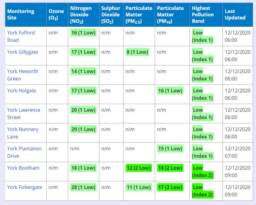
click to access latest figures

No noise measurements have been published, for streets within The Groves area, by the Council.

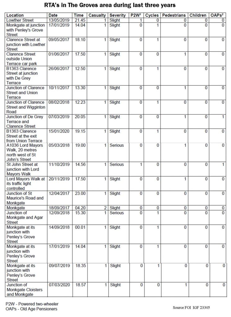
A response to an FOI request a few months ago revealed that accident levels have been very low within The Groves area during the last 3 years.

The Council has admitted that it doesn’t have any base line air quality measurements for the streets within The Groves area. Nor, apparently, is it monitoring current pollutions levels there (although, like the rest of the City, these are likely to be very low – see above).

The Council is also being very coy about what traffic volume information it holds. Traffic flow information for 2019 – when the plans were first discussed – should, in our view, have been published.

Similar benchmark information for June 2020 (post pandemic) should also have been published to inform decisions at that time.

Such figures as have been made public concentrate on the capacity of the nearby diversionary routes.

The Council is refusing to release information about movements within the Groves area raising, at least, a suspicion that it hadn’t completed counts. It now says that it will release information in June 2021.

The most concerning aspect of this whole process has been the lack of any safety audits. The Council has promised that a stage 3 audit will be completed. But it doesn’t say when.

In the meantime the hazards – particularly for cyclists – remain and will grow as movements return to more normal patterns.
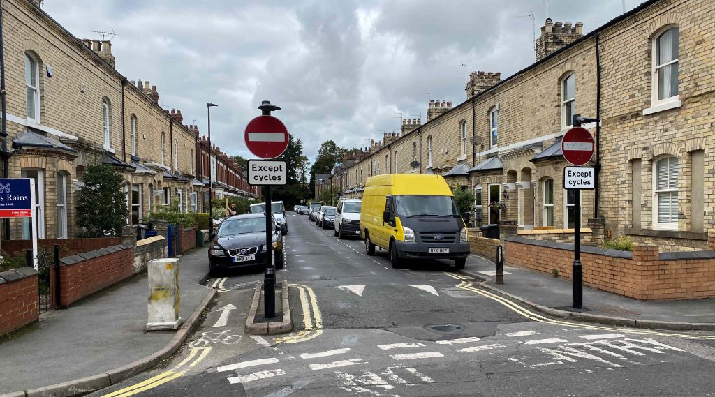
Unsegregated contraflow cycle routes represent a safety risk

We could use the FOI appeal processes to try to force the Council to publish the details it holds on internal modal travel patterns for the periods before the traffic ban was introduced.

It would have no practical effect unless backbench Councillors were prepared to challenge the system. This they don’t seem to be prepared to do.

We must just hope that some of the more perverse aspects of the scheme don’t lead to more avoidable accidents during the run up to next years review.

No safety audit completed on Groves traffic scheme

Contrary to claims made on social media a few months ago, a response to a Freedom of Information request has revealed that no road safety audits were completed on The Groves road layout changes before they were introduced in the summer.

Safety audits area mandatory for changes to highway layouts. Their purpose can be viewed by clicking this link

It is without precedent in York, for a scheme of this size to be implemented without the Stage 1, 2 and 3 audits being completed.

It is of no relevance that the scheme may have been labelled as “experimental” by Council officials.

It appears that a Stage 3 (post construction) audit will be undertaken when changes to the layout have been completed. It is unclear when this will happen and what changes may be planned*.

The revelation is the most serious of several concerns highlighted by the Councils refusal to respond fully to the request for information. In due course, this may be explored further with the Information Commissioner, but the safety aspect (including the controversial unsegregated contraflow cycle lanes) may require action from Grant Shapps the Transport Minister  who has been scathing about the quality of some “emergency” traffic changes introduced post COVID. The Groves scheme was funded from the governments “emergency transport budget”

Unsegregated contraflow cycle lanes on narrow road have been heavily criticised

The Groves scheme was designed in late 2019 and so preceded the start of the pandemic.

The response also raises the question of just what the scheme was intended to achieve?

Most commentators have pointed to improvements in air quality. However, air quality across the whole highway network in York has been good since the start of February and the Council has been unable to produce any figures suggesting that The Groves is any different in that respect.

Some said that there would be fewer collisions. Accident data – mostly pre lockdown –   reveals that there were no severe accidents in The Groves area and that there were no accidents at all involving children. The severe collisions that were recorded happened on the alternative route for traffic (Clarence Street, Lord Mayors Walk, Monkgate) with most at the road junctions which are still open to traffic. Thus, the scheme may actually have increased risks on the network as a whole.

The Council has refused to reveal the pre and post implementation traffic levels in the area. There is absolutely no reason why the 2019 base figures should not be in the public domain. The Council instead promise to include the figures as part of a public review of the scheme during the first quarter of 2021.

With traffic levels currently running at about 80% of pre COVID levels, we are not expecting to see a significant impact on congestion levels on alternative routes.

The removal of “through traffic” from The Groves will offer residents who live there a quieter lifestyle. Whether it is safer or less polluted may now be open to question.

The type of closure chosen and its impact on emergency services, deliveries and local businesses has been subject to criticism

There is no good reason for the York Council to be so secretive about the scheme and it is downright irresponsible to include elements which increase hazards for road users without undertaking, transparent, risk assessments.

Recent accidents in The Groves area. May not include most recent incidents.
  • The Council has now published the changes it is making. They are;

a. Change the position of the road closure on St. John’s Crescent, to relocate it at the junction with Garden Street. Removable bollards will be installed for part of the closure to provide a secondary emergency access route to streets off Garden Street/St John Street;

b. Remove 2.4m of on street parking on St John Street (both side) near the junction with Garden Street to facilitate turning movements at the junction;

c. Change the position of the road closure in place at the junction between Neville Terrace, Park Grove and Brownlow Street, to address issues with some drivers using the alleyways between Neville Terrace, Eldon Terrace and Amber Street to bypass the closures;

d. Remove the parking bay adjacent to 25 Neville Terrace to facilitate access and egress for larger vehicles, including emergency vehicles.

2. Approve a Temporary Traffic Regulation Order (TTRO) to waive Pay & Display charges for parking areas near the shops on Lowther Street and adjacent to the local shop on Townend Street (between Abbot Street and Del Pyke) for a duration of 6 months.

Changes published by York Council on 20th October 2020