Flood defence plans criticised by amenity body

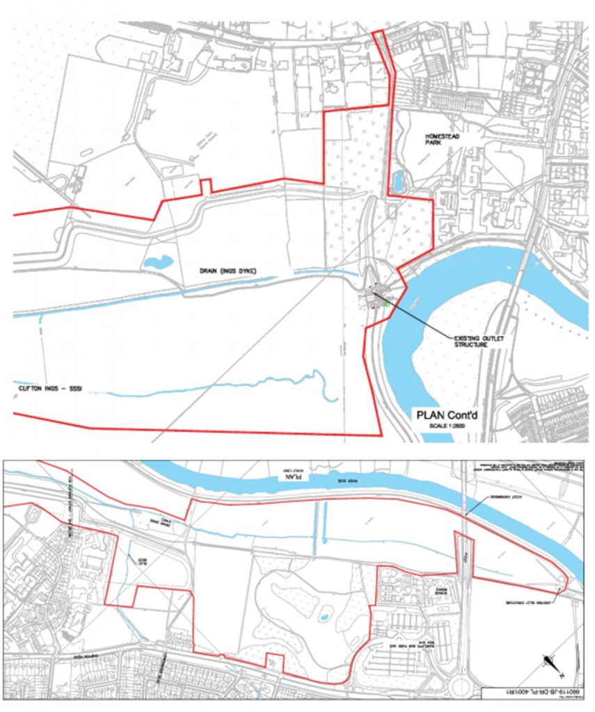
The Friends of Rawcliffe Meadows (FRM) are objecting to a plan to raise and extend flood barriers on the river Ouse near Rawcliffe.

Rawcliffe Meadows

They say “FRM believe the Environmental Statement is fundamentally flawed and must be comprehensively revised to give an honest and comprehensive account of the likely destruction of and damage to SSSI grassland”.

They go on to say, “There will be adverse impacts on the Cornfield Nature Reserve which are of regional or at least district-wide significance”.

The comments are revealed in a report to next weeks planning committee which is being recommended to approve the Environment Agency proposals .

The report says, “The application is for works to repair and extend the Clifton Ings barrier bank. This is one of the projects within the agencies flood alleviation scheme (FAS) to reduce flood risk throughout the city. £45 million has been allocated to the EA which will upgrade defences in 19 areas (referred to as flood cells).

The objective of the FAS is to protect against the 1 in 100 year flood (1% AEP) plus climate change and where this cannot be achieved then deliver the maximum level of protection in each cell within the context of existing flood risk and considering other environmental, social and cultural aspects.

The purpose of the barrier bank is to reduce flooding from rivers (fluvial flooding) to the Clifton / Rawcliffe area.

However, during the floods in 2000, water from the river outflanked the flood defences, spilled onto Shipton Road and flooded over 100 homes. The flood basin at Blue Beck also exceeded its capacity in 2000. In these instances, the Environment Agency had to provide temporary pumps to reduce flooding upstream on Blue Beck.

The barrier bank was constructed in 1980. It is of earth fill construction and is up to 4.5m high. The embankments on both sides of the River Ouse currently have issues with stability created by high pressure in the banks when the reservoir empties. This has meant that the drawdown rate for the reservoir has had to be reduced from 1,360mm/day to 300mm/day in order to reduce the risk of failure. This reduction in the drawdown rate significantly impacts on the operation and effectiveness of the reservoir as a flood defence, particularly for any consecutive flood events.

Clifton Ings provides a flood storage reservoir on the eastern side of the River Ouse close to Rawcliffe Park and Ride and the sports clubs Clifton Alliance and York. When not flooded, the northern section of Clifton Ings is used for grazing and the southern section is used as open land by the public. A Sustrans cycle route runs through this area.

During high flow events it has a flood capacity of 2,300,000 m3. It is owned and maintained by the Environment Agency.

The Planning Committee is meeting on Thursday at 4:30pm. The meeting will also consider a separate proposal to create a temporary access route into the site.
Site Plans

Latest planning application for the Westfield Ward

 Below are the latest planning application received by the York Council for the Westfield ward. 

Full details can be found by clicking the application reference 

—-

80 Tedder Road York YO24 3JF

Proposal Confirmation that all conditions have been complied with – 07/01492/FUL

Reference           AOD/19/00239

——

Representations can be made in favour of, or in objection to, any application via the Planning on line web site.  http://planningaccess.york.gov.uk/online-applications/

NB. The Council now no longer routinely consults neighbours by letter when an application is received

Latest planning applications for the Westfield Ward

 Below are the latest planning applications received by the York Council for the Westfield ward. 

Full details can be found by clicking the application reference 

—-

1 Vesper Drive York YO24 3HT

Various pruning works to trees protected by Tree Preservation Order no.18 

Ref. No: 19/01710/TPO 

Watermeadows Ltd 19 York Road Acomb York YO24 4LW

Condition 3 of 18/02006/FUL 

Ref. No: AOD/19/00285 

——

Representations can be made in favour of, or in objection to, any application via the Planning on line web site.  http://planningaccess.york.gov.uk/online-applications/

NB. The Council now no longer routinely consults neighbours by letter when an application is received

Multiple occupation planning application withdrawn

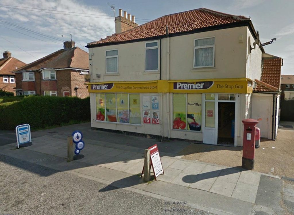
Premier Shop Gale Lane

A planning application, which would have seen the residential accommodation above the Premier shop on Gale Lane converted into 5 letting rooms, has been withdrawn.

The proposal was criticised by some residents who feared that 5 separate, unrelated, tenants would generate additional parking problems in the area. There are already issues with inadequate parking on St Stephens Road.

Other criticisms related to the lack of waste bin space and the absence of any cycle storage.

The owners may be permitted to use the first floor accommodation for single family use.

Latest planning applications for the Westfield Ward

 Below are the latest planning applications received by the York Council for the Westfield ward. 

Full details can be found by clicking the application reference 

—-

Westfield Farm Askham Lane York YO24 3HU

Crown reduce Beech by 5m protected by Tree Preservation Order No. CYC138 

Ref. No: 19/01719/TPO 

——-

24 Tennent Road York YO24 3HF

Single storey rear extension 

Ref. No: 19/01653/FUL 

——-

116 Wetherby Road Acomb York YO26 5BY

Erection of single storey extension extending 4.0 metres beyond the rear wall of the original house, with a height to the eaves of 2.6 metres and a total height of 3.6 metres. 

Ref. No: 19/01593/LHE 

——

Representations can be made in favour of, or in objection to, any application via the Planning on line web site.  http://planningaccess.york.gov.uk/online-applications/

NB. The Council now no longer routinely consults neighbours by letter when an application is received

Developers try to overturn Moor Lane planning ruling

……..as Spark finally submit proposals for cladding their shipping container village

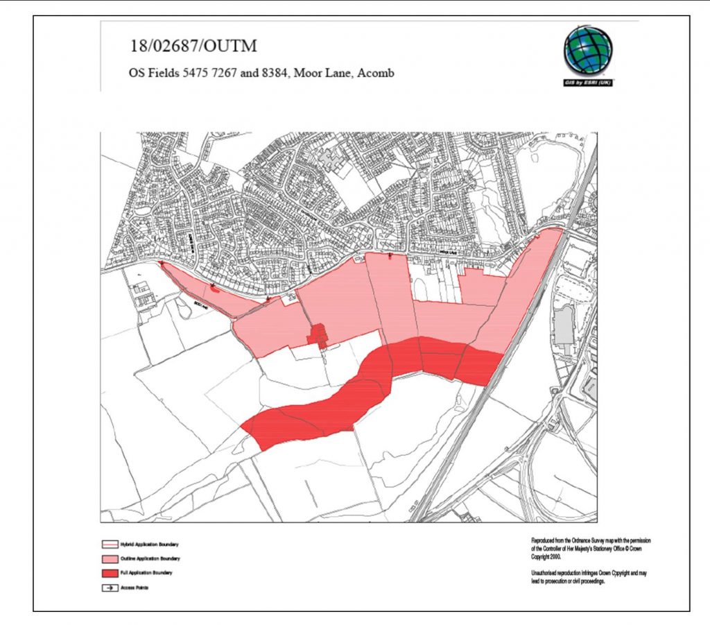
City of York Council has received notification from the Planning Inspectorate that the applicant for the Moor Lane planning application (18/02687/OUTM) has appealed the Council’s decision to refuse the outline permission for up to 516 residential units.

The Planning Inspectorate has notified the Council that the Inquiry will start on 12th November 2019 and it is anticipated that the Inquiry will sit for 12 days.

The Council will send notification of the appeal to any person who was notified or consulted about the application and any other interested persons who made representations.

If however the representation was part of a petition, each individual on the petition will not be notified by the Council.

Spark

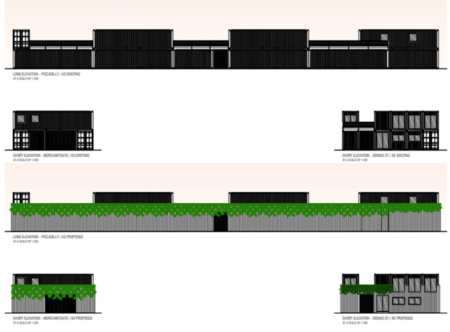
Separately the Spark container village people have finally submitted details of their plans to provide cladding on the development frontage.

cladding plans

They say,  “We propose to attach to this frame a secondary timber structural frame which will be over clad with treated softwood or Siberian Larch battens of 50mm width running vertically with a 50mm gap forming a continuous wrap and palisade along the external boundary. The timber cladding will be overplanted with Clematis growing from planters situated at first floor level”.

The development reaches the end of its 3 year lease next June. We doubt very much whether even fast growing clematis will make much difference to its appearance during the intervening months.

NB. The Council has so far failed to say how much “profit share” they enjoyed from the Spark lease last year.

Latest planning application for the Westfield Ward

 Below are the latest planning applications received by the York Council for the Westfield ward. 

Full details can be found by clicking the application reference 

—-

63 Green Lane Acomb York YO24 3DJ

Proposal              Condition 3 of 17/00884/FUL (bricks, render, stone)

Reference           AOD/19/00252

——

Representations can be made in favour of, or in objection to, any application via the Planning on line web site.  http://planningaccess.york.gov.uk/online-applications/

NB. The Council now no longer routinely consults neighbours by letter when an application is received

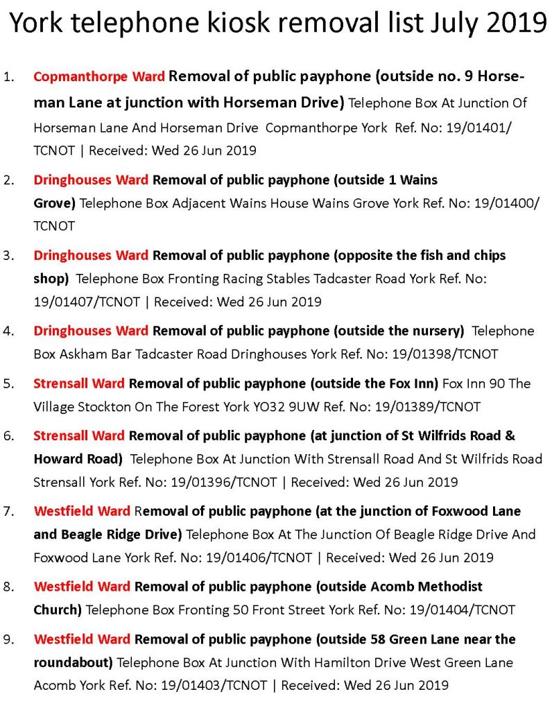
Nine payphone kiosks to be removed

List of payphones in York which may be removed

BT has applied to remove 9 payphone kiosk from streets in York.

The Copmanthorpe, Strensal, Dringhouses and Westfield areas are affected

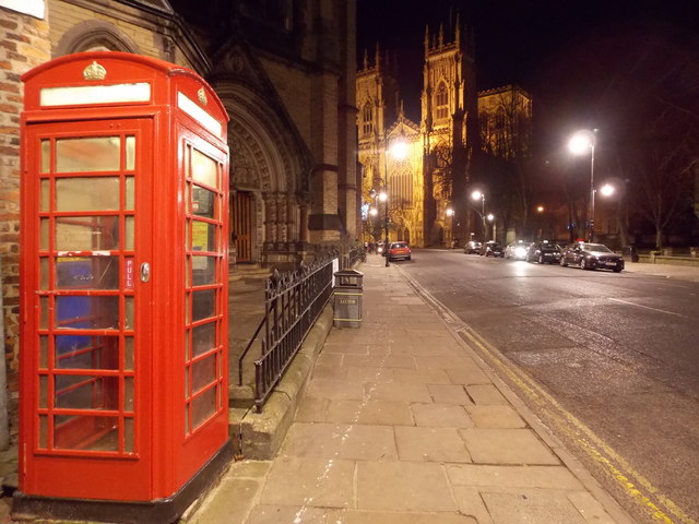
None of the iconic “red” K6 kiosks are on the list although there has been criticism recently about the state of repair of some of them. Several of these are “Listed” buildings.

Iconic K6 kiosks are not affected by the current removal plans. Several are in need of refurbishment

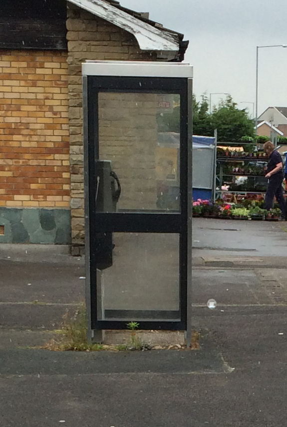
Some of the kiosk listed have been a magnet for drug users, vandalism and anti social behaviour. Their removal is likely to be supported by neighbouring residents.

The use of public payphones has dropped to near zero over the years as mobile phone ownership has increased

Latest planning applications for the Westfield Ward

 Below are the latest planning applications received by the York Council for the Westfield ward. 

Full details can be found by clicking the application reference 

—-

Telephone Box Fronting 50 Front Street York

Removal of public payphone (outside Acomb Methodist Church) 

Ref. No: 19/01404/TCNOT

Telephone Box At The Junction Of Beagle Ridge Drive and Foxwood Lane York

Removal of public payphone (at the junction of Foxwood Lane and Beagle Ridge Drive) 

Beagle Ridge Drive kiosk. Has been a source of complaint about vandalism and anti social behaviour for some time

Ref. No: 19/01406/TCNOT 

NB. Local residents asked for this kiosk to be removed a few months ago. At that time BT declined to act but they now seem to have had a change of heart.

—-

Telephone Box At Junction With Hamilton Drive West Green Lane Acomb York

Removal of public payphone (outside 58 Green Lane near the roundabout) 

Ref. No: 19/01403/TCNOT 

——

Representations can be made in favour of, or in objection to, any application via the Planning on line web site.  http://planningaccess.york.gov.uk/online-applications/

NB. The Council now no longer routinely consults neighbours by letter when an application is received

Bootham Park Masterplan published

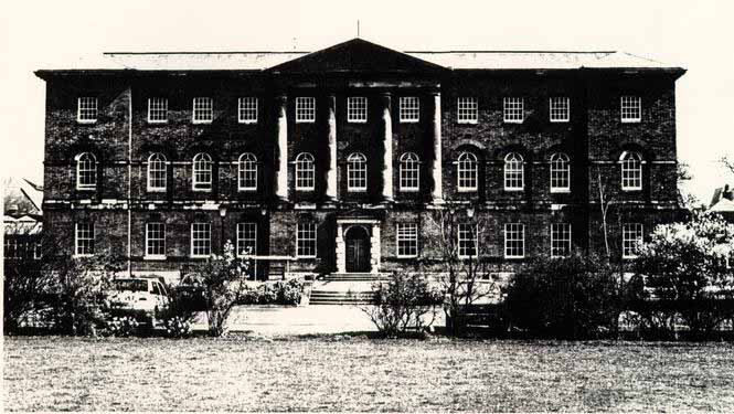
City of York Council has today published a draft masterplan for the Bootham Park Hospital site, following the public consultation which took place last year.

Bootham Park

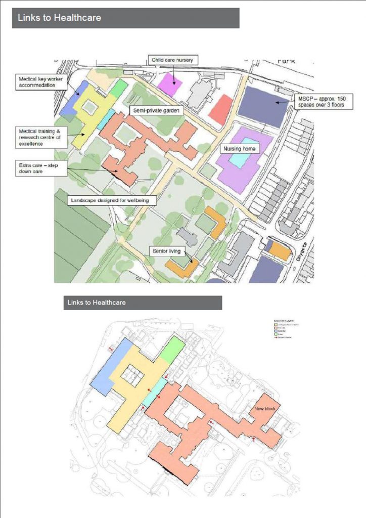
The masterplan, developed jointly between the York Council and the York teaching Hospital NHS Trust, proposes “a viable option for the development of the site, one that meets the needs of York residents by providing care accommodation, public open space, key worker housing and more”.

The key features of the plan include.

  • A Nursing home included on YTHT land (part of former nurse’s accommodation site).
  • Residential development aimed at the senior living market to the
    east of the chapel.
  • Child care nursery located on northern edge of YTHT land –
    directly accessible to the York Hospital site
  • The main former hospital building to be converted to extra care
    apartments (potentially incorporating step down care linked to
    York Hospital). Unlisted elements to be removed and a new block
    built to the north east in order to provide a viable number of units.
  • Unlisted and some grade 2 listed elements to the west
    removed in order to accommodate a Medical Training and
    Research Centre of Excellence with associated Key Worker
    Accommodation (medical staff).
  • A linear ‘’atrium’’ provides a main access and control point but
    also visually separates the form of old and new elements.
  • Landscaped area to the north redesigned to provide a semi
    private garden and courtyard space in the centre of the listed
    building group reinstated as landscape open space.
  • Unlisted cottages off driveway entrance from Bootham removed and replaced with apartments.
  • Existing listed gatehouse reinstated as residential accommodation.
  • Potential café/pavilion proposed adjacent to reopened pedestrian access off Bootham.

The plan involves building on the Union Terrace car park. The coach park would be retained with a multi storey car park, constructed above it,containing 250 spaces. It is claimed that this change will improve access to the hospital site from the south and provide a better “gateway” appearance for a key route into the City centre.

The Council says, “York residents will now be invited to contribute further to the development of the masterplan, by giving their views on the proposals so far.

The Bootham Park Masterplan Consultation will launch in September 2019″.

NB. NHS Property Services have recently engaged in a failed commercial sale and continue to re-market the site.

A copy of the draft masterplan can be downloaded by clicking this link