Parking restrictions on Poppleton Road

click to enlarge
Additional parking restrictions are to be introduced on Poppleton Road. The decision to advertise the proposals was taken at another behind closed doors decision making session at the end of July.
Residents will have only a few weeks to register their objections.
It seems unlikely that many will even know about the proposals given that the Council has also abandoned its regular communication newsletters with residents.
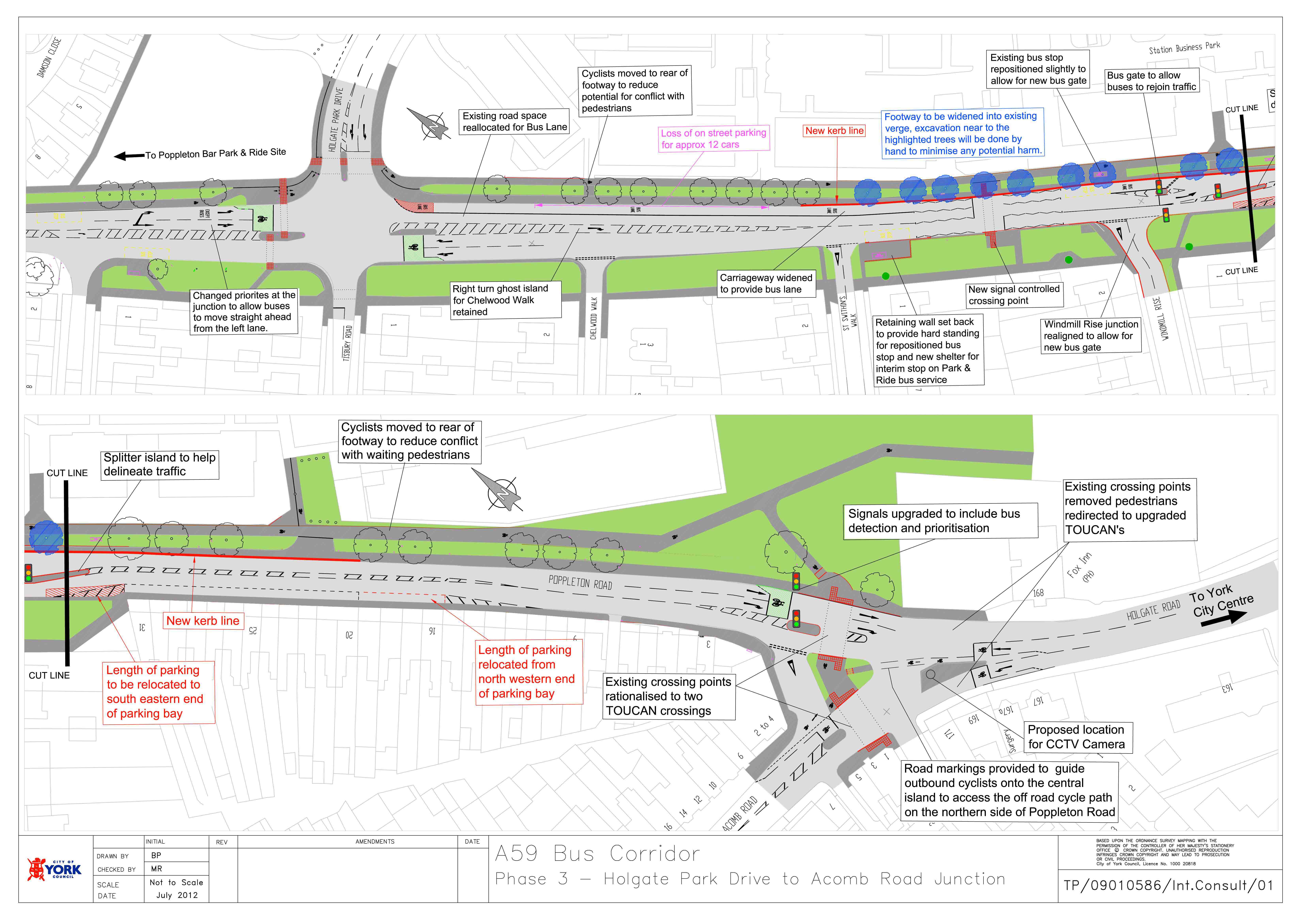
We are reproducing the plans here (see right).
In essence the introduction of bus priority measures – linked to the opening of a new Park and Ride facility at Poppleton – is prompting changes to the layout of the Poppleton Road carriageway between Holgate Park Drive and the Fox.
This plan does affect on street parking.
Details of the reports presented to the meeting can be found here. http://tinyurl.com/Poppleton-Road-bus-lane
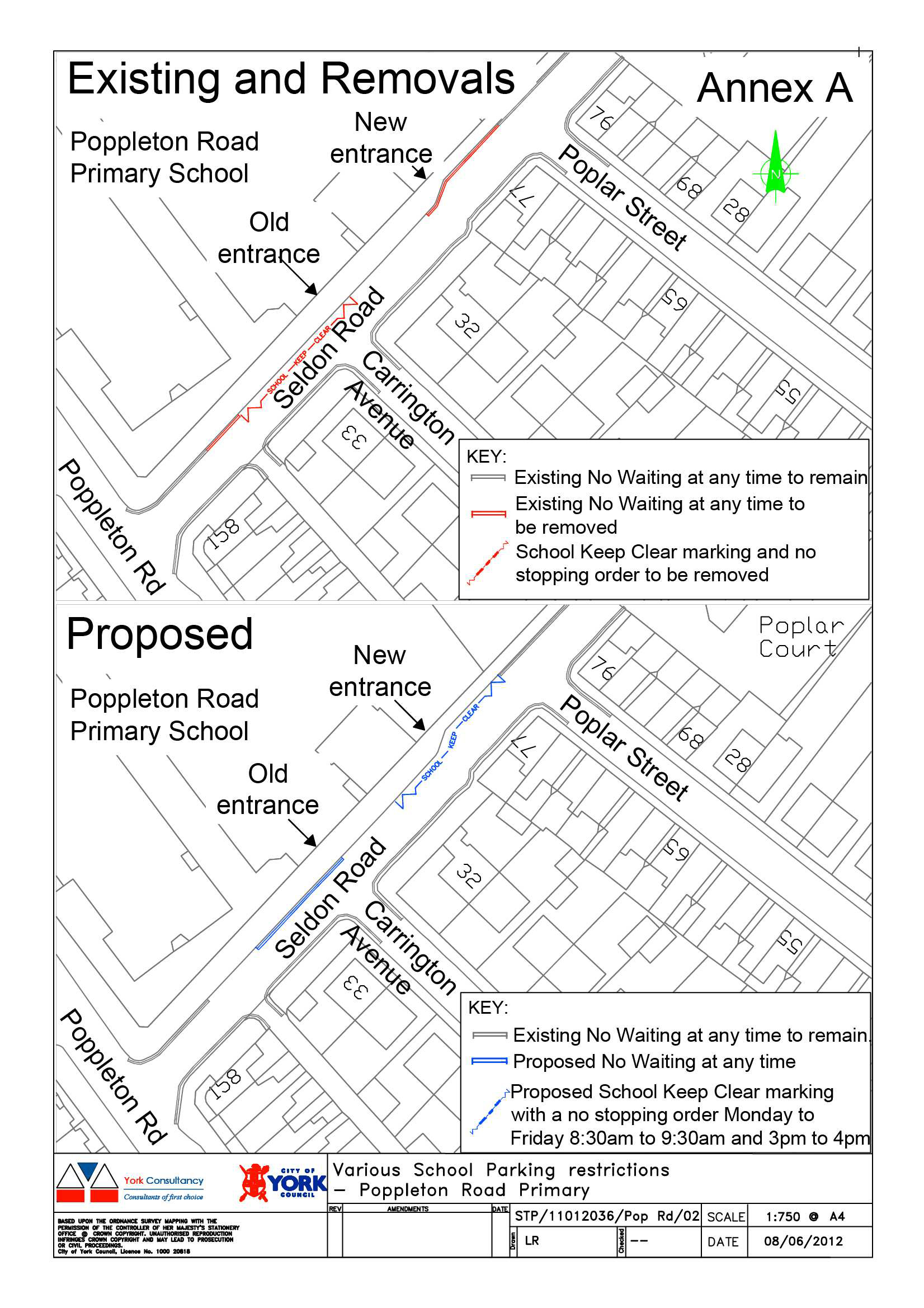
Poppleton School
click to enlarge
Poppleton Road Primary School has recently started using a different pupil entrance on Seldon Road. The school “keep clear” road markings with a mandatory “no stopping” order associated with the former entrance is still in place, whilst parking is currently permitted near the new entrance where there is now a natural desire line for pedestrians to cross.
The main proposal is to remove the existing school keep clear marking and install another one centred on the new pupil entrance as shown in the diagram (right) As now, a mandatory no stopping order (Monday to Friday 8.30am to 9.30am and 3pm to 4pm) would accompany the road marking.
Due to the position of existing double yellow lines, the relocation of the school keep clear marking would reduce the space available for on-street parking in an area of high demand. Therefore, the proposals also include the removal of a short length of no waiting at any time to retain the same number of parking spaces. However parking would still be prohibited opposite Carrington Avenue to enable larger vehicles to turn in and out.
Only one of the areas 3 Labour Councillors responded to a consultation letter on the plans. As far as we can find out, they did not take the time to consult local residents who could be affected by the plans.
Details of the reports presented to the meeting can be found here: http://tinyurl.com/cbvwe23