Green belt to be smashed by Labour plans – biggest threat to York since William Wallace crossed the Scottish border?

click to enlarge

click to enlarge

Details are beginning to emerge of Labours attack on the (draft) York Green belt boundaries.

The full reports can be read by clicking here

We forecast this possibility last week but never guessed at the the scale of the attack

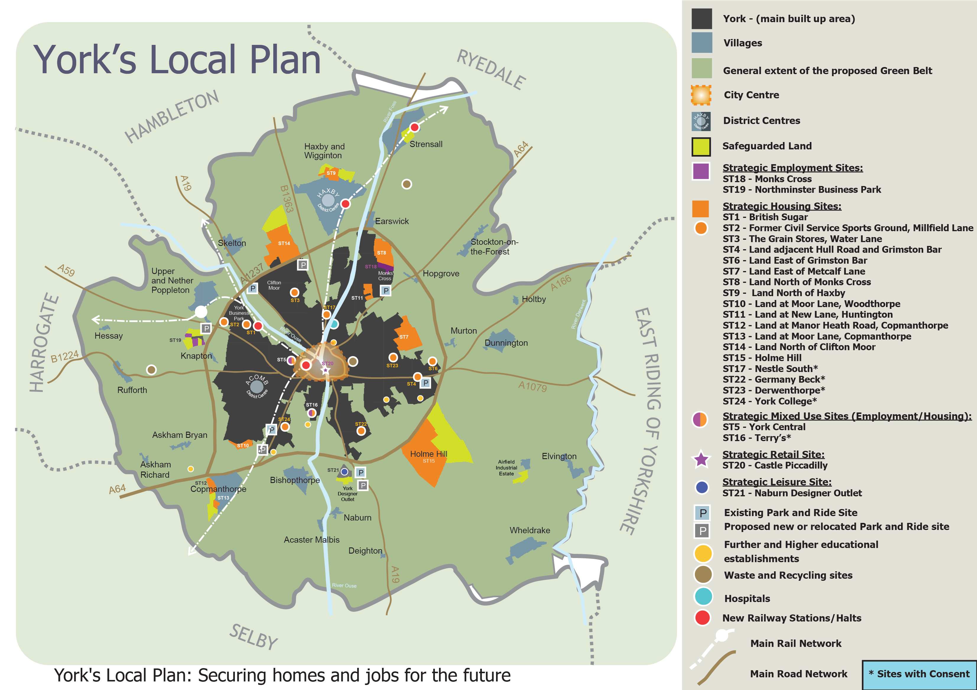
Apparently they plan to build on 640 hectares of land; much of this will be at green field sites.

Green Belt launch

They have quoted a (laughable) figure of 1090 new homes built each year with a total new build of 22,000.

That is twice the size of Huntington and Haxby combined or 20 times the size of Copmanthorpe!

Annual house building rates in York are currently below 300 a year.

This isn’t because of a limited supply of building land.

Thousands of potential homes could be built at previously developed sites like British Sugar, York Central, Nestle South and Terry’s not to mention other sites with planning permission such as Germany Beck and Derwenthorpe.

Low building completions have more to do with mortgage availability and onerous planning conditions.

The release of huge amounts of green belt land for building is likely to depress land values but it will also depress the value of existing homes leaving many ordinary people with “negative equity” problems.

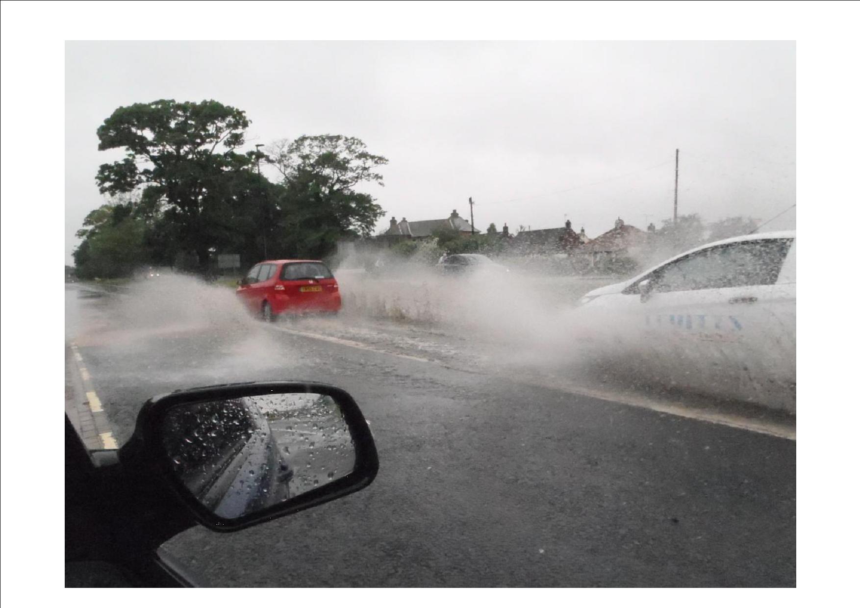
And the effect on public services would be devastating. The City’s roads are already crumbling. Congestion is a major issue on many transport links near Labours “new villages”. Flooding and poor drainage cause chaos in the City. Many schools have limited spare space. The health service is under pressure.

Nor would it do much to help the affordable housing problem. The Council would be fortunate to get a 25% “affordable” contribution from these (privately owned) new sites .

There are over 4500 people on the housing waiting list although most are living in overcrowded accommodation (so they would free up a property for a smaller family when they move on).

A huge indiscriminate increase in the availability of empty houses would simply mean the City would – towards the end of the 15 year plan period – have to accommodate more inward migration.

It could become a dormitory town for Leeds.

But perhaps that is part of Labours real plan.

Over the next few days we will publish an analysis of the Labours building proposals and impact that they could have on our City and on local communities.

Flooding in York – investigation reveals who was to blame?

Extensive surface water flooding took place in Badger Hill and the Leeman Road area last year.

Now a official report into both incidents cast new light on the causes of the problems.

Hull Road

Hull Road

In the Badger Hill area, “flooding occurred due to an intense rain storm on 10 June 2012, affecting Hull Road and the Badger Hill Estate.

Hull Road was closed to traffic for 5 hours, 19 properties flooded internally, and about 40 suffered flooding to gardens and external areas”.

Yorkshire Water was found not to have maintained some of its systems.

Flooding in the Leeman Road area occurred in September and November 2012.

“Salisbury Road and Salisbury Terrace, a major route into the City, had to be closed to traffic as the risk of flood water inundating properties was further aggravated by waves from vehicles.

Temporary pumping eventually reduced the level throughout the area and internal flooding of properties was avoided by sandbagging.

The area is defended against overland flow from the river by an earth embankment maintained by the EA.

The sewerage system is equipped with penstocks, which isolate the river from it, and a pumping station which pumps flows from the defended area to the downstream sewer outside it.

This is the responsibility of Yorkshire Water”.

NB. At the time the Council Leader blamed the Environment Agency for the problems.

The official investigation report reveals that

“some of the penstocks were not fully closed or leaking and in one case open. It was also found that one of the pumps was not correctly seated on its base and was therefore ineffective.

As a result of the investigation Yorkshire Water has reviewed its maintenance and operational procedures to ensure future resilience during flood events.

It is also liaising with the EA to ensure that the improved defences, which will be constructed this year, will not be compromised by shortcomings in the sewerage system”.

Click the following links to read the full reports:

Badger Hill

Leeman Road

Minster yard “potting shed” moves up social ladder

Developers are hoping to persuade planners to allow them to covert a former “potting shed” into a home.

The shed and a basement cellar affected are located within the walls of the former Purey Cust buildings next to the Minster.

fpm_and_weed

The planning application says,

“Listed building consent is sought for a 2-bed dwelling, which would re-use the redundant basement on the eastern side of the site and the ‘potting shed’ which sits against the SE boundary wall and next to the Mason’s Lodge.

The original cellar dates from around 1616 and was extended to include a generator enclosure which was installed in the early 20th century to serve the hospital.
It is proposed that two bedrooms would be accommodated in the cellar and an extension would be added directly above to provide living space.

The new structure would be connected to the potting shed by a lightweight link (glass with timber framing) on the north side and there would be a zinc roof, which would be visually separated from the potting shed by the use of clerestory windows”.

As thousands of middle aged men already regard their potting sheds as home, the planning application probably has a good chance of success.

Racecourse modernisation plans set to get “go ahead” from planners

A meeting taking place next Thursday is being recommended to approve plans to modernise part of the York Racecourse

The plans involve the demolition of an existing perimeter wall, saddling boxes and Broadcasting Box, construction of a new pre-parade ring and a Winning Connections building.

A new perimeter wall, saddling stalls, washdown area and associated ancillary equine facilities, including veterinary accommodation, will be erected together with the provision of a replacement path and associated landscaping

Location of Knavesmire proposed changes

Location of Knavesmire proposed changes

It is phase one of a major modernisation project which will later see spectator facilities improved.

Racing has taken place on the Knavesmire since 1731 when there were no permanent structures on the site. York is considered to have pioneered a new building type for celebrating the racing experience – the Grand Stand by John Carr in 1756. The course has developed over almost 300 years to become a major cultural and leisure venue which makes a significant contribution to the vitality and economy of the city. York Racecourse is of local and national importance, and it attracts owners, horses and riders of international fame and has a global audience.

Details of the planning application can be found by clicking here</strong>