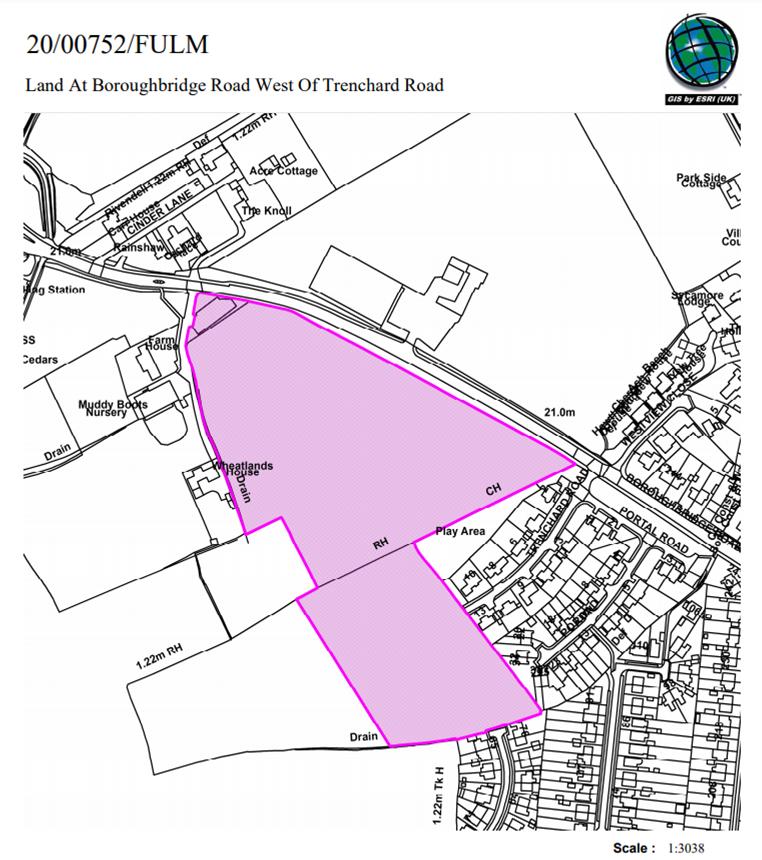
1.1 The site occupies part of an agricultural field on the south side of Boroughbridge Road (A59), positioned at the edge of the suburban area on the west side of the city.

There is housing to the east; Trenchard Road being closest, and Muddy Boots nursery to the west of the site.
Beyond the site, there is further agricultural land to the west and then a petrol station and commercial unit positioned at the junction where the A59 meets the outer ring road.
To the south is agricultural land between the suburban edge and the outer ring road.
Opposite the site on the north side of the A59 is the former Civil Service site, which has planning permission for housing development (266 dwellings approved under application 14/02979/FULM).
The site is within the general extent of the Green Belt.
The development plan for the area is the Upper and Nether Poppleton Neighbourhood Plan. Within the plan the site is designated as being within the Green Belt.
The site is also within land identified as Green Belt in un-adopted local plans – the 2005 Draft Local Plan and the 2018 Publication Draft Local Plan (DLP).
The application proposes 60 dwellings, with a single access point for vehicles from the A59 and associated public open space in the centre of the site and opposite the A59. The vehicle access would be opposite the approved access for the housing site at former civil service site.
The application (click) is recommended for refusal at a meeting which is taking place on 3rd December.
NB. The same meeting will have a second go at determining a planning application for the Castle Mills Car park site. This is a proposal from the Council itself and was deferred to allow further input from the professional advisers. It would see 106 apartments built and is recommended for approval.
