It looks like the proposal to change traffic signal priorities at the Gillygate/Bootham/St Leonard’s Place junction will be abandoned.
Some York Councillors had apparently favoured introducing additional delays on traffic flows through the junction as part of a signal renewal programme.
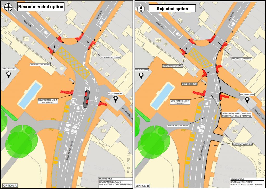
The revised arrangement – although improving pedestrian facilities – could have resulted in a 40% increase in travel times with some journeys being diverted onto already busy alternative routes.
There would also have been a consequential increase in air pollution levels on streets like Gillygate because of standing traffic. Bus journey times would have increased.
A public consultation exercise was undertaken to test residents’ reactions to the plan. Despite some leading questions being included in the on-line survey, most respondents (58%) have come out against major changes.
Although the junction is far from ideal for all road users, it currently reflects the compromises that come if you wish to conserve the historic features of a City like York.
The responses to the consultation do reveal a growing chasm between the views of people who live within walking distance of the City centre and those who use personal transport to travel to the facilities that are located there.
There is a lack of empathy between the two groups which suggests that finding a consensus on a new transport plan for the City (click) may prove to be illusive.
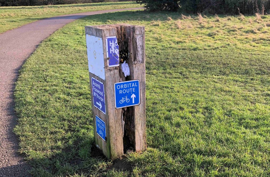
Options consulted on for Bootham Gillygate junction winter 2020/21
Part of the Union Terrace car park would be converted into an electric vehicle recharging site under Council plans.
Three 50kW Rapid chargers and three 150kW Ultra-Rapid chargers would be installed on a central charging island. Four double headed 7kW Fast charge points would also be installed across 8 parking bays in the main car park, adjacent to the HyperHub.
The proposal, which involve the loss of about 20 ordinary parking spaces, is being discussed next week. It replaces a plan to establish the facility on Bootham Court. This site was subsequently abandoned.
The project is expected to cost £900,000
York’s EV charging strategy includes the deployment of Ultra-rapid charging hubs, known as HyperHubs, at strategic locations around the city. £1.35million funding was awarded by North Yorkshire LEP in June 2020 to develop York’s public charging network, of which £550k was allocated for the construction of a 3rd HyperHub located near the city centre.
There are no immediate plans to introduce “on street” charging facilities in terraced areas. These facilities have been provided in several City’s making use of the power supply to streetlights or bollards.
Two other HyperHubs are planned, located next to Monks Cross and Poppleton Bar Park & ride sites. An update can be viewed by clicking here
Electric vehicle charging policies received a panning by Which magazine recently
They said that
Accessing public chargers was unnecessarily complicated and that universal access was needed
Disparate rapid charging plugs were confusing
Charging by time was also confusing
As was the many variable charging speeds
Brand specific networks were considered to be unnecessarily
They called on the government to introduce a standardised approach.
The York Council could usefully add its voice to the calls for more regulation.
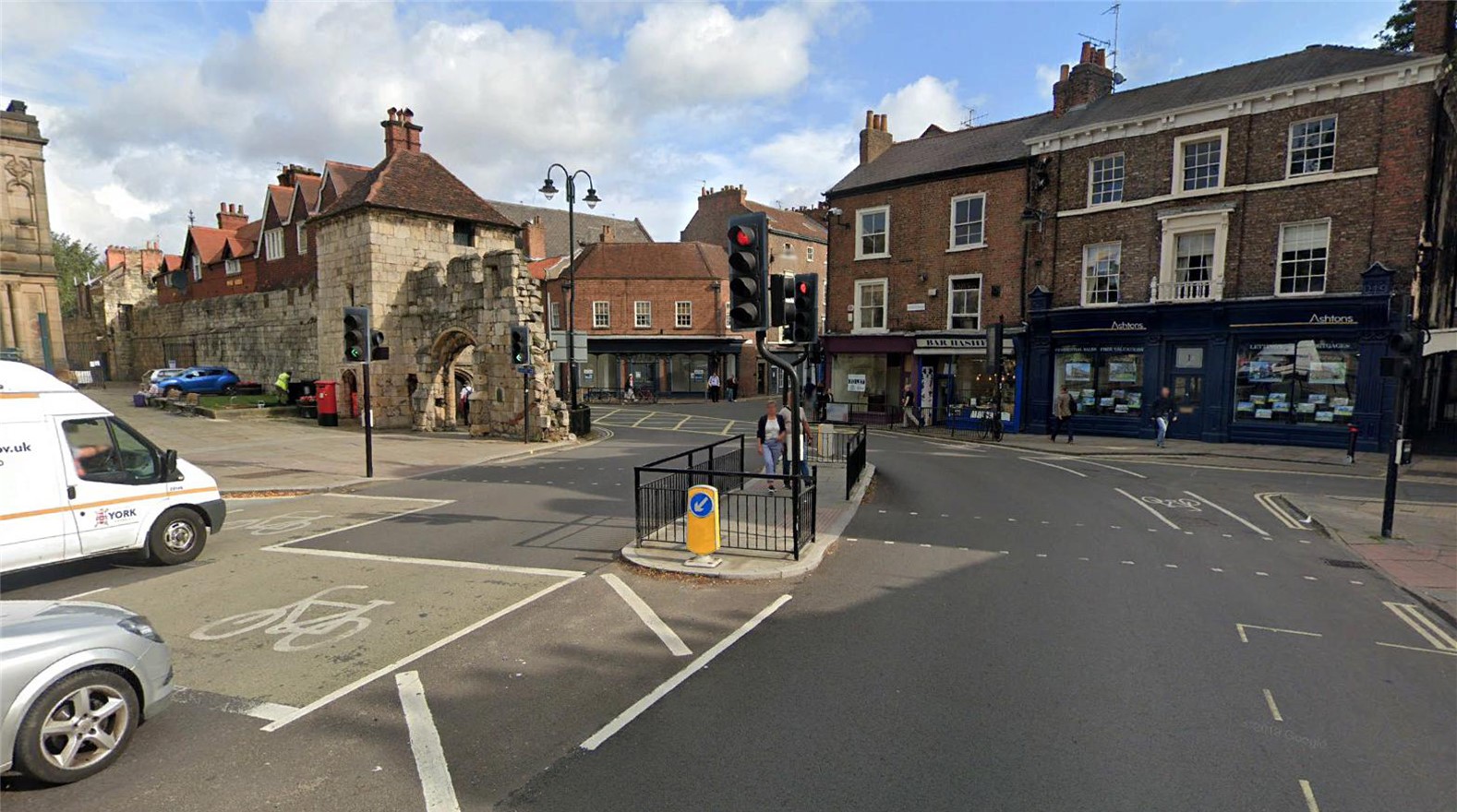
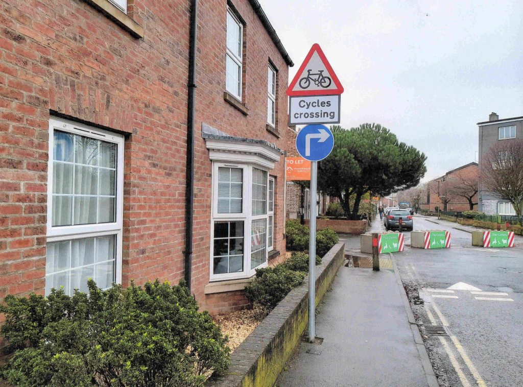
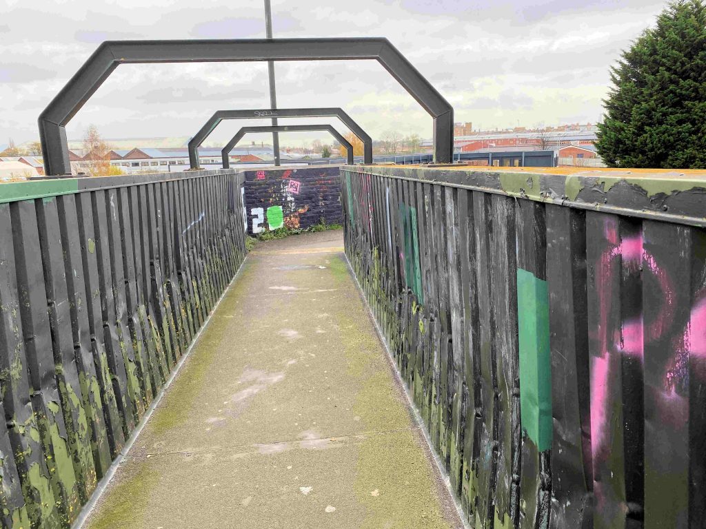
City of York Council wants to hear what residents and businesses think of a new scheme improve pedestrian access at one of the busiest junctions in the city centre.
Works will take place later this year on the Gillygate, Bootham and St Leonard’s junction, which is all part of the Traffic Signal Asset Renewal (TSAR) Project.
The TSAR project involves installing new signalling equipment and ducting, but also provides an opportunity to consider different options that could enhance the whole area for pedestrians and cyclists.
Two possible designs have been prepared, both would replace all the signals and increase the width of space for pedestrians waiting to cross Gillygate.
Option ‘A’ is the simplest design with little change to the existing layout while option ‘B’ would provide more pedestrian space and improve the historic setting of the area.
It would also allow for an ‘all green’ pedestrian phase across all arms of the junction, with no need to wait half way across when crossing from the Art Gallery to Bootham Bar and a less traffic dominated area.
However, the removal of the left turn lane from St Leonard’s Place to Bootham, and the changed signal phasing, would increase traffic delays and queues at peak times, with potential impact on air quality in Gillygate and Bootham.
Tell us what you think
Views are being sought on which design residents and businesses prefer and why, between Monday 1 March until Wednesday 31 March, and can be submitted, by:
Writing to: TSAR Programme, Transport Systems, Corporate Directorate of Economy and Place, West Offices, York, YO1 6GA.
In addition to the above, over 650 properties in the immediate vicinity of the junction will be sent details of the consultation and offered assistance if they cannot view the design options online.
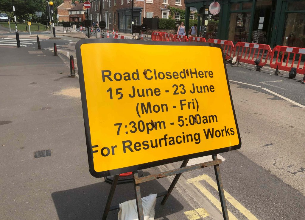
It looks like the government’s announcement in November of a £600,000 grant for cycling and walking in York has strings attached. A “matching” amount is required from local taxpayers.
The York Council had bid for a share of what was termed an “Emergency Active Travel Fund”.
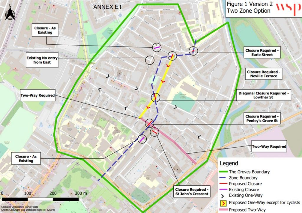
Controversial road closure
It was originally designed to promote social distancing and reduce pressure on public transport. Early examples if the kind of scheme supported by the York Council included the controversial Bishopthorpe Road one way system (since abandoned) and The Groves Low Traffic Neighbourhood scheme. Several foot streets were also extended.
Now the government (rightly) says greater weight should be given to consultation, with Local Authorities required to publish a consultation plan for their programmes by 11th December 2020. Details of York’s Active Travel Fund Tranche 2 application and the Consultation Plan are available as downloads at:https://www.york.gov.uk/lets-york/active-travel-bid/1
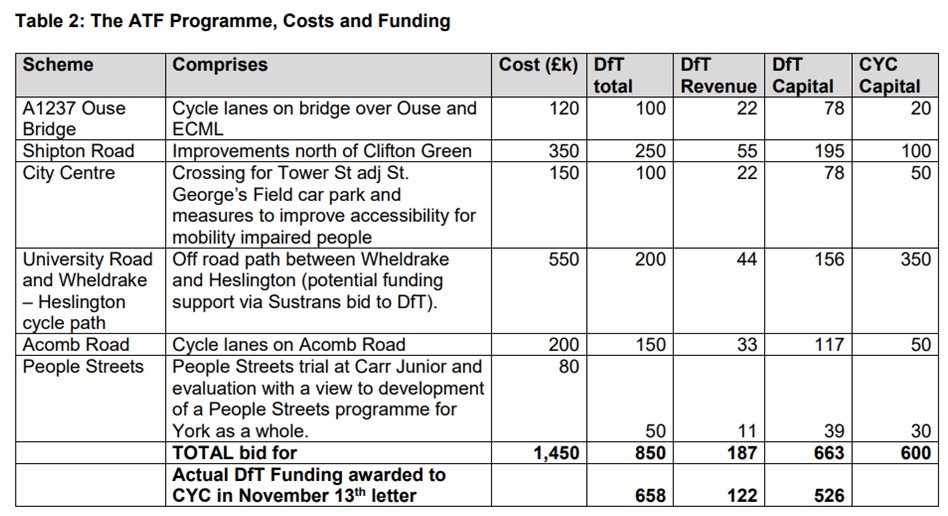
The costs of the individual schemes have now been revealed.
The most expensive is the proposal to construct a cycle path from Wheldrake village to Heslington.
This comes in at an eye watering £550,000.
There has still not been any attempt made to estimate the likely use of such a path although the Councils origin and destination surveys make a cost/benefit analysis relatively easy to produce.
Existing infrastructure is neglected
Ironically, this project does not even appear in the list of cycling schemes that the Council has built up over the years. This is reproduced in a report being considered later this week. (click).
At least that list attempts to assess what impact the investment would have on transport choices. The top-rated improvement locations are
St Leonards Place / Museum Street / Lendal Bridge / Station Road
Micklegate / Bridge Street / Nessgate / Coppergate / Pavement / Stonebow / Peasholme Green
Improvements to Station Road / Station Avenue gyratory
Route through former British Sugar site
Castle Gateway Foss Bridge
York Central – link from Chancery Rise
Bar Lane / Toft Green / Tanner Row
Footpaths have been blocked
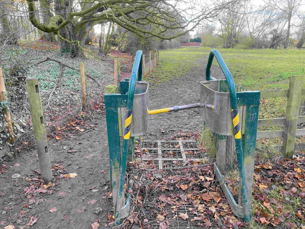
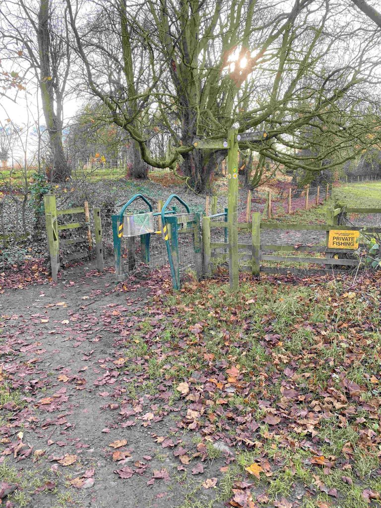
The Council is being urged to develop a new “walking and cycling strategy”. Certainly, those who walk will feel somewhat neglected by current York Council policies. Even more so when they see the lack of progress being made on determining 19 outstanding Public Right of Wayapplications. Some have been outstanding for over 20 years.
The main issue remains a lack of investment in maintaining the existing transport network.
The endless pressure to borrow more money simply sucks resources from the Councils maintenance budget. The results are deteriorating cycle and footpath surfaces coupled with potholed highway margins.
This neglect poses an increasing hazard for pedestrians, cyclists, and other road users.
One of the consequences of the City moving into Tier 4 restrictions, as it is expected to do following an announcement tomorrow, may be that progress on some traffic schemes will be delayed.
This could affect The Groves traffic restrictionswhich were introduced using a temporary (experimental) traffic order last summer. The expectation was that a decision would be made early in 2021 about whether – and with which features – the scheme would be made permanent (or abandoned). However, further restrictions on movement, because of the pandemic, could mean that no stable traffic pattern will be established until well into 2021.
One of the criticisms of the scheme, which was rushed into operation following a meeting last June, was that the area had already become largely devoid of through traffic as a result of changes in the local economy.
Safety concerns remain.
The Council, in response to a Freedom of Information request in October, said, “Stage 1 and Stage 2 Road Safety Audits were not undertaken for this scheme due to its experimental nature. The project team discussed the design with road safety officers to get their input as the scheme was developed. Once the initial adjustments to the scheme are completed, a Stage 3 Road Safety Audit will be undertaken”.
The adjustments were made some months ago but there is still no sign of the promised safety audit.
As well as obvious concerns, such as unmarked contra flow cycle routes, there are other issues to be addressed.
Not least of these, is access for emergency vehicles. Moveable bollards are promised as an option if the scheme becomes permanent but any decision on that is fading into the distance.
The high level of demand for ambulance services, as the pandemic tightens its grip, means revised arrangements are needed sooner rather than later.
One concerned resident has now written to the Council detailing several safety failings on the existing scheme. Issues highlighted include a requirement for all traffic exiting Penley’s Grove Street to turn left and use the Monk Bridge roundabout to complete a U-turn. An unnecessarily dangerous manoeuvre for cyclists (who may well be tempted to ignore the restriction).
In total, the resident has identified over a dozen locations where the provided signs do not meet current national regulation standards or where ad hoc bits of street furniture represent potential hazards for users.
Hopefully, 2021 will bring a more measured approach to changes to the City’s transport systems.
After several attempts, responses to Freedom of Information (FOI)requests have confirmed that the Council had not established key base line data measurements before implementing The Groves traffic ban in the summer.
Although never formalised, those favouring the changes argued that rerouting “through traffic” onto neighbouring roads would;
improve air quality
reduce traffic levels and thereby accident numbers
make the area “quieter”
encourage cycling/walking
utilise time limited central government funding grants
At the time of the decision to press ahead with the scheme (June 2020), the area had been virtually traffic free for 3 months because of the lockdown restrictions.
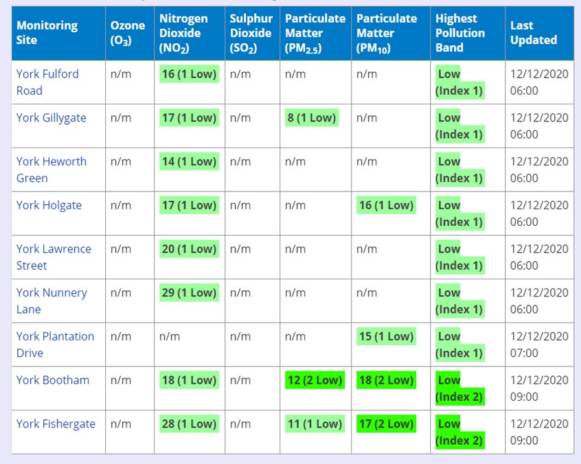
One of the consequences of lower economic activity has been greatly reduced pollution levels during 2020. The table below shows the current situation.
click to access latest figures
No noise measurements have been published, for streets within The Groves area, by the Council.
Aresponseto an FOI request a few months ago revealed that accident levels have been very low within The Groves area during the last 3 years.
The Council has admitted that it doesn’t have any base line air quality measurements for the streets within The Groves area. Nor, apparently, is it monitoring current pollutions levels there (although, like the rest of the City, these are likely to be very low – see above).
The Council is also being very coy about what traffic volume information it holds. Traffic flow information for 2019 – when the plans were first discussed – should, in our view, have been published.
Similar benchmark information for June 2020 (post pandemic) should also have been published to inform decisions at that time.
Such figures as have been made public concentrate on the capacity of the nearby diversionary routes.
The Council is refusing to release information about movements within the Groves area raising, at least, a suspicion that it hadn’t completed counts. It now says that it will release information in June 2021.
The most concerning aspect of this whole process has been the lack of any safety audits. The Council has promised that a stage 3 audit will be completed. But it doesn’t say when.
In the meantime the hazards – particularly for cyclists – remain and will grow as movements return to more normal patterns.
Unsegregated contraflow cycle routes represent a safety risk
We could use the FOI appeal processes to try to force the Council to publish the details it holds on internal modal travel patterns for the periods before the traffic ban was introduced.
It would have no practical effect unless backbench Councillors were prepared to challenge the system. This they don’t seem to be prepared to do.
We must just hope that some of the more perverse aspects of the scheme don’t lead to more avoidable accidents during the run up to next years review.
More minor highways improvement schemes have been approved under the York Councils delegated ward budgets.
They are located in the Dringhouses, Fulford and Osbaldwick wards. A list can be viewed by clicking here
The process and method of prioritisation of the use of the £1 million available budget is obscure. No comprehensive list of the improvements approved and implemented in each part of the City has been published on the Councils web site. Requests for improvements to footpaths and roads in the Westfield area have produced little response.
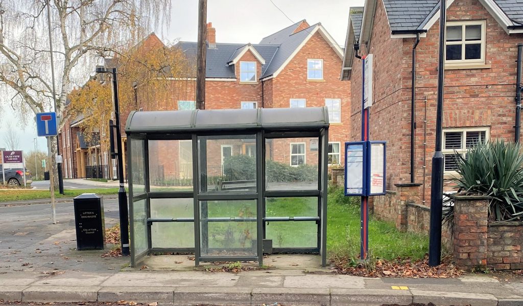
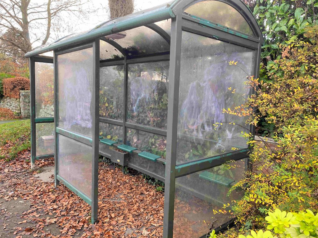
Bus shelters need upgrading
Even in Fulford, where funds are being allocated, some may wonder whether an investment in replacing opaque panels in local bus shelters might have deserved some consideration? Instead two prominent shelters look shabby or are overgrown by vegetation.
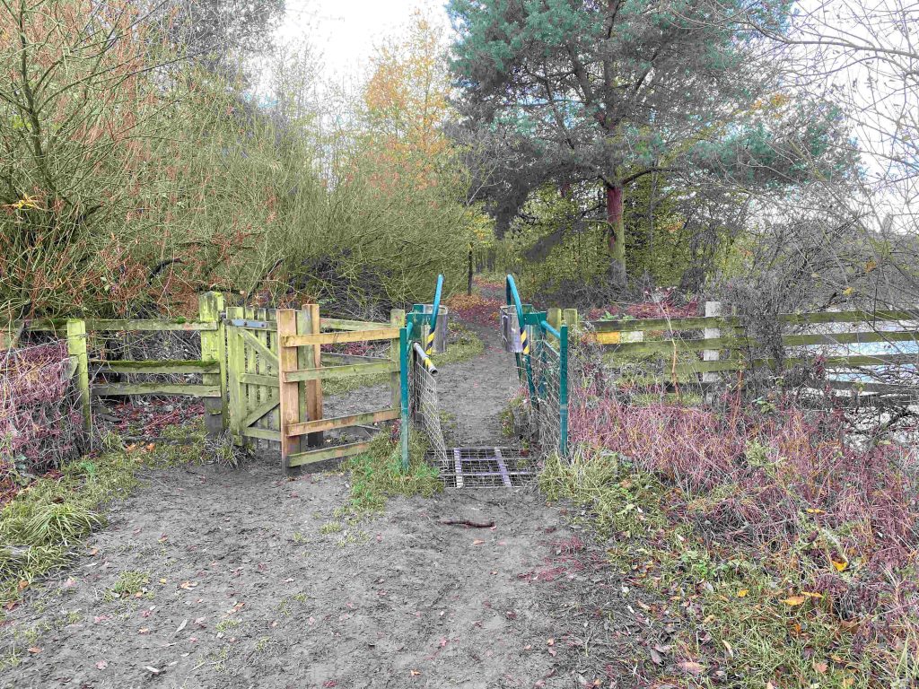
It is a similar picture on the west of the City.
Footpaths in the area near Fulford Ings are muddy in places making cycle access difficult. Some discrete use of chippings would improve the route from Millennium Way to the Designer Outlet, helping to promote benign forms of travel.
The delegation of funding decisions to local communities is a step in the right direction but currently allocation processes look to be a combination of patrimony and chance.
City of York Council has been allocated £658,350 to support more active travel across York and the many residents who are choosing to walk and cycle more throughout the city’s COVID recovery.
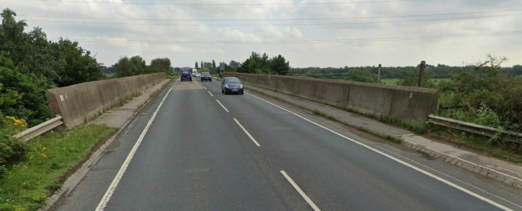
No new bridge for cyclists crossing the river Ouse on the A1237 (not enough money) but the Council says it can widen the existing cycle path (!)
The Government’s Active Travel Fund is designed to support walking and cycling as a long-term method for commuting. To receive any allocation from the fund, the council must carry out wide reaching engagement on a variety of proposed schemes to inform designs for people-centred transport infrastructure and more active travel opportunities for residents.
There is likely to be some scepticism about the Council choice of schemes (see below). It’s plan for a cycle path from Wheldrake (pop 2000) to the City centre for example doesn’t appear to have been based on any sort of cost benefit analysis.
Other villages such as Dunnington (pop 3300) are closer, so cycling is likely to be a much more attractive option for commuters living in that area.
The Council has computer modelling facilities available which would allow it to prioritise, what are very scarce, resources on initiatives which will give the maximum “bang per buck”. We’ve had too many impulsive decisions in the recent past ..and too many vanity projects. Decisions need to be made with clear base line figures, milestones, quantifiable targets and proper outturn appraisals.
No plans have been announced to improve the lamentable state of the existing cycle network. Parts of the York Selby cycle path – which is not too far away from Wheldrake – is currently unusable because of surface damage
Cycle lanes are planned for Acomb Road in Holgate
According to the Council, “the consultation, which will launch later this year, will provide residents the opportunity to shape future plans and ensure that they are designed to meet the needs of local communities. By using the consultation to develop high quality cycle routes, we can encourage more people to walk and cycle as part of their everyday travel in the city”.
This funding is the second phase of funding, following on from an initial £193,000 received in summer this year.
The Council claims that, “This second phase of funding will allow the city to build upon action taken so far this year through temporary changes to road layout and improving cycle safety, and enable the council to design and implement more permanent and wider reaching schemes to support residents with active travel opportunities across the city”.
The measures proposed to be consulted upon and delivered include:
Measures on Shipton Road (north of Clifton Green), linking with ongoing improvements to cycling infrastructure on Bootham;
Cycle lanes along Acomb Road;
Some city centre measures, for example a pedestrian/ cyclists crossing of Tower Street near St George’s Field;
Improvements to the cycle lane on the A1237 bridges over the Ouse and East Coast Main Line;
Cycle improvements between Wheldrake and Heslington.
Consultation will be carried out in the coming months and feedback collected from this will be reported at an Executive Member for Transport Decision Session in early 2021.
This work will be carried out in coordination with the implementation of the council’s Economic Recovery Strategy. The strategy focuses on prioritising active travel, working with bus and rail operators to ensure people can continue to use public transport with confidence and creating a more people-focussed city centre.
The council’s iTravel team will be supporting engagement across local communities and schools to better understand barriers to active travel and how this funding can improve this across the city.
Residents will wake up this morning to discover that the York central development has passed another milestone. It now has the necessary planning permissions to permit a start to be made on site.
A Public Inquiry will still be held to determine whether Leeman Road near the Railway Museum can be stopped up.
Overall the development should provide a welcome boost for jobs and homes in the City.
The Council has, however, failed to recognise the importance of “first impressions” and the practicalities of accessing the site by various modes of transport.
Accesses to the York Central site are unwelcoming
The proposed one way system through the Leeman Road tunnel is ridiculous. It means more congestion and a cycle ride which will be both awkward and – in wet weather – unnecessarily unpleasant.
The access from Wilton Rise is hopeless for all but the fittest cyclists and is totally inaccessible for the disabled. The promised new cycle bridge from Chancery Rise should have been incorporated in the latest planning application but no Councillor seems to have had the guts to highlight the issue.
So off to a bad start then.
Lets hope the developers come up with some solutions to these issues before the new properties are occupied.
The new lockdown arrangements will alter once again traffic flows in the City.
The changes will affect the monitoring of schemes like The Groves, where the Council have so far been unable to produce before and after figures for air pollution and congestion.
A review of the scheme was promised early in 2021.
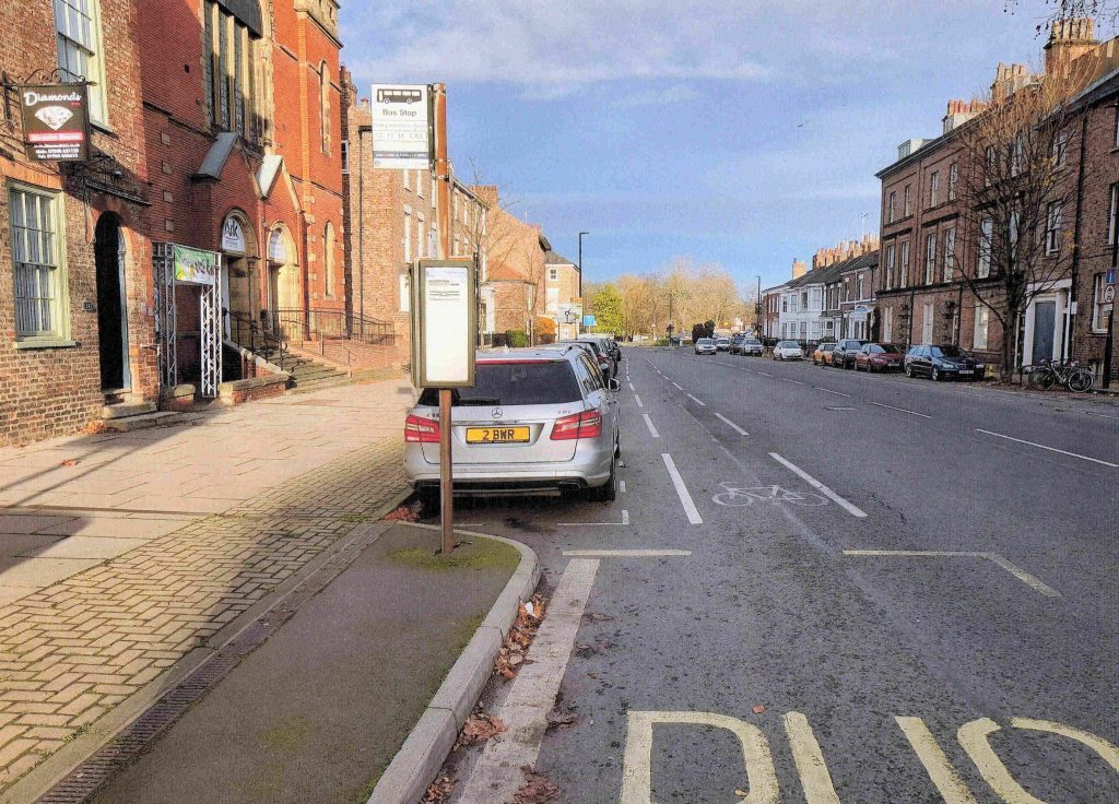
Very low traffic levels on Penley’s Grove Street during first lockdown
The effected streets were – like many in other parts of the City – virtually deserted during the first lockdown. Alternative routes have also been quiet since the beginning of the year.
Now the Council has formally changed the The Groves restrictions twice in the space of 7 days.
As no figures have been shared with residents it is impossible to judge whether the changes are justified.
However, the absence of any action on safety aspects of the scheme – including the controversial contra flow cycle routes – tells its own story.
Reopening the restricted access, at least for emergency vehicles, would also have been worth addressing as pressures on the NHS grow. .
Elsewhere, West Offices leaked a plan to the media yesterday which said that foot-street hours were being changed to 10:30am – 5:00pm during the lockdown.
There was no consultation on the proposal and no decision appears in the Councils official “on line” log. Sources say that it is aimed at making access to “takeaways” easier.
Maybe so.
But it is unclear why the revision simply didn’t reinstate the traditional footstreet hours (10:30am – 4:00pm). At least the signage for that restriction is already available!
York Central
It seems that the Council will determine the detailed planning application for the York Central site during the lockdown.
The proposal is likely to go to a public inquiry but when and how that could be arranged under the pandemic restrictions remains to be seen.
The applicants have failed to satisfy perfectly reasonable objections to transport access proposals for the site.
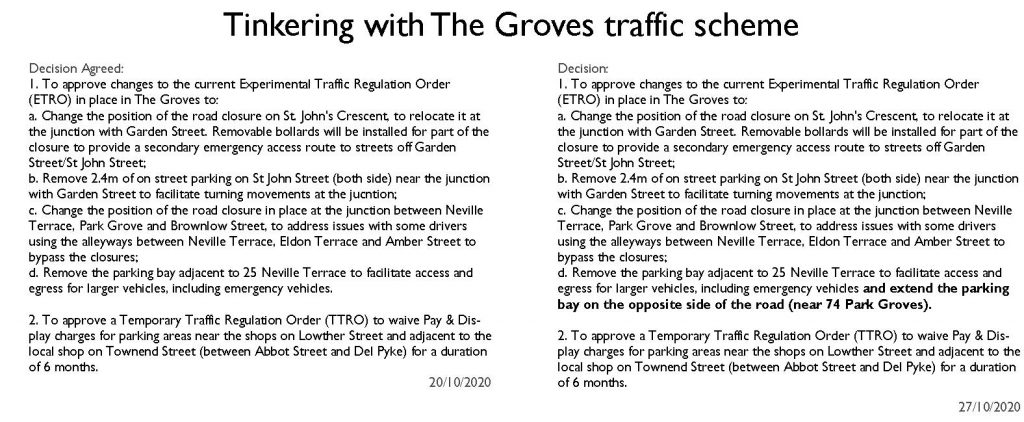
The Marble Arch pedestrian access
The Leeman Road tunnel (next to Marble Arch) would still be made one way with cyclists apparently expected to brave a deluge of liquid manure during wet weather.
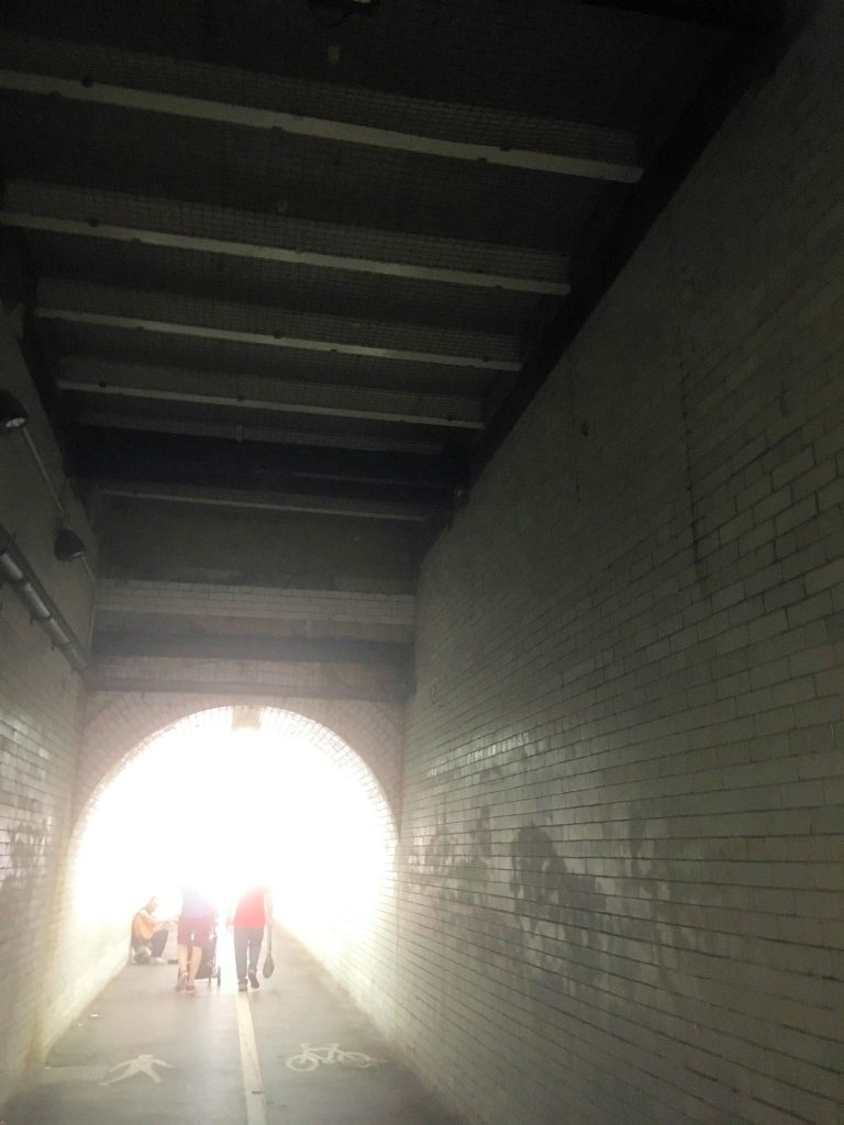
Wilton Rise existing footbridge
Problems with the poor access for cyclists in the Wilton Rise area have also not been addressed.
Local residents – quite legitimately – are objecting to losing pedestrian access down the current line of Leeman Road as the railway museum stubbornly pursues its “annexation” policies.
Other more extreme objections have been lodged – including the impractical “no vehicles” lobby – but it is the failure of the developers to satisfy the concerns of “moderate” residents, which may lead to lengthy delays is getting this important scheme actually built.