 The first residents knew of a plan to extend alcohol sale times at the local Tesco express store on Acomb Wood Drive was when one found a vandalised notice in a hedgerow.
It was unclear where, or for how long, the Council notice had been displayed but the date for representations had already passed.
Late night alcohol sales – in this case the application would allow sales from 7:00am to 11:00pm seven days a week – are an issue in the area where an adjacent pub already supplies on premises needs.
Residents only find out about licensing applications if they happen to access an obscure part of the Councils web site. On the page, they can download the latest list.
There is no option for interested parties to be alerted to changes through text or Email alerts.
We think that the Council needs to up its game on consultation and make use of increasingly sophisticated social media channels.
It still hasn’t rolled out the much-promised personal account system which it claimed would allow every individual citizen to interact with the authority.
6 months after access to litter reports was rolled out – with some success – other service reports are still dogged by inadequate feedback systems.
Traffic Regulation Orders (TROs)

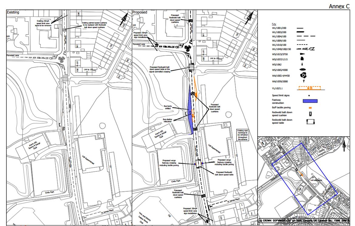
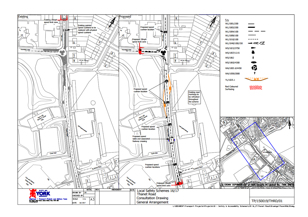
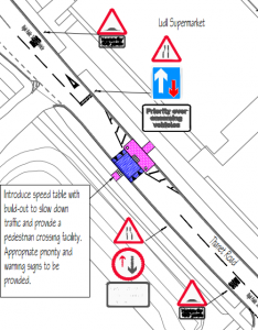
Thanet Road proposed road humps
Worse still is the publicity given to TROs. This is a statutory activity. The Council is required to advertise any proposed changes to parking, access, speed limit and other transport restrictions.
For many years, the draft orders appeared on an obscure page in the local paper.
One would reasonably think that in 2017 the orders would also be displayed on the Councils web site.
It appears not.
Use the search facility on the Councils web site and no TROs are displayed.
It is almost as if the Council didn’t want drivers to find out what they are planning to do!
If objections to an draft Order are received, the Council is required to consider them and make a public decision on each.
One of the TROs currently out for consultation concerns Thanet Road where a 20-mph speed limit – and traffic calming measures – may be introduced.
Anyone searching for Thanet Road on the Council web site will be disappointed.
It is a shame that the Council doesn’t make better use of its web site, Facebook and Twitter together with more traditional methods like noticeboards.
The noticeboards in Windsor Garth and Ascot Way (both close to Thanet Road) have not had any notices of any sort displayed on them for over a year!

 The responsible Council executive member – Ian Gillies – has today thrown out plans which would have seen use of the bus lay-bys on Thanet Road discontinued.