Real time bus information reaches suburbs

Pleased to see that information screens, which indicate when the next bus will arrive, have finally reached Westfield.

They are common in other parts of the City

A screen has recently been installed at a stop on Tudor Road.

We hope that the programme will soon extend to cover busy stops like the ones on Green Lane and Foxwood Lane.

Still its some progress at a time when public transport services are facing huge pressures as a result of the pandemic

Car parking availability signs still out of order

“On line” web guide scrapped

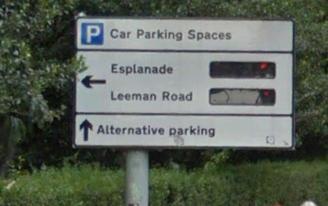
Car parking space availability signs still not working

The Council has about 20 signs on arterial roads which, until about 5 years ago, showed how many empty parking spaces there were at each car park.

Such facilities became commonplace on City streets more than a decade ago. They’re still to be found at many tourist destinations.

The FOI response has also revealed that the counters which allow the number of spaces to be identified, will only be reactivate on three of the signs before the end of the financial year.

The Council – after promising that its on line service, which also gives a guide to finding space, would be updated – has now been decommissioned.  The number of spaces shown has been incorrect for several years.

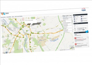
Users are now referred to the iTravel web site which contains only a list of car parks (and without an indication of the number of spaces at each).

Commercial sites like https://en.parkopedia.co.uk/ are much better.

There were also hopes that space availability would be linked to GPS systems to allow “Sat Nav” users to optimise their routes. Now it seems that driving round the inner ring road will continue to be the only way of finding a space.

That’s bad news for a Council leadership that claims to be trying to reduce pollution levels in the City centre, by cutting out unnecessary travel. Its also bad news fro some City centre traders who sell goods that require a purchaser to have access to their own transport.

New contract for real time bus information in York

Rougier_St_RTI_Screen

Tenders for a new real time bus information system are currently being evaluated. A new contract, which replaces one last let in 2002, is being managed through the “West Yorkshire Combined Authority”.

Tenders were invited last year and evaluation is currently underway.

The contract provides real time information at bus stops. It is linked to (most) buses which operate in York. The information also feeds into (generally good) mobile phone apps 

The 2002 contract was worth around £400,000. When it expired in 2012, the York Council decided to pay £60,000 a year to continue to maintain the old system.

Although systems like these are also capable of providing weekly or monthly reliability statistics, the old Labour run authority refused to publicise this data.

The only guide to reliability in the City comes from an annual single day sample published by the Department of Transport. The last reported figure suggested that 80% of buses were running “on time”

The new Council has yet to announce its policy on the provision of public transport reliability and quality information.

York congestion cameras still not working – York Council

Moving York’s CCTV cameras onto a system that provides residents with real time information on traffic congestion “has required more recoding of the website’s processing system than originally anticipated.” the responsible Councillor has admitted.

click to access

click to access

Live camera information has been available in North Yorkshire for several years but the York equivalent has been dogged by delays despite investment of over £300,000.

The Council now says that “this additional work is now almost complete and the CCTV images should be available on the website during October / November”.

For the mobile applications the updates required will be included in the next update releases of the apps, expected later this year.”

We will see.

Shame they weren’t working for today’s Yorkshire Marathon