Access to green spaces

It isn’t just cycle paths which have seen a major increase in use over the last few months.

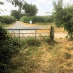
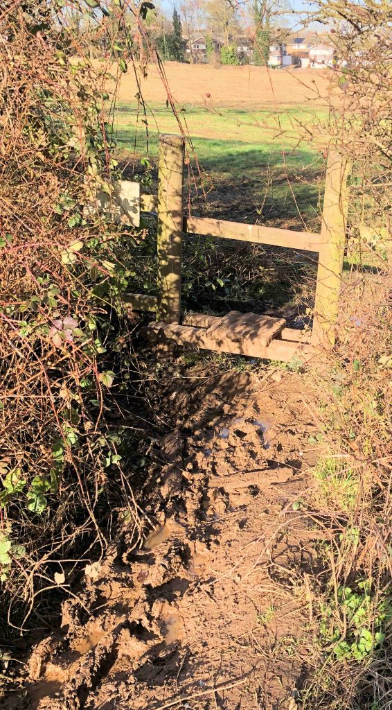
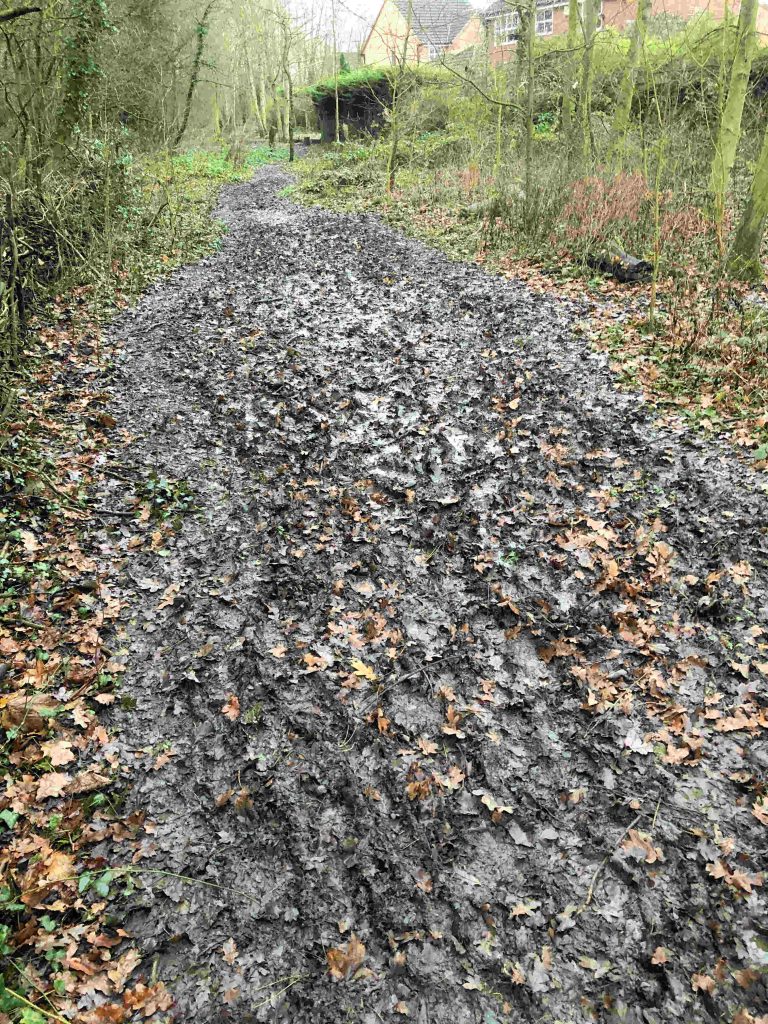
Sometimes long forgotten Public Rights of Way have been rediscovered as residents have sought to heed government advice to exercise safely.

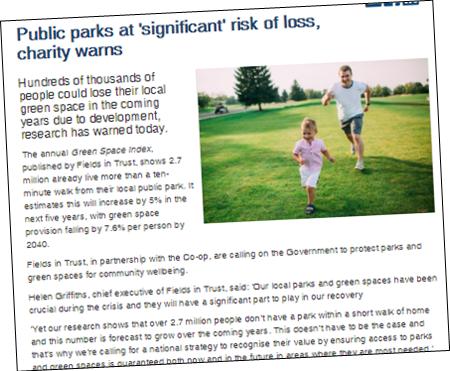
Nationally a campaign group has identified threats to many open spaces.

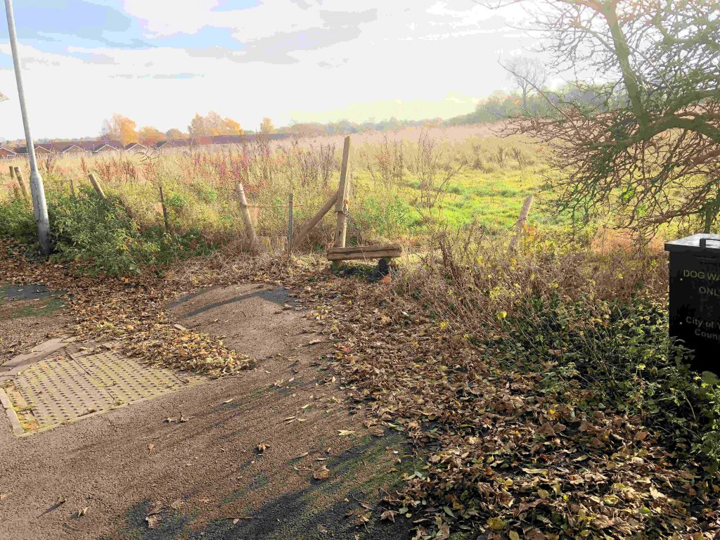
Sadly, in York, building work is underway on former sports fields at Lowfield and on Windmill Lane.  Several spaces in the green belt remain under threat.

The loss of this green space needs to be compensated for. It is important not only for peoples health but also to conserve natural fauna and flora.

The opportunities to create additional green spaces near the City centre are limited – although what is available could perhaps be better managed – but there are more options available between the City boundary and the ring road.

Local Councillors could lead the fight to improve the availability of both urban and county parks by identifying suitable areas which could be protected under “village green” legislation.

There are several opportunities on the west of the City where access could be sustained for people living in the Westfield, Dringhouses and Acomb wards. Some proactive  leadership is now required

Last year the York Council did say that they wanted to extend and add to the number of strays in the City. There has so far been little tangible progress to report on that promise.

Council asked to take action

Car parking sign at Foxwood Lane bus shelter has disappeared
We’ve reported detritus build up on the highway in Osprey Close. The footpath link to Acomb Moor is now just about passable now although we’ve asked for some hardcore to be put down.
Definitely “Wellingtons” needed if you plan to use the footpath link to Acomb Moor. This can be improved when the right of way is formally recognised. Ward Councillors have promised to follow this up
Not sure that this advertising signs are authorised

Council blocks popular footpath link

Over the last few days contractors have been working on the Council owned section of Acomb Wood near the top of Osprey Close.

They put some hard core down near the entrance gate (good) but they have left a large spoil heap blocking the popular footpath access to the wood.

They have also erected Council owned barriers on the PROW footpath link to Acomb Moor and Foxwood Lane beyond.

As well as the spoil heap, the actions of a tractor have reduced the path to an impassable quagmire. A spectacularly bad time of year to undertaken work like this.

It is unclear who is responsible for the work (the farmer has a right of access but he usually accesses his field direct from Askham Lane).

Paths in the Council owned section of Acomb Wood get very muddy. Their condition contrast with the well maintained – by volunteers – section of the wood on the other side of the road.

Only the Council would have any reason to work on this land – which is a publicly owned amenity area – but to do so without any warning or consultation is remarkably insensitive.

The residents association are planning to discuss the issue at their meeting next week.

There is scope for putting down hardcore on other sections of the popular footpath which goes through the Council owned part of Acomb Wood and which gets very muddy in places.

York Council decides on Public Right of Way requests

The York Council has considered several requests for changes to the definitive map of public rights of way (PROW).

In total Councillors and officials have decided whether to pursue 13 applications.

There will now be a further period of consultation.

The Council has a large backlog of applications which it has agreed to determine before the end of February

Click an individual application below to view each and the decision

Stile collapses

We’d reported on several occasions that the stile access from Foxwood Lane onto Acomb Moor was unstable. It has now collapsed (wood rot).

Hopefully the field owners and local Councillors will get it fixed. There si no grazing on the moor at present so security is not compromised.

A decision on the Public Right of Way route, which uses the stile, will be made by the York Council in February.

Acomb Moor footpath project takes step forward

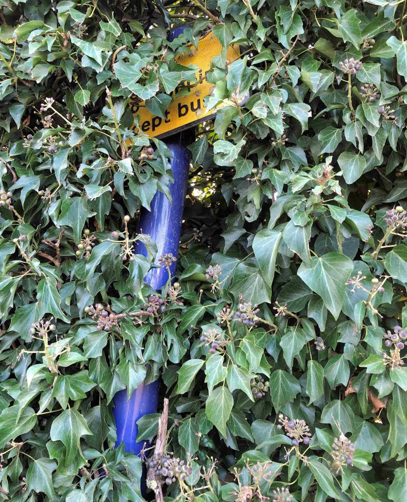
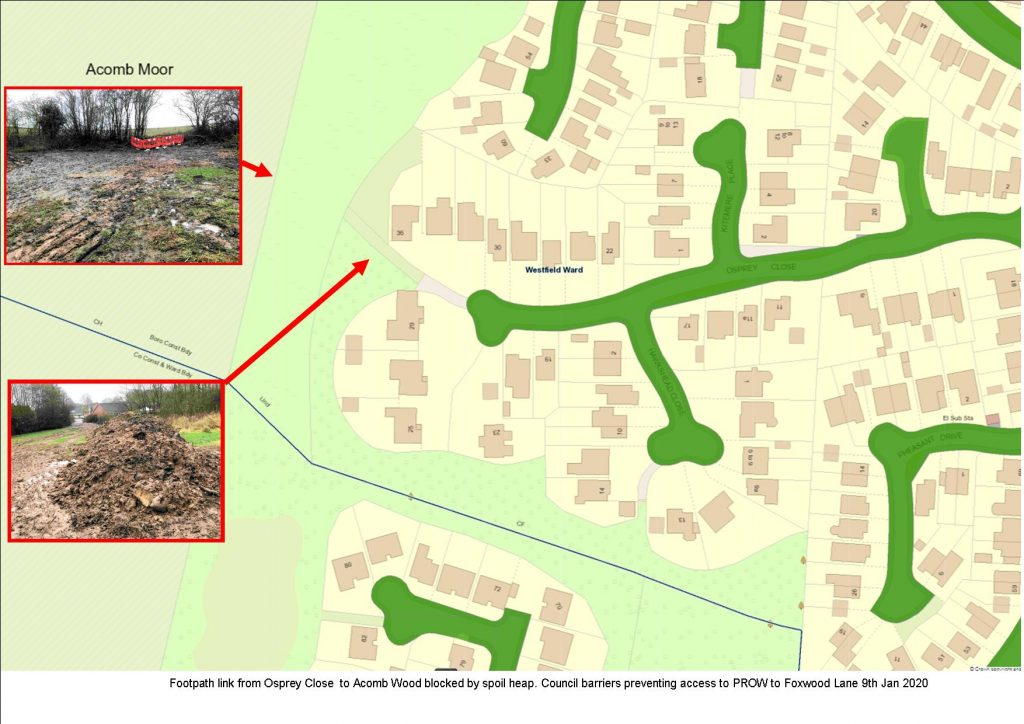
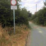
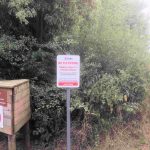
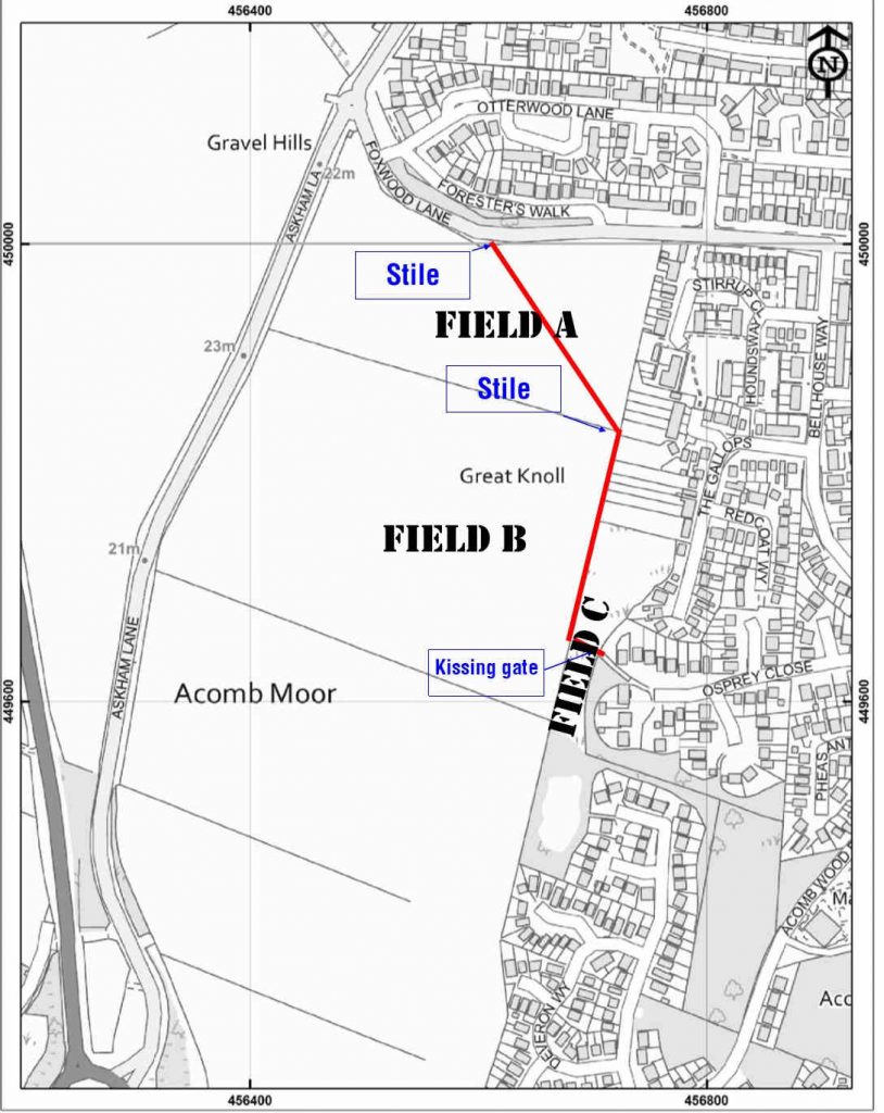
The Foxwood Residents Association has now served notice on the owners of the land that the Foxwood Lane/Osprey Close Public Right of Way crosses.

This forms part of the proposal to have the path included on the definitive rights of way map.

The York Council will now consider the proposal.

The link has been used by residents for over 30 years.  It starts on Foxwood Lane, near the former kennels site, and finishes at the kissing gate access on Osprey Close.

Many “evidence of use” forms have already been submitted. There is still time to confirm that you have used at least part of the claimed route at some time over the last 20 years. Even a couple of years occasional use helps to build the evidence base.

If you would like to fill in a form please Email Foxwoodra@btinternet.com and they will email a blank one to you.

When the PROW is confirmed it will be possible to seek repairs to the stiles and kissing gate on the route.

The application processes does normally take several months to conclude.

When is a footpath a “Restricted Byway”?

That is the question that the Councils Executive member for Transport will be asked to answer next week.  He will be asked to decide whether, not only pedestrians, but also cyclists, horse riders and a “horse and cart” should be able to use the full length of Grange Lane.

The section in dispute lies between the boundary of the built-up area and Rufforth airfield.

While some farmers prefer to regard the lane, from the A1237 to the airfield as “private”, the Council agreed in 2008 that it was a Public Right of Way (and therefore could be used by walkers)

Grange Lane – end of public highway

Three people are now claiming that other modes of transport should be allowed.

The main area in contention is the section between the A1237 and Chapelfields. This has been a footpath for many years. Some 25 years ago a young child cycled down the slope into the path of an approaching vehicle. The resulting fatality fuelled calls for the access to be gated. This was done for a while, but the access has become insecure again.

One representation has apparently been made claiming that the Council should surface and maintain the whole length of the route although it is effectively a “road to nowhere” for most forms of transport (It is used by farmers to access their fields)

Grange Lane start of public footpath

A horse and cyclist could use the Chapelfields section of path with relatively little work.

A horse and cart? We think not.

Widening and levelling the lane would be a waste of money (Rights for mechanically propelled vehicles were removed by the NERC Act 2006.)

The path was suggested as the preferred cycle route from Rufforth to York a few years ago but a line via Knapton was later selected.

Both are potentially unsafe at the by-pass junction and really need a bridge to be useable.

Grange Lane A1237 junction

The Council would be wise to take whatever steps it can to restrict the use of this path at least until pedestrian safety can be ensured.

In the meantime the interested parties should back off and allow a proportionate solution to emerge. Even heavily used roads in York are full of potholes and diverting budget to maintain a little used path is not in taxpayers interests.