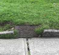
Local gullies and drainage ditches seem to be coping well with surface water in York.
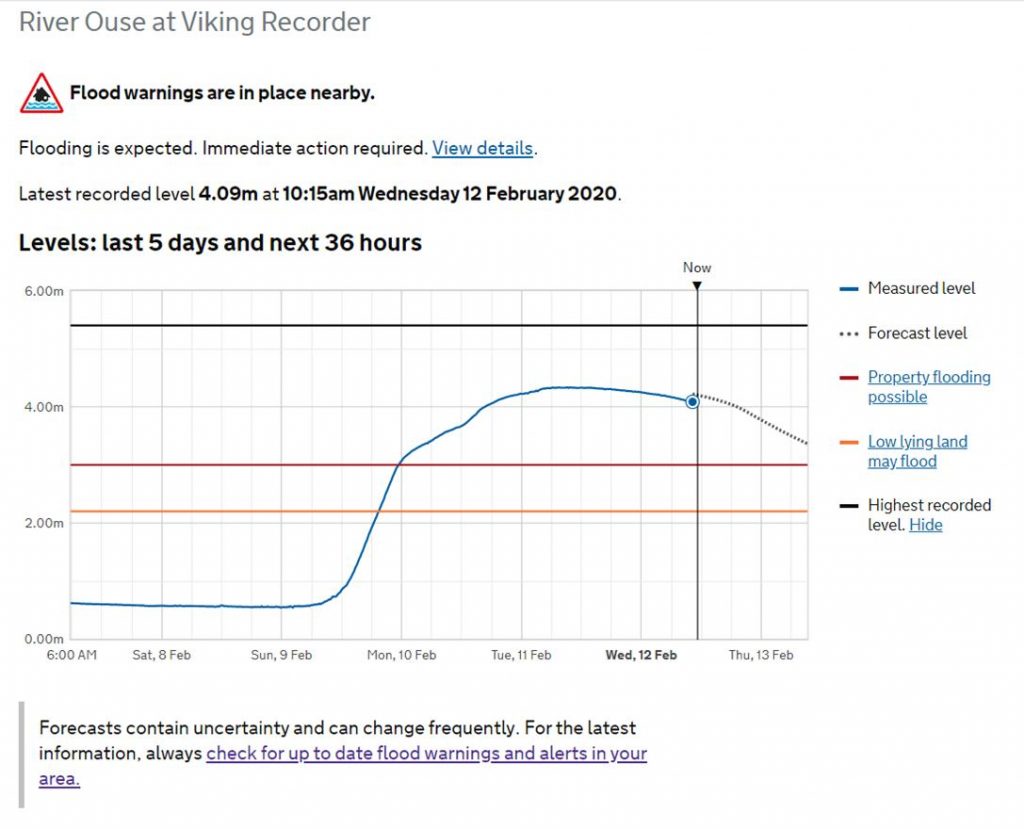
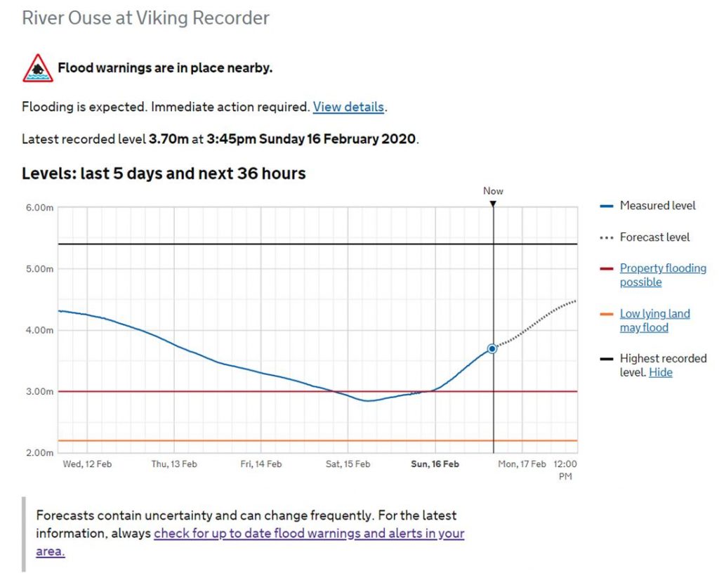
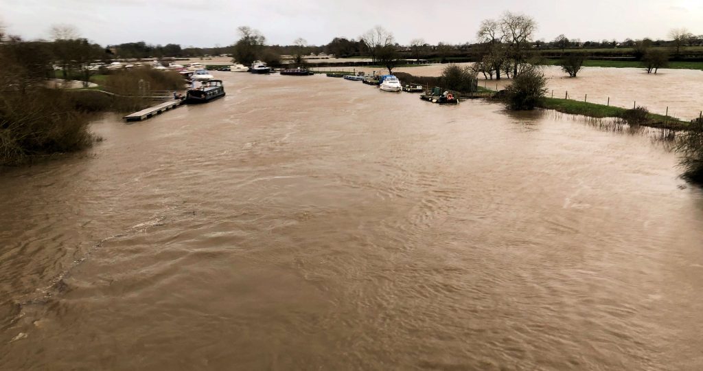
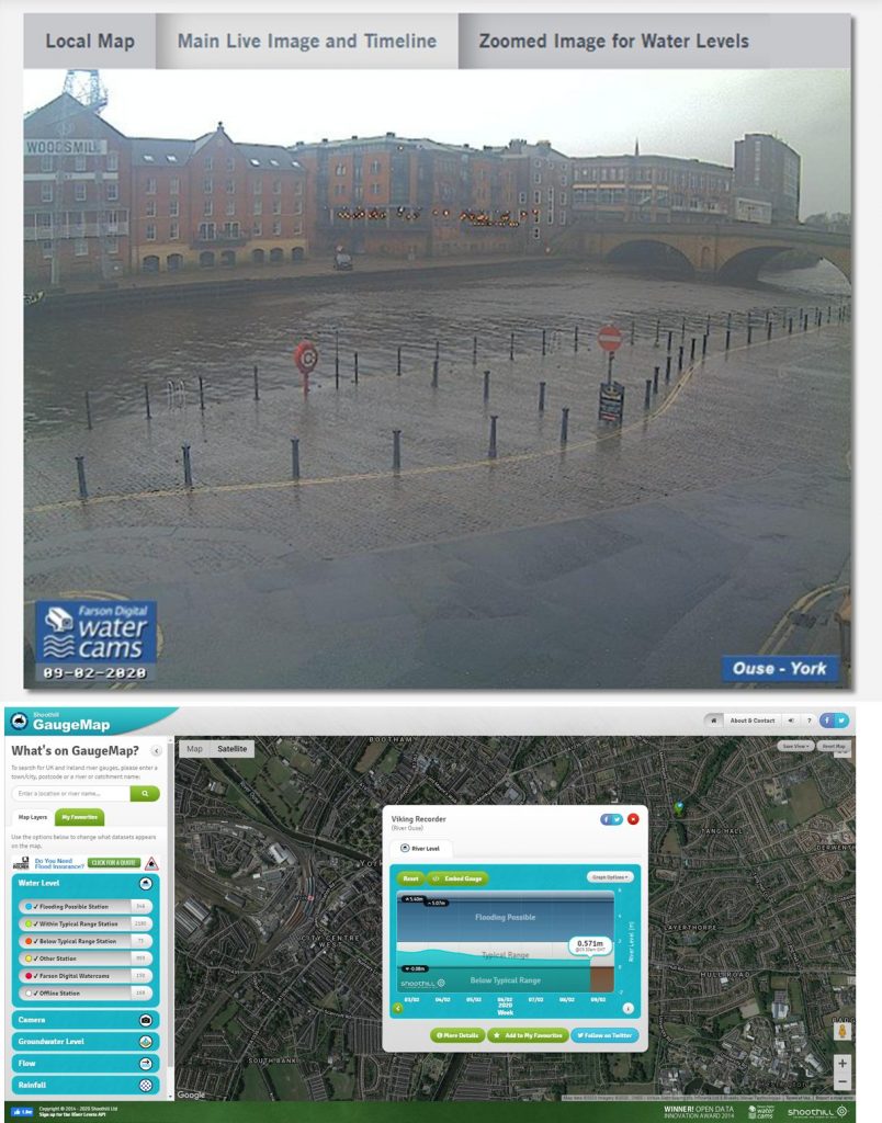
River levels are high but are not expected to peak now until late on Monday.
Meanwhile the York Council Leader Keith Aspden has issued a statement .
With the news that river levels are increasing, I wanted to email to provide an update on the impact of Storm Dennis in York, and to reassure residents that a wide-range of actions are being taken, both by the Council and key partners, to ensure the impact to the city and our communities is kept to a minimum.
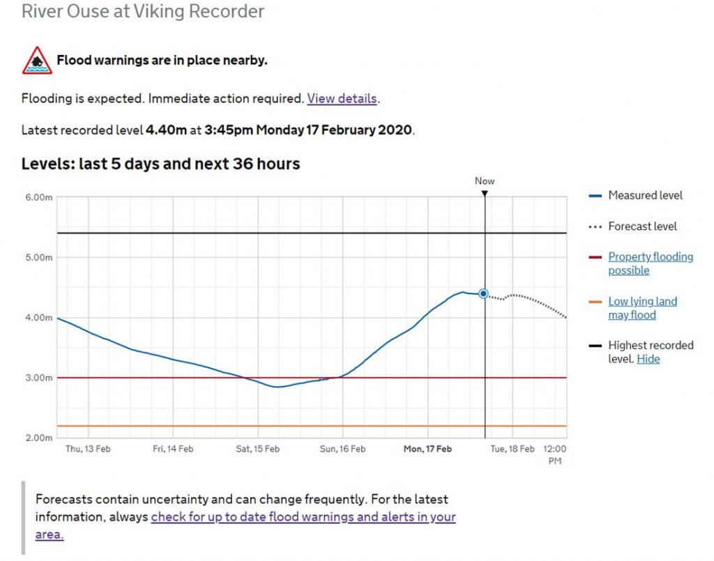
The Environment Agency (EA) has confirmed levels on the River Ouse in York are forecast to be close to the levels in 2015. Current forecasts from the EA are showing that river levels could reach between 4.8 and 5 metres on the morning of Tuesday 18 February. However, conditions remain unsettled, with further rain forecast over the next 48 hours, and this could result in changes to the levels and peak timings. The Environment Agency river forecasters will continue to monitor the situation 24/7 and provide further updates.
The Council has spent Friday and Saturday strengthening the city’s flood defences and today we will be helping residents in the most ‘at risk’ locations with the provision of sandbags to protect their homes and businesses. Local Liberal Democrat Councillors have also been out working with local communities to ensure precautions are taken and vulnerable residents are provided support. We will continue to make preparations to keep our fantastic city open.
With the uncertainty over weather conditions, we ask that people continue to keep an eye out for the latest information and alerts from the Environment Agency, which provides river levels for the next 36 hours in York, and to look out for friends and neighbours who may need support. Above all, please stay well away from the rivers and flood water. I have copied below some useful information and links. For the latest information and advice visit: www.york.gov.uk/flood.
The Liberal Democrats in York have long campaigned to secure better flood defences for York and since the Boxing Day floods of 2015, a number of flooding schemes have been given the green light. However, far more needs to be done and further action is needed to build in the latest in flood prevention technology across the entire city. I will continue to make the case to the new Government and request that immediate action is taken to aid affected communities across our city.
Finally, I would like to thank all community volunteers, staff, and key services who are working tirelessly to keep York safe and open for all everyone.
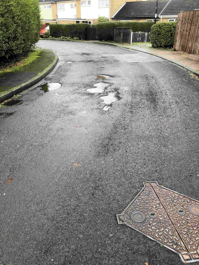
We see that local Councillors are taking up issues with minor flooding on roads and footpaths.
Today’s poor weather is likely to highlight where the main blockages are.
One resident has used https://www.fixmystreet.com/ to highlight a problem near Lidl.
In some cases the “ponding” results from blocked or damaged drainage gullies.
In others, the carriageway has sunk and more extensive repairs may be necessary.
The Council has allocated over £3.5 million for repairs to drainage channels over the next few years. . A Council report published last week said, “It is calculated that more than £8m of investment will be needed over 12 years to address all defective assets on a priority/needs based approach, and the funding included is based on two additional works gangs and materials”
It is not just gullies that are waterlogged.
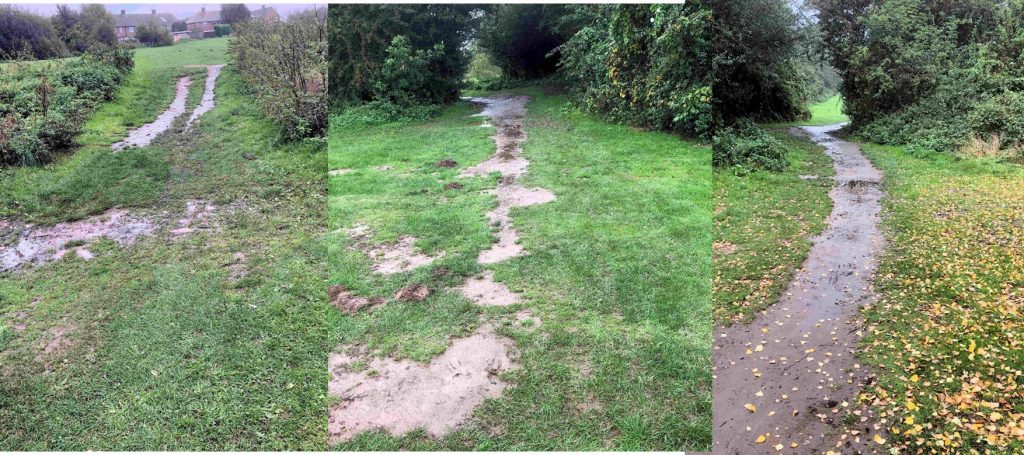
Several off road paths – including those linking Acomb Wood, Acomb Moor and the Westfield Park off Grange Lane – are obstructed.
The local ward committee has a delegated budget which is available to address problems with cycle and pedestrian routes. We think it should use some of it to ensure that these paths remain usable in wet weather.
Whatever the issue, residents are strongly recommended to report problems to the Council. The sooner work gets into the forward programme the sooner issues will be resolved. https://www.york.gov.uk/reportproblems
The following flood defences will remain in place in line with the council’s flood plan throughout this week as teams assess the potential impacts of Storm Dennis over the weekend.
These include:
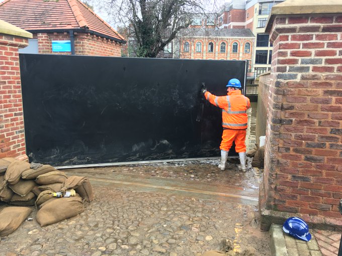
It is unlikely that the riverside paths will be fully accessible but they will be cleansed after river levels return to 2.5m.
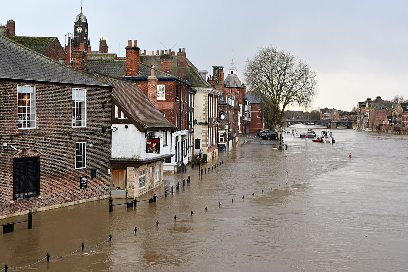
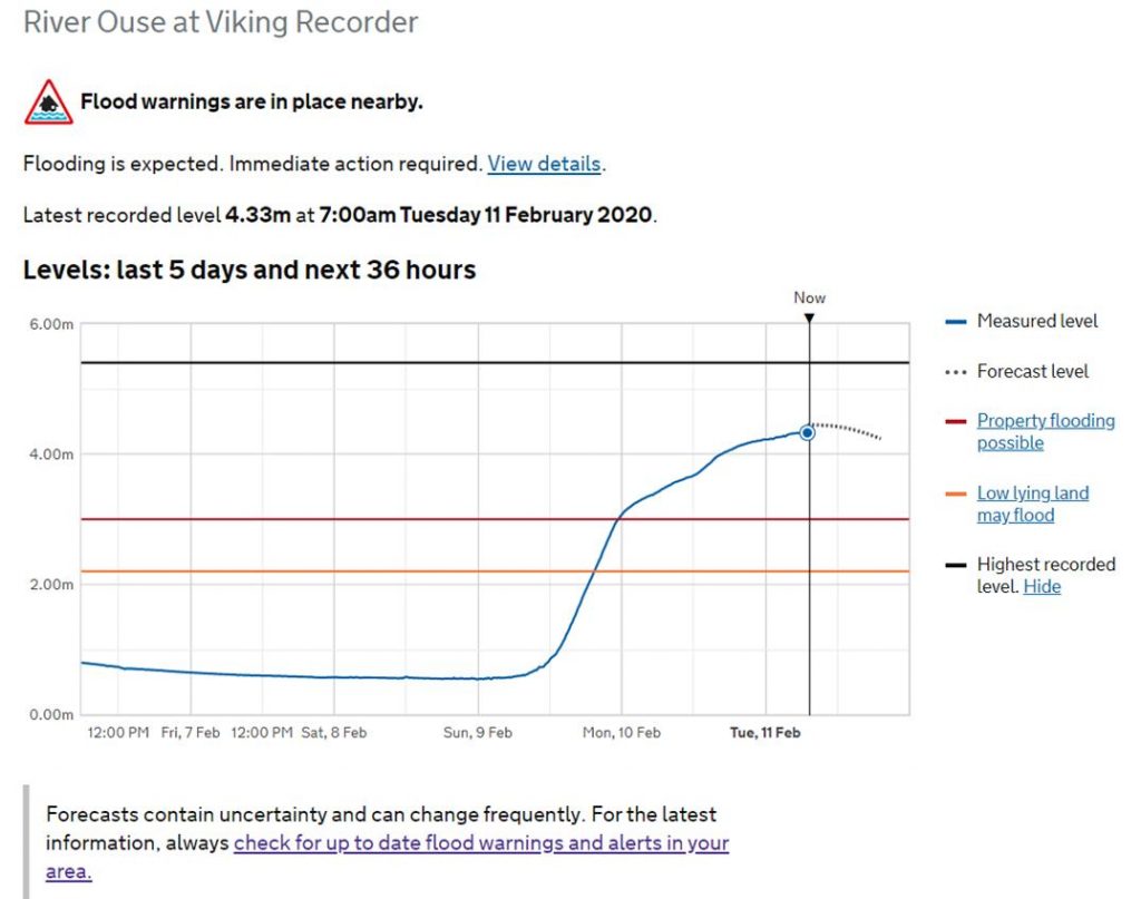
Following on from Storm Ciara, the River Ouse peaked at 4.35m (0.85m lower than the 2015 peak) at 6am on 11 February. No properties have flooded internally and defences installed since 2015 have been operating effectively.
Stay up-to-date with the latest storm information related to York at www.york.gov.uk/FloodUpdate11022020
Cllr Paula Widdowson, Executive Member for Climate at City of York Council, said:
“I’d like to thank all our staff and key services, such as the Environment Agency and emergency services, who have worked round the clock to ensure York remains open and safe for all our residents and visitors.
“We’ll be keeping a close watch on rainfall and wind strength over the coming days and into the weekend, with Storm Dennis forecast to arrive on Saturday 15 February, with heavy rain and strong winds. The council will work with partners to take action should river levels rise again.
“River levels are likely to rise over the weekend and into early next week. So, all temporary measures will be kept in place and monitored during this period.
“We have an exciting weekend of events taking place here in York, including the much loved JORVIK Viking Festival, which has announced new venues to avoid potential damage from the storm. We look forward to welcoming lots of residents and visitors to our beautiful city this weekend!”
The York Council is set to spend more on reducing the impact of flooding in the City.
The plans, revealed just hours before the latest flooding problems hit the City, include the provision of a dedicated pump which will help to keep the A19 near Fulford clear of water.
A council report also promises more work to deal with surface water drainage issues
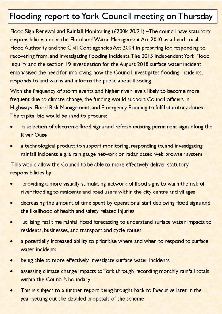
” £200,000 for improved drainage. To continue funding the restoration of the Council’s drainage infrastructure supporting the findings of the Surface Water Management Plan. This funding reflects the amount of work that can realistically be done using the available resources within the Council where there is extensive local knowledge
£3.5 million will be spent on Gully Repair Engineering Works – A rolling programme of capital funded drainage survey and investigation works has led to significant improvements of the cities highway gullies and has provided detailed information to identify the condition of the assets and their long term maintenance needs.
It is calculated that more than £8m of investment will be needed over 12 years to address all defective assets on a priority/needs based approach.
£200,000 will also be invested in improving real time signage and on rainfall monitoring equipment (see below).
It looks like the level of the River Ouse in York has now peaked. The level is forecast to slowly recede as the day progresses.
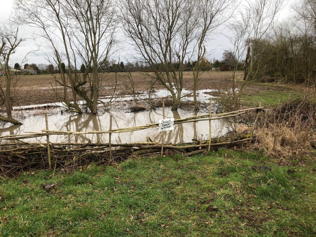
There will be an increased risk of flooding in York over the next couple of days as Storm Ciara passes by.
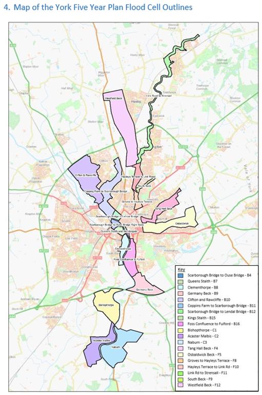
The immediate threat may be surface water if drainage gulleys are unable to cope with the rainfall. A copy of a map showing the vulnerability of different neighbourhoods to surface water can be found by clicking here
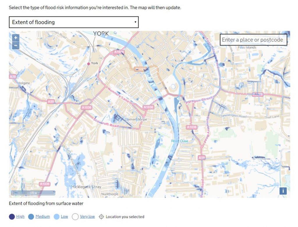
Surface water vulnerability map
It will be some hours before the bulk water currently falling in the hills makes its way into the rivers Ouse and Foss in York. Residents can check the real time position on river gauge levels at this site https://www.gaugemap.co.uk/#!Map
Some reports of highway defects are being knocked back with “no further action required” responses this year.
One of the deficiencies of the Councils “report it on line” system is that no reason for inaction is given. There was a time when a pothole might go unfilled because it didn’t meet what were styled “the Councils intervention level”. Basically they weren’t judged to be deep enough.
Eventually frost damage would, of course, ensure that it did become bad enough to justify filling.
But there are some very uneven roads which are, perversely, being judged as safe these days
Council officials are also reluctant to send warning letters to drivers who have damaged verges, even when it is obvious who is responsible,
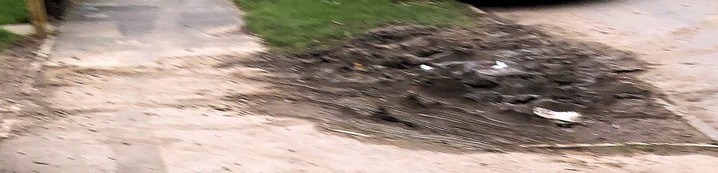
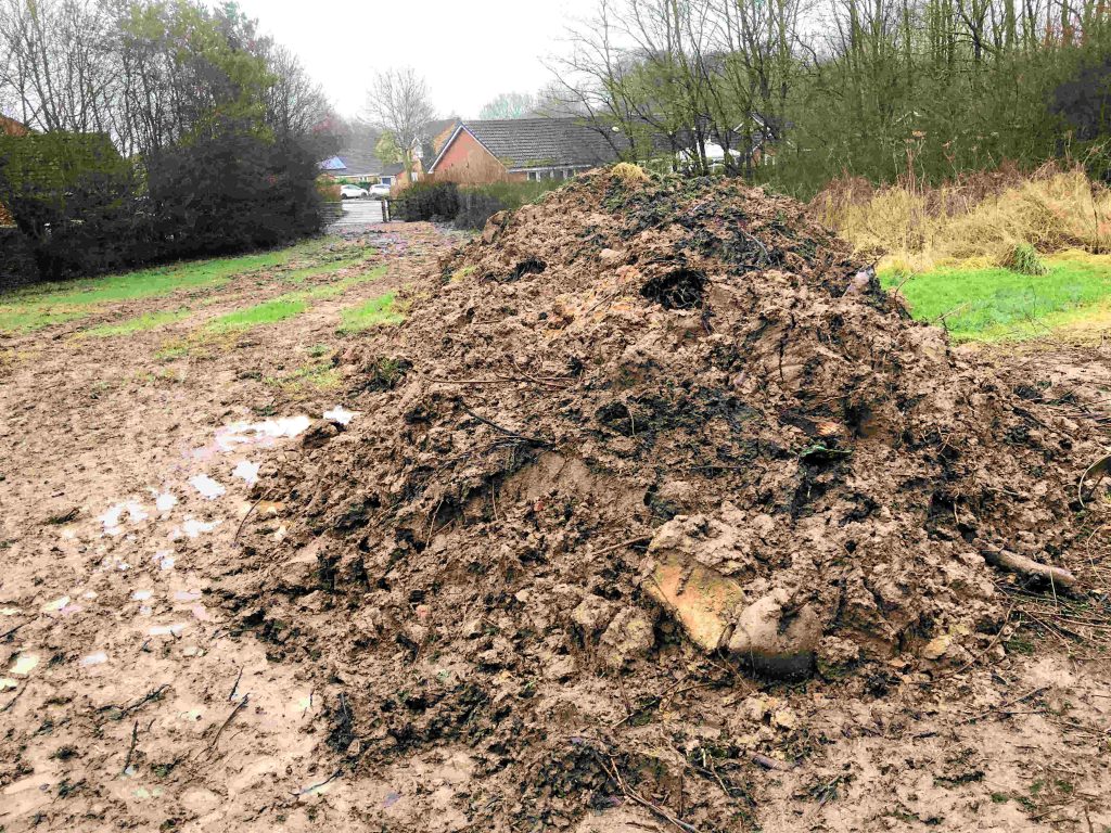
One piece of better news, with local Councillors reporting that work on finishing drainage work on the Osprey Close footpath will recommence shortly. The footpath may be diverted around the worst of the mud with further repairs to the land drains taking place when the area dries out.
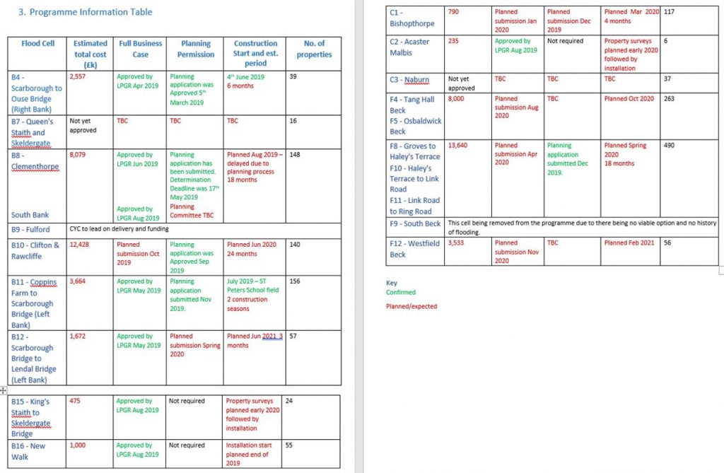
The Council will receive an update report on the progress with flood prevention works at a meeting taking place on 13th January 2020.
Flooding in late December 2015 followed an intense period of rainfall across November and December due to the impacts of Storms Desmond and Eva. Record river levels were observed in many river catchments across the north of England. More than 4000 homes and 2000 businesses flooded across Yorkshire with 453 properties and 174 businesses flooded in York
Funding was allocated to the Environment Agency (EA) following the floods to renew existing and provide new flood defences across the city, £28m has been allocated to the Foss Barrier improvements and £45m to the wider flood defences across the city.
The Yorkshire Future Flood Resilience Pathfinder project led by City of York Council has recruited three Flood Resilience Project Officers who are in the early stages of the development of a range of demonstration and awareness materials that will be used to build flood resilience across Yorkshire.