No immediate flooding fears in York despite heavy rain

York river level guages remain within normal limits despite recent heavy rain.

You can check river levels at the following web site http://www.gaugemap.co.uk/#!Map

Click to access river level guages

Click to access river level guages

Meanwhile the Environment Agency have confirmed details of the flood prevention project exhibitions that they plan for the City.

The exhibitions will take place on Friday and Saturday

floods-exhibition-25th-nov

Five year action plan to reduce flood risk in York

Residents get only one weeks notice of new exhibition

York flood 2012The Environment Agency has announced a new five-year action plan to better protect the City of York against flooding. It provides more details of how physical flood barriers will be improved following the announcement last March of a £45 million budget for the work

The Environment Agency’s plans emerged only today – just one week before a two-day exhibition of the proposals takes place.

The plans have not been published “on line” yet

The exhibition will take place at Hotel 53 in Piccadilly, York, between 12 and 7pm on Friday November 25 and from 10am until 5pm on Saturday November 26.

No implementation timetable for the improvements has been released but it could be a decade before all work has been completed.

Sources at the York Council criticised the Agency for failing to agree a coordinated communications plan for the proposals which sets out options to reduce the risk of flooding to 2,000 properties across 10 York communities.

The schemes would affect

  • Clifton/RawcliffeLatest 0917 27th Dec 2015 copy
  • Holgate Beck
  • Poppleton
  • Foss
  • City Centre
  • Osbaldwick & Tang Hall Beck
  • Clementhorpe
  • Fulford and Germany beck
  • Bishopthorpe
  • Naburn and Acaster Malbis

The plan looks at a range of potential flood reduction measures including the creation of storage areas, increasing pumping capacity, raising and building new walls, raising land and building embankments.

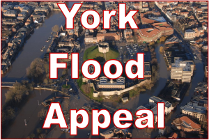
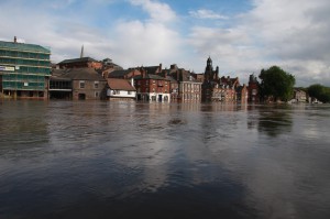
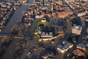
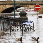
Following the devastating floods of Boxing Day 2015 which affected over 600 properties in York, the Government committed £45 million to reduce flood risk and increase resilience to at least 2,000 properties at risk and keep the city open for business during major floods.

The agency stresses that its proposals are not final, and will need to win public support, be technically feasible and affordable.

It wants to know what residents think at its exhibition next week.

Earlier in the week, delays in presenting an independent inquiry report into the 2015 floods attracted criticism

Public meeting to explain plans for Foss barrier upgrade on Friday & Saturday

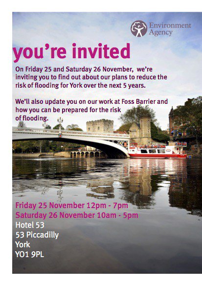
The Environment Agency will share its plans for upgrading the Foss Barrier and seek views on options for reducing flood risk throughout the City of York at a public exhibition this week.

The exhibition will be at Hotel 53, Piccadilly, York on Friday 20 May (12pm – 7pm) and Saturday 21 May (10am – 5pm), and will be an opportunity for residents and businesses to comment on flood defence proposals.

Environment Agency and City of York Council staff will be on hand to discuss the proposals and give advice on flood resilience.

There will also be a chance to see copies of the Foss Barrier Investigation report, released last week, which explained how water got inside the Foss Barrier during the floods on 26 December.

In York, a further £45 million has been secured to upgrade York’s flood defences. The additional funding means that areas of York will gain further benefit from reduced flood risk over the next five years.
(more…)

Floods update – Environment Agency publishes key Foss river level graph

What really happened

The Environment Agency has published the most comprehensive information of how river levels on the Foss rose during the evening of the 26th December.
Click to access

Click to access


The information is likely to form a key consideration when the independent inquiry finally gets underway.

The Agency has yet to provide a convincing explanation of why some of its river level gauges failed – even before the telecoms outage occurred. 

York Flood update – Environment Agency announces dates of meetings with victims

flooding in York
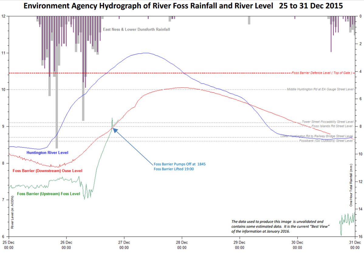
The Environment Agency has announced a series of drop-in meetings in York for next month to help people learn more about flooding.

Rather than hosting a large, public meeting, the idea is that smaller, “one-on-one” sessions will allow people to ask bespoke questions about how the city manages rising waters.

Experts will be on hand to answer ANY questions, including why the controversial decision was taken to raise the Foss Barrier during the Boxing Day floods.

Details of meetings:

  • 2nd February, 3 to 8 PM at Southlands Methodist Church, Bishopthorpe Road, York YO23 1NX.
  • 4th February, 3 to 6:30 PM at New Earswick Folk Hall, Hawthorn Terrace, York, YO32 4AQ
  • 8th February, 3 to 7:30 PM at St Aelred’s Community Centre, 216 Fifth Ave, York, YO31 0PN.
  • 9th February, 3 to 8 PM at National Centre for Early Music, St Margaret’s Church, Walmgate, York, YO1 9TL.
  • 10th February, 3 to 8 PM at York Saint John University, Lord Mayor’s Walk, York, YO31 7EX.
We can only hope that the Agency has learned a few communications lessons.
They should invite written questions and make sure that the answers are published “on line” before any meetings take place.
Time at the meetings can then be concentrated on dealing with follow up questions and matters of outstanding concern.

York Floods: Statement needed to reassure residents

The York Council would be right to take a few weeks to pull together a report on the recent flooding issues in the City.

It should not take the two years that the post 2012 floods report took to compile.

click to donate

click to donate

But there is an urgent need to reassure residents about precisely what went wrong with the Foss barrier last weekend.

At the time the authorities claimed that the barrier was raised (prompting a 2 foot increase in the level of the Foss and the flooding of the Huntington Road area and telephone exchange)  because there were fears that water would damage the lifting equipment or the power supply.

In the cold light of day this seems an unlikely explanation, not least because the system had reserve generators which could be brought on line or, failing that, a manual lifting system.

We know that water from the Ouse was approaching the Foss from the Tower Street area (but it never actually over-topped the barriers).

So the issue presumably was an unprecedented run off into the Foss catchment area?

Tang Hall beck certainly did experience record levels.

  • Could the Foss barrier pumps not cope?
  • Were they all working to maximum capacity?
  • Why was the pumping station evacuated? (a new bridge to it was later provided by Army engineers)
The questions need to be answered quickly and publicly by the Environment Agency.

It isn’t a question of apportioning blame.

It is a matter of reassuring hundreds of residents and business owners that the cause of the problem is understood and, should another similar event occur this winter, that contingency plans have been upgraded.

After all we are now in a vulnerable position.
The ground is saturated guaranteeing that any rainfall will run off quickly into ditches and rivers..
Many previous floods have been caused by a combination of melting snow and localised rainfall.
Add in the already wet ground and the conditions for a “perfect storm” may already exist.

Local MPs and the Environment Agency must reassure residents without delay