
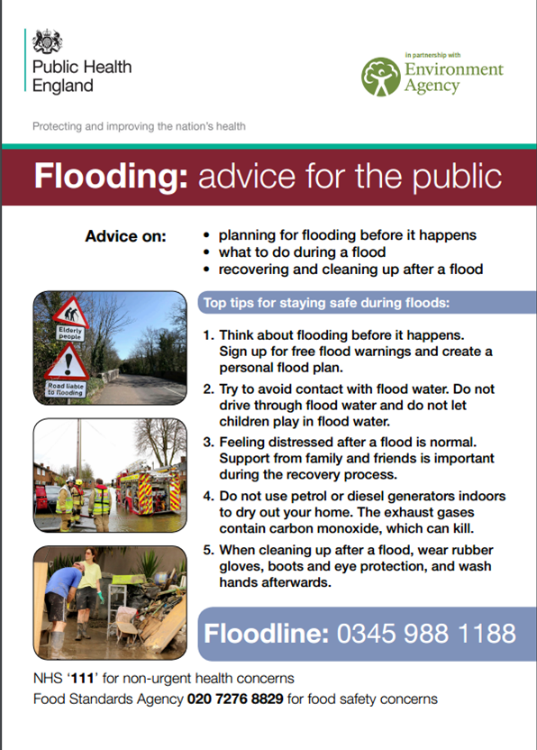
Useful information for anyone cleaning up after being flooded
Click to download
Click to download
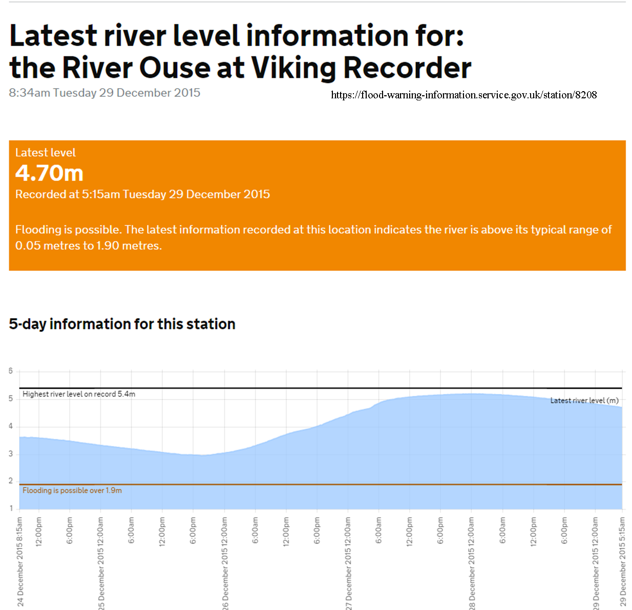
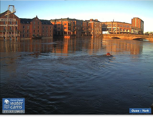
. The Ouse is currently 4.7 metres above normal levels and gradually falling from the peak of 5.2 metres seen on Sunday.
click to update
River levels are expected to remain very high over the next few days.
The Foss Barrier has been repaired & lowered. 4 of the 8 pumps are now operating. This should be good news for the Huntington Road/Walmgate areas
View the Environment Agency’s map showing current flood warnings for the York area.
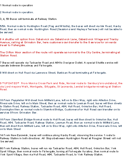
Most bus routes are being diverted, with severe delays to be expected.
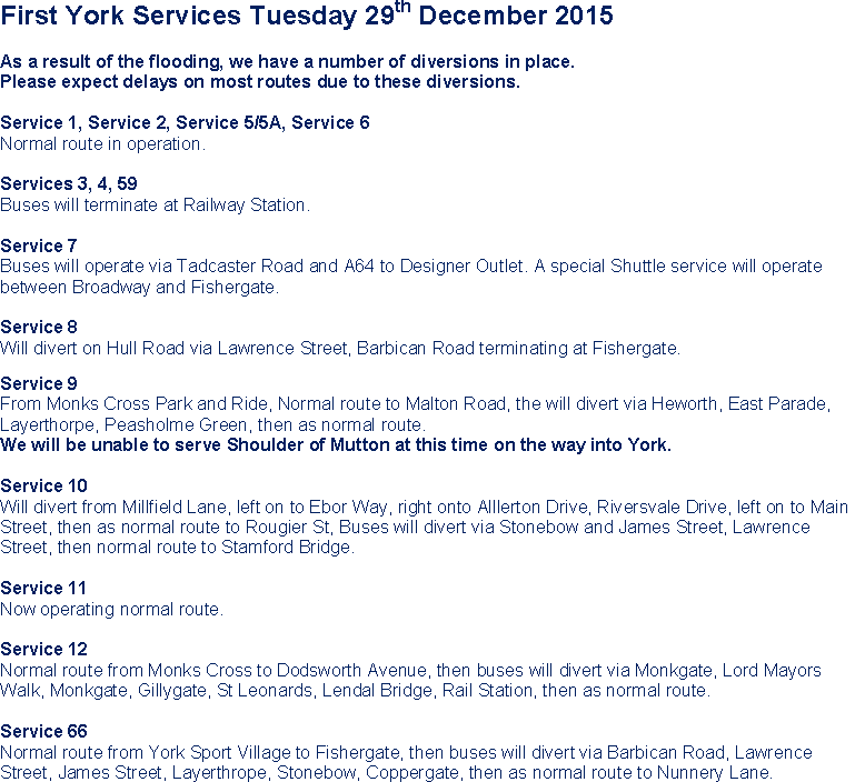
Bus services 29th Dec 2015
Traffic signals have failed at several junctions, including Walmgate Bar and New Lane/Malton Rd. Please proceed with caution where traffic signals are not functional.
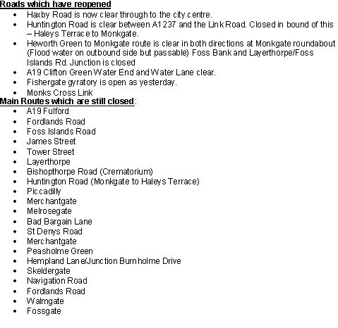
Fulford area
Inner Ring Road area
City Centre
Huntington Road area
Tang Hall area
Bishopthorpe area
Please do not take any unneccessary risks and only travel if absolutely necessary.
The Environment Agency is working to top up the low spots in the River Ouse’s defences at Marygate, North Street Gardens and Lower Ebor Street. It is expected that the defences will withstand the predicted river levels and there is not thought to be risk to people or properties behind the defences.
Work is ongoing to identify any vulnerable individuals or groups who would need notifying if the forecast changes.
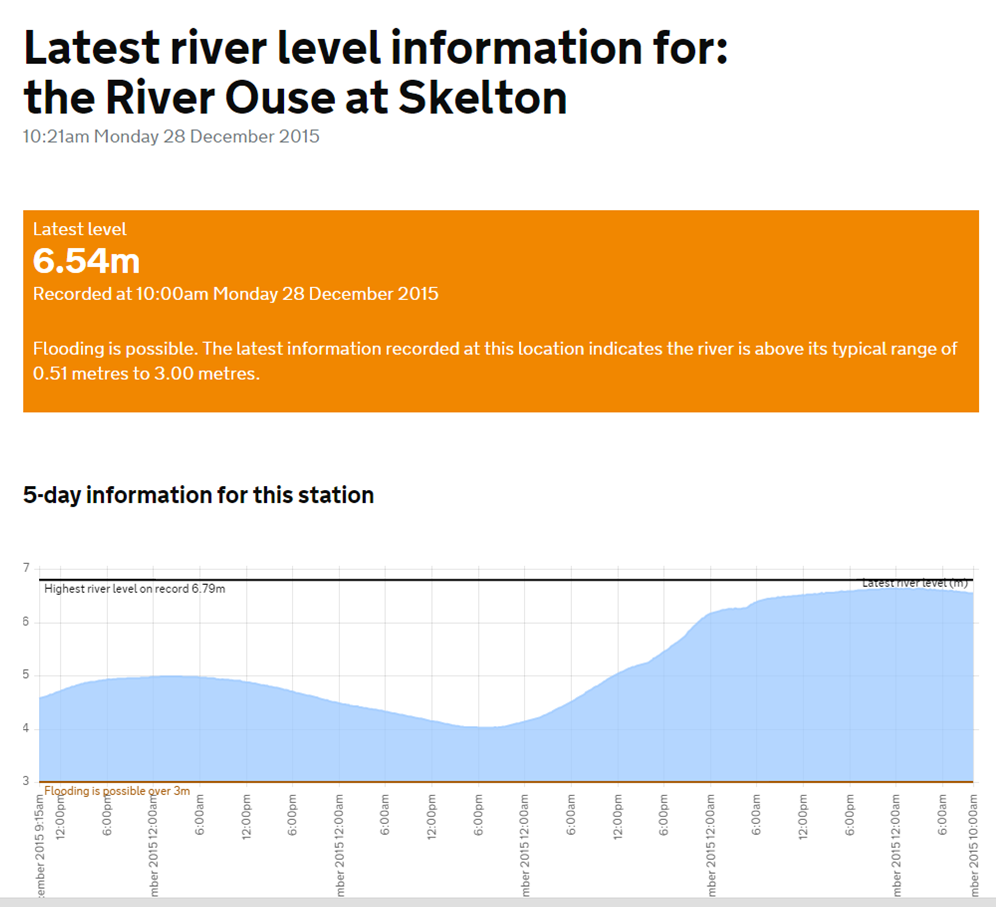
Ouse at Poppleton/Skelton 1000 hours 28th Dec 2015
The River Ouse has stabilised at 5.2m although there is potential for a rise in river levels towards the end of the week. The river gauges on the Ouse are still not reporting although those on Blue Beck and Tang Hall Beck show water levels falling.
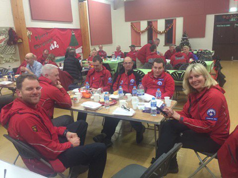
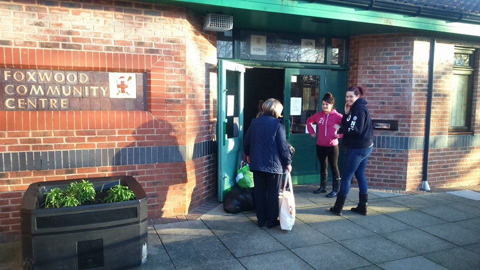
Rescue workers take a break at the Foxwood Community Centre
These are the current services
The Foxwood Residents Association is thanking everyone for their support on flood victim relief today.
However they have as many donations and help as they can manage today so they are requesting that no more offers are made.
They will update their web site tomorrow.
York, Cawood and Selby are currently experiencing unprecedented levels of flooding, with rivers expected to peak during the evening and early hours of tomorrow morning.
DCC Tim Madgwick, Gold Commander said:
“We would advise people not to visit the affected areas of York and Selby at this time of high risk. Many major routes into York and Selby are currently flooded and travel in and around these areas is very challenging.”
“Routes that are open and passable are critical to emergency services to access to those who need support. We would ask people who do not need to travel to York , Selby and Selby district to delay their visit until the flood risk has passed.”
“The risk is being constantly monitored through a multi-agency approach. As flood waters are currently rising, we expected a clearer picture of maximum levels tomorrow, when they peak.”
“To residents and business owners – if you are contacted by emergency or support agencies and asked to evacuate your property, we realise the inconvenience and disruption, but please be assured that all risks will have been assessed and the decision to evacuate will have been made with your safety and best interest in mind.”
The latest flood warning information can be access here https://flood-warning-information.service.gov.uk/map
You can also follow @EnvAgencyYNE and #floodaware on Twitter for the latest updates. Or call Floodline on 0345 9881188.
Keep up to date with the weather forecast and weather warnings at www.metoffice.gov.uk or tune in to your local BBC radio station.
Early times, and there is still a lot of water to reach York from the Dales, but the Ouse gauges seem to be peaking.
The weather forecast suggests that we are due to have another dry day tomorrow which will help.
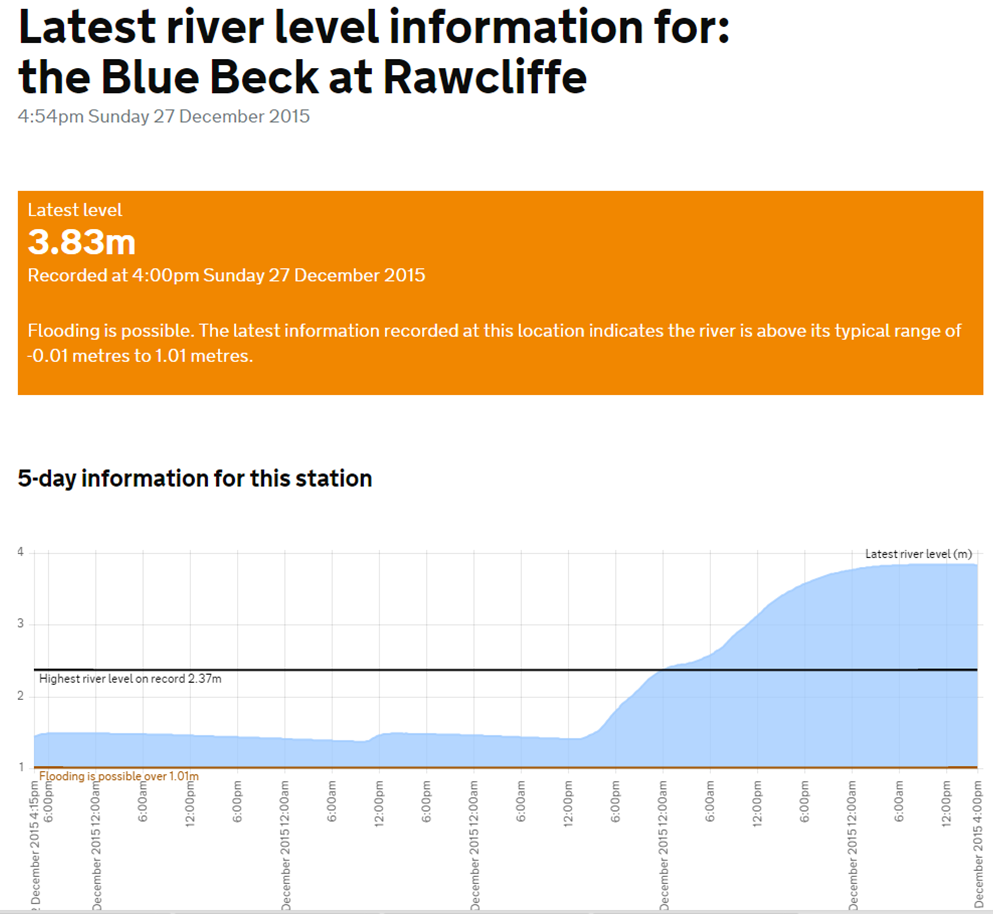
Blue beck Rawcliffe stable but very high
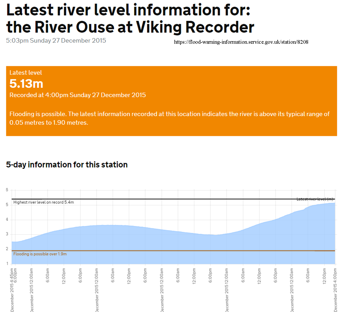
Ouse Bridge Viking recorder. Rate of increase is reducing
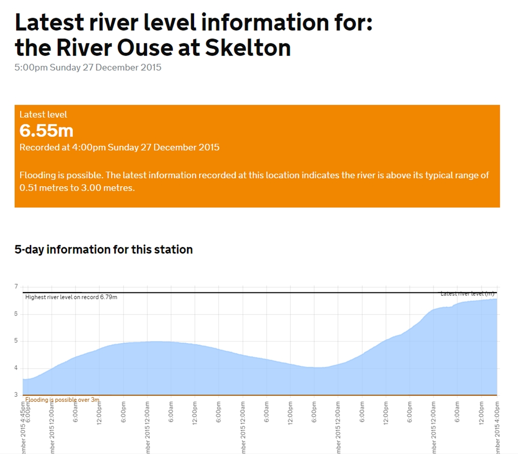
Ouse at Poppleton and Skelton – rate of increase reducing
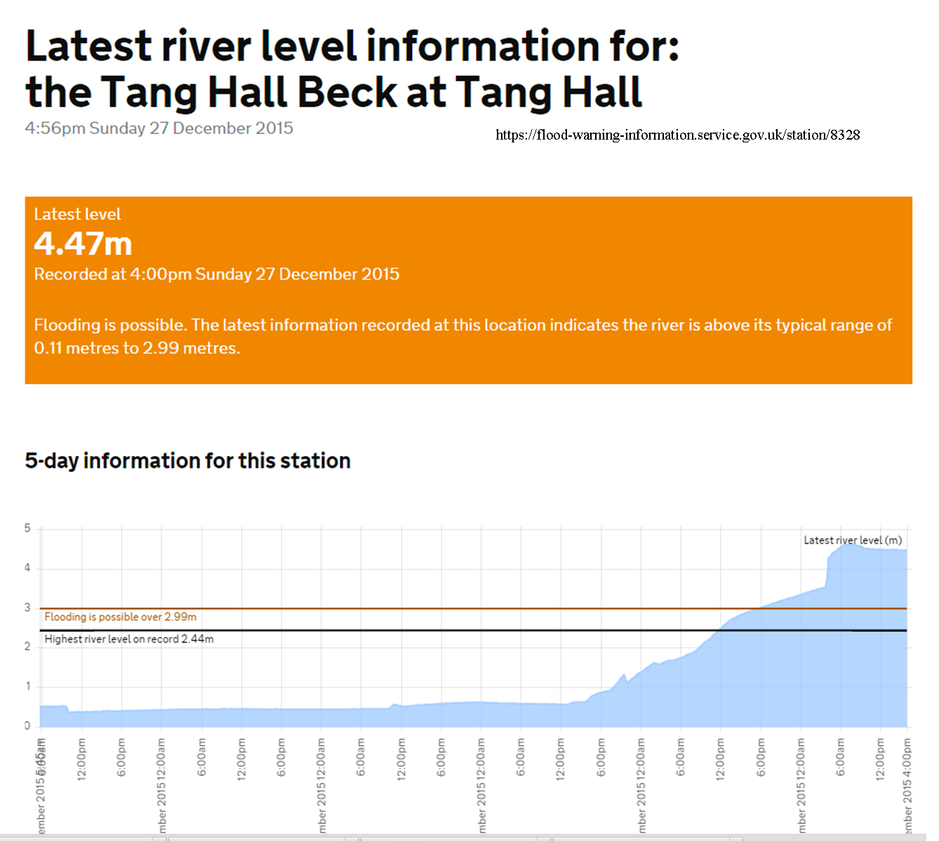
Tang Hall beck – falling back from record high
Thanks to those who generously responded to the appeal for clothes, bedding etc by the Foxwood Residents Association.
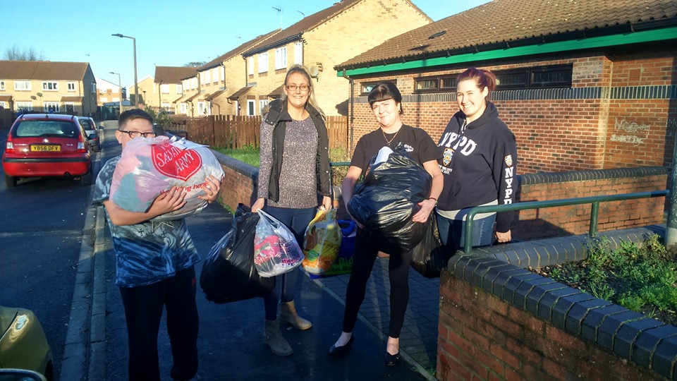
Flood aid being collected at Foxwood Community Centre
Flood aid being collected at Foxwood Community Centre
7 car loads now on their way to the coordinating centre at Archbishop Holgates school (which is open to receive those evacuated from their homes).
Next up for Foxwood may be a challenge to feed 52 flood workers arriving from the south at 9:00pm.
More as it become clear at https://www.facebook.com/foxwood.residentsassociation.14

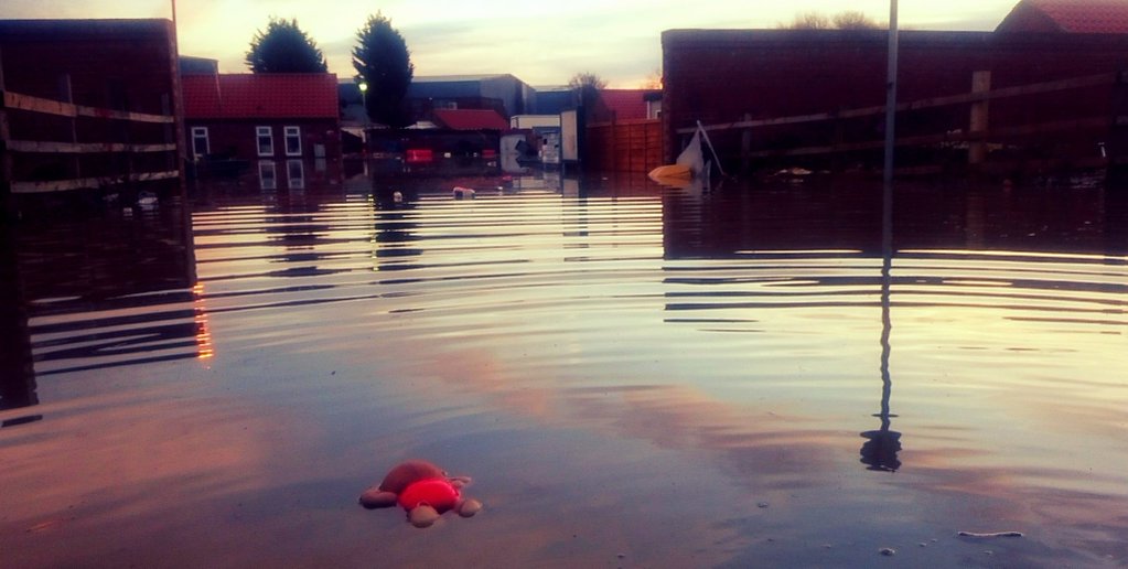
Flooded York. Levels now officially higher than 2012
The Foxwood Community Centre on Bellhouse Way (Cranfield Place junction) is opening between 12:00 noon and 2:00pm today (Sunday) to receive gifts of:
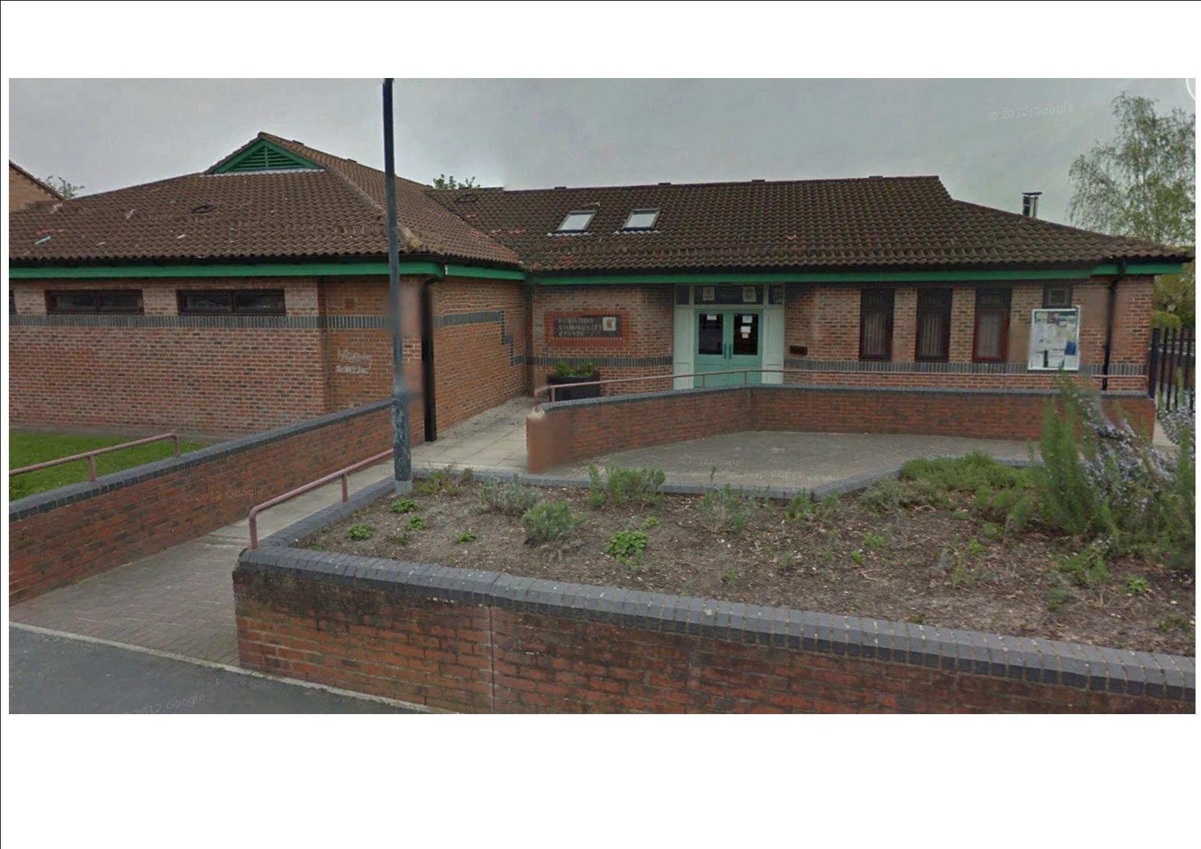
Foxwood Community Centre
which will be offered to the victims of flooding here in York.
https://www.facebook.com/FoxwoodResidentsAssociation/
http://foxwoodcommunitycentre.org.uk/
Generally the floods have had less impact on west York than on roads nearer the Foss and the Ouse.
Windsor House older peoples home suffered basement flooding yesterday and the was a re-occurrence of “backing up” problems in the sewers in Foxwood Lane south.
In the Woodthorpe area sandbags had to be deployed in the Coeside/Nevis way area.
The Community is therefore being asked to help wherever possible those who have been evacuated from their homes in central and east York
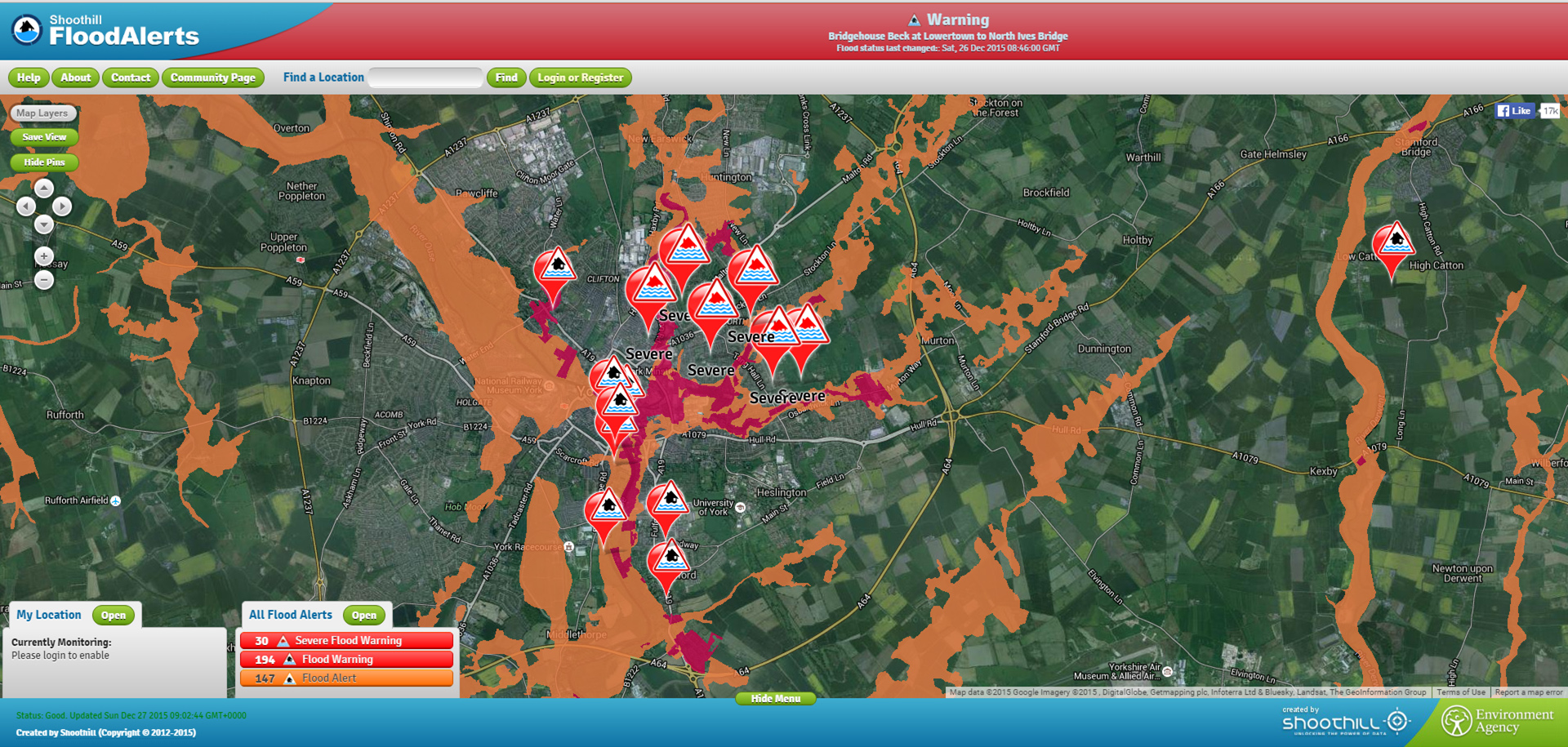
Click to go to individual flood alerts
Several flood gauges have recorded their highest ever levels.One or two now seem to have been overwhelmed by the deluge but the following links still work
click to access in “real time”. Wait for advert to finish