North Yorkshire Police mobile safety (speed) camera routes 26 September – 2 October 2012

North Yorkshire Police will be carrying out mobile safety camera enforcement on the following roads between Wednesday 26 September and Tuesday 2 October 2012.

•A64 east-bound Bowbridge Farm Tadcaster
•A64 west-bound Bowbridge Farm Tadcaster
•Broadway, Fulford, York
•Murton Way, Murton, York
•Fordlands Road, Fulford York
•A64 east-bound Bowbridge Farm Tadcaster
•B1228 Main Street, Elvington, York
•B1228 Dunnington Lodge, Elvington, York
•A1237 Monks Cross, York
(more…)

Flooding update – York open for “business as usual”

The weather in context. http://www.bbc.co.uk/blogs/paulhudson/2012/09/all-eyes-on-york-after-worst-s.shtml

The Environment Agency expects river levels in York to peak this afternoon but levels will remain high until tomorrow morning. They are likely to be the highest seen over the last 5 or so years but they are unlikely to reach an historic high for the Ouse.

Some riverside properties are subject to flood risk. http://tinyurl.com/Skelton-river-levels

The retail, tourism and business sectors of the City are still functioning with minimal disruption

The Foss is at record high levels with some localised flooding. http://tinyurl.com/New-Earswick-river-level

A list of local flood warnings can be found here http://tinyurl.com/York-flooding-26th-Sept-2012

Upstream, all tributaries are now showing declining river levels. http://tinyurl.com/Ouse-catchment

NB. The A1 southbound near Sedgefield remains closed but is expected to reopen at about 5:00pm. The A1 northbound is closed at Dishforth.
See traffic information tab (left) for updates.

A list of roads closed in York can be found here: http://www.york.gov.uk/advice/emergencies/weather/01update/

Train services are still disrupted. Details can be found here: http://www.nationalrail.co.uk/service_disruptions/today.html#

Changes to First bus services (Poppleton, Skeldergate etc) can be found here: http://tinyurl.com/First-bus-service-updates

Rowntree & the reading cafe

Thursday 18 October 6pm – 7pm, Rowntree Park Reading Cafe.

Celebrate the opening of Rowntree Park Reading Cafe and explore the life of Joseph Rowntree and why he would approve of this innovative library model.

This local history talk with Nestle Archivist, Alex Hutchinson, will give an introduction to York’s world famous, Rowntree Family, in particular focusing on the life of Joseph Rowntree, his passion for reading, libraries and learning, and his desire for Rowntree Park to aid the citizens of York of all ages towards a healthier and happier life.

Tickets cost £4 and are available online from the http://tinyurl.com/Rowntree-18th-Oct-12 or from Rowntree Park Reading Café tel: (01904) 551489 .

£600,000 A59 bus priority works could start immediately

Grantham Drive to The Fox proposals. click to enlarge

An urgent item has been added to a council meeting which is taking place on Thursday.

If approved it would see works start almost immediately on the bus priority measures recently consulted on which affect the Boroughbridge Road areas of the Holgate and Acomb Wards.

Dozens of objections were raised by residents during a recent consultation process on the section of Boroughbridge Road between Grantham Drive and The Fox roundabout.

There were fewer objections to the proposals for the Water End to Carr Lane section.

The report and list of objections can be found here http://tinyurl.com/Boroughbridge-Road-27th-Sept-1

Carr Lane to Water End proposals. click to enlarge

Although residents have the right to attend and register to speak at Thursday’s meeting, it is unlikely that many will even know that the bus lane and parking changes are being discussed!

NHS cuts in York and North Yorkshire.

The NHS North Yorkshire and York board was meeting today and was being asked to approve a range of cuts to NHS services in the region. The cuts result from budget mismanagement over several years.

Unlike some York Council meetings, the NHS Board do at least hold their meetings in public and they publish agendas and background papers in advance.

Those for today’s meeting can be found here: http://tinyurl.com/NHS-25th-Sept-12

However anyone seeking a detailed list of the cuts to be made will be disappointed.

The Board said at their last meeting that “we may not take everyone with us, we are committed to ensuring that, whilst they may not agree with the decisions we have to take, the public will be fully aware of the challenges we face and the reasons behind the decisions we take”.

Strange therefore that the Board did not publicise in advance of the meeting the measures that they intended to discuss let alone take the opportunity to give residents, patients and staff the chance to make representations.

The NHS PCT Board is being wound up early next year.

Floods in York

1600 update. Flood warnings have now been issued for river front properties in York as river levels continue to rise.

1400 – It looks like record high levels are being reached on the Swale (Catterick Bridge), Ure (Ripon) and Nidd (Gouthwaite). http://tinyurl.com/Ouse-catchment

All this water will be heading for York so it’s mildly reassuring that neither the Council nor emergency services seem to be concerned enough to issue high level warnings or put their contingency plans into gear?

A lot, of course, depends on when it stops raining.

These are the direct links to the Environment Agencies water level monitoring stations for York.

They give the current river levels and compare them to historical records.

Levels are all now in the range where some flooding is possible and the Agency is forecasting further rises in the levels later today.

Holgate http://tinyurl.com/Holgate-beck-level

City centre http://tinyurl.com/York-City-centre-river-level

Foss barrier http://tinyurl.com/Foss-Barrier-river-level

New Earswick http://tinyurl.com/New-Earswick-river-level

Skelton/Poppleton http://tinyurl.com/Skelton-river-levels

Update 1300: A1 north & south blocked near Darlington. East Coast main line services to and from the north suspended.

Mid day Update: St George’s Field car park in York is beginning to flood. City of York Council ask any motorists parked there to return to their cars

Check out the current river level position on this Kings Staith web cam http://www.farsondigitalwatercams.com/live-webcams/north/Ouse/York/#

It the water level rises above the top of the “no entry” sign then some properties are likely to flood.

You can register to receive flood warnings from the Environment Agency here https://fwd.environment-agency.gov.uk/app/olr/home

AA road and path defect survey

The AA are seeking volunteers to help with a detailed survey of highway conditions across the country.

They say,

“Each year AA Streetwatch volunteers help us check out the state of the nation’s neighbourhood roads and pavements. Our 2012 Autumn survey will commence on the 6 October and once again I am seeking your help with our simple survey.

We ask our volunteers to take about thirty minutes to stroll around their local area noting the number of various defects, such as potholes, that we have listed. It can be carried out on a day and time to suit you during the two weeks after 6th October. Surveys like Streetwatch are vital to the AA’s role as the motorists’ champion.

This time we are also asking whether any of the defects you see would be hazardous for cyclists. We will provide guidance, a checklist to take with you and tell you how to submit your results in a further e-mail to you once you have registered here http://tinyurl.com/AA-survey-2012

When completed your survey will provide valuable data that we can share with the highway authorities. Last year the information you provided was published in a report commissioned by the (LibDem) Transport Minister Norman Baker”.

Given the deteriorating condition of Yorks roads we hope as many volunteers as possible will help with the survey.

20 mph speed limit

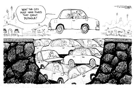
The arguments about the introduction of a 20 mph speed limit across the whole of York seem likely to intensify with the publication and distribution by the Council of a highly misleading leaflet on the subject.

click to enlarge

The cost of producing and distributing the leaflet is not revealed – a clear breach of the agreement that there would be transparency about such issues. Since 2001 all Council publications have included a line indicating publication costs. Generally publishing a leaflet and delivering to every household costs around £10,000.

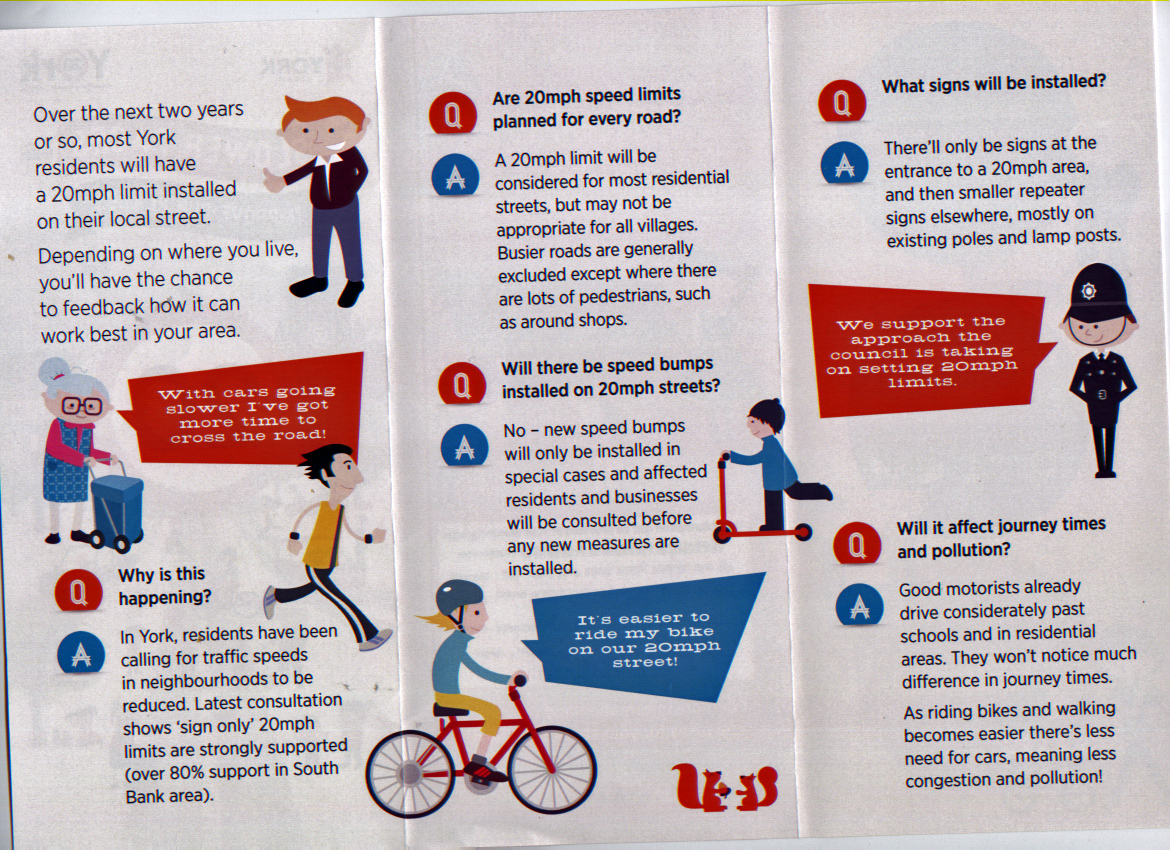
The tone of the leaflet is highly patronising and seeks to mislead the public about the level of support for the 20 mph proposal.

It disingenuously quotes 80% support for a 20 mph limit in South Bank without revealing the number who responded to the consultation nor revealing that in 2009 – when the decision to implement a trial 20 mph limit in South Bank was taken – it was in the wake of speed surveys revealing that traffic speeds in the area were already well under 20 mph. The only issue was whether the large cost of putting up 20 mph repeater signs represented a prudent use of taxpayer’s money.

click to enlarge

The introduction of 20 mph limits elsewhere in the country, where recorded speeds were already around 20 mph, resulted only in a 1 mph actual reduction in mean speeds.

It would be unsurprising if residents in the South Bank area, which is comprised mainly of relatively narrow terraced streets with large volumes of “on street” parking – which effectively slows traffic , would vote in a way which might be interpreted as encouraging vehicles to travel quicker.

Accident levels in the area were very low with no killed or seriously injured (KSI) victims recorded when the matter was considered in December 2009. There had been some minor accidents and it was hoped that the trial introduction of a lower speed limit would reveal whether these accidents could be eliminated. Prior to the approval of the trial in December 2009, there had been fifteen slight accidents in the previous ten years and five slight accidents in the previous three years.

What changed, was a decision by the new Council in 2011 to include Bishopthorpe Road in the trial. The shopping area might have been included as it was another section of highway where the daytime average recorded speeds were only around 15 mph. This is, again, hardly surprising given the location of the pedestrian crossing, traffic lights and road junctions together with high congestion levels at peak times.

(more…)