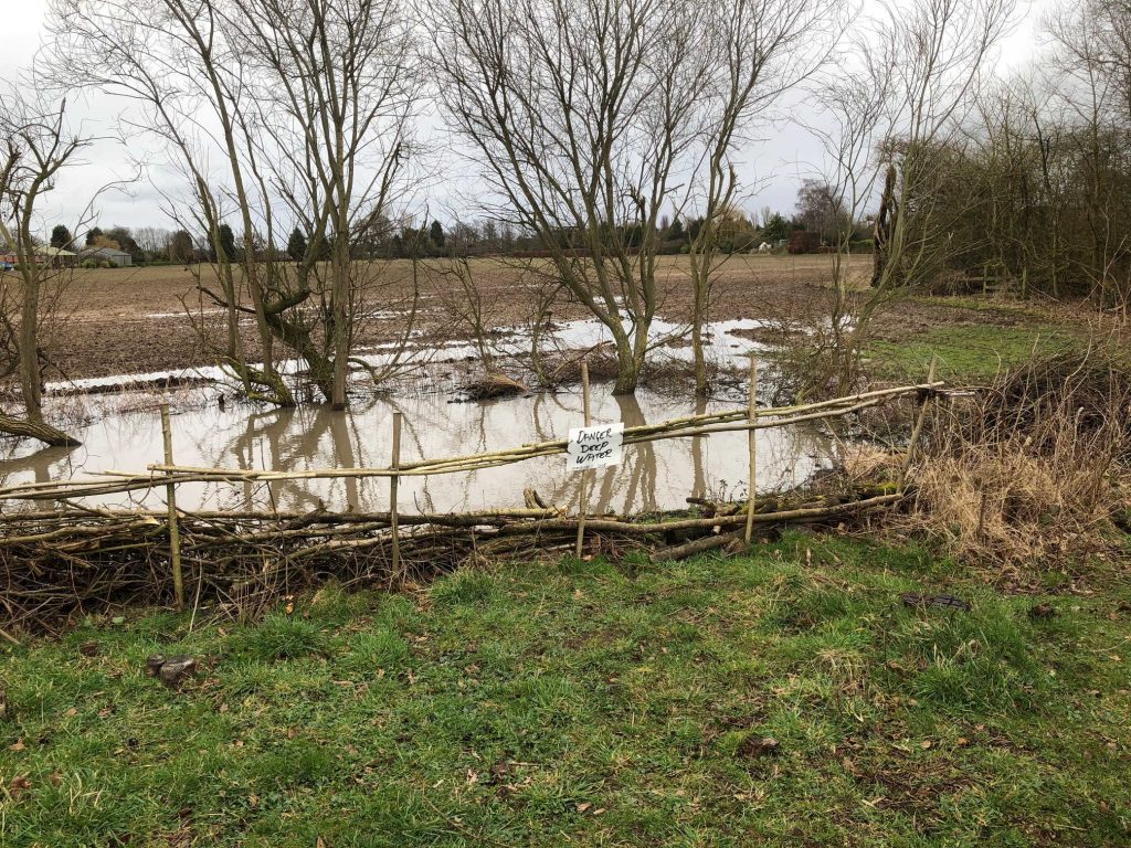
Local gullies and drainage ditches seem to be coping well with surface water in York.
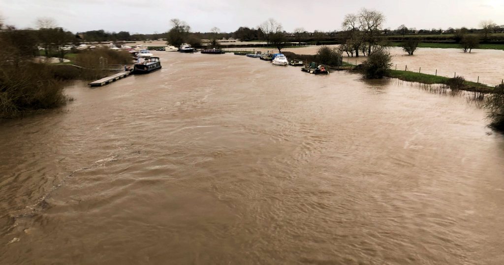
River levels are high but are not expected to peak now until late on Monday.
Meanwhile the York Council Leader Keith Aspden has issued a statement .
With the news that river levels are increasing, I wanted to email to provide an update on the impact of Storm Dennis in York, and to reassure residents that a wide-range of actions are being taken, both by the Council and key partners, to ensure the impact to the city and our communities is kept to a minimum.
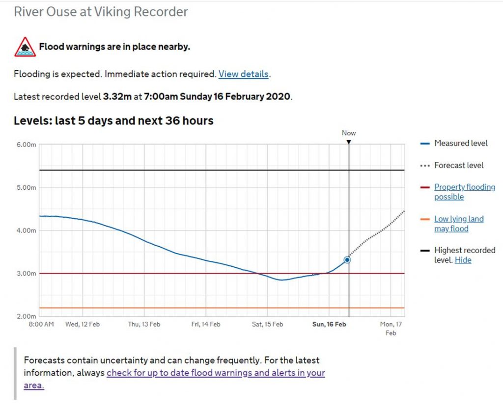
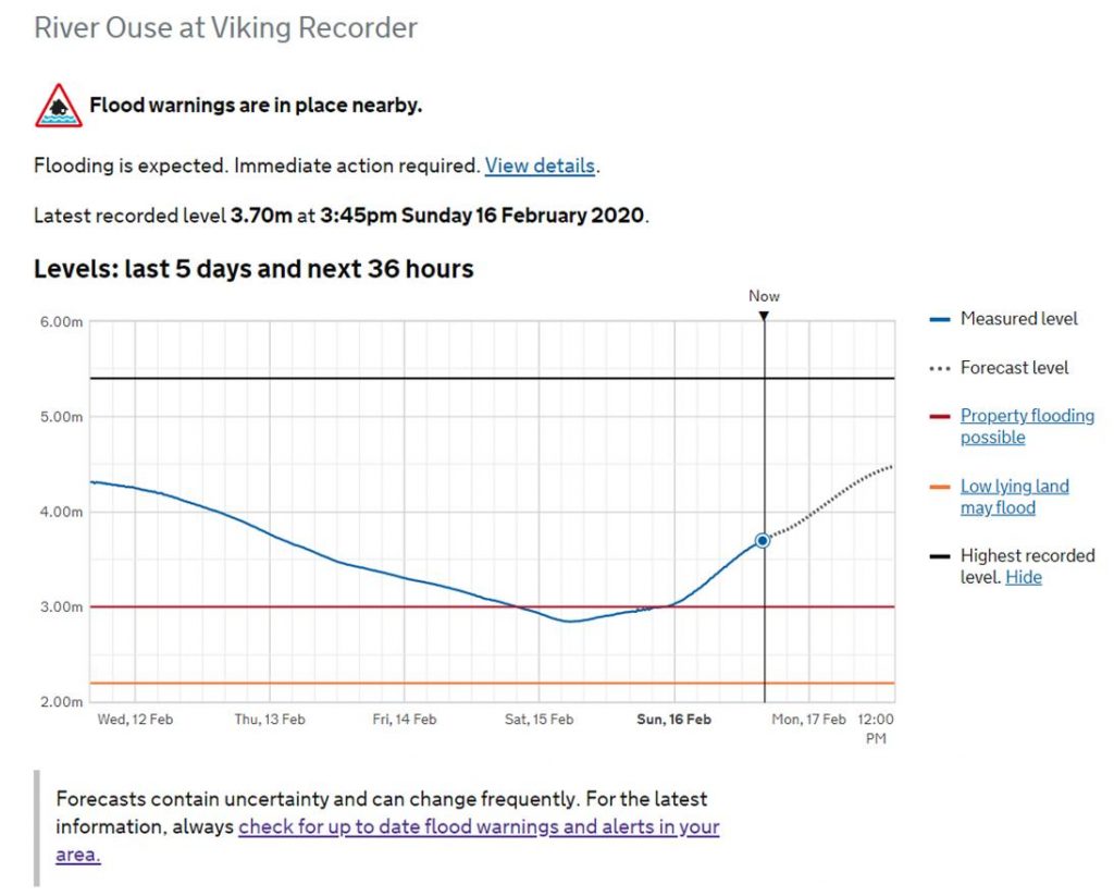
The Environment Agency (EA) has confirmed levels on the River Ouse in York are forecast to be close to the levels in 2015. Current forecasts from the EA are showing that river levels could reach between 4.8 and 5 metres on the morning of Tuesday 18 February. However, conditions remain unsettled, with further rain forecast over the next 48 hours, and this could result in changes to the levels and peak timings. The Environment Agency river forecasters will continue to monitor the situation 24/7 and provide further updates.
The Council has spent Friday and Saturday strengthening the city’s flood defences and today we will be helping residents in the most ‘at risk’ locations with the provision of sandbags to protect their homes and businesses. Local Liberal Democrat Councillors have also been out working with local communities to ensure precautions are taken and vulnerable residents are provided support. We will continue to make preparations to keep our fantastic city open.
With the uncertainty over weather conditions, we ask that people continue to keep an eye out for the latest information and alerts from the Environment Agency, which provides river levels for the next 36 hours in York, and to look out for friends and neighbours who may need support. Above all, please stay well away from the rivers and flood water. I have copied below some useful information and links. For the latest information and advice visit: www.york.gov.uk/flood.
The Liberal Democrats in York have long campaigned to secure better flood defences for York and since the Boxing Day floods of 2015, a number of flooding schemes have been given the green light. However, far more needs to be done and further action is needed to build in the latest in flood prevention technology across the entire city. I will continue to make the case to the new Government and request that immediate action is taken to aid affected communities across our city.
Finally, I would like to thank all community volunteers, staff, and key services who are working tirelessly to keep York safe and open for all everyone.