Looks like most of the water will reach York overnight. Other site data available here https://flood-warning-information.service.gov.uk/station/8208?direction=u
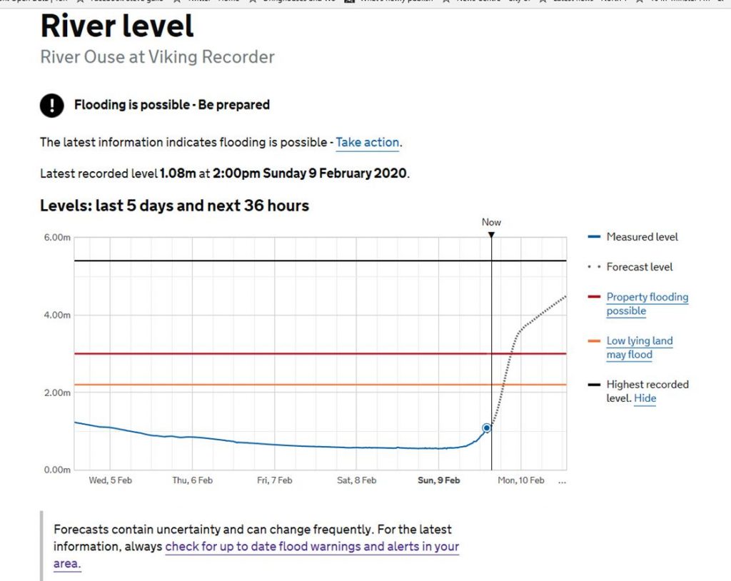
Looks like most of the water will reach York overnight. Other site data available here https://flood-warning-information.service.gov.uk/station/8208?direction=u
There will be an increased risk of flooding in York over the next couple of days as Storm Ciara passes by.
The immediate threat may be surface water if drainage gulleys are unable to cope with the rainfall. A copy of a map showing the vulnerability of different neighbourhoods to surface water can be found by clicking here
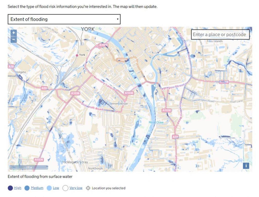
Surface water vulnerability map
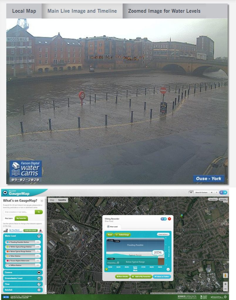
It will be some hours before the bulk water currently falling in the hills makes its way into the rivers Ouse and Foss in York. Residents can check the real time position on river gauge levels at this site https://www.gaugemap.co.uk/#!Map