
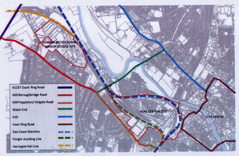
York North West development site
The Council will be deciding next Monday the location of the new roads and footpaths that will be needed to access the major York North West (YNW) development site (see site plan above). They are also set to endorse a “Transport Masterplan” which will detail the investment needed in infrastructure across the City to accommodate the addition movement of people and vehicles. These proposals will include changes to the A1237.
The Council has not, however, made public the Transport Masterplan leaving residents to draw their own conclusions and making it impossible for them to make representations before the meeting.
However some details of the councils preferred access routes area now clearer.
Establishing appropriate site access is key to the regeneration of the York Central site (the land behind the station). This is due to the site being bounded by live rail lines. It is currently accessible only via Leeman Road.
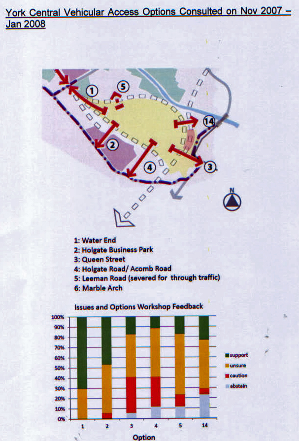
Public consultation results - York central access options
Previous modelling work indicated that given the scale of development envisaged at York Central, two new all-mode accesses would be required to the site, alongside some use of the existing Leeman Road accesses and new or improved pedestrian and cyclist routes. A new all-mode access should be created from the A59 Poppleton/ Holgate Road (where 4 options were considered) , and a second from Water End (near Millennium Green).
There are two options being looked at further.
• To use Chancery Rise (near the entrance to the former Carriage works) with the road offset away to protect the Cleveland Street play area and nearby homes. Estimated cost is £9.1 million. The junction with Holgate Road would probably incorporate a roundabout.
• To access from the open space at Holgate Business Park. The nearest residential properties are at Renshaw Gardens. Costs have been put at between £7.2 and £22.7 million (!)
A mini roundabout option is being considered for the Water End access junction.
It is likely that the A59 (Poppleton Road) access will be provided first.
The Council looks set to carry out its threat to close Leeman Road near the Marble Arch bridge. The Queen Street bridge could also be demolished at a cost of £5.5 million.

Possible access routes into York Central
Cycle and pedestrian link routes to the British Sugar/Manor School site have also been published.
A pedestrian bridge over the Harrogate railway line to the Business Park and then onto Poppleton Ings will be provided at a cost of around £500,000.
Another route is planned linking the site to the City centre. Costs are put at around £1 million.
So hopes of a discrete transport link along the side of the railway line look to have been abandoned.
Those hoping for a Maglev or Monorail link were always likely to be disappointed, but some form of light rail option did for a time seem more likely. Sadly that now looks a long way off.
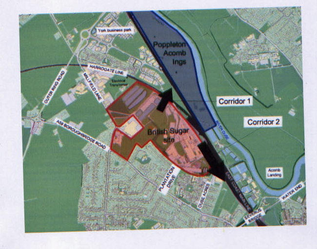
British Sugar site - possible access routes (pedestrian)